Filtered by Category:Pacific Ocean, New Zealand, Australia(Show All Categories)
Current Auction
11 lots
Lot 641
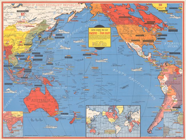
Subject: Pacific Ocean, World War II
Turner, Stanley
Dated Events War Map of the Pacific and Far East [Second Edition], 1942
Size: 26.3 x 19.8 inches (66.8 x 50.3 cm)
Estimate: $240 - $300
Scarce Dated Events War Map Published Immediately After Pearl Harbor
Lot 642
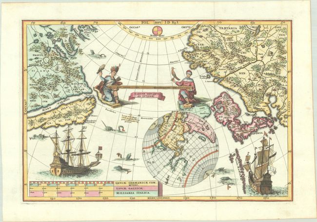
Subject: North Pacific Ocean
Scherer, Heinrich
[North Pacific Ocean] Fol. I.D. Fig. I., 1703
Size: 13.5 x 9.1 inches (34.3 x 23.1 cm)
Estimate: $800 - $950
Lot 643
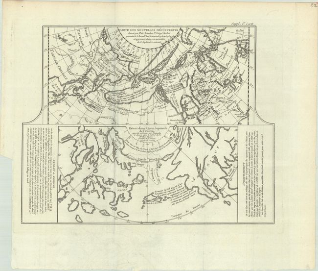
Subject: North Pacific Ocean
Robert de Vaugondy/Diderot
Carte des Nouvelles Decouvertes Dressee par Phil. Buache... [on sheet with] Extrait d'une Carte Japonoise de l'Univers..., 1772
Size: 15 x 11.7 inches (38.1 x 29.7 cm)
Estimate: $70 - $90
NO RESERVE
Lot 644
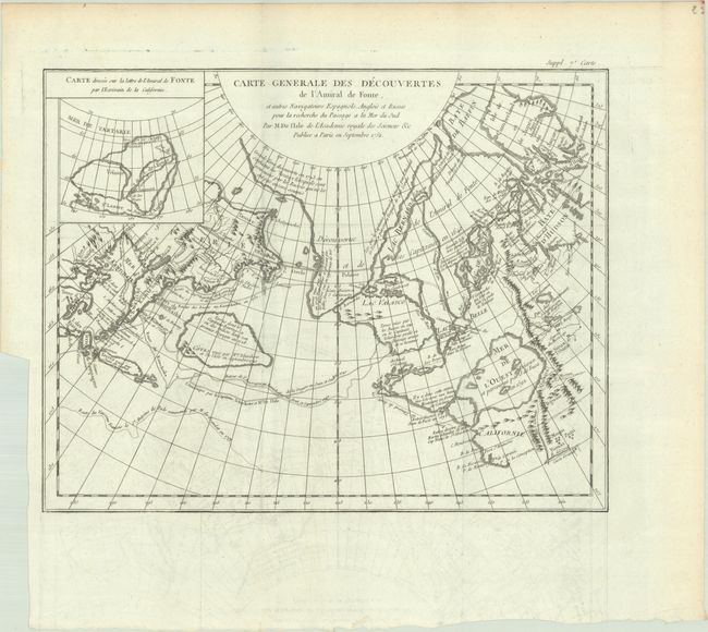
Subject: North Pacific Ocean
Robert de Vaugondy, Didier
Carte Generale des Decouvertes de l'Amiral de Fonte, et Autres Navigateurs Espagnols, Anglois et Russes pour la Recherche du Passage a la Mer du Sud..., 1772
Size: 14.9 x 11.6 inches (37.8 x 29.5 cm)
Estimate: $120 - $150
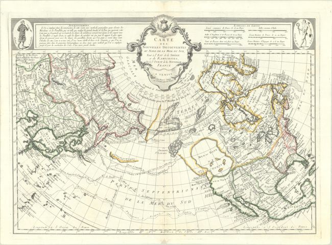
Lot 645
Subject: North Pacific Ocean
Santini, Francois
Carte des Nouvelles Decouvertes au Nord de la Mer du Sud, tant a l'Est de la Siberie et du Kamtchatka, qu'a l'Ouest de la Nouvelle France, 1776
Size: 24.8 x 17.9 inches (63 x 45.5 cm)
Estimate: $800 - $950
A Fascinating Map of the Pacific Northwest with a Huge "Sea of the West"
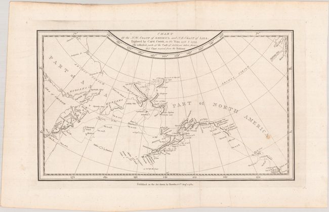
Lot 646
Subject: North Pacific Ocean
Harrison, John
Chart of the N.W. Coast of America and N.E. Coast of Asia, Explored by Capt. Cook, in the Years 1778 & 1779..., 1784
Size: 12.5 x 7.4 inches (31.8 x 18.8 cm)
Estimate: $180 - $210
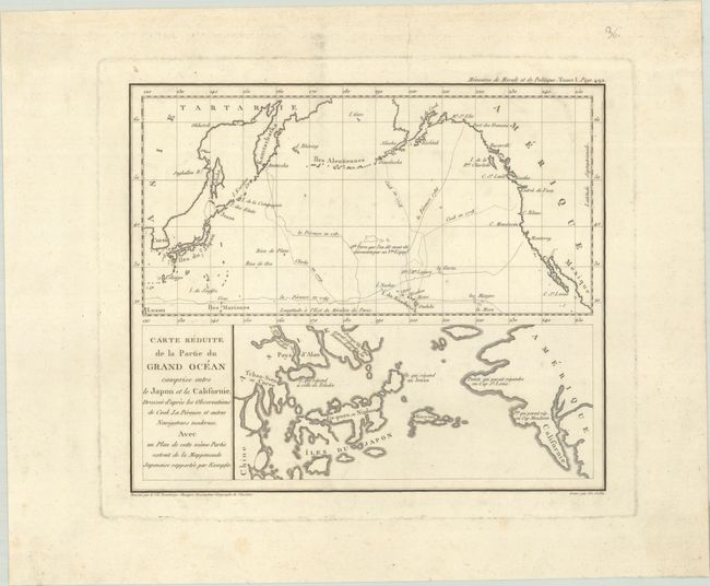
Lot 647
Subject: North Pacific Ocean
Beautemps-Beaupre, Charles Francois
Carte Reduite de la Partie du Grand Ocean Comprise Entre le Japon et la Californie, Dressee d'Apres les Observations de Cook, La Perouse et Autres Navigateurs Modernes..., 1820
Size: 10.2 x 8.7 inches (25.9 x 22.1 cm)
Estimate: $160 - $190
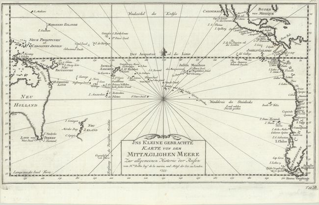
Lot 648
Subject: South Pacific Ocean
Bellin, Jacques Nicolas
Jns Kleine Gebrachte Karte von dem Mittaeglighen Meere zur Allgemeinen Historie der Reisen, 1753
Size: 13.9 x 8 inches (35.3 x 20.3 cm)
Estimate: $200 - $230
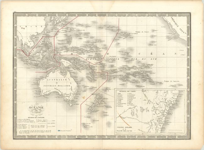
Lot 649
Subject: South Pacific Ocean
Monin, Charles V.
Oceanie, 1834
Size: 15.6 x 11.3 inches (39.6 x 28.7 cm)
Estimate: $110 - $140
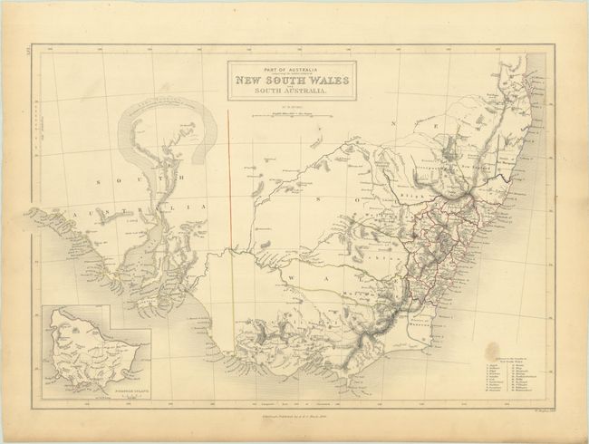
Lot 650
Subject: New South Wales, Australia
Black, Adam & Charles
Part of Australia Comprising the Settled Portions of New South Wales and South Australia, 1844
Size: 15.8 x 10.6 inches (40.1 x 26.9 cm)
Estimate: $120 - $150
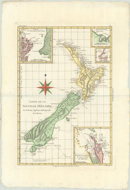
Lot 651
Subject: New Zealand
Bonne, Rigobert
Carte de la Nouvelle Zeelande, 1787
Size: 9.2 x 13.4 inches (23.4 x 34 cm)
Estimate: $400 - $475
11 lots