Filtered by Category:16th Century(Show All Categories)
Articles
12 articles
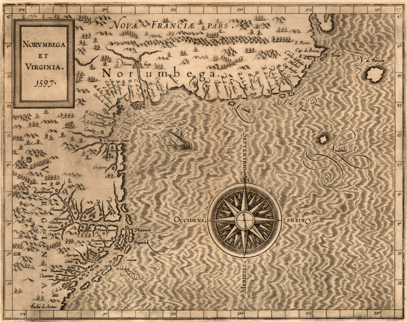
Norumbega: The Dream Behind New England
This August 2024 article explores the cartographic myth of Norumbega, a region that appeared in the vicinity of present-day New England on maps of the New World in the 16th and 17th centuries. It discusses the roots of Norumbega as a place name, geographical region, and colonial concept, starting with the voyage of Giovanni da Verrazzano and culminating in the exploration and establishment of New England.
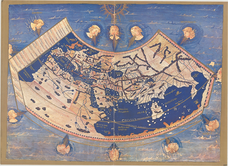
The Maps & Editions of Ptolemy
This January 2024 article reviews the major Ptolemaic works published between 1477 to 1730. Based on the work of the 2nd-century geographer Claudius Ptolemy, they provide a glimpse into an ancient understanding of the world. This primer provides clarity about Ptolemy, his ideas, and the most notable editions of his "Geographia."
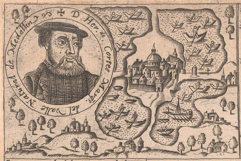
Mapping Cortés
This July 2023 article gives an overview of the explorations and conquests of Hernán Cortés through Mexico, with an emphasis on the maps and related engravings that documented and mythologized his exploits.
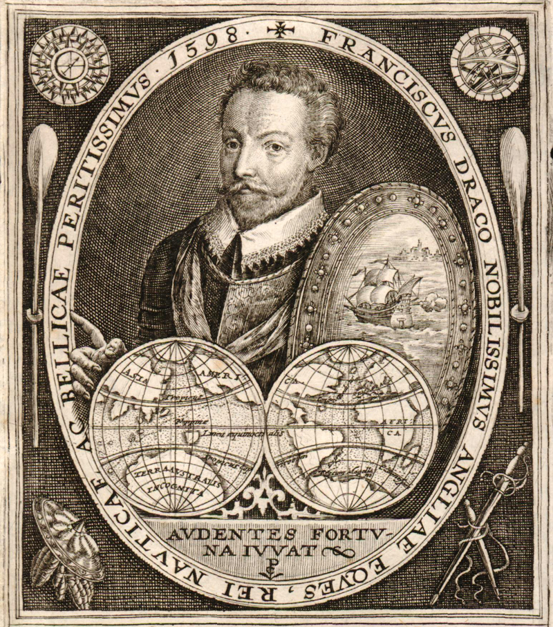
Mapping Drake
This March 2023 article tells the tale of Sir Francis Drake’s journey around the world, with an emphasis on how his circumnavigation voyage was reflected on maps over the centuries.
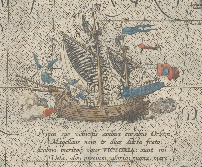
Mapping Magellan
This January 2023 article retraces the route of Ferdinand Magellan’s extraordinary circumnavigation of the world, identifying maps that showcase the places that were discovered along the way.
Theodore de Bry's Grands Voyages Part I Inventory
This March 2021 article is by guest contributor Luke Vavra, former map dealer and specialist in Virginia material. This is the fourth in a four-part series about Part I of Theodore de Bry's "India Occidentalis" (America). This fourth article discusses the current inventory of existing volumes of "Grands Voyages."
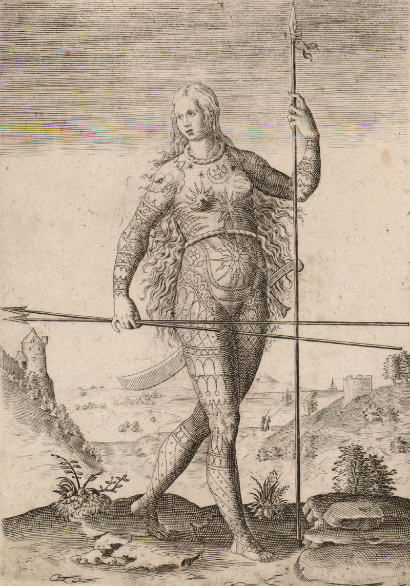
Theodore de Bry's Pict Plates from Grands Voyages Part I
This March 2021 article is by guest contributor Luke Vavra, former map dealer and specialist in Virginia material. This is the third in a four-part series about the engravings in Part I of Theodore de Bry's "India Occidentalis" (America). This third article discusses the Pict plates in Part I, which depicted ancient Britons.
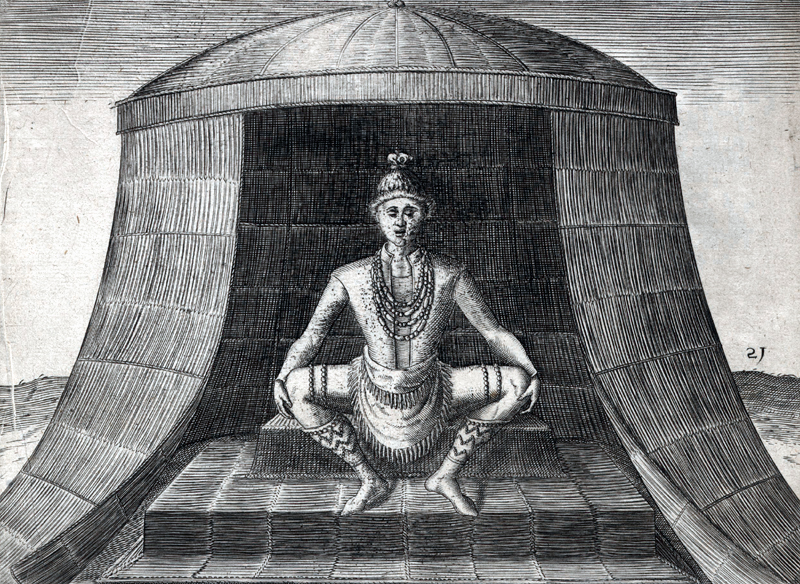
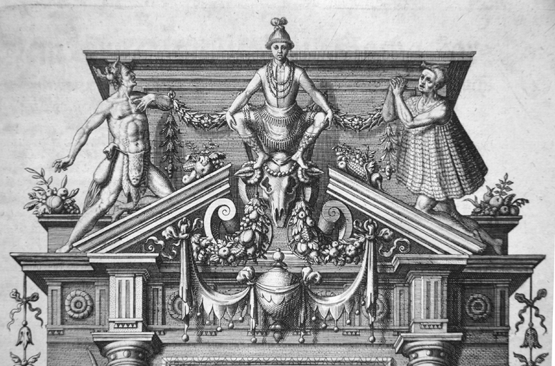
Theodore de Bry's Plates from Grands Voyages Part I
This February 2021 article is by guest contributor Luke Vavra, former map dealer and specialist in Virginia material. This is the second in a four-part series about the engravings in Part I of Theodore de Bry's "India Occidentalis" (America). This second article discusses the plates in Part I, including the title page, the dedication, the Virginia map, and the Algonquian series, with particular attention to the Kiwasa plate.
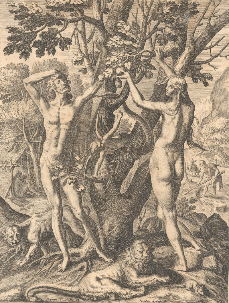
Theodore de Bry's Adam & Eve Engraving from Grands Voyages
This January 2021 article is by guest contributor Luke Vavra, former map dealer and specialist in Virginia material. This is the first in a four-part series about the engravings in Part I of Theodore de Bry's "India Occidentalis" (America). This first article concerns the first engraving in Part I - that of Adam and Eve in the Garden of Eden.
The Mapmakers Who Made the 16th Century
Read our March 2020 newsletter featuring an article about "The Mapmakers Who Made the 16th Century," which gives an overview of some of the most important cartographers of the 1500s and their most iconic maps. Also in this newsletter is a list of free online resources that offer cartographic content to help you expand your worldview while staying safely at home.
Auction Trends in 2017 & Braun & Hogenberg
This December 2017 newsletter features two articles. The first gives an overview of the auction market for antique maps in 2017, with some interesting insights about the big winners and losers. The second article discusses Braun & Hogenberg and their incredible town book, "Civitates Orbis Terrarum."
Three "Old-School" Dealers & a Book Summary on Abraham Ortelius
This May 2016 newsletter features an article about 3 "old school" dealers: Luke Vavra of Cartographic Arts, Jonathan Potter of Jonathan Potter Ltd., and Steve Luck of Tooley Adams & Co.Find out how the map business has changed over the last 40 years and what their thoughts are on the future. Also included is a book summary of "Abraham Ortelius (1527-1598) Life, Works, Sources, and Friends" by Marcel van den Broecke.
12 articles