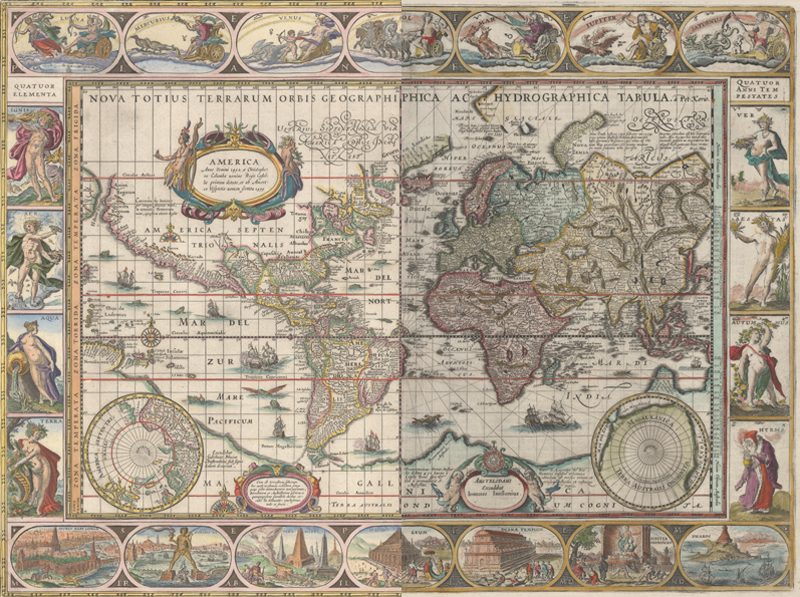
Nova Totius Terrarum Orbis Geographica ac Hydrographica Tabula: half Blaeu and half Jansson - but which is which?
Blaeu vs. Hondius/Jansson: The Battle for Cartographic Supremacy
by Jon Dotson
There are countless examples of great rivalries throughout history, popping up in virtually every human activity from business, politics, and religion to sports and games. A few that come to mind include: Alexander Hamilton vs. Aaron Burr; Thomas Edison vs. Nikola Tesla; Bill Gates vs. Steve Jobs; Muhammad Ali vs. Joe Frazier; and Callum vs. Remi Dotson (my teenage children!). Some rivalries escalate to bloodshed or even outright war, while others are more civilized (at least on the surface). Rivalry did not escape the map world, with one of the most enduring occurring during the Golden Age of Dutch cartography. The battle for map publishing supremacy lasted for over 40 years between the Hondius/Jansson firm and the Blaeu family. How did it evolve? Who "won" the battle?
Willem Janszoon Blaeu was born about 50 kilometers north of Amsterdam in 1571. He was the son of a wealthy herring merchant and was originally trained to join his father's business. Blaeu had an interest in science from an early age, however, and in 1595 shifted careers to study under the celebrated astronomer Tycho Brahe in Denmark. Upon his return to Amsterdam in 1599, he published a celestial globe based on the observations of Brahe. In 1603, he expanded the business to include scientific instruments and books. A few years later, Willem's business included maps, charts and atlases with some of his early works being maps of the world and continents and a marine atlas or pilot guide, Het Licht der Zeevaerdt (The Light of Navigation).
Jan Jansson was born 90 kilometers southeast of Amsterdam in 1588. He was the son of a printer, publisher, and bookseller of the same name. In 1612 he married Elisabeth Hondius, the daughter of Jodocus Hondius. Shortly thereafter, he began his career in the map business, occasionally working with his brothers-in-law Jodocus Hondius Jr. and Henricus Hondius. In 1618 Jansson made the bold move of establishing his business right next door to Willem Blaeu's shop. Jansson's encroachment was not limited to his physical location but also Blaeu's imprint, as Willem was publishing under the name Willem Jansz. or Guilelmus Janssonius. To prevent any misunderstandings with Jansson's works, Willem changed his family name to Blaeu after his grandfather, who was known as "blauwe Willem" (blue Willem). The rivalry further escalated when Jansson decided to copy Blaeu's popular Het Licht der Zeevaerdt in 1620, the year that Blaeu's publishing privilege (a limited patent) ended for that work.
Willem Janszoon Blaue, Het Licht der See-Vaert..., 1623. Map image courtesy the Harvard Map Collection.
In the early part of the 17th century, the Hondius (and later with Jansson) firm held a near monopoly on the map trade in Amsterdam. In 1604, Jodocus Hondius acquired the copper plates from Gerard Mercator, who was the first to use the term "atlas" to describe his collection of maps. Hondius shortly thereafter issued a new edition of Mercator's Atlas sive Cosmographicae, featuring 36 new maps and descriptive text which was not included in Mercator's 1595 edition. Hondius also created reduced-sized copies of the maps and issued Atlas Minor in 1607, offering a more economical product to a larger audience. When Jodocus Hondius died in 1612, his business passed to his two sons, Jodocus Hondius Jr. and Henricus, and his son-in-law Jan Jansson. By 1621, Jodocus Hondius Jr. set off on his own due to personal issues with Henricus, leaving management of the existing business to his brother and Jansson. Jodocus Jr. was commercially successful during the 1620's having worked with Isaac Elsevier and Petrus Bertius on Theatrum Geographiae Veteris, as well as publishing his own Nova et Accurata Italiae Hodiernae Descriptio, complete with 31 maps and 66 town views. By the end of the 1620s, Jodocus Jr. began working on a new modern atlas to compete with his brother and brother-in-law's Atlas, which had been using outdated maps from Mercator for many years. These new maps were more decorative and featured carte-a-figure borders along with inset views and town plans. Unfortunately Jodocus Jr. passed away in 1629 and was not able to complete the new atlas.
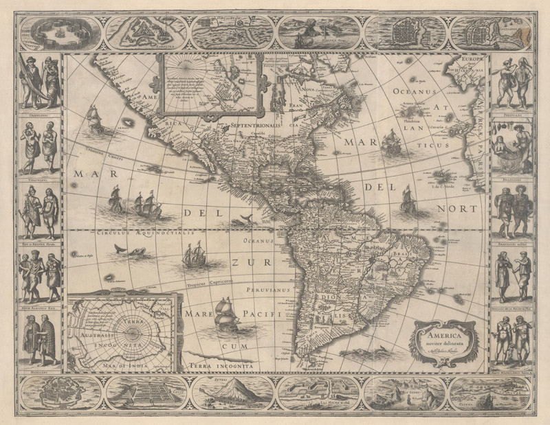
Jodocus Hondius Jr., America Noviter Delineata, 1618. Features elaborate borders and inset maps not seen on earlier maps.
Willem Blaeu, seeing the large economic opportunity in the atlas market, was eager to publish his own world atlas and compete head-to-head with Hondius/Jansson. Somehow, Blaeu pulled off a cartographic coup de gras by purchasing the new plates Jodocus Hondius Jr. had made for the unfinished atlas from his widow. Shortly thereafter in 1630, Willem Blaeu published his Atlantis Appendix with 60 maps, 36 of which came directly from Jodocus Jr. Henricus Hondius and Jansson were bitterly disappointed by this family betrayal, and criticized Blaeu's atlas as "a hotch-potch of old maps, which he had altered, adapted, or copied from their atlas."
Hondius/Jansson answered by hiring two Amsterdam engravers to make copies of the copperplates used in Blaeu's atlas. The contract stated "these 36 maps have to be ready 18 months after this date, should be accurate and fine, yes, finer and better and not less in quality than the (Blaeu) maps given to the engravers." The Hondius/Jansson firm quickly responded with their own Appendix later in 1630 and included some maps from the newly copied plates. These "new" maps were augmented by a combination of existing Hondius/Jansson maps, old Hondius Sr. maps, as well as maps from Claes Janszoon Visscher. The Atlantis Appendix turned a rivalry into a feud over the following decades with atlases containing an increasing number of maps, often copying each other's work in the process.
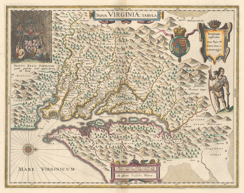
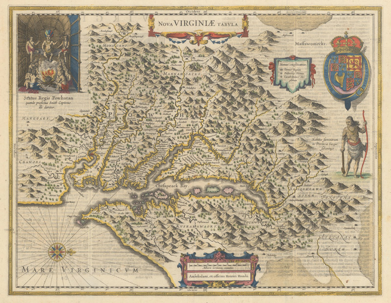
Willem Blaeu (left) & Henricus Hondius (right), Nova Virginiae Tabula . There are only minor decorative differences, including the direction in which the Susquehanna chief is facing. The Blaeu version faces to the north while the Hondius version faces inward toward the Chesapeake Bay.
Following the Appendix competition, Jansson would be the first to issue an updated Atlas (reinforcing the link to Mercator) in French and German in 1633, each with over 200 maps. Blaeu responded by publishing his German edition Novus Atlas in 1634 also with over 200 maps, followed by Latin, French and Dutch editions in 1635 under the title Theatrum Orbis Terrarum (using Ortelius' nomenclature). Jansson countered with an English edition and a revised German edition in 1636. This cartographic back and forth continued well after Willem Blaeu's death in 1638, when his son Joan Blaeu took over the family business. Both firms published multi-volume atlases that grew steadily both in terms of number of volumes and quantity of maps throughout the 1640s-50s.
The final tussle between these two firms occurred in the late 1650s. Jansson aspired to issue a large atlas containing maps of the entire known world and the heavens. In 1658 he issued his 10-volume Novus Atlas Absolutissimus (German edition only) with 546 maps, though the maps were mostly a patchwork of existing stock complemented by maps from Nicolas Visscher. Additionally, the atlas was missing descriptive text that would tie the maps together. Joan Blaeu rebutted in 1662 with the mammoth Atlas Maior, one of the most expensive books published in the 17th century. In 1670, prices ranged from 350-450 Dutch guilders, or equivalent to a year's worth of rent in Amsterdam. Although Joan's original concept for the Atlas Maior was also to include maps of the heavens and oceans, the final work contained around 600 terrestrial maps of the known world and was published in 9-12 volumes from 1662-72 in Latin, French, Dutch and Spanish. Blaeu not only increased the map count over Jansson's largest work, but he did so in four different language editions, each with several thousand pages of text. The Atlas Maior is considered by many to be the greatest atlas ever published, and arguably elevated the Blaeu firm to the top position in the battle for 17th century Dutch cartographic supremacy.
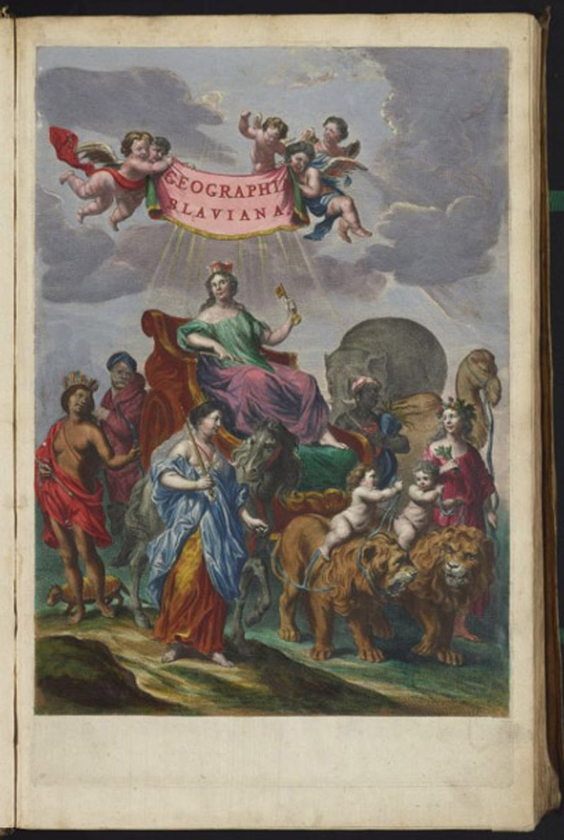
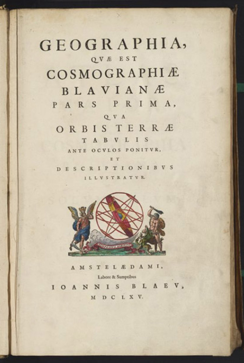
Joan Blaeu, [Frontispiece and Title Page from Atlas Maior], 1662. Images courtesy of the David Rumsey Collection.
Considering the strong similarities between the maps and atlases of the Blaeu and Hondius/Jansson firms, how do we know that Blaeu truly won the battle? Yes Blaeu had the largest work, but are there other differences that help elucidate the matter? One would expect quality to be a factor, however, spotting the difference between a Blaeu and Jansson map can be a difficult task. Many of their competing maps show little to no cartographic or decorative differences. Given this commonality, perhaps the cartographic legacies of these firms hundreds of years later can shed light on the winner?
Using the Old World Auctions archive (over 76,000 records and growing), I examined a series of identical maps in order to compare selling prices between the two firms. In order to have reliable data, I only considered examples that were: 1) sold in the last 15 years; 2) hand colored; 3) B+ condition or better. The analysis resulted in the following observations:
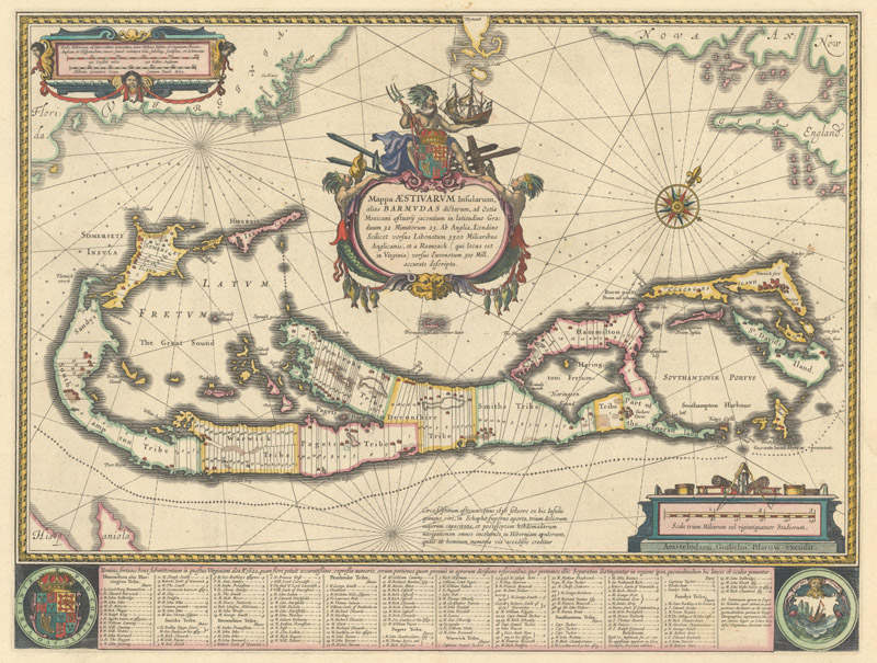
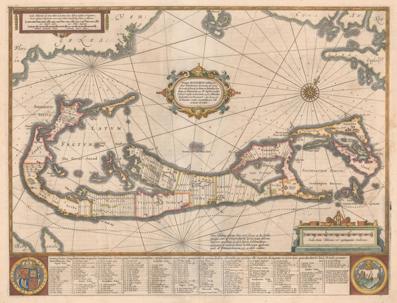
Willem Blaeu (left) & Hondius/Jansson (right), Mappa Aestivarum Insularum.
Note: The average price of the Blaeu map sells for $1,541 while the Jansson sells for $1,022, or a 34% discount. (Sample size: 15)
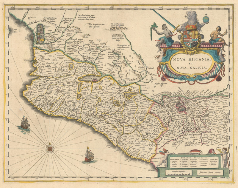
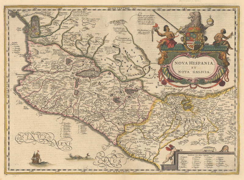
Willem Blaeu (left) & Jansson (right), Nova Hispania, et Nova Galicia.
Note: The average price of the Blaeu map sells for $348 while the Jansson sells for $298, or a 14% discount. (Sample size: 24)
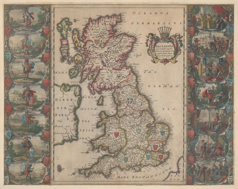
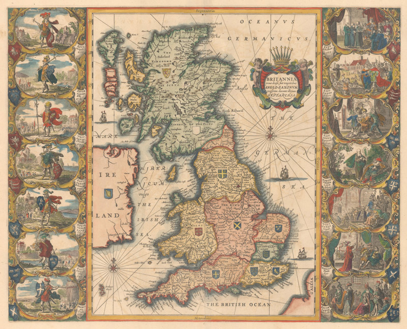
Joan Blaeu (left) & Jansson (right), Britannia Prout Divisa suit Temporibus Anglo-Saxonum.
Note: The average price of the Blaeu map sells for $2,475 while the Jansson sells for $1,663, or a 33% discount. (Sample size: 16)
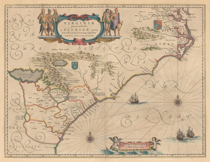
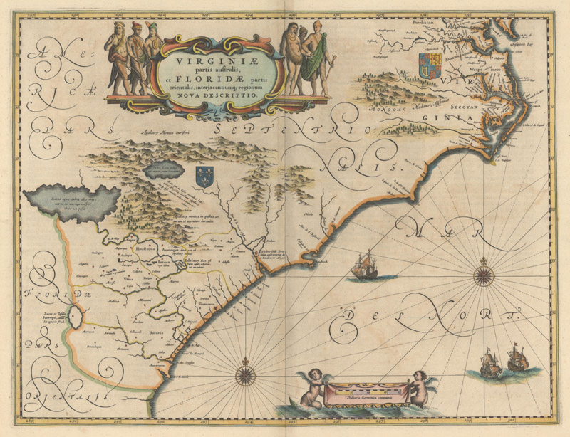
Willem Blaeu (left) & Jansson (right), Virginiae Partis Australis.
Note: The average price of the Blaeu map sells for $1,026 while the Jansson sells for $856, or a 17% discount. (Sample size: 27)
Using this market-based approach, the data indicates that the Blaeu firm wins this cartographic rivalry, with average prices nearly 30% higher than Jansson's equivalent maps (in most cases). The next time you are considering a map from the Golden Age of Dutch cartography, ask yourself if you want the "best publisher" or the "best value." If your answer is the former, buy Blaeu; if it is the latter, consider the Hondius/Jansson version. Hanging the map on a wall in a nice frame, it is hard to detect the difference!
Determining a true winner is subjective and a matter of personal opinion. Beauty is in the eye of the beholder, after all. What is undeniable, however, is the significant impact this rivalry had on the map publishing industry and the evolution of the world atlas as we know it today.
REFERENCES
Baynton-Williams, Ashley, "Jodocus Hondius Jr.'s Appendix Atlantis Maioris [1629/30] And Its Rivals," MapForum Issue 7, Autumn 2005.
Goss, John, Blaeu's The Grand Atlas of the 17th Century World, Rizzoli International Publications, New York, 1991.
Krogt, Peter van der, Atlas Maior "The Greatest and Finest Atlas Ever Published", Benedikt Taschen, New York, 2006.
Krogt, Peter van der, Koeman's Atlantes Neerlandici, HES Publishers, 't Goy-Houten, The Netherlands, 1997.
Tooley, R.V., Tooley's Dictionary of Mapmakers Revised Edition, Early World Press, Riverside, CT, 2001.