Catalog Archive
57 lots
Page 1 of 2
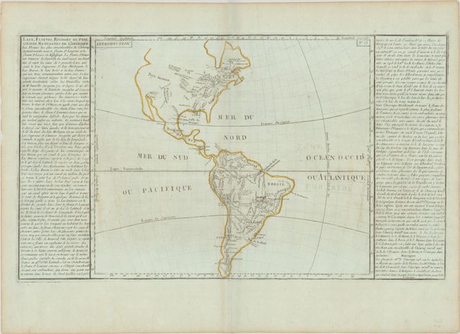
Auction 209, Lot 84
Subject: Western Hemisphere - America
Clouet, Jean Baptiste Louis
Lacs, Fleuves, Rivieres et Principales Montagnes de l’Amerique, 1780
Size: 21.8 x 12.5 inches (55.4 x 31.8 cm)
Estimate: $100 - $130
Unsold
Closed on 6/17/2026
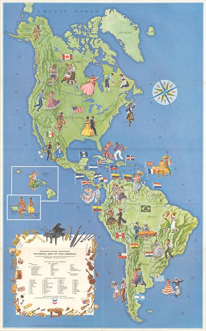
Auction 209, Lot 90
Subject: Western Hemisphere - America
Standard School Broadcast Pictorial Map of Pan-America, 1966
Size: 24.9 x 40.5 inches (63.2 x 102.9 cm)
Estimate: $180 - $220
Unsold
Closed on 6/17/2026
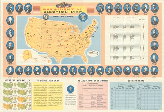
Auction 209, Lot 144
Subject: United States
Hammond, C. S.
Presidential Election Map Compliments of Disabled American Veterans, 1964
Size: 37 x 25 inches (94 x 63.5 cm)
Estimate: $110 - $140
Unsold
Closed on 6/17/2026
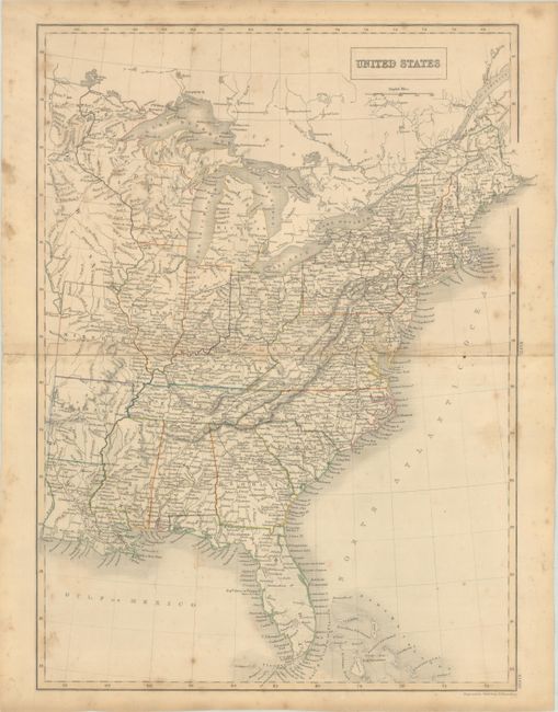
Auction 209, Lot 150
Subject: Eastern United States, Iowa
Black, Adam & Charles
United States, 1840
Size: 15 x 20 inches (38.1 x 50.8 cm)
Estimate: $100 - $130
Unsold
Closed on 6/17/2026
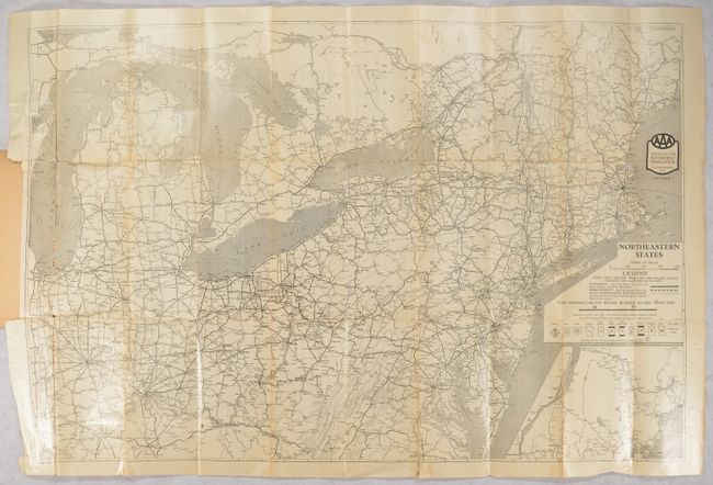
Auction 209, Lot 152
Subject: Northeastern United States
American Automobile Assoc.
[Map in Book] Northeastern States [in] AAA Official Tour Book and Map of Northeastern States..., 1926
Size: 35.4 x 23.4 inches (89.9 x 59.4 cm)
Estimate: $140 - $170
Unsold
Closed on 6/17/2026
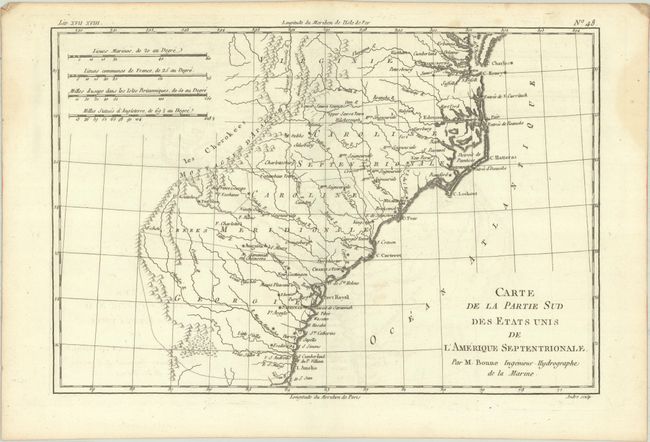
Auction 209, Lot 162
Subject: Colonial Southeastern United States
Bonne, Rigobert
Carte de la Partie Sud des Etats Unis de l'Amerique Septentrionale, 1780
Size: 12.6 x 8.5 inches (32 x 21.6 cm)
Estimate: $100 - $130
Unsold
Closed on 6/17/2026
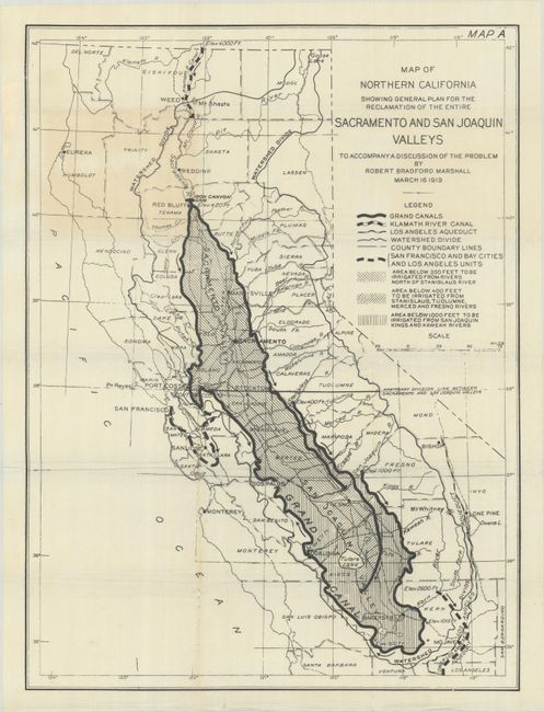
Auction 209, Lot 191
Subject: California
Map of Northern California Showing General Plan for the Reclamation of the Entire Sacramento and San Joaquin Valleys to Accompany a Discussion of the Problem, 1919
Size: 16.5 x 22.1 inches (41.9 x 56.1 cm)
Estimate: $140 - $170
Illustrates the Marshall Water Plan
Unsold
Closed on 6/17/2026
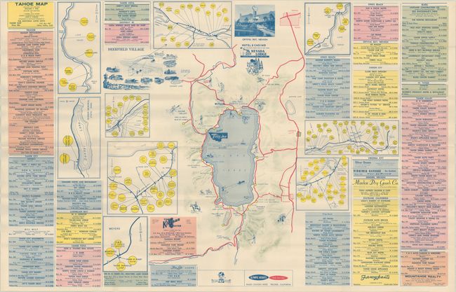
Auction 209, Lot 195
Subject: Lake Tahoe, California
Tahoe Map, 1961
Size: 33.9 x 21.9 inches (86.1 x 55.6 cm)
Estimate: $150 - $180
Unrecorded Map of Lake Tahoe Following the 1960 Olympics
Unsold
Closed on 6/17/2026
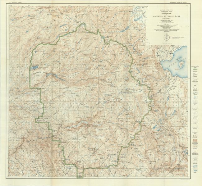
Auction 209, Lot 196
Subject: Yosemite, California
U.S. Geological Survey (USGS)
Topographic Map of Yosemite National Park California..., 1932
Size: 28.8 x 27.3 inches (73.2 x 69.3 cm)
Estimate: $150 - $180
Unsold
Closed on 6/17/2026
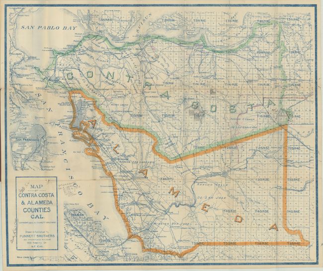
Auction 209, Lot 197
Subject: East Bay, California
Map of Contra Costa & Alameda Counties Cal., 1908
Size: 29 x 24.3 inches (73.7 x 61.7 cm)
Estimate: $140 - $170
Unsold
Closed on 6/17/2026
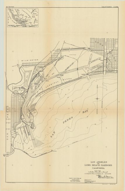
Auction 209, Lot 204
Subject: Los Angeles, California
U.S. Corps of Engineers
[Map with Report] Los Angeles and Long Beach Harbors California, 1921
Size: 12.9 x 19.7 inches (32.8 x 50 cm)
Estimate: $140 - $170
Unsold
Closed on 6/17/2026
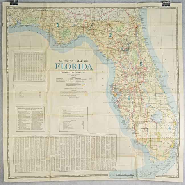
Auction 209, Lot 219
Subject: Florida
Matthews-Northrup Co
Sectional Map of Florida Issued by Department of Agriculture, 1938
Size: 44.8 x 44.5 inches (113.8 x 113 cm)
Estimate: $140 - $170
Unsold
Closed on 6/17/2026
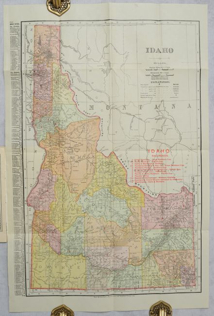
Auction 209, Lot 230
Subject: Idaho
Rand McNally & Co.
Idaho, 1908
Size: 12.4 x 19.1 inches (31.5 x 48.5 cm)
Estimate: $110 - $140
Unsold
Closed on 6/17/2026
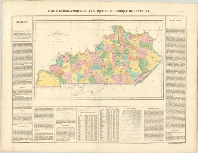
Auction 209, Lot 240
Subject: Kentucky
Buchon, Jean Alexandre
Carte Geographique, Statistique et Historique du Kentucky, 1825
Size: 18.3 x 11.2 inches (46.5 x 28.4 cm)
Estimate: $140 - $170
Unsold
Closed on 6/17/2026
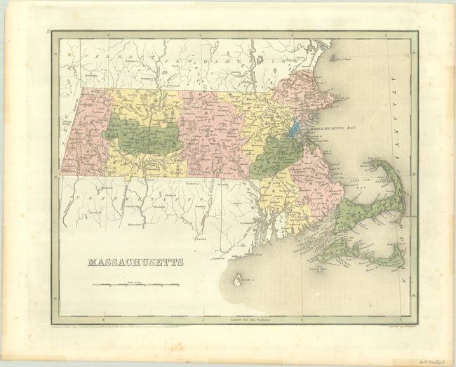
Auction 209, Lot 248
Subject: Massachusetts
Bradford, Thomas Gamaliel
Massachusetts, 1838
Size: 14.3 x 11.4 inches (36.3 x 29 cm)
Estimate: $100 - $130
Unsold
Closed on 6/17/2026
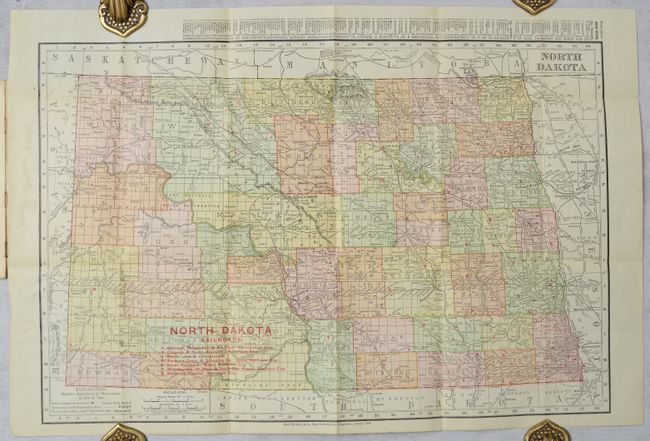
Auction 209, Lot 270
Subject: North Dakota
Rand McNally & Co.
North Dakota, 1909
Size: 18.9 x 12.6 inches (48 x 32 cm)
Estimate: $95 - $120
Unsold
Closed on 6/17/2026
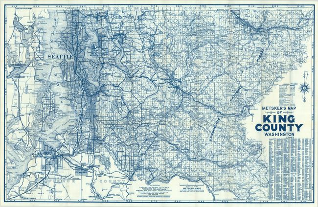
Auction 209, Lot 290
Subject: Seattle, Washington
Metsker
Metsker's Map of King County Washington, 1950
Size: 39 x 25 inches (99.1 x 63.5 cm)
Estimate: $140 - $170
Unsold
Closed on 6/17/2026
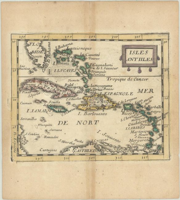
Auction 209, Lot 308
Subject: Caribbean
Duval, Pierre
Isles Antilles, 1682
Size: 4.9 x 3.9 inches (12.4 x 9.9 cm)
Estimate: $140 - $170
Unsold
Closed on 6/17/2026
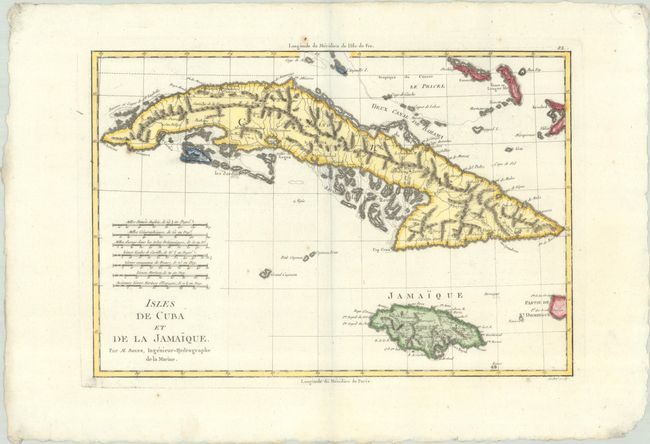
Auction 209, Lot 314
Subject: Cuba & Jamaica
Bonne, Rigobert
Isles de Cuba et de la Jamaique, 1787
Size: 13.6 x 9.3 inches (34.5 x 23.6 cm)
Estimate: $130 - $160
Unsold
Closed on 6/17/2026
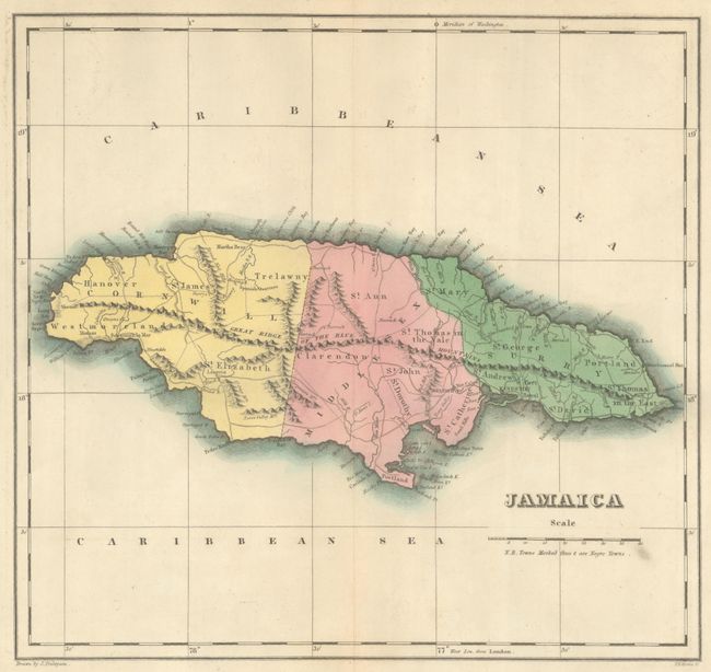
Auction 209, Lot 317
Subject: Jamaica
Carey & Lea
Geographical, Statistical, and Historical Map of Jamaica, 1827
Size: 12.2 x 11.4 inches (31 x 29 cm)
Estimate: $140 - $170
Unsold
Closed on 6/17/2026
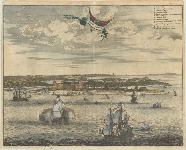
Auction 209, Lot 333
Subject: Todos os Santos Bay, Brazil
Montanus, Arnoldus
Sinus Omnium Sanctoru, 1671
Size: 14.1 x 11 inches (35.8 x 27.9 cm)
Estimate: $95 - $120
Unsold
Closed on 6/17/2026
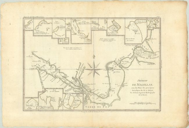
Auction 209, Lot 340
Subject: Strait of Magellan
Bonne, Rigobert
Detroit de Magellan, avec les Plans des Principaux Ports, Bayes &c. de ce Detroit, 1788
Size: 13.5 x 9.1 inches (34.3 x 23.1 cm)
Estimate: $110 - $140
Unsold
Closed on 6/17/2026
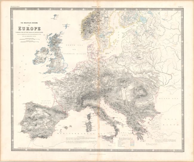
Auction 209, Lot 361
Subject: Europe
Johnston, W. & A.K.
The Mountain Systems of Europe Constructed on the Basis of Contour Lines..., 1856
Size: 23.4 x 19.5 inches (59.4 x 49.5 cm)
Estimate: $120 - $150
Unsold
Closed on 6/17/2026
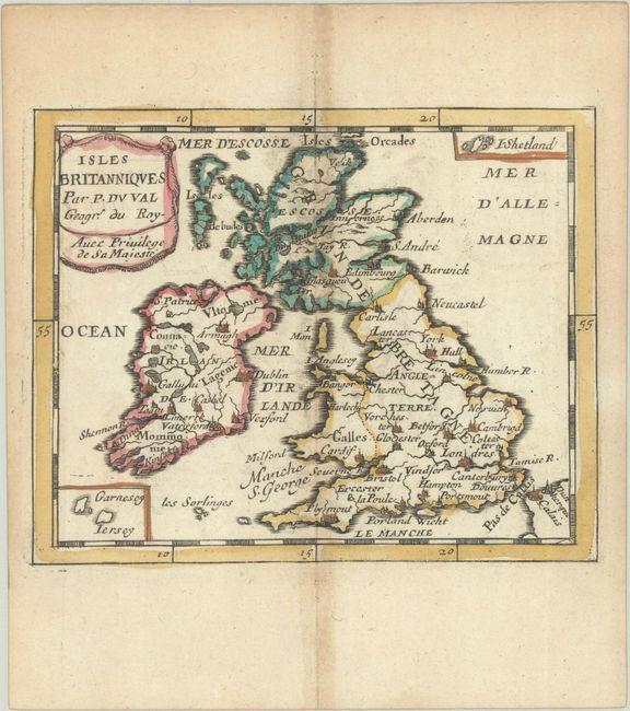
Auction 209, Lot 367
Subject: Britain
Duval, Pierre
Isles Britanniques, 1682
Size: 5 x 4 inches (12.7 x 10.2 cm)
Estimate: $110 - $140
Unsold
Closed on 6/17/2026
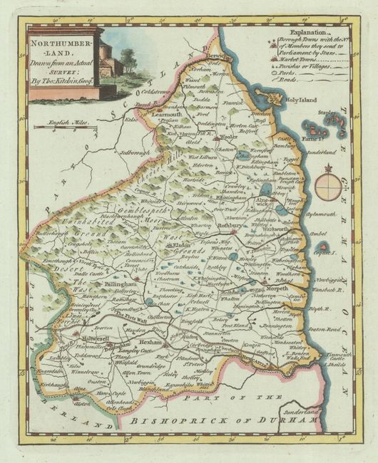
Auction 209, Lot 371
Subject: Northern England
Kitchin, Thomas
[Lot of 2] Northumberland, Drawn from an Actual Survey [and] Westmoreland Drawn from ye Best Authorities and Regulated by Astronl. Observatns, 1749
Size: See Description
Estimate: $100 - $130
Unsold
Closed on 6/17/2026
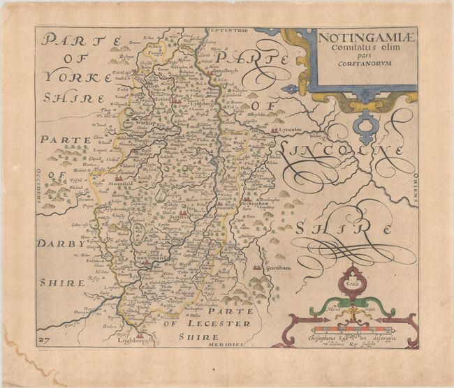
Auction 209, Lot 374
Subject: Central England
Saxton/Kip
Notingamiae Comitatus olim pars Coritanorum, 1637
Size: 12.3 x 10.4 inches (31.2 x 26.4 cm)
Estimate: $90 - $110
Unsold
Closed on 6/17/2026
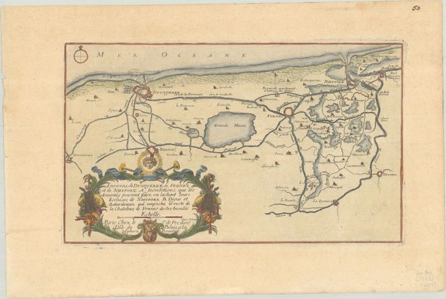
Auction 209, Lot 425
Subject: Northern France & Western Belgium
Fer, Nicolas de
Environs, de Dunquerke, de, Furnes, et de Nieuport..., 1705
Size: 12.4 x 7.4 inches (31.5 x 18.8 cm)
Estimate: $100 - $130
Unsold
Closed on 6/17/2026
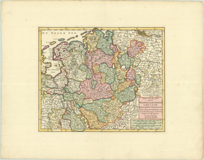
Auction 209, Lot 428
Subject: Western Germany & Eastern Netherlands
Tirion, Isaac
Nieuwe Kaart van de Westfaalse Kreits Verdeelt in Deszelfs Bisdommen Vorstendommen Graafschappen enz na de Naaukeurigste Ondervindingen int Ligt Gegeven, 1769
Size: 13.4 x 11.1 inches (34 x 28.2 cm)
Estimate: $100 - $130
Unsold
Closed on 6/17/2026
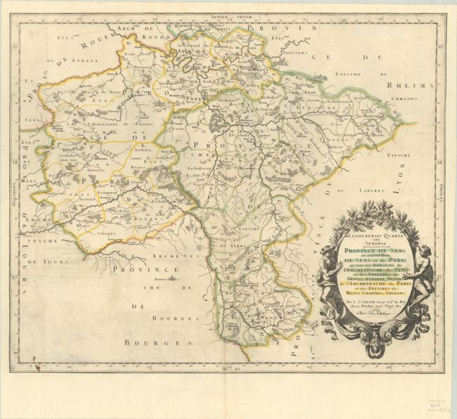
Auction 209, Lot 433
Subject: Northern France, Paris
Sanson, Nicolas
Lugdunensis Quarta sive Senonia. Province de Sens et Aujourdhuy de Sens et de Paris ou sont les Dioeceses de l'Archevesche de Sens..., 1667
Size: 18.9 x 15.6 inches (48 x 39.6 cm)
Estimate: $110 - $140
Unsold
Closed on 6/17/2026
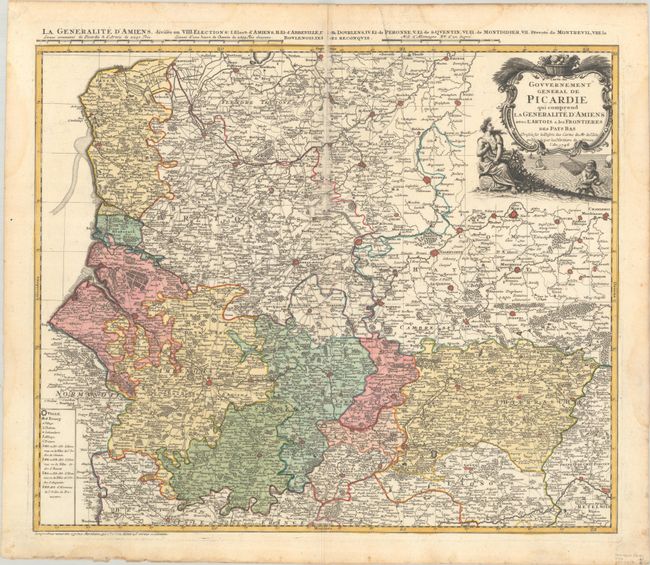
Auction 209, Lot 434
Subject: Northern France
Homann Heirs
Carte du Gouvernement General de Picardie qui Comprend la Generalite d'Amiens avec l'Artois & les Frontieres des Pays Bas..., 1746
Size: 22 x 18.4 inches (55.9 x 46.7 cm)
Estimate: $80 - $95
Unsold
Closed on 6/17/2026
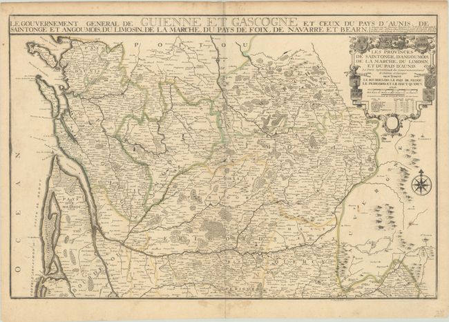
Auction 209, Lot 437
Subject: Western France
Fer, Nicolas de
Les Provinces de Saintonge, d'Angoumois, de la Marche, du Limosin, et du Pais d'Aunis..., 1711
Size: 28 x 18.7 inches (71.1 x 47.5 cm)
Estimate: $140 - $170
Unsold
Closed on 6/17/2026
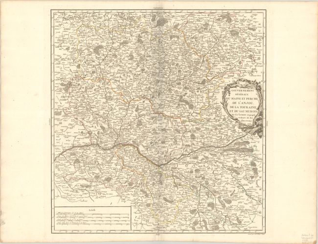
Auction 209, Lot 438
Subject: Western France
Robert de Vaugondy, Gilles
Gouvernemens Generaux du Maine et Perche, de l'Anjou, de la Touraine, et du Saumurois, 1753
Size: 18.1 x 18.9 inches (46 x 48 cm)
Estimate: $70 - $90
Unsold
Closed on 6/17/2026
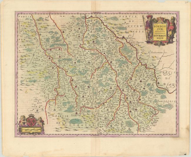
Auction 209, Lot 440
Subject: Central France
Jansson, Jan
Borbonium, Ducatus - Bourbonnois, 1645
Size: 19.7 x 15.1 inches (50 x 38.4 cm)
Estimate: $100 - $130
Unsold
Closed on 6/17/2026
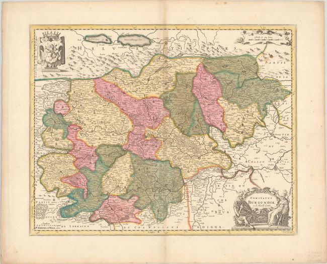
Auction 209, Lot 442
Subject: Eastern France
Valck and Schenk
Comitatus Burgundiae ou sa Franche Comte, 1700
Size: 20.8 x 16.4 inches (52.8 x 41.7 cm)
Estimate: $100 - $130
Unsold
Closed on 6/17/2026
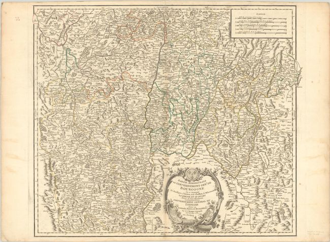
Auction 209, Lot 443
Subject: Eastern France
Robert de Vaugondy, Gilles
Partie Meridionale du Gouvernement Genl. de Bourgogne... / Gouvernement General du Lyonois..., 1752
Size: 22.5 x 19.2 inches (57.2 x 48.8 cm)
Estimate: $70 - $95
Unsold
Closed on 6/17/2026
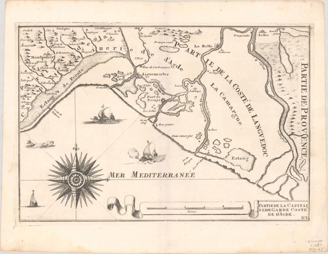
Auction 209, Lot 444
Subject: Southern France
Fer, Nicolas de
Partie de la Capitainerie Garde Coste de d'Agde, 1690
Size: 13.1 x 8.8 inches (33.3 x 22.4 cm)
Estimate: $80 - $95
Unsold
Closed on 6/17/2026
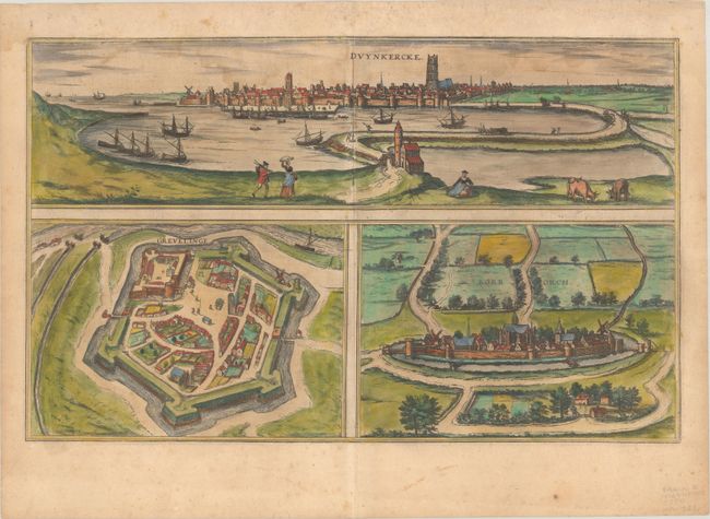
Auction 209, Lot 452
Subject: Dunkirk, France
Braun & Hogenberg
Duynkercke [on sheet with] Grevelinge [and] Borborch, 1597
Size: 19.4 x 12 inches (49.3 x 30.5 cm)
Estimate: $120 - $160
Unsold
Closed on 6/17/2026
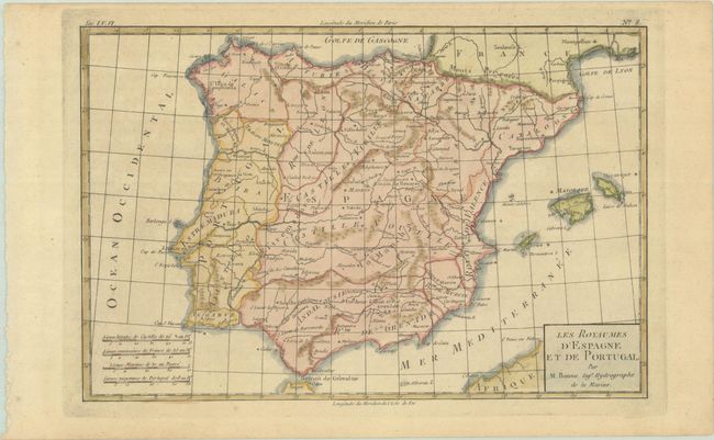
Auction 209, Lot 460
Subject: Spain & Portugal
Bonne, Rigobert
Les Royaumes d'Espagne et de Portugal, 1780
Size: 12.6 x 8.3 inches (32 x 21.1 cm)
Estimate: $110 - $140
Unsold
Closed on 6/17/2026
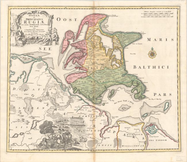
Auction 209, Lot 478
Subject: Rugen, Germany
Homann, Johann Baptist
Insulae et Principatus Rugiae cum Vicinis Pomeraniae Littoribus Nova Tabula, 1716
Size: 22.5 x 18.9 inches (57.2 x 48 cm)
Estimate: $150 - $180
Unsold
Closed on 6/17/2026
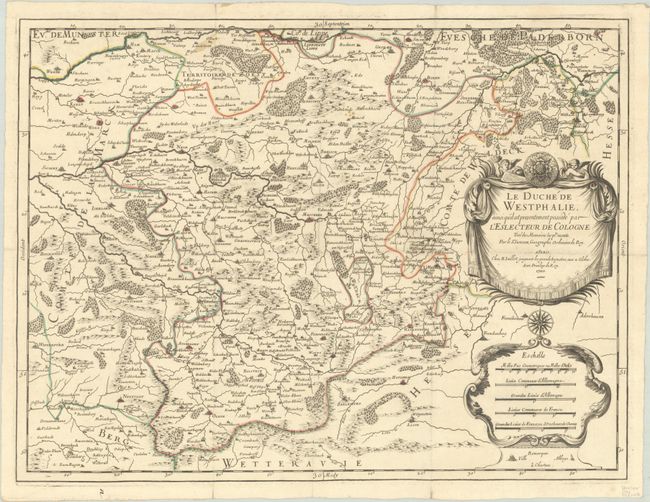
Auction 209, Lot 479
Subject: Western Germany
Sanson/Jaillot
Le Duche de Westphalie, Ainsi qu'il est Presentement Possede par l'Eslecteur de Cologne Tire des Memoires les Pl. Recents, 1700
Size: 22.8 x 17.2 inches (57.9 x 43.7 cm)
Estimate: $120 - $150
Unsold
Closed on 6/17/2026
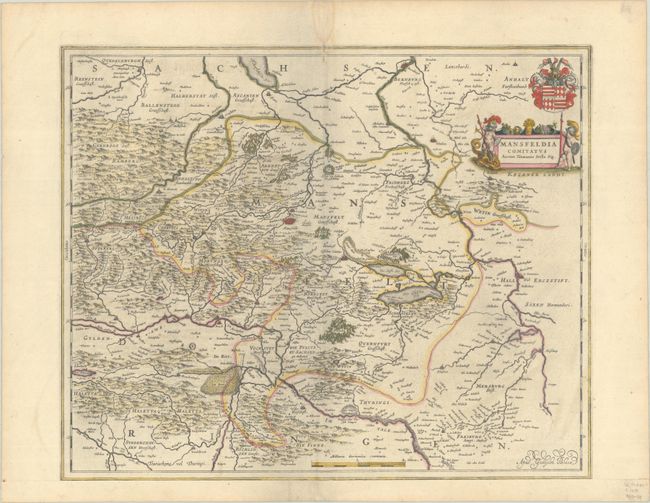
Auction 209, Lot 482
Subject: Central Germany
Blaeu, Willem
Mansfeldia Comitatus Auctore Tilemanno Stella Sig., 1650
Size: 19.6 x 16.1 inches (49.8 x 40.9 cm)
Estimate: $100 - $130
Unsold
Closed on 6/17/2026
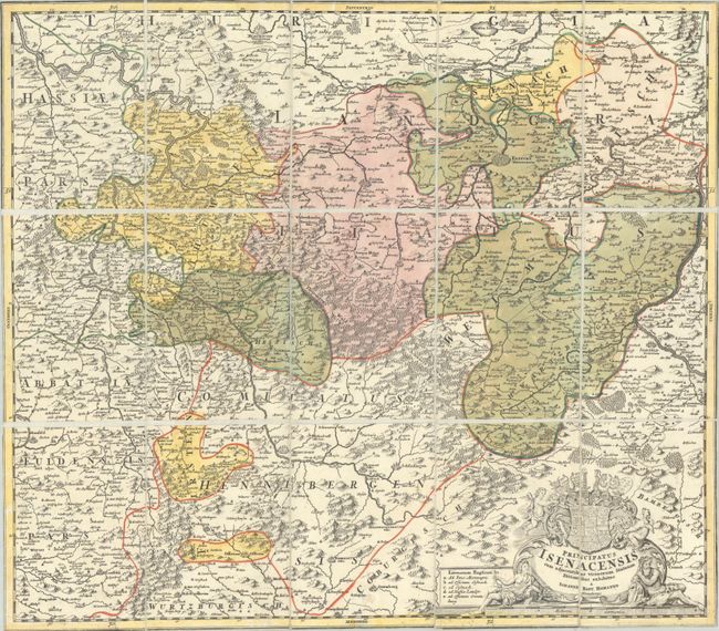
Auction 209, Lot 484
Subject: Central Germany
Homann, Johann Baptist
Principatus Isenacensis cum Adjacentibus Vicinorum Statuum Ditionibus Exhibitus, 1720
Size: 22.3 x 19.4 inches (56.6 x 49.3 cm)
Estimate: $100 - $130
Unsold
Closed on 6/17/2026
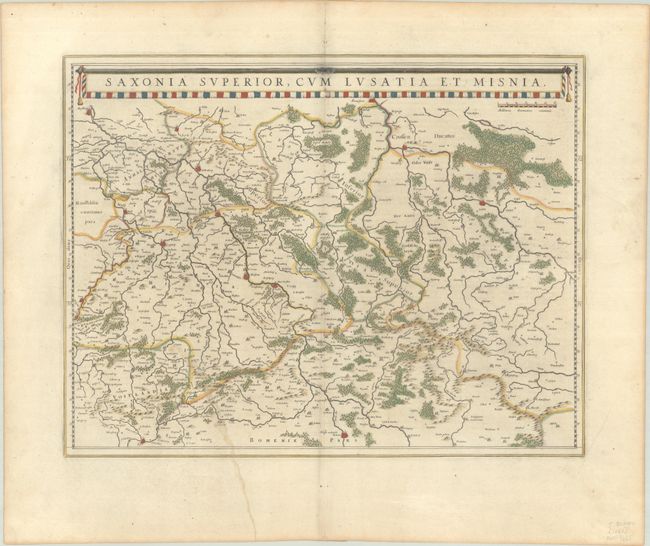
Auction 209, Lot 485
Subject: Eastern Germany
Blaeu, Johannes
Saxonia Superior, cum Lusatia et Misnia, 1662
Size: 20.1 x 15.5 inches (51.1 x 39.4 cm)
Estimate: $100 - $130
Unsold
Closed on 6/17/2026
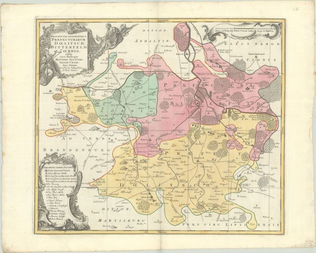
Auction 209, Lot 486
Subject: Eastern Germany
Seutter/Lotter
Descriptio Geographica Praefecturarum Doelitsch, Bitterfeld, Zoerbig..., 1730
Size: 22.8 x 19.7 inches (57.9 x 50 cm)
Estimate: $80 - $100
Unsold
Closed on 6/17/2026
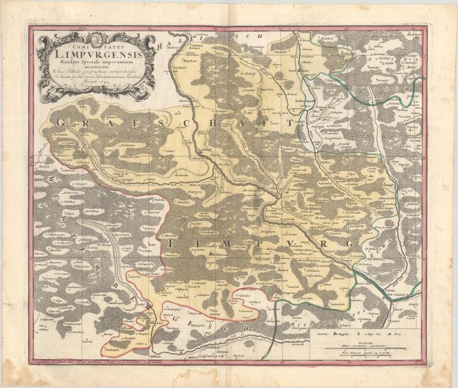
Auction 209, Lot 489
Subject: Southwestern Germany
Homann Heirs
Comitatus Limpurgensis Mandato Speciali Imperantium Mensuratus..., 1749
Size: 20.8 x 17.8 inches (52.8 x 45.2 cm)
Estimate: $100 - $130
Unsold
Closed on 6/17/2026
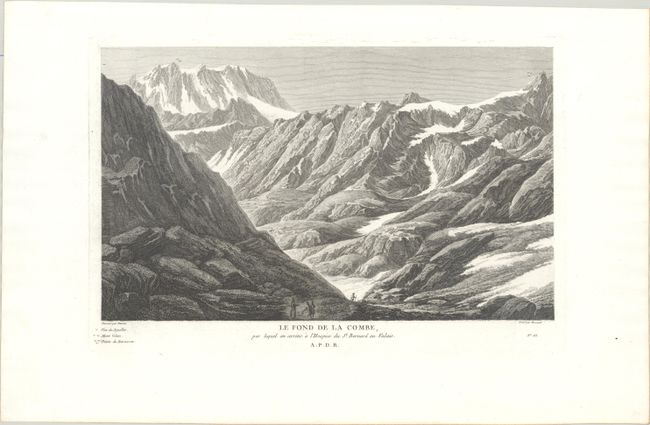
Auction 209, Lot 510
Subject: Great St. Bernard Pass, Switzerland, Alps
Le Fond de la Combe, par Lequel on Arrive a l'Hospice du St. Bernard au Valais, 1780
Size: 13.9 x 8.4 inches (35.3 x 21.3 cm)
Estimate: $110 - $140
View of Great St. Bernard Pass from Baron de Zurlauben's Great Illustrated Swiss History
Unsold
Closed on 6/17/2026
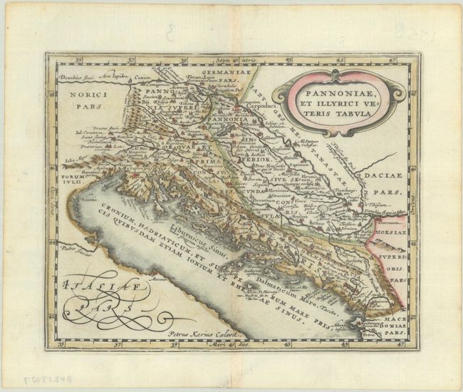
Auction 209, Lot 525
Subject: Western Balkans
Cluver, Philipp
Pannoniae, et Illyrici Veteris Tabula, 1676
Size: 7.8 x 6.1 inches (19.8 x 15.5 cm)
Estimate: $110 - $140
Unsold
Closed on 6/17/2026
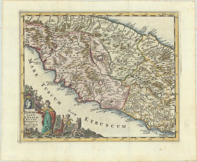
Auction 209, Lot 535
Subject: Central Italy
Cluver, Philipp
Etruriae Latii Umbriae Piceni Sabinorum et Marsorum Vetus et Nova Descriptio, 1729
Size: 10.1 x 8.2 inches (25.7 x 20.8 cm)
Estimate: $110 - $140
Unsold
Closed on 6/17/2026
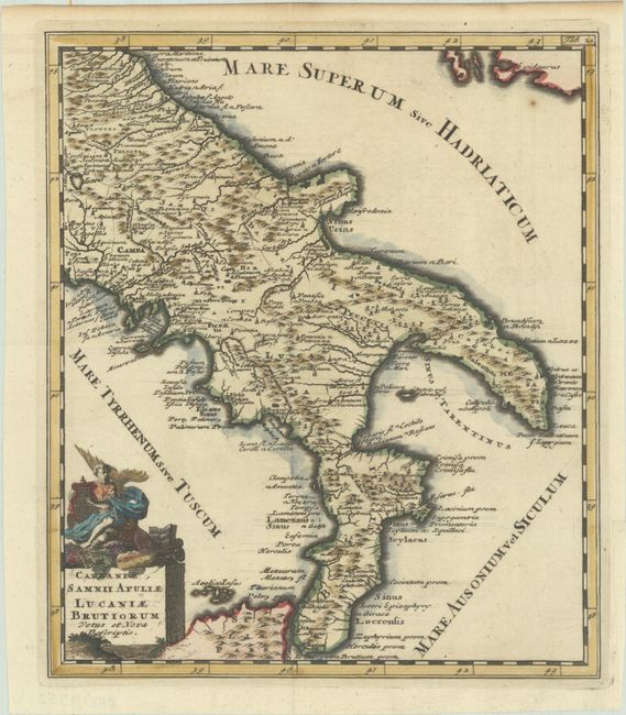
Auction 209, Lot 538
Subject: Southern Italy
Cluver, Philipp
Campaniae, Samnii Apuliae Lucaniae Brutiorum Vetus et Nova Descriptio, 1697
Size: 8.6 x 10.1 inches (21.8 x 25.7 cm)
Estimate: $95 - $120
Unsold
Closed on 6/17/2026
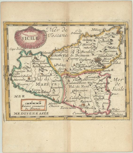
Auction 209, Lot 547
Subject: Sicily, Italy
Duval, Pierre
Sicile, 1682
Size: 5.2 x 4.1 inches (13.2 x 10.4 cm)
Estimate: $110 - $140
Unsold
Closed on 6/17/2026
57 lots
Page 1 of 2