Filtered by Category:United States(Show All Categories)
Showing results for:Auction 192
Catalog Archive
197 lots
Page 1 of 4
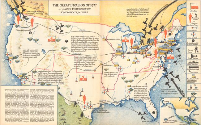
Auction 192, Lot 69
Subject: Cartographic Miscellany, United States
The Great Invasion of 19?? A Jingo's View, Based on Some Potent Realities, 1935
Size: 22.3 x 14 inches (56.6 x 35.6 cm)
Estimate: $220 - $250
Sold for: $110
Closed on 4/26/2023
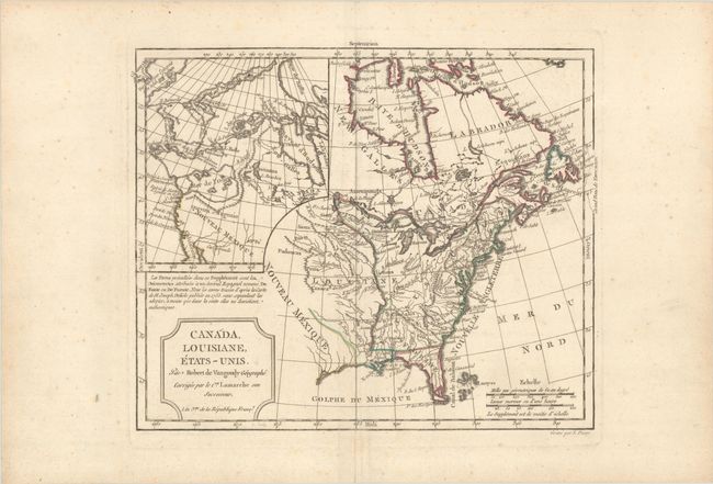
Auction 192, Lot 123
Subject: United States & Canada
Robert de Vaugondy/Delamarche
Canada, Louisiane, Etats-Unis, 1794
Size: 11.7 x 9.5 inches (29.7 x 24.1 cm)
Estimate: $230 - $275
Sold for: $170
Closed on 4/26/2023
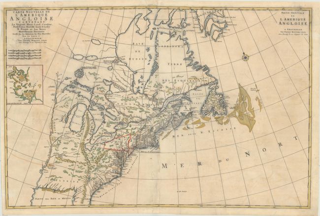
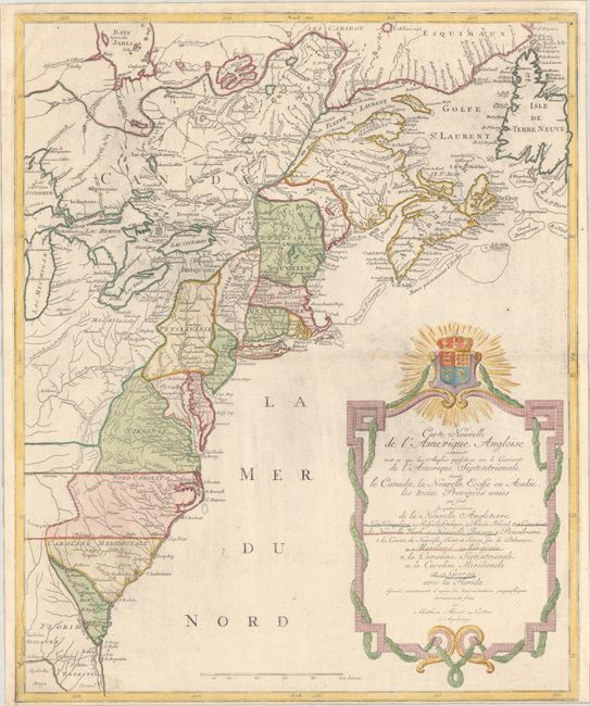
Auction 192, Lot 124
Subject: Colonial Eastern United States & Canada
Mortier, Pierre
Carte Nouvelle de l'Amerique Angloise Contenant la Virginie, Mary-Land, Caroline, Pensylvania Nouvelle Iorck. N: Iarsey N: France, et les Terres Nouvellement Decouerte..., 1700
Size: 35.4 x 23.4 inches (89.9 x 59.4 cm)
Estimate: $1,800 - $2,200
A Map Showing Fascinating Geographic Misconceptions
Sold for: $1,300
Closed on 4/26/2023
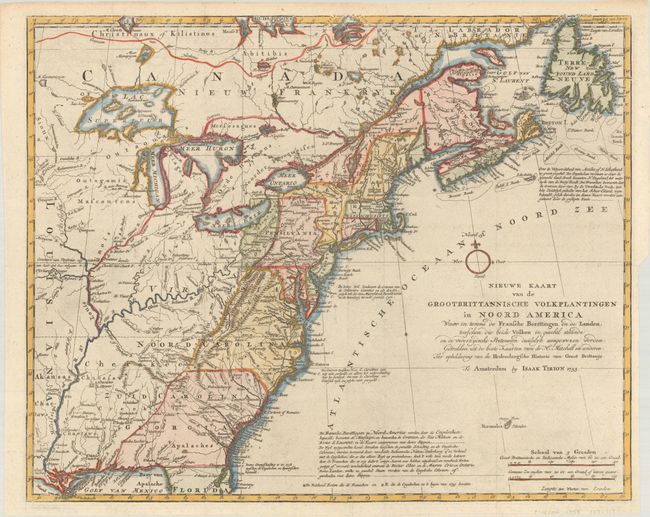
Auction 192, Lot 125
Subject: Colonial Eastern United States & Canada
Tirion, Isaac
Nieuwe Kaart van de Grootbrittannische Volkplantingen in Noord America waar in Tevens de Fransche Bezittingen en de Landen, Tusschen die Beide Volken in Geschil Staande..., 1755
Size: 17.9 x 14.5 inches (45.5 x 36.8 cm)
Estimate: $600 - $750
Sold for: $475
Closed on 4/26/2023
Auction 192, Lot 126
Subject: Colonial Eastern United States & Canada
Le Rouge, George Louis
[Canada et Louisiane], 1755
Size: 19.6 x 24.3 inches (49.8 x 61.7 cm)
Estimate: $1,200 - $1,500
Rare First State of Uncommon French & Indian War Map
Sold for: $750
Closed on 4/26/2023
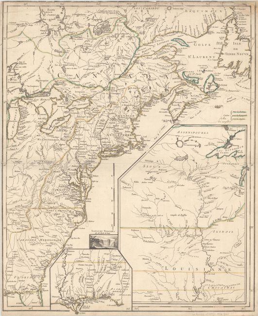
Auction 192, Lot 127
Subject: Colonial Eastern United States & Canada
Lotter, Mathias Albrecht
Carte Nouvelle de l'Amerique Angloise Contenant tout ce que les Anglois Possedent sur le Continent de l'Amerique Septentrionale Savoir le Canada, la Nouvelle Ecosse ou Acadie, les Treize Provinces Unies..., 1777
Size: 19.4 x 23.6 inches (49.3 x 59.9 cm)
Estimate: $1,000 - $1,300
Sold for: $750
Closed on 4/26/2023
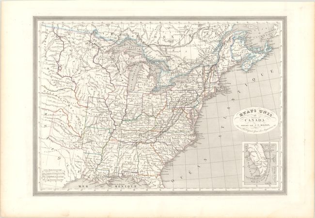
Auction 192, Lot 128
Subject: Eastern United States & Canada
Monin, Charles V.
Etats Unis et Canada, 1820
Size: 18 x 12.8 inches (45.7 x 32.5 cm)
Estimate: $140 - $170
Sold for: $100
Closed on 4/26/2023
Auction 192, Lot 129
Subject: Colonial Northeastern United States & Canada
Robert de Vaugondy, Didier
Carte des Pays Connus sous le Nom de Canada, dans Laquelle sont Distinguees les Possessions Francoises, & Angl?..., 1755
Size: 26.4 x 18.9 inches (67.1 x 48 cm)
Estimate: $2,300 - $2,750
A Separately Issued, French Political Propaganda Map at the Outset of the French & Indian War
Unsold
Closed on 4/26/2023
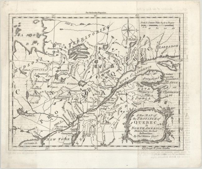
Auction 192, Lot 130
Subject: Colonial Northeastern United States & Canada
Kitchin, Thomas
A New Map of the Province of Quebec in North America; Drawn from the Best Authorities, 1764
Size: 8.6 x 6.8 inches (21.8 x 17.3 cm)
Estimate: $200 - $230
Sold for: $140
Closed on 4/26/2023
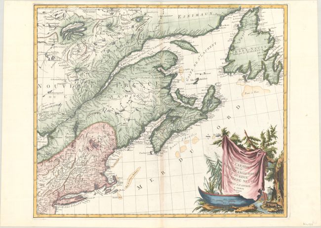
Auction 192, Lot 131
Subject: Colonial Northeastern United States & Canada
D'Anville/Santini
Partie Orientale du Canada, avec la Nouvelle Angleterre l'Acadie, et la Terre-Neuve, 1776
Size: 22.8 x 19.1 inches (57.9 x 48.5 cm)
Estimate: $475 - $600
Sold for: $500
Closed on 4/26/2023
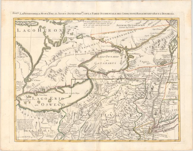
Auction 192, Lot 132
Subject: Colonial Northeastern United States & Canada, Great Lakes
Zatta, Antonio
La Pensilvania, la Nuova York, il Jersey Settentriole, con la Parte Occidentale del Connecticut, Massachusset-s Bay e l'Irochesia, 1780
Size: 16.6 x 12.1 inches (42.2 x 30.7 cm)
Estimate: $475 - $600
Sold for: $275
Closed on 4/26/2023
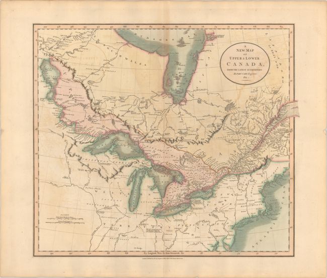
Auction 192, Lot 133
Subject: Northeastern United States & Canada
Cary, John
A New Map of Upper & Lower Canada, from the Latest Authorities, 1811
Size: 20.6 x 18 inches (52.3 x 45.7 cm)
Estimate: $350 - $425
Sold for: $250
Closed on 4/26/2023
Auction 192, Lot 134
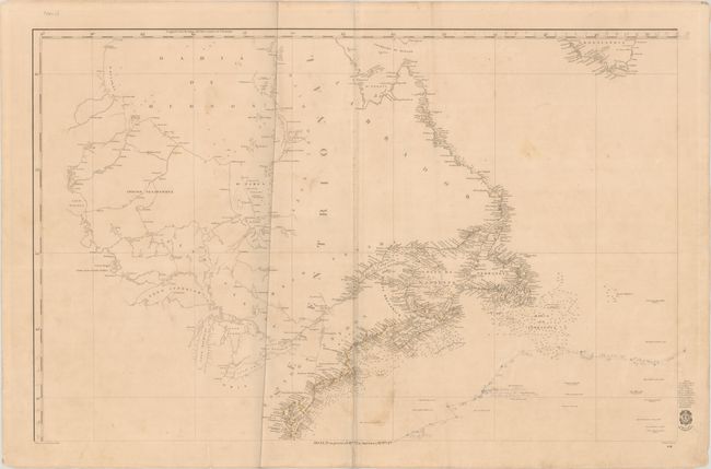
Subject: Northeastern United States & Canada
Direccion de Hidrografia
[Carta General del Oceano Atlantico Septentrional en Cuatro Hojas... - Northwestern Sheet] Hoja 3a. su Precio 13 Rs. Vn. En America 7 Rs. Pta. Fte., 1855
Size: 35.8 x 22.9 inches (90.9 x 58.2 cm)
Estimate: $300 - $400
NO RESERVE
Unsold
Closed on 4/26/2023
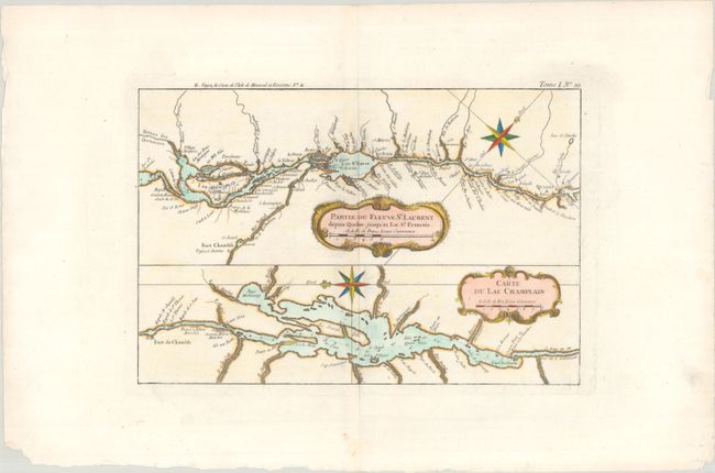
Auction 192, Lot 135
Subject: Lake Champlain & St. Lawrence River
Bellin, Jacques Nicolas
Partie du Fleuve St. Laurent Depuis Quebec Jusqu'au Lac St. Francois [on sheet with] Carte du Lac Champlain, 1764
Size: 12.4 x 8.3 inches (31.5 x 21.1 cm)
Estimate: $160 - $190
Sold for: $210
Closed on 4/26/2023
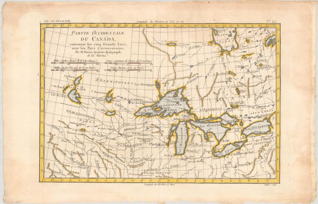
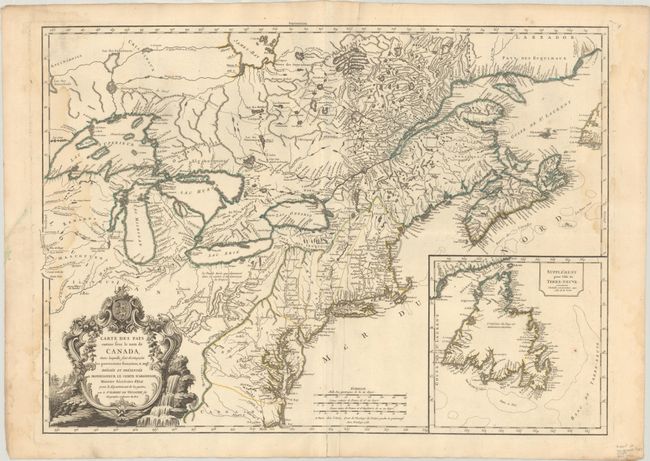
Auction 192, Lot 136
Subject: Colonial Great Lakes
Bonne, Rigobert
Partie Occidentale du Canada, Contenant les Cinq Grands Lacs, avec les Pays Circonvoisins, 1775
Size: 12.8 x 8.5 inches (32.5 x 21.6 cm)
Estimate: $200 - $230
Sold for: $325
Closed on 4/26/2023
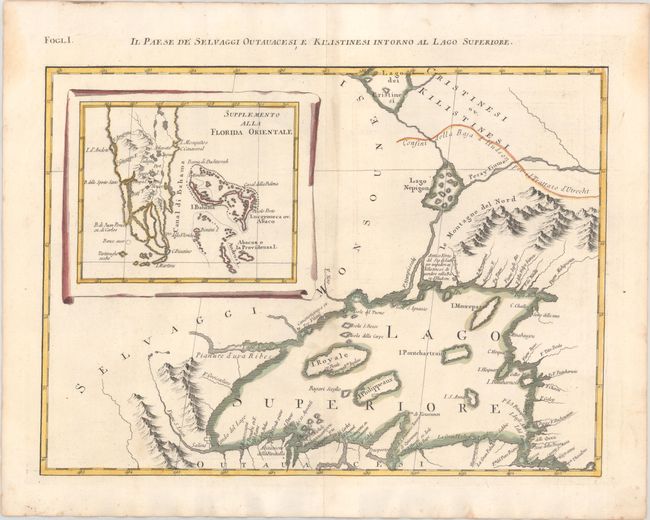
Auction 192, Lot 137
Subject: Colonial Great Lakes & Florida
Zatta, Antonio
Il Paese de Selvaggi Outauacesi, e Kilistinesi Intorno al Lago Superiore, 1780
Size: 16.6 x 12.1 inches (42.2 x 30.7 cm)
Estimate: $240 - $300
Sold for: $180
Closed on 4/26/2023
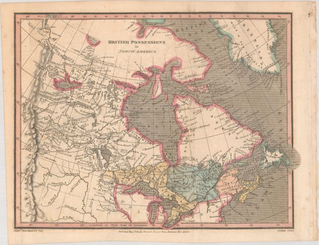
Auction 192, Lot 138
Subject: Northern United States & Canada
MacPherson, Alex.
British Possessions in North America, 1821
Size: 9.9 x 7.5 inches (25.1 x 19.1 cm)
Estimate: $110 - $140
Sold for: $60
Closed on 4/26/2023
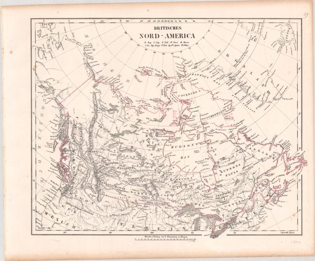
Auction 192, Lot 139
Subject: Northern United States & Canada
Flemming, Carl
[Lot of 3] Britisches Nord-America, 1844-50
Size: 15.8 x 12.6 inches (40.1 x 32 cm)
Estimate: $200 - $250
Set of 3 Oregon Boundary Maps
Sold for: $150
Closed on 4/26/2023
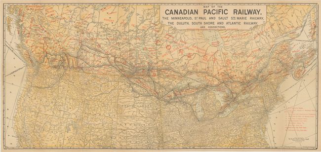
Auction 192, Lot 140
Subject: Northern United States & Canada
Poole Bros.
Map of the Canadian Pacific Railway, the Minneapolis, St. Paul and Sault Ste Marie Railway, the Duluth, South Shore and Atlantic Railway..., 1911
Size: 31.4 x 14.6 inches (79.8 x 37.1 cm)
Estimate: $140 - $170
Sold for: $100
Closed on 4/26/2023
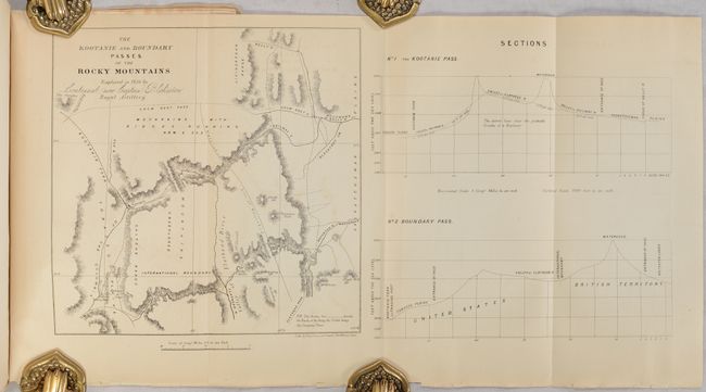
Auction 192, Lot 141
Subject: Northwestern Montana & Alberta, Canada
[Map in Report] The Kootanie and Boundary Passes of the Rocky Mountains Explored in 1858 by Lieutenant (now Captain) Blakiston Royal Artillery [in] The American Journal of Science and Art - Second Series. Vol. XXVII. - July, 1859 Nos. 82, 83, 84 , 1859
Size: 7.8 x 7.8 inches (19.8 x 19.8 cm)
Estimate: $150 - $180
Blakiston's Exploration of the Northern Rocky Mountains
Sold for: $100
Closed on 4/26/2023
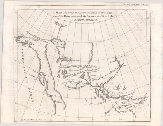
Auction 192, Lot 142
Subject: Western Canada & Alaska
Anon.
A Map Shewing the Communication of the Lakes and the Rivers Between Lake Superior and Slave Lake in North America, 1790
Size: 9.3 x 7.8 inches (23.6 x 19.8 cm)
Estimate: $240 - $300
Sold for: $180
Closed on 4/26/2023
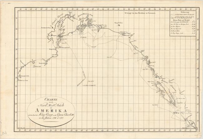
Auction 192, Lot 143
Subject: Western Canada & Alaska
Charte von der Nord-West Kuste von Amerika mit dem Laufe des King George u: der Queen Charlotte in den Jahren 1786 & 1787, 1791
Size: 17.4 x 11.8 inches (44.2 x 30 cm)
Estimate: $275 - $350
Unsold
Closed on 4/26/2023
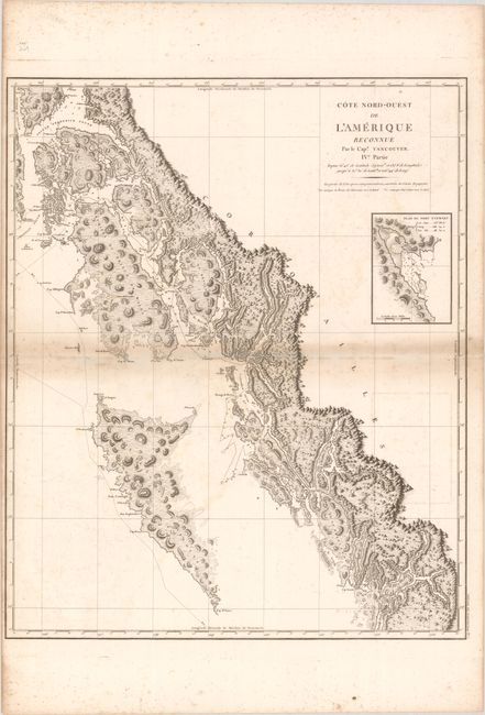
Auction 192, Lot 144
Subject: Western Canada & Alaska
Vancouver, George (Capt)
Cote Nord-Ouest de l'Amerique Reconnue par le Cape. Vancouver. IVe. Partie..., 1799
Size: 24.3 x 29.5 inches (61.7 x 74.9 cm)
Estimate: $500 - $650
Sold for: $450
Closed on 4/26/2023
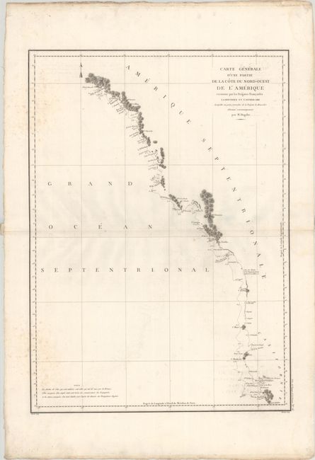
Auction 192, Lot 145
Subject: Western United States & Canada
La Perouse, Comte Jean F. Galoup, de
Carte Generale d'une Partie de la Cote du Nord-Ouest de l'Amerique Reconnue par les Fregates Francaises la Boussole et l'Astrolabe..., 1797
Size: 19.5 x 27.1 inches (49.5 x 68.8 cm)
Estimate: $180 - $210
Unsold
Closed on 4/26/2023
Auction 192, Lot 146
Subject: United States, Texas
Flemming, Carl
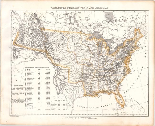
Vereinigte Staaten von Nord-America, 1844
Size: 16.3 x 12.3 inches (41.4 x 31.2 cm)
Estimate: $200 - $230
Sold for: $190
Closed on 4/26/2023
Auction 192, Lot 147
Subject: United States
Johnson & Browning
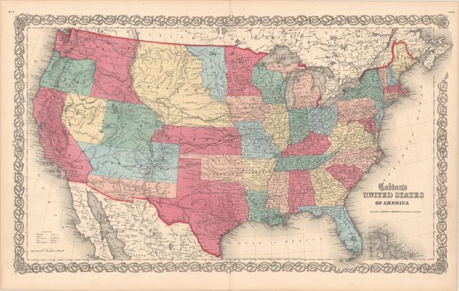
Colton's United States of America, 1859
Size: 26.4 x 15.7 inches (67.1 x 39.9 cm)
Estimate: $750 - $900
Scarce Map Featuring Colona
Sold for: $850
Closed on 4/26/2023
Auction 192, Lot 148
Subject: United States
Stanford, Edward
The United States of North America, 1860
Size: 15.1 x 12.5 inches (38.4 x 31.8 cm)
Estimate: $100 - $130
Sold for: $95
Closed on 4/26/2023
Auction 192, Lot 149
Subject: United States
Mitchell, Samuel Augustus
Map of the United States, and Territories. Together with Canada &c., 1860
Size: 21.5 x 13.1 inches (54.6 x 33.3 cm)
Estimate: $150 - $180
Sold for: $110
Closed on 4/26/2023
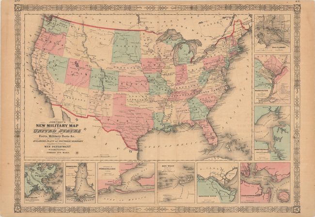
Auction 192, Lot 150
Subject: United States, Civil War, Montana
Johnson and Ward
Johnson's New Military Map of the United States Showing the Forts, Military Posts &c. with Enlarged Plans of Southern Harbors..., 1861
Size: 24 x 17.5 inches (61 x 44.5 cm)
Estimate: $200 - $250
Scarce Version with an Early Montana Territory
Sold for: $160
Closed on 4/26/2023
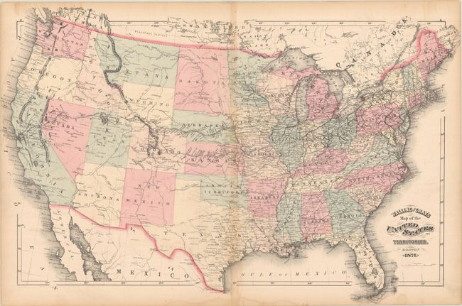
Auction 192, Lot 151
Subject: United States
Walling & Gray
Walling and Gray's Map of the United States and Territories, 1871
Size: 25.7 x 16.6 inches (65.3 x 42.2 cm)
Estimate: $160 - $190
Features an Orphaned "Part of Dakota"
Sold for: $120
Closed on 4/26/2023
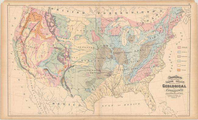
Auction 192, Lot 152
Subject: United States, Geology
Hitchcock, Charles Henry
Gray's Atlas Map of the United States Showing the Principal Geological Formations, 1873
Size: 26.5 x 16.3 inches (67.3 x 41.4 cm)
Estimate: $140 - $170
Sold for: $110
Closed on 4/26/2023
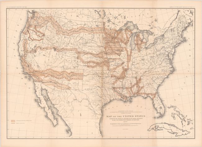
Auction 192, Lot 153
Subject: United States
U.S. Department of Interior
Map of the United States Exhibiting the Grants of Lands Made by the General Government to Aid in the Construction of Railroads and Wagon Roads, 1878
Size: 28.4 x 19.8 inches (72.1 x 50.3 cm)
Estimate: $275 - $350
Sold for: $200
Closed on 4/26/2023
Auction 192, Lot 154
Subject: United States
Vuillemin, Alexander A.
Etats-Unis, 1880
Size: 14.8 x 10.8 inches (37.6 x 27.4 cm)
Estimate: $50 - $70
NO RESERVE
Sold for: $55
Closed on 4/26/2023
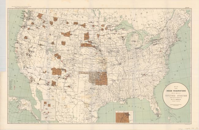
Auction 192, Lot 155
Subject: United States
U.S. Bureau of Indian Affairs
Map Showing Indian Reservations Within the Limits of the United States Compiled Under the Direction of the Hon. T.J. Morgan, 1894
Size: 33.3 x 21.1 inches (84.6 x 53.6 cm)
Estimate: $160 - $190
Sold for: $300
Closed on 4/26/2023
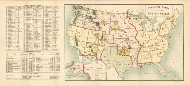
Auction 192, Lot 156
Subject: United States
Territorial Growth of the United States, 1898
Size: 12.5 x 8.1 inches (31.8 x 20.6 cm)
Estimate: $140 - $170
First Correct GLO Map of United States Territorial Growth
Sold for: $100
Closed on 4/26/2023
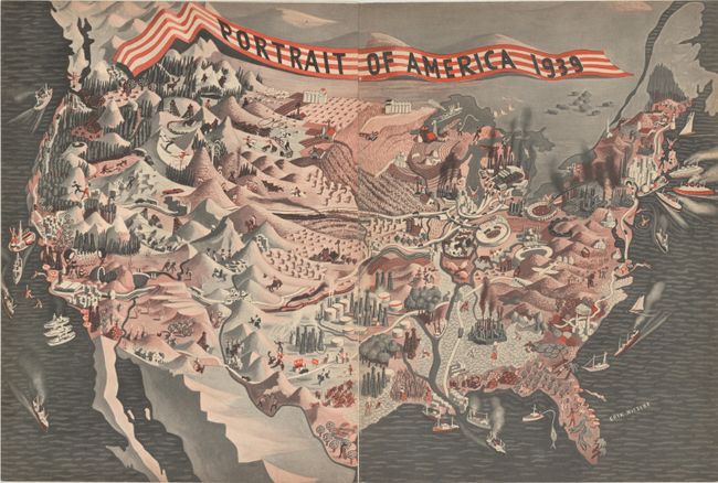
Auction 192, Lot 157
Subject: United States, World War II
Portrait of America 1939, 1939
Size: 20.9 x 14.1 inches (53.1 x 35.8 cm)
Estimate: $100 - $130
Sold for: $75
Closed on 4/26/2023
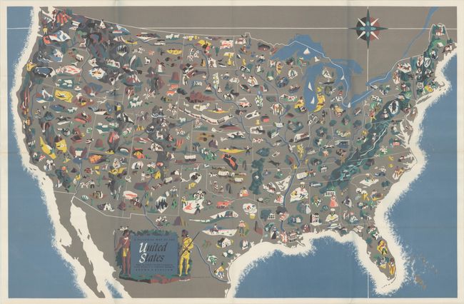
Auction 192, Lot 158
Subject: United States
Rand McNally & Co.
A Pictorial Map of the United States, 1944
Size: 36.8 x 24 inches (93.5 x 61 cm)
Estimate: $180 - $220
Sold for: $60
Closed on 4/26/2023
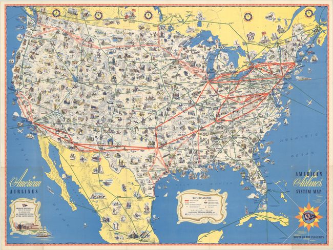
Auction 192, Lot 159
Subject: United States, Aviation
American Airlines System Map - Route of the Flagships, 1945
Size: 31.3 x 23.3 inches (79.5 x 59.2 cm)
Estimate: $100 - $130
NO RESERVE
Sold for: $190
Closed on 4/26/2023
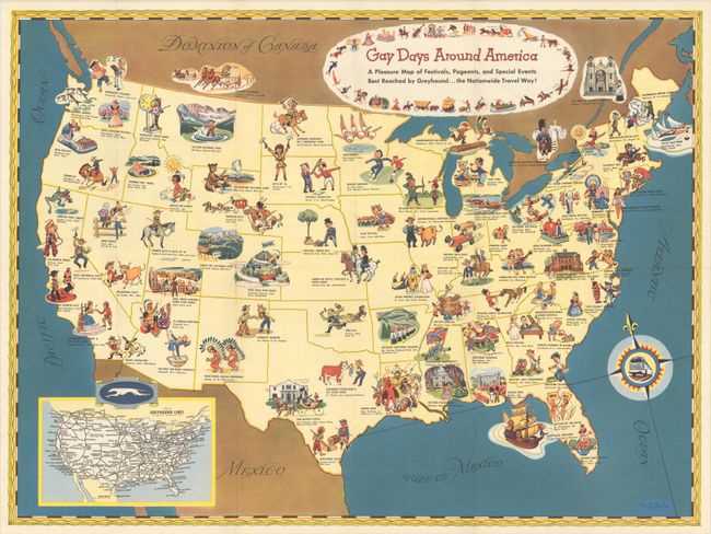
Auction 192, Lot 160
Subject: United States
Gay Days Around America - A Pleasure Map of Festivals, Pageants, and Special Events Best Reached by Greyhound... the Nationwide Travel Way!, 1949
Size: 23.4 x 17.5 inches (59.4 x 44.5 cm)
Estimate: $220 - $250
Sold for: $550
Closed on 4/26/2023
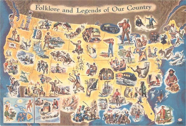
Auction 192, Lot 161
Subject: United States
Folklore and Legends of Our Country, 1962
Size: 33.6 x 22.6 inches (85.3 x 57.4 cm)
Estimate: $160 - $190
Sold for: $120
Closed on 4/26/2023
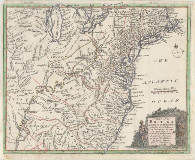
Auction 192, Lot 162
Subject: Colonial Eastern United States
Bowen, Emanuel
A Map of the British American Plantations, Extending from Boston in New England to Georgia; Including All the Back Settlements in the Respective Provinces, as Far as the Mississipi, 1754
Size: 10.8 x 8.8 inches (27.4 x 22.4 cm)
Estimate: $400 - $500
Sold for: $300
Closed on 4/26/2023
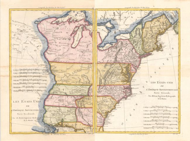
Auction 192, Lot 163
Subject: Eastern United States
Bonne, Rigobert
[Lot of 2] Les Etats Unis de l'Amerique Septentrionale, Partie Occidentale [and] ... Partie Orientale, 1787
Size: 9.3 x 13.6 inches (23.6 x 34.5 cm)
Estimate: $350 - $425
Sold for: $250
Closed on 4/26/2023
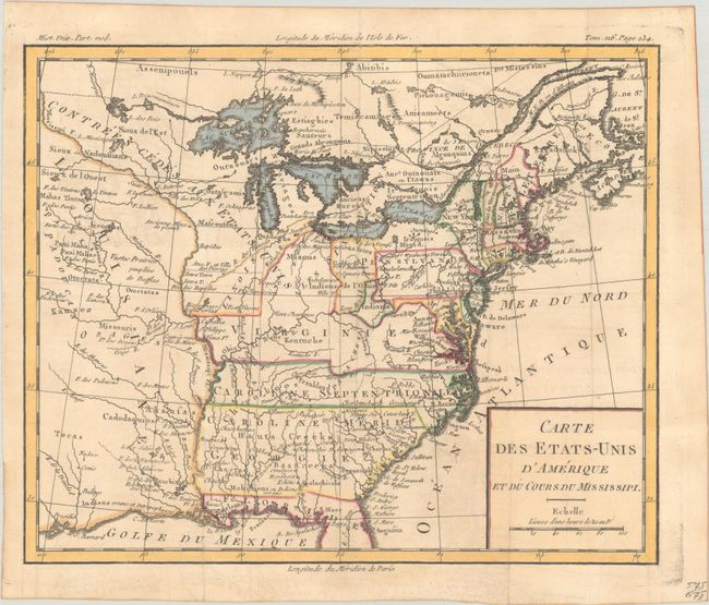
Auction 192, Lot 164
Subject: Eastern United States, Franklin
Brion de la Tour, Louis
Carte des Etats-Unis d'Amerique et du Cours du Mississipi, 1788
Size: 10.7 x 8.8 inches (27.2 x 22.4 cm)
Estimate: $950 - $1,200
One of the Earliest Maps to Feature the State of Franklin
Sold for: $1,100
Closed on 4/26/2023
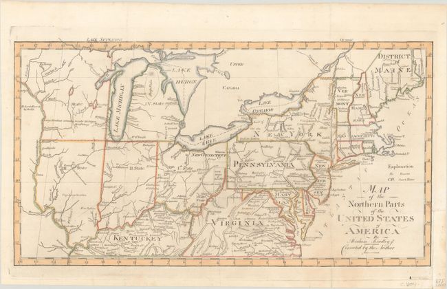
Auction 192, Lot 165
Subject: Eastern United States
Bradley, Abraham Jr.
Map of the Northern Parts of the United States of America, 1804
Size: 15.5 x 8.5 inches (39.4 x 21.6 cm)
Estimate: $350 - $425
Sold for: $275
Closed on 4/26/2023
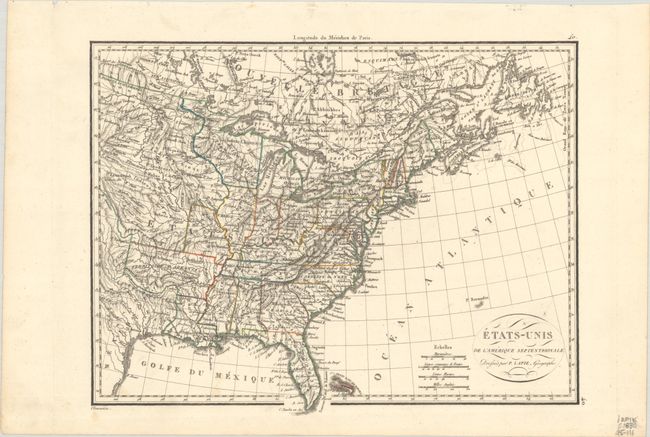
Auction 192, Lot 166
Subject: Eastern United States
Lapie, Alexander Emile & Pierre
Etats-Unis de l'Amerique Septentrionale, 1830
Size: 11.9 x 9.1 inches (30.2 x 23.1 cm)
Estimate: $110 - $140
Sold for: $80
Closed on 4/26/2023
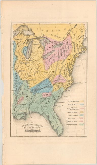
Auction 192, Lot 167
Subject: Eastern United States
Aboriginal America, East of the Mississippi, 1844
Size: 4.3 x 6.4 inches (10.9 x 16.3 cm)
Estimate: $90 - $110
NO RESERVE
Sold for: $120
Closed on 4/26/2023
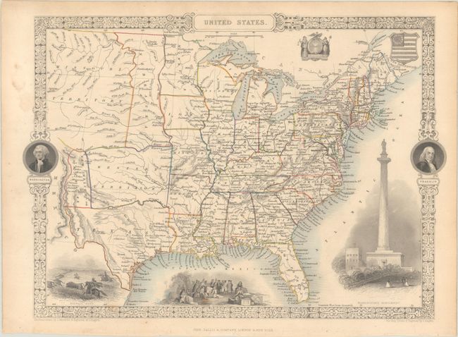
Auction 192, Lot 168
Subject: Eastern United States
Tallis, John
United States, 1851
Size: 13.5 x 9.8 inches (34.3 x 24.9 cm)
Estimate: $200 - $230
Sold for: $150
Closed on 4/26/2023
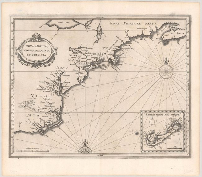
Auction 192, Lot 169
Subject: Colonial New England & Mid-Atlantic United States
Gerritsz/De Laet
Nova Anglia, Novum Belgium et Virginia, 1630
Size: 14 x 11 inches (35.6 x 27.9 cm)
Estimate: $6,000 - $7,500
A Critically Important Map in the Cartographic Evolution of North America
Sold for: $4,500
Closed on 4/26/2023
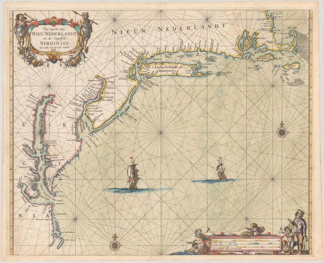
Auction 192, Lot 170
Subject: Colonial New England & Mid-Atlantic United States
Goos, Pieter
Pas Caerte van Nieu Nederlandt en de Engelsche Virginies Van Cabo Cod tot Cabo Canrick, 1666
Size: 20.9 x 16.9 inches (53.1 x 42.9 cm)
Estimate: $7,000 - $8,500
Goos' Gorgeous Chart of the Mid-Atlantic & New England
Unsold
Closed on 4/26/2023
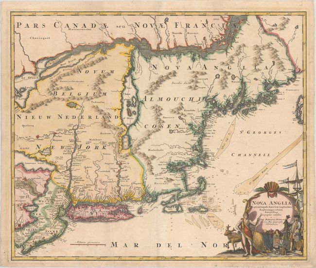
Auction 192, Lot 171
Subject: Colonial New England & Mid-Atlantic United States
Homann, Johann Baptist
Nova Anglia Septentrionali Americae Implantata Anglorumque Coloniis Florentissima, 1730
Size: 22.9 x 19.2 inches (58.2 x 48.8 cm)
Estimate: $950 - $1,200
Sold for: $650
Closed on 4/26/2023
197 lots
Page 1 of 4