Subject: Western Canada & Alaska
Period: 1790 (published)
Publication: Gentleman's Magazine
Color: Black & White
Size:
9.3 x 7.8 inches
23.6 x 19.8 cm
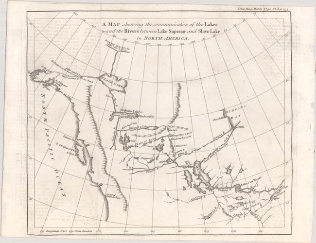
This intriguing map is based on the map and report by Peter Pond in 1787. The map traces the route from Lake Superior to Lake Winnipeg and then through an interconnected chain of lakes and rivers to Arabaska Lake and Slave Lake. The most interesting feature is the speculative river flowing out of Slave Lake, over "falls said to be the largest in the known world," and emptying into Cook Inlet in Alaska, a remarkable journey considering the topography. Pond's map influenced Alexander Mackenzie's quest to find the Northwest Passage in his famous expedition in the region. Published in the March 1790 issue with no attribution to the engraver.
References: Hayes #103; Jolly #GENT-283; Kershaw #1159; Wheat (TMW) #222.
Condition: B+
A crisp impression on a bright sheet, issued folding with offsetting from an opposing page of text along the sides of the map.