Subject: United States
Period: 1860 (dated)
Publication:
Color: Hand Color
Size:
21.5 x 13.1 inches
54.6 x 33.3 cm
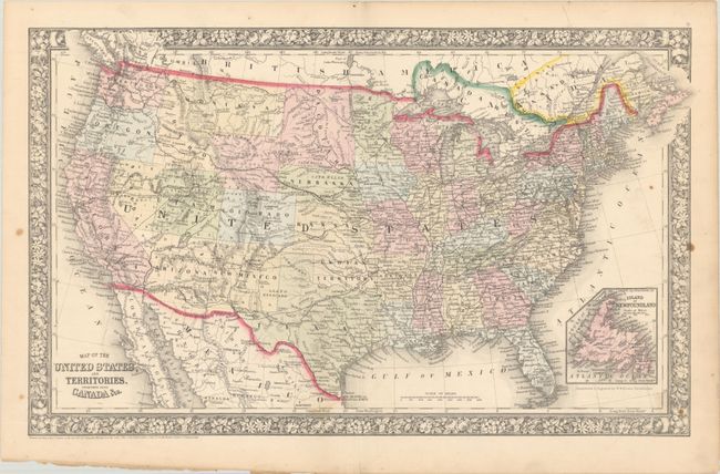
This is an attractive map of the United States enclosed in a floral border. It shows one large Dacotah Territory attached to the region that would become Wyoming (1868). Arizona is still in possession of the southern tip of present-day Nevada, and Utah is oversized as the newly formed Nevada borders on the 115th meridian. Oklahoma is Indian Territory. An extensive railroad network runs throughout the East, with proposed railroads, wagon roads, emigrant routes, and the Overland Mail Route shown in the western territories. Copyright date 1860, but published in 1865.
References:
Condition: B+
There are a few faint spots and minor chips along the bottom sheet edge, away from the map image.