Subject: United States & Canada
Period: 1794 (dated)
Publication:
Color: Hand Color
Size:
11.7 x 9.5 inches
29.7 x 24.1 cm
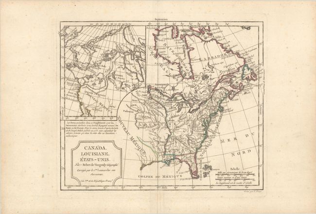
This interesting map shows the colonial possessions of England, France and Spain in North America. The United States extends to the Mississippi River while Spain controls Florida and Nouveau Mexique, and France controls Canada and Louisiana. The most notable part of the map however, is the large inset map that covers the west coast and describes two remarkable cartographic misconceptions; a huge Mer de l' Ouest or Sea of the West and a Northwest Passage through a system of rivers and lakes connecting Hudson Bay with the Pacific based on the fictitious discoveries of Admiral de Font. This is the third state of the map with a re-engraved title cartouche. Engraved by E. Dussy.
References: McCorkle #762.3; McGuirk #110; Pedley #449; Sellers & Van Ee #96.
Condition: B+
A nice impression with contemporary outline color on a sheet with a large medallion watermark, light foxing, and a bit of creasing along the centerfold.