Subject: Northeastern United States & Canada
Period: 1811 (dated)
Publication: New Universal Atlas
Color: Hand Color
Size:
20.6 x 18 inches
52.3 x 45.7 cm
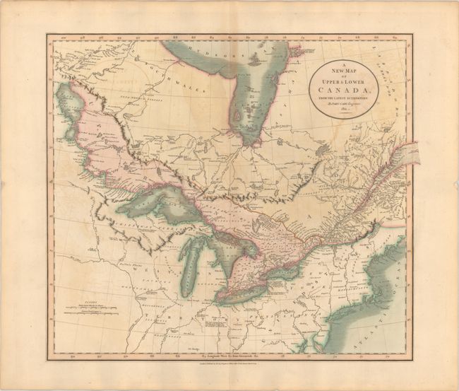
This is the second edition of Cary’s map of eastern Canada and the United States. Centered on the Great Lakes, it extends to Lake Winnipeg, Hudson Bay, the St. Lawrence estuary, and the New England coast. The map is filled with place names, excellent detail of interior watersheds, and copious notations concerning the land, animals, and native inhabitants. In the United States, a large Western Territory extends from the Ohio River to the headwaters of the Mississippi River with the fictitious Isle Philippeaux in Lake Superior serving as a boundary point with Canada.
References: cf. Phillips (A) #714-53.
Condition: B+
A crisp impression on a sturdy sheet with light offsetting and a tiny hole to the right of the title cartouche.