Catalog Archive
Auction 192, Lot 155

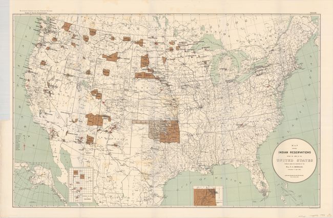
"Map Showing Indian Reservations Within the Limits of the United States Compiled Under the Direction of the Hon. T.J. Morgan", U.S. Bureau of Indian Affairs

Subject: United States

Period: 1894 (published)

Publication: Eleventh Census of the United States

Color: Printed Color

Size:
33.3 x 21.1 inches
84.6 x 53.6 cm
Download High Resolution Image
(or just click on image to launch the Zoom viewer)

This oversized map of the United States focuses on the large number of Indian Reservations that existed in 1894. The reservations are named and shown in dark brown overprinting. Inset maps are used where the reservation concentration prevents them showing well on the large map. Insets include Indian Territory and the Mission Indian Reservations in California. A third inset covers the Territory of Alaska. The extensive legend locates Military Stations, Capitals, County Seats, railroads, Indian Agencies, Training Schools, Boarding Schools, Day Schools, and Contract Schools. Printed by Sackett & Wilheims Litho Co., New York.

References:

Condition: B+

Issued folding with some light color offsetting and a short binding tear at left that has been closed on verso with archival tape.

Estimate: $160 - $190

Sold for: $300

Closed on 4/26/2023

Archived