Subject: Western Canada & Alaska
Period: 1799 (circa)
Publication: Vancouver's Voyages (French Edition)
Color: Black & White
Size:
24.3 x 29.5 inches
61.7 x 74.9 cm
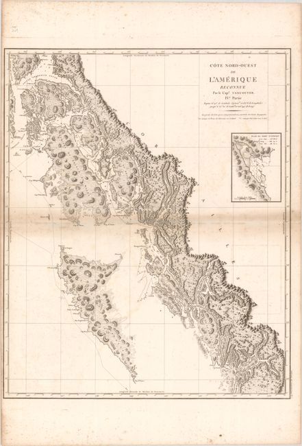
This is the French edition of an important, large-scale chart presenting the coastal topography from Frederick Sound, Alaska south to Queen Charlotte Islands and east to mainland British Columbia. The track of Vancouver's route is shown zigzagging throughout the region and is coupled with excellent detail of the coastlines, along with numerous shoals, soundings, anchorages identified. The chart features an inset of Fort Stewart at right. During the summers of 1792-94, George Vancouver and the crew of the British naval ships Discovery and Chatham mapped the western coast of North America from Baja California to Alaska. Vancouver's voyage was the last, and longest, of the great Pacific voyages of the late eighteenth century. Taking the art and technique of distant voyaging to a new level, Vancouver eliminated the possibility of a Northwest Passage, and his remarkably precise surveys completed the outline of the Pacific.
References: Phillips (Atlases) #1219; cf. Wagner #855.
Condition: B
A crisp impression with scattered foxing, minor soiling adjacent to the centerfold, and a few wormholes along the left centerfold. There is a light extraneous crease down the center of the map, likely the result of a previous owner folding it in half.