Subject: Colonial Northeastern United States & Canada, Great Lakes
Period: 1780 (circa)
Publication: Atlante Novissimo
Color: Hand Color
Size:
16.6 x 12.1 inches
42.2 x 30.7 cm
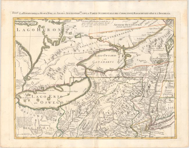
This is one sheet of Zatta's version of John Mitchell's epic and important map of the United States. The whole map was titled Le Colonie Unite dell' America Settentrle and was published as a set of twelve individual maps. This fifth sheet covers the northeastern United States and eastern Canada from the Hudson River west to lakes Ontario, Erie and Huron. Pennsylvania is shown extending too far to the north with New York squeezed in to its north and east, and the boundary dispute between New Jersey and New York is prominently depicted. The interior is filled with Indian tribes, trails, forts and settlements, river systems, and copious notations.
This example is accompanied by a copy of the map printed on a transparency sheet.
References: Sellers and Van Ee #163; Shirley (BL Atlases) T.ZAT-1a, Vol. 4 #32.
Condition: A
A crisp impression with contemporary color on a bright sheet with the watermarks of three crescent moons and "Mezana." There is a hint of toning and offsetting along the centerfold, and light dampstains in the top corners of the sheet.