Filtered by Category:Pacific Ocean, New Zealand, Australia(Show All Categories)
Showing results for:Auction 192
Catalog Archive
13 lots
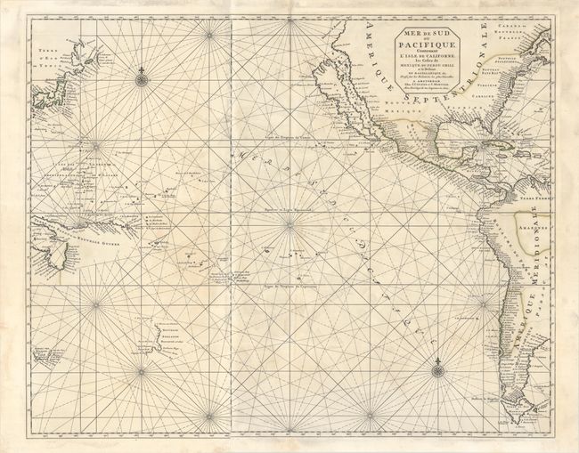
Auction 192, Lot 682
Subject: Pacific Ocean
Covens & Mortier
Mer de Sud, ou Pacifique, Contenant l'Isle de Californe, les Costes de Mexique, du Perou, Chili, et le Destroit de Magellanique &c..., 1721
Size: 29.3 x 23.5 inches (74.4 x 59.7 cm)
Estimate: $2,400 - $3,000
Dramatic Sea Chart Featuring the Island of California
Unsold
Closed on 4/26/2023
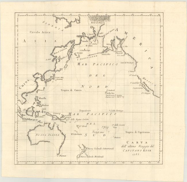
Auction 192, Lot 683
Subject: Pacific Ocean
La Harpe, Jean Francis de
Carta dell' Ultimo Viaggio del Capitano Kook, 1785
Size: 13.3 x 13.6 inches (33.8 x 34.5 cm)
Estimate: $325 - $400
Unsold
Closed on 4/26/2023
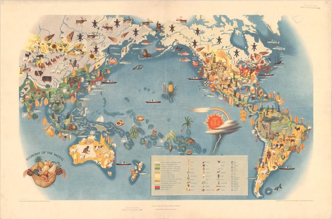
Auction 192, Lot 684
Subject: Pacific Ocean
Covarrubias, Miguel
Economy of the Pacific - Plate IV: Pageant of the Pacific, 1940
Size: 33.8 x 21.2 inches (85.9 x 53.8 cm)
Estimate: $160 - $190
Sold for: $160
Closed on 4/26/2023
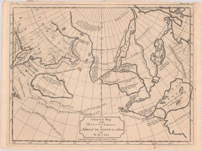
Auction 192, Lot 685
Subject: North Pacific Ocean
Delisle, Joseph Nicholas
A General Map of the Discoveries of Admiral de Fonte & Others, by M. De l'Isle, 1754
Size: 10.1 x 7.8 inches (25.7 x 19.8 cm)
Estimate: $160 - $190
Sold for: $120
Closed on 4/26/2023
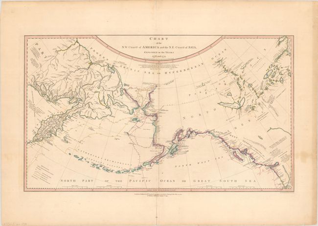
Auction 192, Lot 686
Subject: North Pacific Ocean
Faden, William
Chart of the N.W. Coast of America and the N.E. Coast of Asia, Explored in the Years 1778 and 1779, 1794
Size: 26.9 x 15.6 inches (68.3 x 39.6 cm)
Estimate: $700 - $850
Sold for: $500
Closed on 4/26/2023
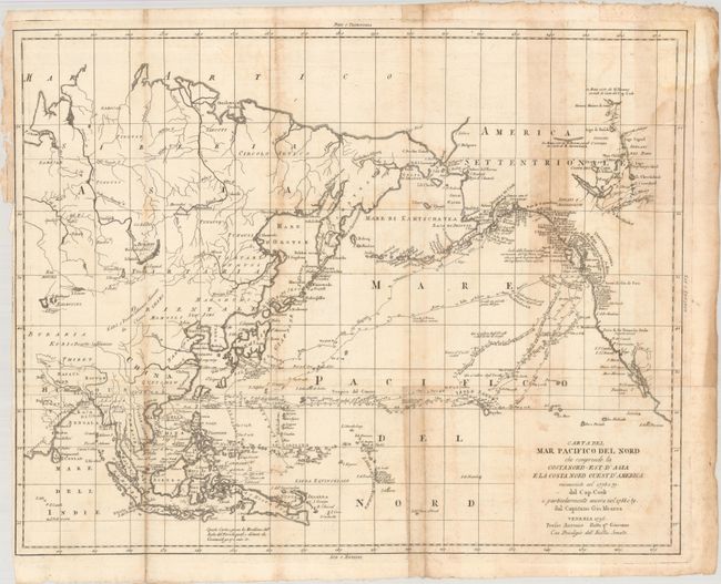
Auction 192, Lot 687
Subject: North Pacific Ocean
Meares, John (Capt.)
Carta del Mar Pacifico del Nord che Comprende la Costa Nord-Est d'Asia e la Costa Nord Ouest d'America Riconosciute nel 1778 e 79 dal Cap. Cook..., 1796
Size: 22.9 x 18.1 inches (58.2 x 46 cm)
Estimate: $300 - $375
Sold for: $220
Closed on 4/26/2023
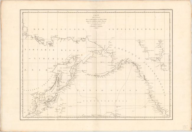
Auction 192, Lot 688
Subject: North Pacific Ocean
La Perouse, Comte Jean F. Galoup, de
Carte des Cotes de l'Amerique et de l'Asie Depuis la Californie Jusqu'a Macao..., 1797
Size: 27.3 x 19.7 inches (69.3 x 50 cm)
Estimate: $200 - $230
Sold for: $150
Closed on 4/26/2023
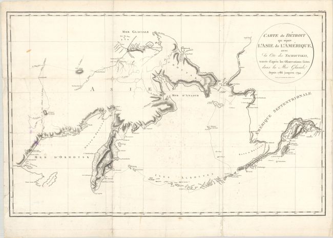
Auction 192, Lot 689
Subject: North Pacific Ocean
Sauer, Martin
Carte du Detroit qui Separe l'Asie de l'Amerique, avec la Cote des Tschoutskis, Tracee d'Apres Les Observationsfaites dans la Mer Glaciale Depuis 1786 Jusqu' en 1794, 1802
Size: 24 x 15.6 inches (61 x 39.6 cm)
Estimate: $90 - $120
NO RESERVE
Sold for: $17
Closed on 4/26/2023
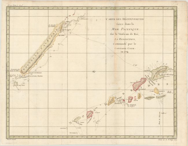
Auction 192, Lot 690
Subject: New Caledonia & New Hebrides
Cook/Benard
Carte des Decouvertes Faites dans la Mer Pacifique sur le Vaisseau de Roi, la Resolution, Commande par le Capitaine Cook. En 1774, 1778
Size: 18.3 x 14.2 inches (46.5 x 36.1 cm)
Estimate: $110 - $140
Sold for: $80
Closed on 4/26/2023
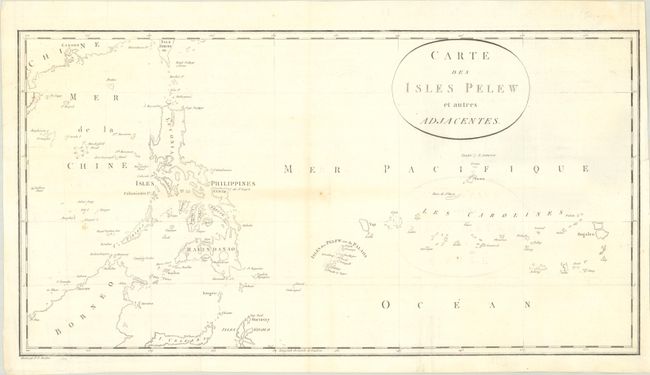
Auction 192, Lot 691
Subject: Pacific Islands
Wilson, Capt. Henry
Carte des Isles Pelew et Autres Adjacentes, 1788
Size: 20.9 x 11 inches (53.1 x 27.9 cm)
Estimate: $400 - $475
Sold for: $250
Closed on 4/26/2023
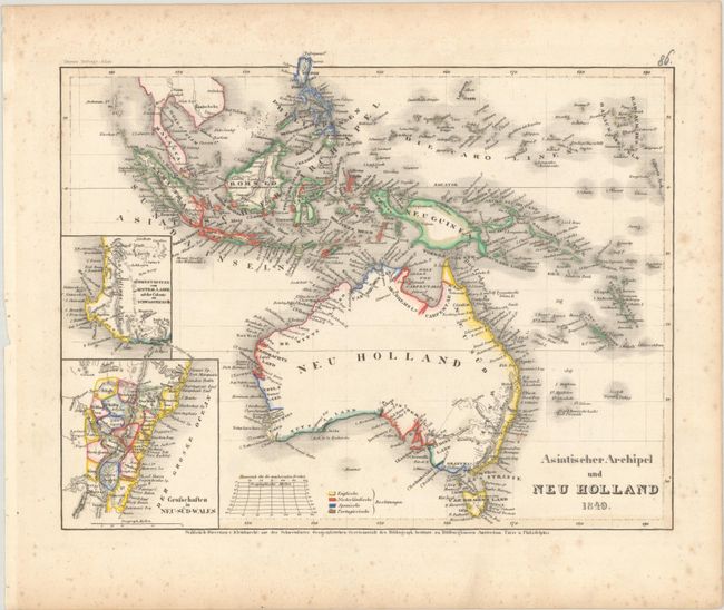
Auction 192, Lot 692
Subject: Australia & East Indies
Radefeld, Carl Christian Franz
Asiatischer Archipel und Neu Holland, 1849
Size: 10.6 x 8.3 inches (26.9 x 21.1 cm)
Estimate: $100 - $130
Sold for: $75
Closed on 4/26/2023
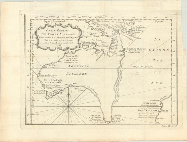
Auction 192, Lot 693
Subject: Australia
Bellin, Jacques Nicolas
Carte Reduite des Terres Australes pour Servir a l'Histoire des Voyages, 1753
Size: 11 x 8 inches (27.9 x 20.3 cm)
Estimate: $900 - $1,100
A Rare Pre-Cook Map Focusing on Australia
Sold for: $650
Closed on 4/26/2023
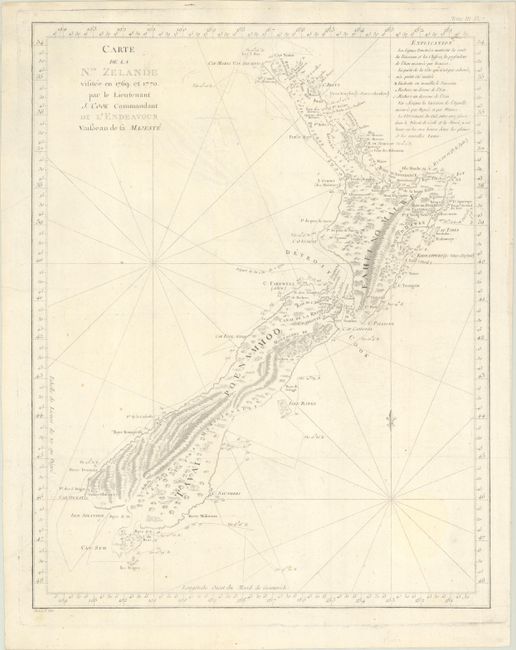
Auction 192, Lot 694
Subject: New Zealand
Cook/Benard
Carte de la Nle. Zelande Visitee en 1769 et 1770. Par le Lieutenant J. Cook Commandant de l'Endeavour Vaisseau de sa Majeste, 1785
Size: 14.8 x 18.9 inches (37.6 x 48 cm)
Estimate: $1,200 - $1,500
Cook's Landmark Map of New Zealand
Sold for: $900
Closed on 4/26/2023
13 lots