Subject: Eastern United States
Period: 1830 (circa)
Publication:
Color: Hand Color
Size:
11.9 x 9.1 inches
30.2 x 23.1 cm
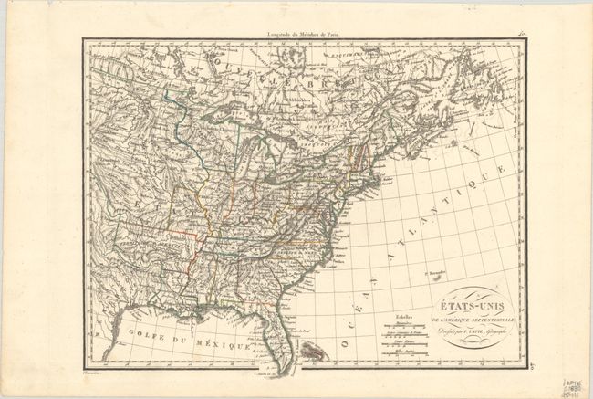
Interesting map of the United States in the first part of the 19th century that features a very well mapped river system. Missouri has a vertical western border and the Northwest Territory takes in present-day Wisconsin and Minnesota. Arkansas Territory is in its largest configuration with its western boundary at the Texas panhandle. Texas is still part of Mexico and includes a few place names such as S. Antonio and Nacogdoches. The balance of the Midwest is labeled with numerous Indian tribes. Fancy titling in a small oval cartouche. Four distance scales with longitude measured only from Paris. Engraved by Chamouin.
References:
Condition: A
Contemporary outline color on a bright sheet with a couple of very faint spots and remnants of hinge tape on verso.