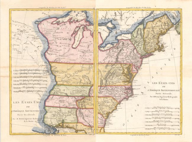
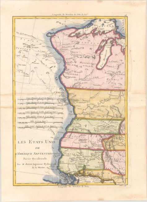
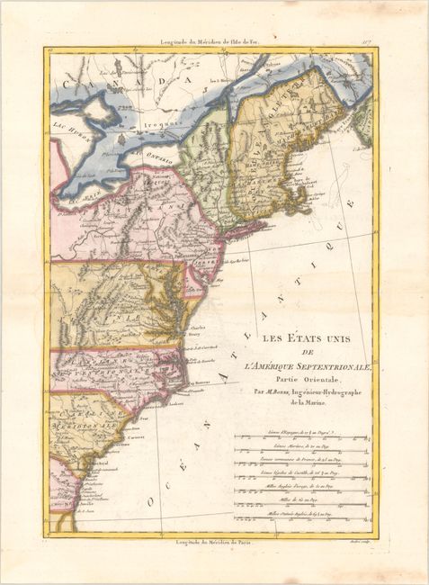
Subject: Eastern United States
Period: 1787 (circa)
Publication:
Color: Hand Color
Size:
9.3 x 13.6 inches
23.6 x 34.5 cm
Matched pair of maps covering the territory of the newly created United States. Partie Orientale covers the eastern seaboard from New England to the coast of Georgia. Partie Occidentale shows the territory from the Appalachian Mountains to the Mississippi River. The southern states are shown with their western boundaries extended to the Mississippi River. Early settlements, frontier forts, missions, mines, Indian villages, as well as some trails and portages are revealed in great detail. Both with seven distance scales. Engraved by Andre.
References: McCorkle #788-1; Sellers and Van Ee #794.
Condition: B+
Bright, watermarked sheets with modern coloring, light offsetting, and light dampstains along the centerfolds and surrounding the coloring. The first image is a composite image - the map is in two separate sheets.