Filtered by Category:Books, Atlases, Travel Guides, Geography & Reference Books(Show All Categories)
Showing results for:Auction 192
Catalog Archive
54 lots
Page 1 of 2
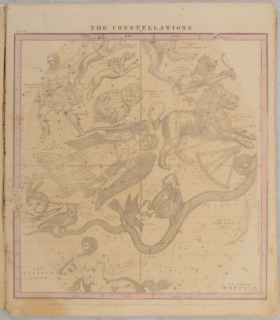
Auction 192, Lot 58
Subject: Celestial, Atlases
Burritt, Elijah H.
Atlas Designed to Illustrate Burritt's Geography of the Heavens, Comprising the Following Maps or Plates..., 1856
Size: 14.3 x 16.5 inches (36.3 x 41.9 cm)
Estimate: $350 - $425
Sold for: $220
Closed on 4/26/2023
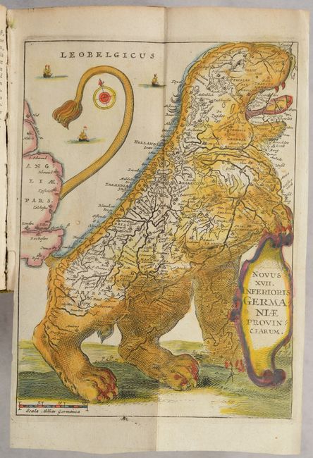
Auction 192, Lot 70
Subject: Cartographic Miscellany, Title Pages, Low Countries
Strada, Famiamo, S.J.
[2 Volumes with 2 Leo Belgicus] Famiani Stradae Romani e Societate Iesu de Bello Belgico Decas Prima... [and] ... Decas Secunda..., 1648
Size: 5.3 x 7 inches (13.5 x 17.8 cm)
Estimate: $1,000 - $1,300
Two-Volume Set Includes Two Leo Belgicus Engravings
Sold for: $1,200
Closed on 4/26/2023
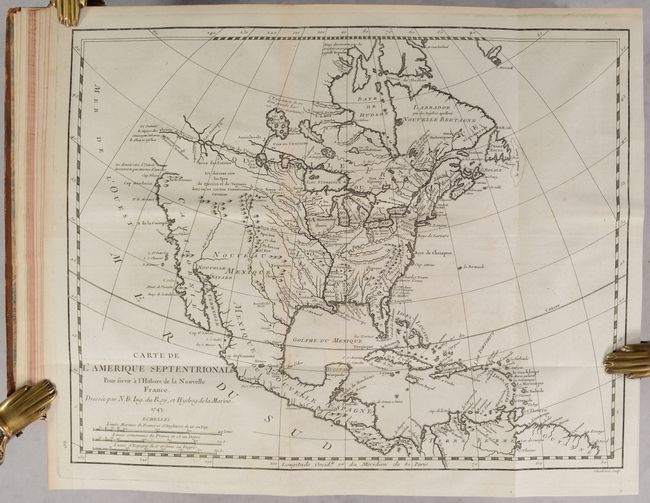
Auction 192, Lot 90
Subject: Colonial North America
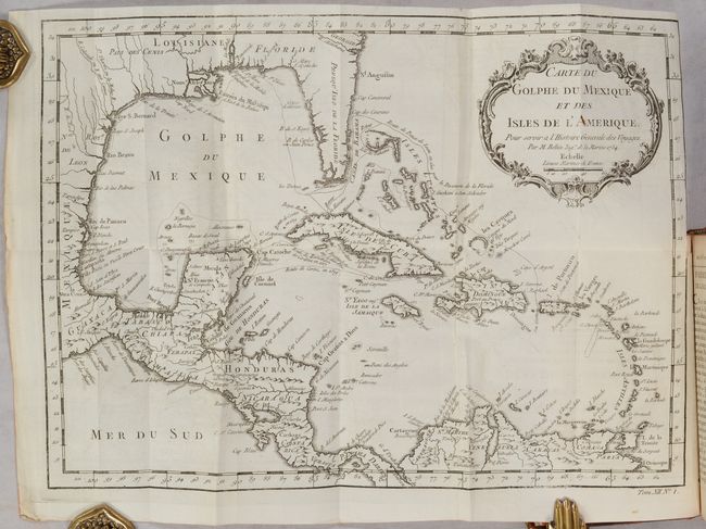
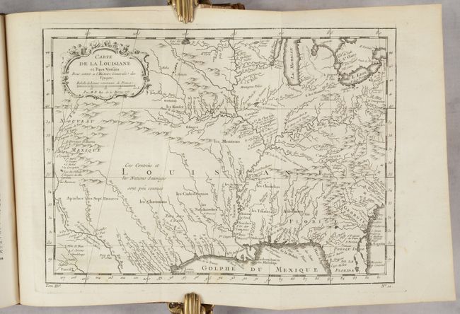
Charlevoix, P. F. Xavier de
[3 Volumes] Histoire et Description Generale de la Nouvelle France, avec le Journal Historique d'un Voyage fait par Ordre du Roi dan l'Amerique Septentrionale..., 1744
Size: 7.8 x 10.3 inches (19.8 x 26.2 cm)
Estimate: $5,500 - $7,000
Important Account of French Possessions in Colonial North America with 28 Maps
Sold for: $4,750
Closed on 4/26/2023
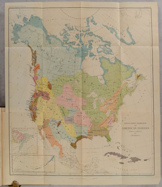
Auction 192, Lot 101
Subject: North America
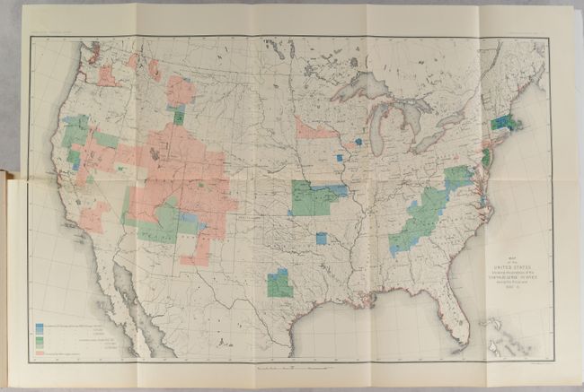
Bureau of American Ethnology
[Map in Book] Linguistic Families of American Indians North of Mexico [in] Handbook of American Indians North of Mexico - In Two Parts Part 1, 1907
Size: 17.5 x 20 inches (44.5 x 50.8 cm)
Estimate: $150 - $180
Sold for: $110
Closed on 4/26/2023
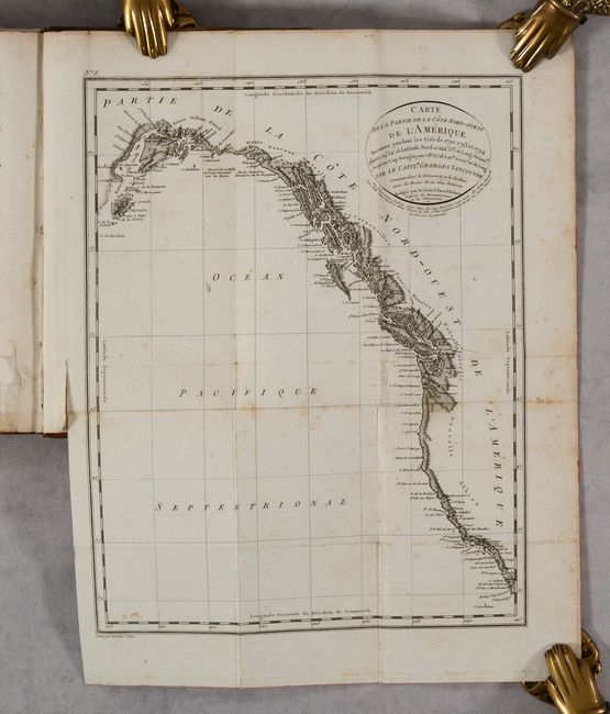
Auction 192, Lot 105
Subject: Western North America
Vancouver, George (Capt)
[5 Volumes & Atlas] Voyage de Decouvertes, a l'Ocean Pacifique du Nord, et Autour du Monde... [and] Atlas du Voyage de Decouvertes..., 1801
Size: 5.1 x 7.9 inches (13 x 20.1 cm)
Estimate: $950 - $1,200
Unsold
Closed on 4/26/2023
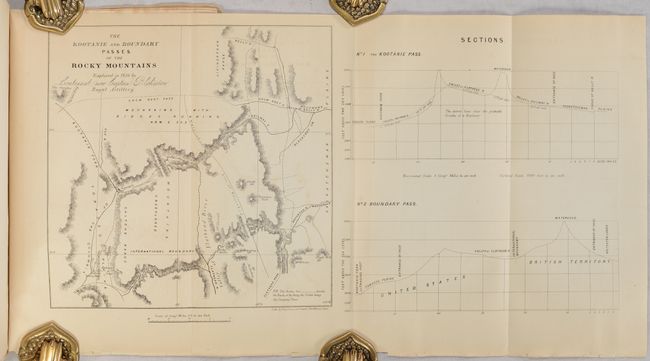
Auction 192, Lot 141
Subject: Northwestern Montana & Alberta, Canada
[Map in Report] The Kootanie and Boundary Passes of the Rocky Mountains Explored in 1858 by Lieutenant (now Captain) Blakiston Royal Artillery [in] The American Journal of Science and Art - Second Series. Vol. XXVII. - July, 1859 Nos. 82, 83, 84 , 1859
Size: 7.8 x 7.8 inches (19.8 x 19.8 cm)
Estimate: $150 - $180
Blakiston's Exploration of the Northern Rocky Mountains
Sold for: $100
Closed on 4/26/2023
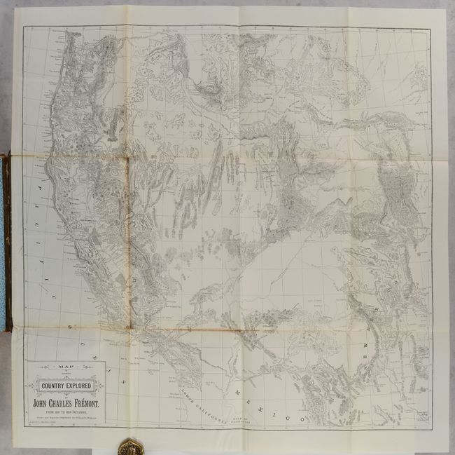
Auction 192, Lot 206
Subject: Western United States
Fremont, John Charles
[Map in Book] Memoirs of My Life, by John Charles Fremont. Including in the Narrative Five Journeys of Western Exploration, During the Years 1842, 1843-4, 1845-6-7, 1848-9, 1853-4..., 1887
Size: 25 x 24.3 inches (63.5 x 61.7 cm)
Estimate: $450 - $550
Unsold
Closed on 4/26/2023
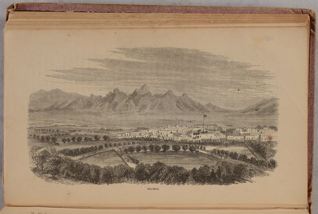
Auction 192, Lot 220
Subject: Arizona
Browne, J. Ross
Adventures in the Apache Country: A Tour Through Arizona and Sonora, with Notes on the Silver Regions in Nevada, 1869
Size: 4.8 x 7.8 inches (12.2 x 19.8 cm)
Estimate: $200 - $250
Classic Arizona Travel Account and Early View of Tucson
Sold for: $100
Closed on 4/26/2023
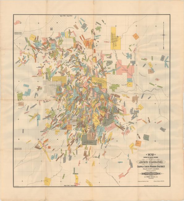
Auction 192, Lot 243
Subject: Central Colorado
[Map in Book] Map Showing the Surface Holdings of the Mining Companies in the Cripple Creek Mining District Teller County, Colorado [in] The Official Manual of the Cripple Creek District Colorado, U.S.A., 1900
Size: 24.3 x 26.8 inches (61.7 x 68.1 cm)
Estimate: $240 - $300
Map of the Famous Cripple Creek Mining District
Sold for: $150
Closed on 4/26/2023
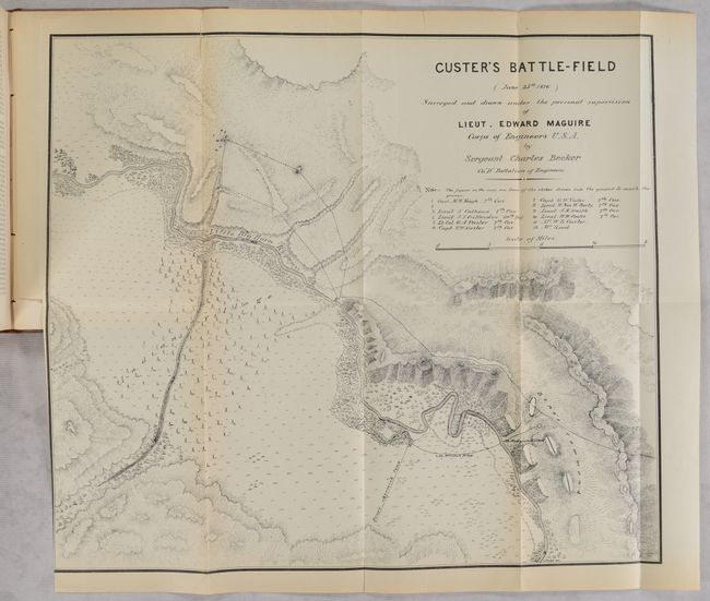
Auction 192, Lot 270
Subject: Montana
Maguire, Lieut. Edward
[Map in Report] Custer's Battle-Field (June 25th 1876)... [bound in] Report of the Secretary of War; Being Part of the Message and Documents Communicated to the Two Houses of Congress ... Volume II. Part III, 1876
Size: 17.3 x 15.1 inches (43.9 x 38.4 cm)
Estimate: $800 - $950
Custer Battlefield Map and Report
Sold for: $500
Closed on 4/26/2023
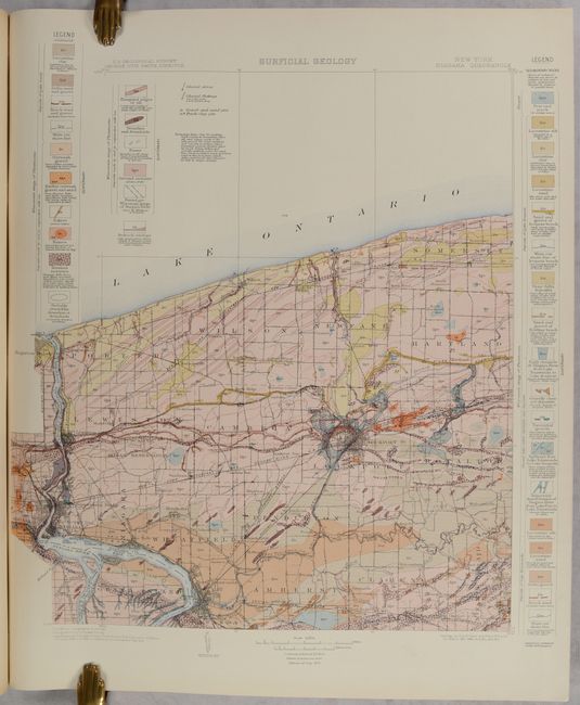
Auction 192, Lot 287
Subject: Niagara Falls, New York
U.S. Geological Survey (USGS)
Geologic Atlas of the United States - Niagara Folio New York, 1913
Size: 18.5 x 21.8 inches (47 x 55.4 cm)
Estimate: $140 - $170
Sold for: $80
Closed on 4/26/2023
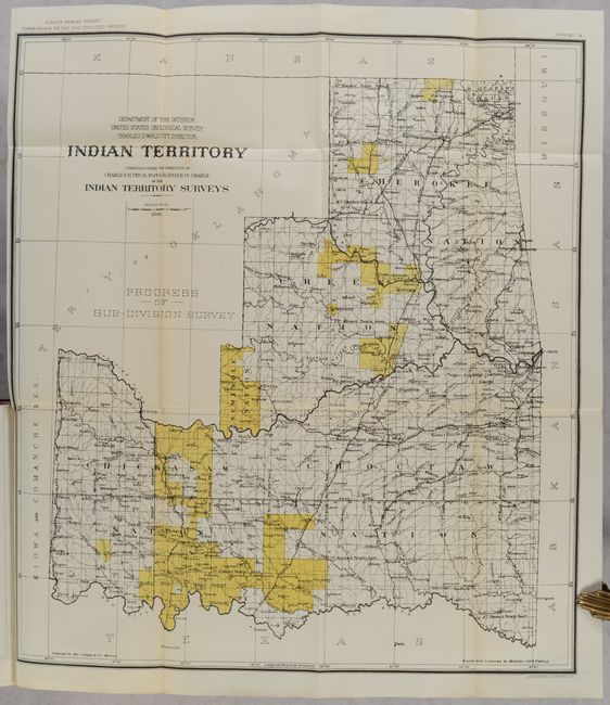
Auction 192, Lot 292
Subject: Oklahoma
U.S. Department of Interior
[11 Maps in Report] Annual Reports of the Department of the Interior for the Fiscal Year Ended June 30, 1901. Indian Affairs. Part II. Commission to the Five Civilized Tribes..., 1902
Size: 6 x 9.4 inches (15.2 x 23.9 cm)
Estimate: $400 - $475
Sold for: $450
Closed on 4/26/2023
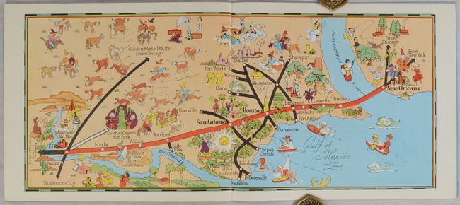
Auction 192, Lot 301
Subject: Southern Texas & Louisiana
Interstate Company
Views of Texas and Louisiana Along the Southern Pacific Lines - The Sunset Route, 1947
Size: 11.3 x 9.8 inches (28.7 x 24.9 cm)
Estimate: $240 - $300
Unsold
Closed on 4/26/2023
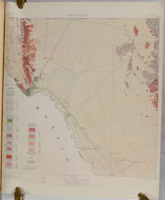
Auction 192, Lot 304
Subject: El Paso, Texas
U.S. Geological Survey (USGS)
Geologic Atlas of the United States El Paso Folio Texas, 1909
Size: 18.6 x 21.8 inches (47.2 x 55.4 cm)
Estimate: $110 - $140
Sold for: $65
Closed on 4/26/2023
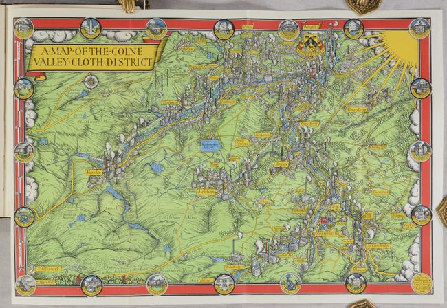
Auction 192, Lot 404
Subject: Northern England
Gill, MacDonald
[Map in Book] A Map of the Colne Valley Cloth District [in] Colne Valley Cloth from the Earliest Times to the Present Day, 1947
Size: 19 x 12.6 inches (48.3 x 32 cm)
Estimate: $160 - $190
Book with a Late Pictorial Map by the Great MacDonald Gill
Sold for: $120
Closed on 4/26/2023
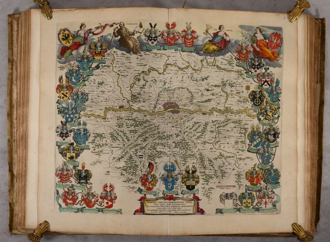
Auction 192, Lot 740
Subject: Atlases
Blaeu, (Family)
Toonneel des Aerdrycx, oft Nieuwe Atlas ... Eerste Deels, 1650
Size: 14.6 x 21.8 inches (37.1 x 55.4 cm)
Estimate: $12,000 - $14,000
Blaeu's Atlas of Germany and the Netherlands with 107 maps in Full Contemporary Color
Unsold
Closed on 4/26/2023
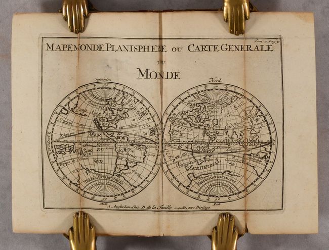
Auction 192, Lot 741
Subject: Atlases
La Feuille, Paul de
Les Tablettes Guerrieres, ou Cartes Choisies pour la Commodite des Officiers et des Voyageurs..., 1711
Size: 3.3 x 8 inches (8.4 x 20.3 cm)
Estimate: $1,200 - $1,500
Unsold
Closed on 4/26/2023
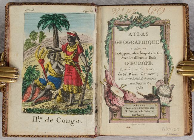
Auction 192, Lot 742
Subject: Atlases
Rizzi-Zannoni, Giovanni Antonio
Atlas Geographique Contenant la Mappemonde et les Quatre Parties, avec les Differents Etats d'Europe..., 1763
Size: 3.4 x 5 inches (8.6 x 12.7 cm)
Estimate: $1,400 - $1,700
Includes 29 Miniature Maps and 4 Engravings of People Around the World
Unsold
Closed on 4/26/2023
Auction 192, Lot 743
Subject: Atlases
Robert de Vaugondy/Delamarche
Nouvel Atlas Portatif Destine Principalement pour l'Instruction de la Jeunesse..., 1817
Size: 9.9 x 12.9 inches (25.1 x 32.8 cm)
Estimate: $800 - $950
Charming French Student Atlas with 51 Maps
Sold for: $600
Closed on 4/26/2023
Auction 192, Lot 744
Subject: Atlases
Willard, Emma Hart
A Series of Maps to Willard's History of the United States, or, Republic of America..., 1829
Size: 9 x 11.1 inches (22.9 x 28.2 cm)
Estimate: $800 - $950
A Female Pioneer Championing Women's Education
Sold for: $1,100
Closed on 4/26/2023
Auction 192, Lot 745
Subject: Atlases
Black, Adam & Charles
[Black's General Atlas: Comprehending Sixty-One Maps from the Latest and Most Authentic Sources...], 1848
Size: 13.2 x 17.4 inches (33.5 x 44.2 cm)
Estimate: $400 - $475
Sold for: $475
Closed on 4/26/2023
Auction 192, Lot 746
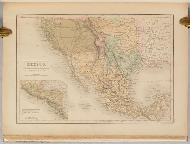
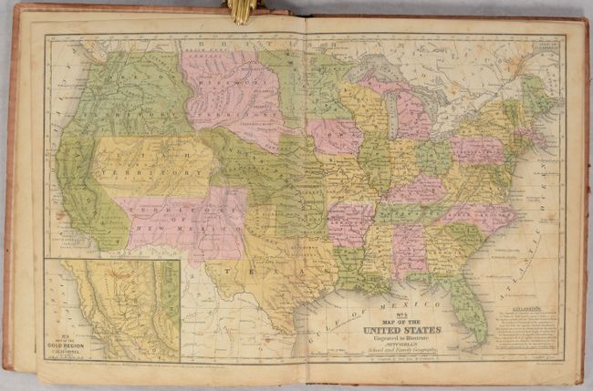
Subject: Atlases, Texas
Mitchell/Cowperthwait
Mitchell's School Atlas: Comprising the Maps, Etc., Designed to Illustrate Mitchell's School and Family Geography, 1851
Size: 9.6 x 12 inches (24.4 x 30.5 cm)
Estimate: $250 - $325
Sold for: $180
Closed on 4/26/2023
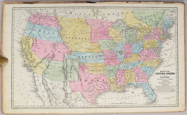
Auction 192, Lot 747
Subject: Atlases
Smith, Roswell C.
Smith's Atlas of Modern and Ancient Geography, Corrected and Enlarged, to Accompany Smith's Geograph for Schools, Academies, and Families, 1856
Size: 9.9 x 12 inches (25.1 x 30.5 cm)
Estimate: $275 - $350
Sold for: $200
Closed on 4/26/2023
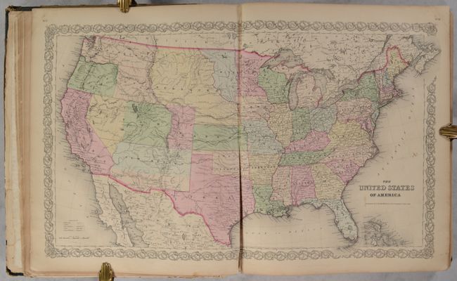
Auction 192, Lot 748
Subject: Atlases
Colton, G.W. & C.B.
Colton's General Atlas, Containing One Hundred and Seventy Steel Plate Maps and Plans, on One Hundred Imperial Folio Sheets, 1859
Size: 15.1 x 18.1 inches (38.4 x 46 cm)
Estimate: $1,500 - $1,800
Colton's Impressive General Atlas
Sold for: $2,000
Closed on 4/26/2023
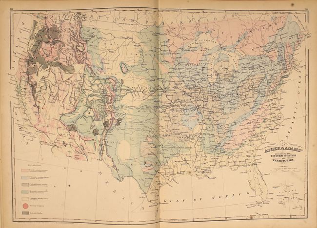
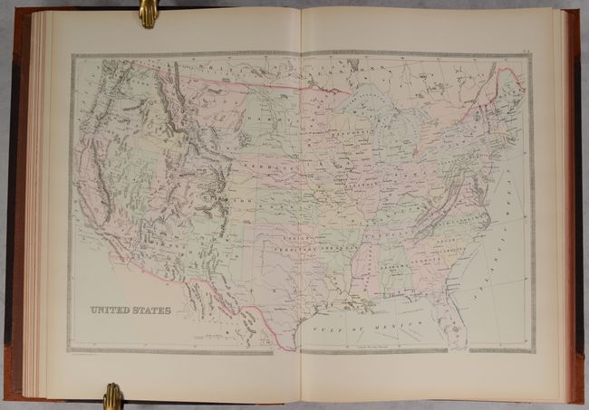
Auction 192, Lot 749
Subject: Atlases
Asher & Adams
Asher & Adams' New Statistical and Topographical Atlas of the United States…, 1872
Size: 13 x 18 inches (33 x 45.7 cm)
Estimate: $750 - $900
Unsold
Closed on 4/26/2023
Auction 192, Lot 750
Subject: Atlases
Bradley, William M. [& Bros.]
Bradley's Atlas of the World for Commercial and Library Reference..., 1886
Size: 14 x 19.8 inches (35.6 x 50.3 cm)
Estimate: $550 - $700
Sold for: $500
Closed on 4/26/2023
Auction 192, Lot 751
Subject: Atlases
Cram, George F. & Company
Auto Trails and Commercial Survey of the United States, 1918
Size: 11.8 x 14.8 inches (30 x 37.6 cm)
Estimate: $180 - $210
Sold for: $170
Closed on 4/26/2023
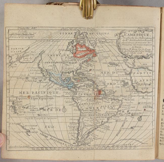
Auction 192, Lot 752
Subject: Geography Books
Bion, Nicolas
L'Usage des Globes Celeste et Terrestre, et des Spheres Suivant les Differens Systemes du Monde..., 1728
Size: 5.8 x 8.4 inches (14.7 x 21.3 cm)
Estimate: $550 - $700
Sold for: $400
Closed on 4/26/2023
Auction 192, Lot 753
Subject: Exploration & Surveys
Prevost, Anton Francois
Histoire Generale des Voiages, ou Nouvelle Collection de Toutes les Relatios de Voiages ... Tome Quarante-Cinquieme, 1754
Size: 4 x 6.8 inches (10.2 x 17.3 cm)
Estimate: $600 - $750
Sold for: $400
Closed on 4/26/2023
Auction 192, Lot 754
Subject: Exploration & Surveys
Prevost, Anton Francois
Histoire Generale des Voyages, ou Nouvelle Collection de Toutes les Relations de Voyages ... Tome Quatorzieme, 1757
Size: 8 x 10.5 inches (20.3 x 26.7 cm)
Estimate: $2,400 - $3,000
Prevost's Volume on the Americas
Unsold
Closed on 4/26/2023
Auction 192, Lot 755
Subject: Exploration & Surveys
Powell, John Wesley
Ninth Annual Report of the United States Geological Survey to the Secretary of the Interior 1887-'88, 1889
Size: 8 x 11.6 inches (20.3 x 29.5 cm)
Estimate: $275 - $350
Unsold
Closed on 4/26/2023
Auction 192, Lot 756
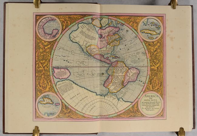
Subject: References, Facsimile Atlas
Mercator, Gerard
[Facsimile] Atlas sive Cosmographicae Meditationes de Fabrica Mundi et Fabricati Figura, 1985
Size: 13.3 x 17.8 inches (33.8 x 45.2 cm)
Estimate: $375 - $450
Sold for: $275
Closed on 4/26/2023
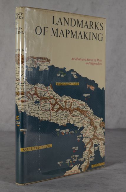
Auction 192, Lot 757
Subject: References
Tooley & Bricker
Landmarks of Mapmaking - An Illustrated Survey of Maps and Mapmakers, 1968
Size: 11.1 x 16.4 inches (28.2 x 41.7 cm)
Estimate: $50 - $70
NO RESERVE
Sold for: $170
Closed on 4/26/2023

Auction 192, Lot 758
Subject: References
[Lot of 5 - First Issues] The Map Collector [and] Meridian [and] Mercator's World [and] Map Forum [and] Biblio, 1977-2004
Size: See Description
Estimate: $80 - $100
NO RESERVE
Sold for: $27
Closed on 4/26/2023
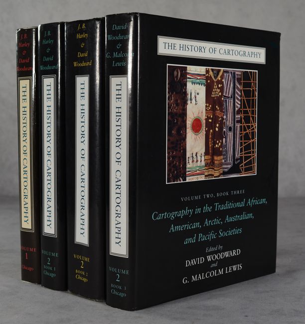
Auction 192, Lot 759
Subject: References
Woodward, David
[2 Volumes in 4 Books] The History of Cartography Volume One [and] Volume Two, Books 1-3, 1987-98
Size: 8.8 x 11.3 inches (22.4 x 28.7 cm)
Estimate: $550 - $700
First Two Available Volumes of this Comprehensive Reference Series
Sold for: $400
Closed on 4/26/2023
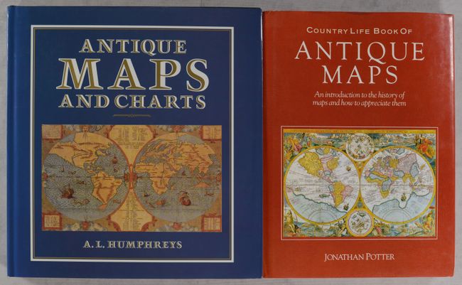
Auction 192, Lot 760
Subject: References
[Lot of 2] Country Life Book of Antique Maps - An Introduction to the History of Maps and How to Appreciate Them [and] Antique Maps and Charts, 1988-89
Size: See Description
Estimate: $55 - $75
NO RESERVE
Sold for: $33
Closed on 4/26/2023
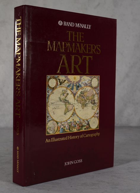
Auction 192, Lot 761
Subject: References
Goss, John
The Mapmaker's Art - An Illustrated History of Cartography, 1993
Size: 10.9 x 14.9 inches (27.7 x 37.8 cm)
Estimate: $80 - $100
NO RESERVE
Sold for: $60
Closed on 4/26/2023
Auction 192, Lot 762
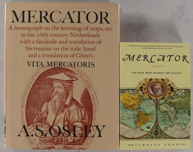
Subject: References, Mercator
[Lot of 2] Mercator - A Monograph on the Lettering of Maps, Etc. in the 16th Century Netherlands with a Facsimile and Translation of His Treatise... [and] Mercator: The Man Who Mapped the Planet, 1969-2003
Size: See Description
Estimate: $40 - $60
NO RESERVE
Sold for: $60
Closed on 4/26/2023
Auction 192, Lot 763
Subject: References, French Cartography
Les Cartographes & le Nouveaux Mondes - Une Representation Normande des Grandes Decouvertes, 2011
Size: 10 x 14 inches (25.4 x 35.6 cm)
Estimate: $120 - $150
Sold for: $90
Closed on 4/26/2023
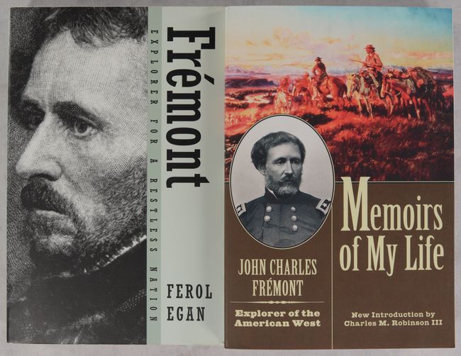
Auction 192, Lot 764
Subject: References, Explorers
[Lot of 2] Memoirs of My Life [and] Fremont - Explorer for a Restless Nation, 1985-2001
Size: 6 x 9 inches (15.2 x 22.9 cm)
Estimate: $20 - $40
NO RESERVE
Sold for: $44
Closed on 4/26/2023
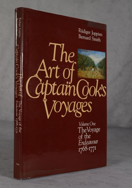
Auction 192, Lot 765
Subject: References, Captain Cook
The Art of Captain Cook's Voyages Volume One - The Voyage of the Endeavour 1768-1771..., 1985
Size: 10.1 x 13.9 inches (25.7 x 35.3 cm)
Estimate: $100 - $130
Sold for: $75
Closed on 4/26/2023
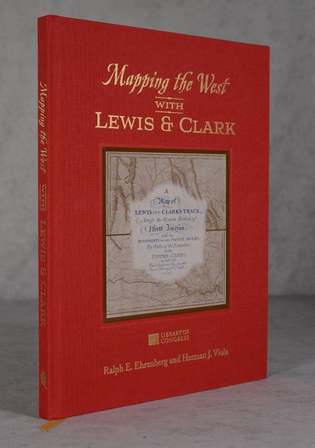
Auction 192, Lot 766
Subject: References, Lewis & Clark
Mapping the West with Lewis & Clark, 2015
Size: 11.3 x 14.3 inches (28.7 x 36.3 cm)
Estimate: $160 - $190
Unsold
Closed on 4/26/2023
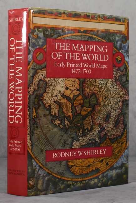
Auction 192, Lot 767
Subject: References, World
Shirley, Rodney W.
The Mapping of the World - Early Printed World Maps 1472-1700, 1987
Size: 9.6 x 13.8 inches (24.4 x 35.1 cm)
Estimate: $325 - $400
Sold for: $230
Closed on 4/26/2023
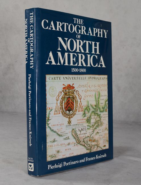
Auction 192, Lot 768
Subject: References, North America
Portinaro & Knirsch
The Cartography of North America 1500-1800, 1987
Size: 9.8 x 13 inches (24.9 x 33 cm)
Estimate: $45 - $65
NO RESERVE
Sold for: $31
Closed on 4/26/2023
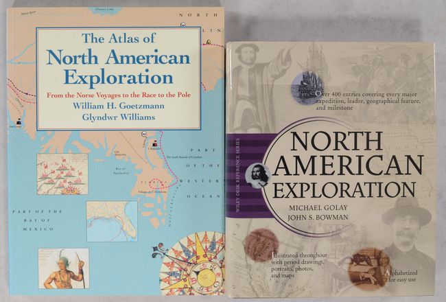
Auction 192, Lot 769
Subject: References, North America
[Lot of 2] The Atlas of North American Exploration - From the Norse Voyages to the Race to the Pole [and] North American Exploration, 1992-2003
Size: See Description
Estimate: $30 - $50
NO RESERVE
Sold for: $9
Closed on 4/26/2023
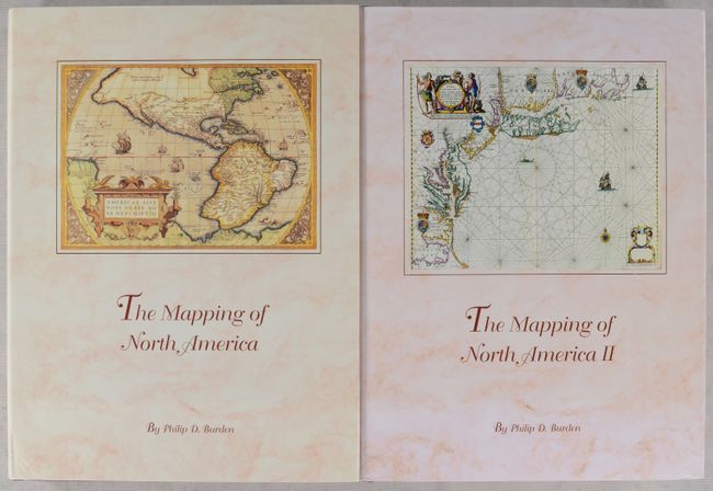
Auction 192, Lot 770
Subject: References, North America
Burden, Philip D.
[2 Volumes] The Mapping of North America - A List of Printed Maps 1511-1670 [and] ... 1671-1700, 1996-2007
Size: 10.5 x 14.4 inches (26.7 x 36.6 cm)
Estimate: $400 - $500
Sold for: $300
Closed on 4/26/2023
Auction 192, Lot 771
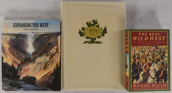
Subject: References, Western United States
[Lot of 3] Western America in 1846-1847 - The Original Travel Diary of Lieutenant J.W. Abert... [and] Exploring the West [and] The Real Wild West - The 101 Ranch and the Creation of the American West, 1966-99
Size: See Description
Estimate: $70 - $90
Sold for: $50
Closed on 4/26/2023
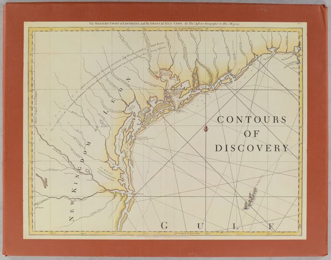
Auction 192, Lot 772
Subject: References, Texas
[Portfolio] Contours of Discovery - Printed Maps Delineating the Texas and Southwestern Chapters in the Cartographic History of North America, 1513-1930, 1981
Size: 22.3 x 17.5 inches (56.6 x 44.5 cm)
Estimate: $40 - $60
NO RESERVE
Sold for: $21
Closed on 4/26/2023
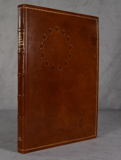
Auction 192, Lot 773
Subject: References, American Revolution
Nebenzahl, Kenneth
Atlas of the American Revolution, 1974
Size: 11.5 x 15.2 inches (29.2 x 38.6 cm)
Estimate: $120 - $150
Sold for: $300
Closed on 4/26/2023
Auction 192, Lot 774
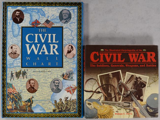
Subject: References, Civil War
[Lot of 2] The Civil War Wall Chart [and] The Illustrated Encyclopedia of the Civil War - The Soldiers, Generals, Weapons, and Battles, 1990-2001
Size: See Description
Estimate: $30 - $50
NO RESERVE
Sold for: $21
Closed on 4/26/2023
54 lots
Page 1 of 2