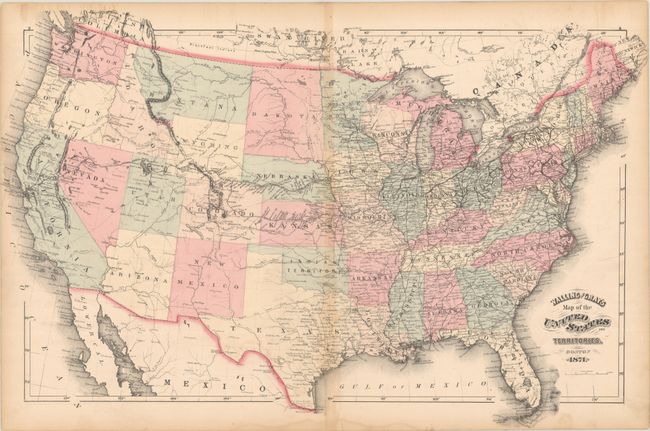
Subject: United States
Period: 1871 (dated)
Publication:
Color: Hand Color
Size:
25.7 x 16.6 inches
65.3 x 42.2 cm
This attractive map of the United States shows most western territories with their final boundaries. A notable exception is the large Dakota Territory, which also includes a small triangular wedge between Montana and Idaho that is "Part of Dakota." On most maps of the period, this wedge was absorbed by Montana Territory once Wyoming's western boundary was finalized along the 111th Meridian. There is no mention of Yellowstone as this map was issued one year before its creation. The map shows great detail of existing and proposed railroads, forts, rivers, and topography.
References:
Condition: B
There is light toning along the centerfold and a short centerfold separation at bottom that has been closed on verso with archival tape. A light dampstain is confined to the bottom blank margin, and some minor stains run along the top sheet edge.