Subject: Northeastern United States & Canada
Period: 1855 (circa)
Publication:
Color: Hand Color
Size:
35.8 x 22.9 inches
90.9 x 58.2 cm
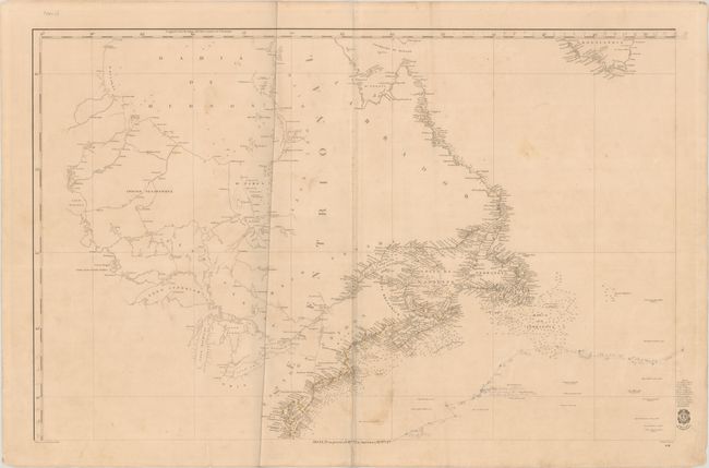
This is the northwestern sheet of Direccion de Hidrografia's Carta General del Oceano Atlantico Septentrional en Cuatro Hojas..., a rare and highly detailed four-sheet chart of the Atlantic Ocean. It spans from the Chesapeake Bay north to Hudson Bay and the southern tip of Greenland. There is an impressive amount of navigational information along the coast of the Mid-Atlantic, New England, and eastern Canada, although detail starts to become sparse as the chart travels to the northern parts of Labrador. A plethora of lighthouses are located with red and yellow ink. There is little inland information, although the Great Lakes and the region's various waterways are delineated. The territory between Lake Winnipeg and James Bay is labeled Indios Nenawewhek. Various small islands and depth soundings are shown in Hudson Bay. Adorned by the insignia of the Direccion de Hidrografia in the bottom right corner. Designed and lettered by F. Bregante and engraved by J. Estruch.
References:
Condition: B+
On a lightly toned sheet with light soiling, a vertical extraneous crease, and a couple edge tears entering the map at bottom that have been closed on verso with archival materials. There are manuscript notations in pencil.