Catalog Archive
Auction 192, Lot 162

"A Map of the British American Plantations, Extending from Boston in New England to Georgia; Including All the Back Settlements in the Respective Provinces, as Far as the Mississipi", Bowen, Emanuel

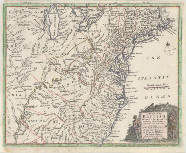
Subject: Colonial Eastern United States

Period: 1754 (dated)

Publication: Gentleman's Magazine

Color: Hand Color

Size:
10.8 x 8.8 inches
27.4 x 22.4 cm
Download High Resolution Image
(or just click on image to launch the Zoom viewer)

This splendid map with unusual colonial borders covers the area east of the Mississippi River, from Niagara Falls to Port Royal, SC. It presents major towns and cities, Indian villages and tribal territory, English and French forts, boundaries, trails and topography. According to Cumming, this map has the most complete delineation of Indian tribes, especially west of the Blue Ridge Mountains, in a printed map up to this time.

References: Cumming (SE) #272; Jolly #GENT-89; McCorkle #754-1; Sellers & Van Ee #708.

Condition: B

Issued folding, now flattened. Narrow, but adequate margins as issued, with one chip in the upper left margin close to the map. Backed with light tissue to repair the torn lower right corner. Later color with some bleed through on verso.

Estimate: $400 - $500

Sold for: $300

Closed on 4/26/2023

Archived