Subject: Colonial Northeastern United States & Canada
Period: 1776 (dated)
Publication: Atlas Universel
Color: Hand Color
Size:
22.8 x 19.1 inches
57.9 x 48.5 cm
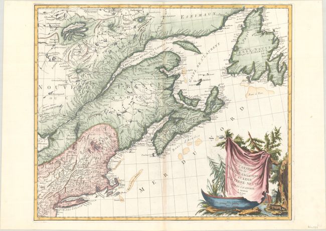
This large, attractive map covers New England, the St. Laurence River, Nova Scotia, and Newfoundland. It presents good detail of boundaries, towns and cities, harbors, bays, rivers and lakes, Indian tribal territory, and fishing grounds. Though crediting D'Anville, the map is also partially based on the cartography of Bellin and Robert de Vaugondy. The large cartouche, featuring a ferocious-looking beaver, is copied from Robert de Vaugondy's 1755 map of Canada and the Great Lakes. This is the second state, with the plate number removed from the top right corner.
References: Kershaw #714; McCorkle #776.4; Phillips (A) #647-47; Sellers & Van Ee #138.
Condition: A
Issued on a very clean sheet of paper with a three crescent moon watermark. There is a hint of toning along the centerfold, otherwise fine.