Filtered by Category:Canada(Show All Categories)
Catalog Archive
2831 lots
Page 1 of 57
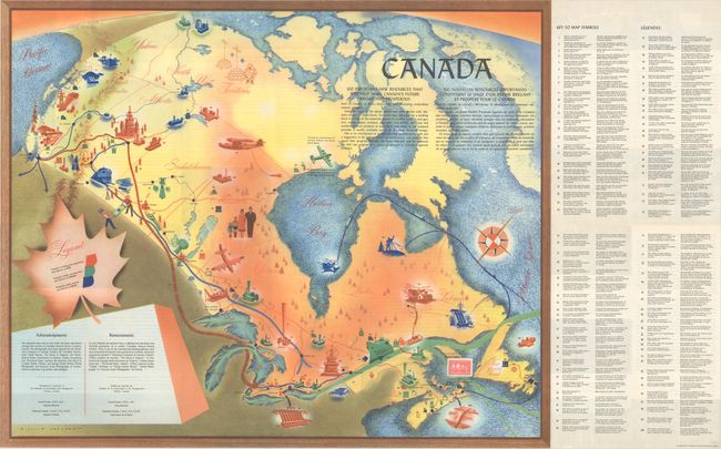
Auction 197, Lot 85
Subject: Canada
Canada - 100 Important New Resources... / 100 Nouvelles Ressources Importantes..., 1950
Size: 25.3 x 20.6 inches (64.3 x 52.3 cm)
Estimate: $110 - $140
NO RESERVE
Sold for: $34
Closed on 4/24/2024
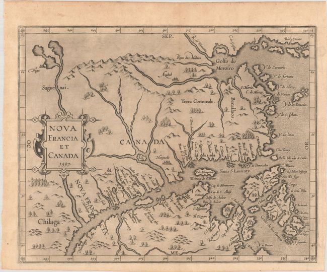
Auction 197, Lot 86
Subject: Eastern Canada
Wytfliet, Cornelis
Nova Francia et Canada, 1597
Size: 11.6 x 9.3 inches (29.5 x 23.6 cm)
Estimate: $2,000 - $2,300
First State of Wytfliet's Landmark Map of Eastern Canada
Sold for: $3,500
Closed on 4/24/2024
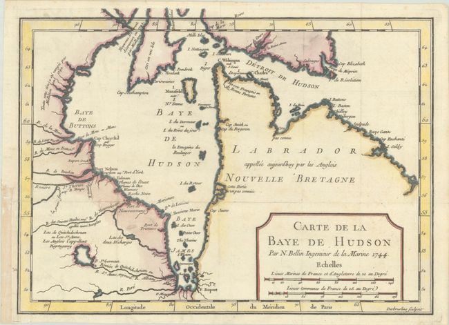
Auction 197, Lot 87
Subject: Eastern Canada, Hudson Bay
Bellin, Jacques Nicolas
Carte de la Baye de Hudson, 1744
Size: 11.5 x 8.5 inches (29.2 x 21.6 cm)
Estimate: $110 - $140
Sold for: $70
Closed on 4/24/2024
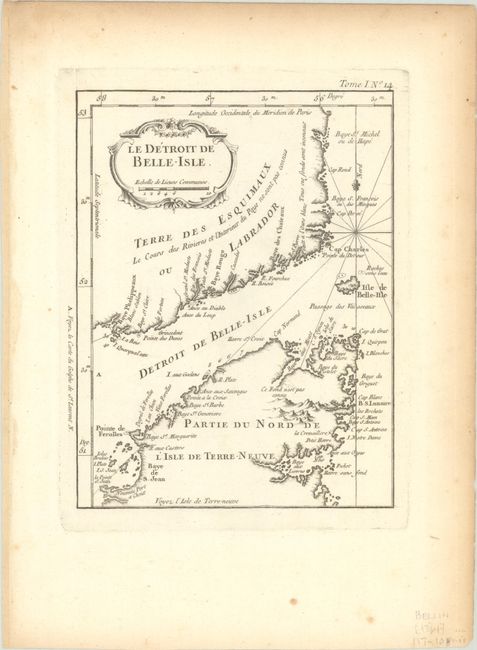
Auction 197, Lot 88
Subject: Eastern Canada
Bellin, Jacques Nicolas
Le Detroit de Belle-Isle, 1764
Size: 6.3 x 8.3 inches (16 x 21.1 cm)
Estimate: $70 - $90
Sold for: $50
Closed on 4/24/2024
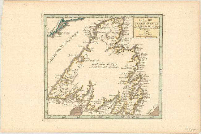
Auction 197, Lot 89
Subject: Newfoundland, Canada
Robert de Vaugondy
Isle de Terre-Neuve, 1749
Size: 7.6 x 6.8 inches (19.3 x 17.3 cm)
Estimate: $140 - $170
Sold for: $70
Closed on 4/24/2024
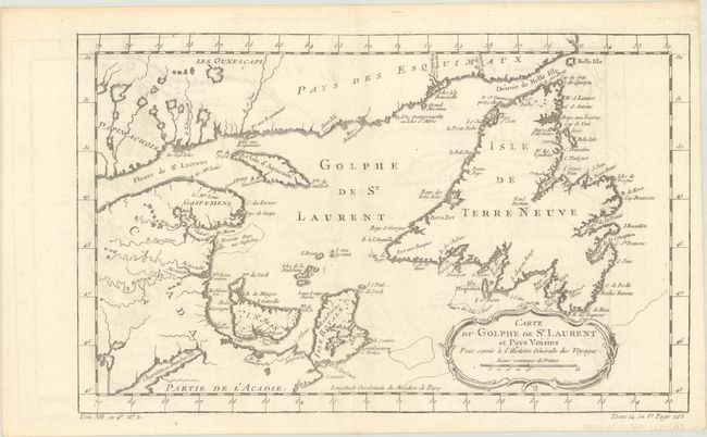
Auction 197, Lot 90
Subject: St. Lawrence Bay, Canada
Bellin, Jacques Nicolas
Carte du Golphe de St. Laurent et Pays Voisins pour Servir a l'Histoire Generale des Voyages, 1780
Size: 14.2 x 8.8 inches (36.1 x 22.4 cm)
Estimate: $95 - $120
Sold for: $70
Closed on 4/24/2024
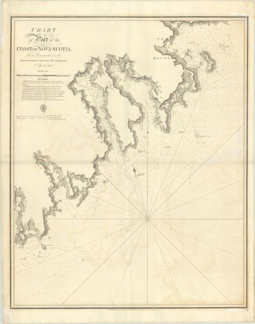
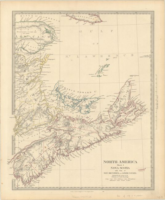
Auction 197, Lot 91
Subject: Nova Scotia, Canada
British Admiralty
Chart of Part of the Coast of Nova Scotia. From Documents in the Hydographical Office of the Admiralty. April 1824. Sheet III, 1831
Size: 24.8 x 30.4 inches (63 x 77.2 cm)
Estimate: $240 - $300
Price reduced by $30
Sold for: $150
Closed on 4/24/2024
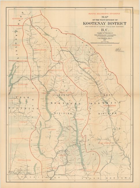
Auction 197, Lot 92
Subject: British Columbia, Canada, Mining
Mining Recording Divisions - Map of the West Division of Kootenay District and a Portion of Lillooet, Yale & East Kootenday, B.C., 1897
Size: 22.3 x 30.6 inches (56.6 x 77.7 cm)
Estimate: $200 - $230
Sold for: $190
Closed on 4/24/2024
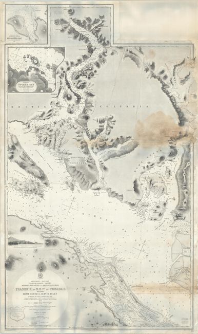
Auction 197, Lot 93
Subject: Strait of Georgia
British Admiralty
North America - West Coast Strait of Georgia - Sheet I. Between Vancouver I. & British Columbia - Fraser R, to N.E. Pt. of Texada I. Including Howe Sound & Jervis Inlet..., 1865
Size: 26.4 x 44.5 inches (67.1 x 113 cm)
Estimate: $275 - $350
Sold for: $140
Closed on 4/24/2024
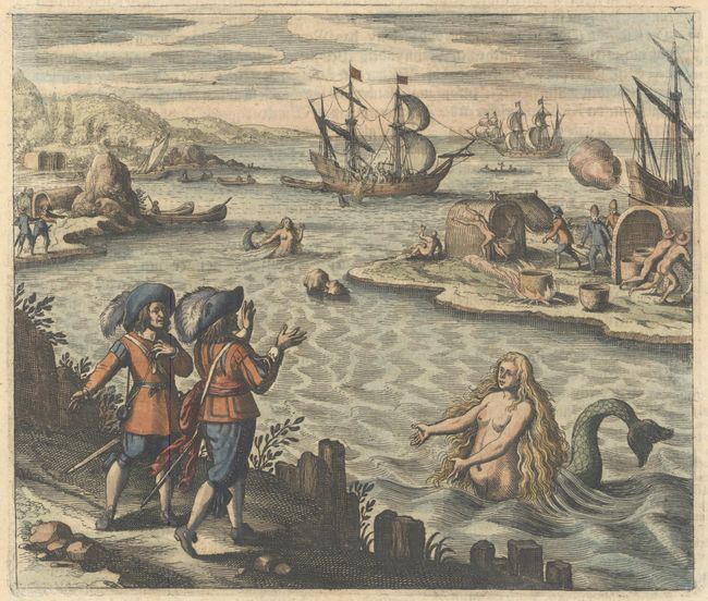
Auction 197, Lot 94
Subject: St. John's Harbor, Canada
Bry, Theodore de
[Untitled - A Strange Creature at St. John's Harbour], 1631
Size: 6.9 x 5.9 inches (17.5 x 15 cm)
Estimate: $240 - $300
Sold for: $375
Closed on 4/24/2024
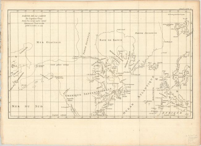
Auction 197, Lot 95
Subject: Colonial United States & Canada, Arctic
Robert de Vaugondy, Didier
Partie de la Carte du Capitaine Cluny Auteur d'un Ouvrage Anglois Intitule American Traveller Publie a Londres en 1769, 1773
Size: 19.6 x 11.6 inches (49.8 x 29.5 cm)
Estimate: $120 - $150
Price reduced by $30
Unsold
Closed on 4/24/2024
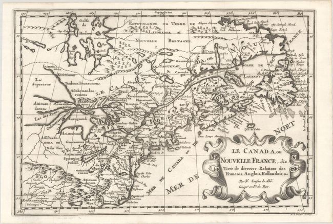
Auction 197, Lot 96
Subject: Colonial Eastern United States & Canada, Great Lakes
Sanson, Nicolas
Le Canada, ou Nouvelle France, &c. Tiree de Diverses Relations des Francois, Anglois, Hollandois, &c, 1700
Size: 11.9 x 8.1 inches (30.2 x 20.6 cm)
Estimate: $475 - $600
Small Version of a Keystone Map for Great Lakes Collections
Sold for: $375
Closed on 4/24/2024
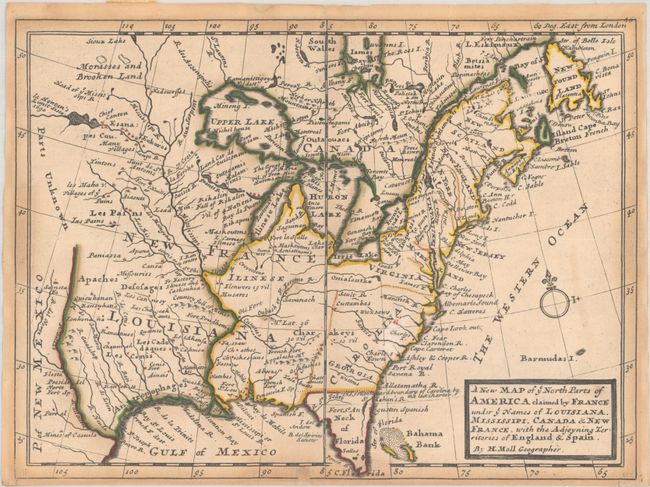
Auction 197, Lot 97
Subject: Colonial Eastern United States & Canada
Moll, Herman
A New Map of ye North Parts of America Claimed by France Under ye Names of Louisiana, Mississipi, Canada & New France. With the Adjoyning Territories of England & Spain, 1736
Size: 10.7 x 7.9 inches (27.2 x 20.1 cm)
Estimate: $400 - $475
Sold for: $400
Closed on 4/24/2024
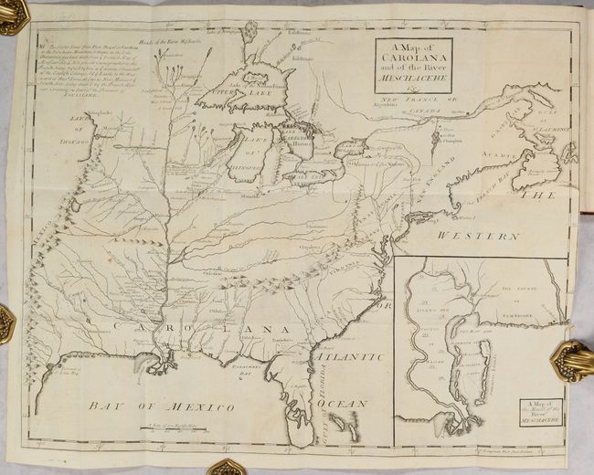
Auction 197, Lot 98
Subject: Colonial Eastern United States & Canada
Coxe, Daniel
[Map in Book] A Map of Carolana and of the River Meschacebe &c. [in] A Description of the English Province of Carolana. By the Spaniards Call'd Florida, and by the French, la Louisiane, 1741
Size: 21.5 x 16.8 inches (54.6 x 42.7 cm)
Estimate: $8,000 - $9,500
First English Depiction of the Mississippi Valley
Sold for: $7,500
Closed on 4/24/2024
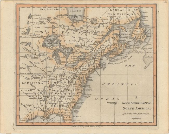
Auction 197, Lot 99
Subject: Colonial Eastern United States & Canada
Cary, John
A New & Accurate Map of North America; from the Best Authorities, 1780
Size: 8.8 x 7.6 inches (22.4 x 19.3 cm)
Estimate: $200 - $230
Sold for: $150
Closed on 4/24/2024
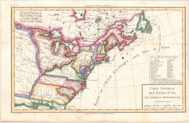
Auction 197, Lot 100
Subject: Eastern United States & Canada, Franklin
Crevecoeur, Michel Guillaume De
Carte Generale des Etats-Unis de l'Amerique Septentrionale, Renfermant Aussi Quelques Provinces Angloises Adjacentes, pour les Lettres d'un Cultivateur Ameriquain, 1787
Size: 16.9 x 10.2 inches (42.9 x 25.9 cm)
Estimate: $600 - $750
One of the Earliest Maps to Name Franklinia
Sold for: $450
Closed on 4/24/2024
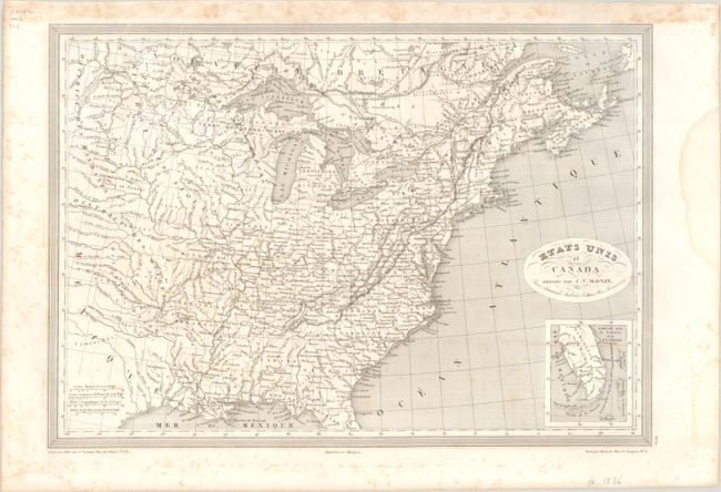
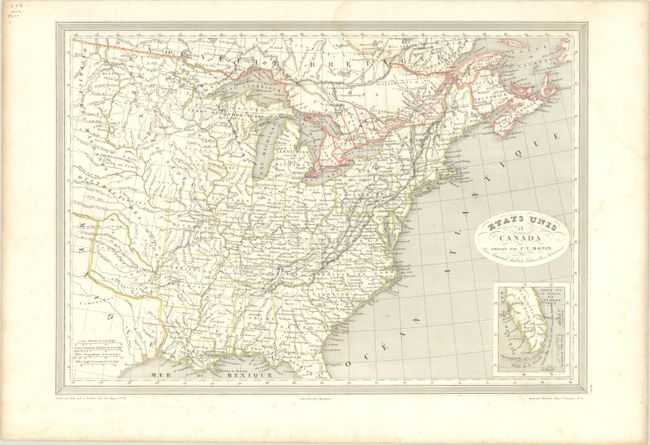
Auction 197, Lot 101
Subject: Eastern United States & Canada, Texas
Monin, Charles V.
Etats Unis et Canada , 1830
Size: 18.1 x 12.6 inches (46 x 32 cm)
Estimate: $120 - $150
Sold for: $60
Closed on 4/24/2024
Auction 197, Lot 102
Subject: Eastern United States & Canada
SDUK Society for the Diffusion of Useful Knowledge
[Lot of 14 - United States & Canada], 1835
Size: See Description
Estimate: $1,000 - $1,300
Price reduced by $150
Sold for: $600
Closed on 4/24/2024
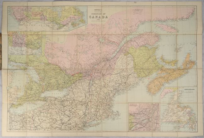
Auction 197, Lot 103
Subject: Eastern United States & Canada
Dawson's Map of the Dominion of Canada, 1888
Size: 32.5 x 21.6 inches (82.6 x 54.9 cm)
Estimate: $160 - $190
Sold for: $85
Closed on 4/24/2024
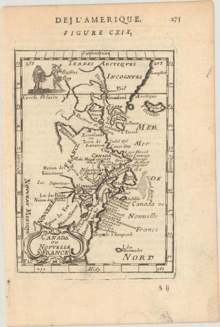
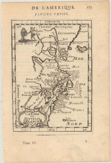
Auction 197, Lot 104
Subject: Colonial Northeastern United States & Canada
Mallet, Alain Manesson
Canada ou Nouvelle France, 1683
Size: 4 x 5.6 inches (10.2 x 14.2 cm)
Estimate: $180 - $220
Sold for: $200
Closed on 4/24/2024
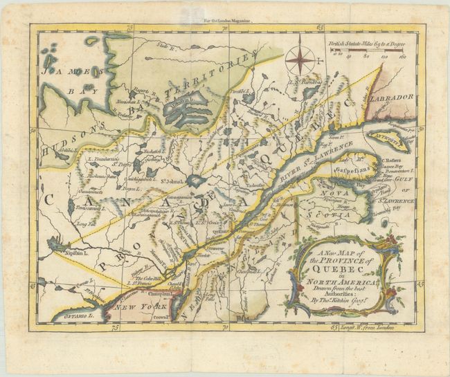
Auction 197, Lot 105
Subject: Colonial Northeastern United States & Canada
Kitchin, Thomas
A New Map of the Province of Quebec in North America; Drawn from the Best Authorities, 1764
Size: 8.7 x 6.8 inches (22.1 x 17.3 cm)
Estimate: $220 - $250
Sold for: $160
Closed on 4/24/2024
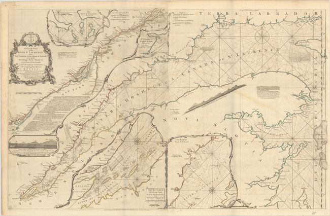
Auction 197, Lot 106
Subject: Colonial Northeastern United States & Canada
Jefferys/Sayer
An Exact Chart of the River St. Laurence, from Fort Frontenac to the Island of Anticosti Shewing the Soundings, Rocks, Shoals &c with Views of the Lands and All Necessary Instructions for Navigating that River to Quebec..., 1775
Size: 37.5 x 23.8 inches (95.3 x 60.5 cm)
Estimate: $600 - $750
Sold for: $400
Closed on 4/24/2024
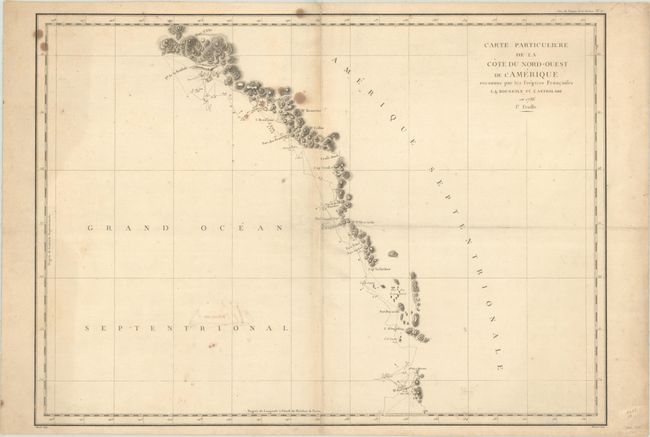
Auction 197, Lot 107
Subject: Western United States & Canada, Alaska
La Perouse, Comte Jean F. Galoup, de
[Lot of 2] Carte Particuliere de la Cote du Nord-Ouest de l'Amerique Reconnue par les Fregates Francaises la Boussole et l'Astrolabe en 1786. 1e Feuille [and] ... 2e Feuille, 1797
Size: 27.1 x 19.5 inches (68.8 x 49.5 cm)
Estimate: $300 - $375
Price reduced by $45
Unsold
Closed on 4/24/2024
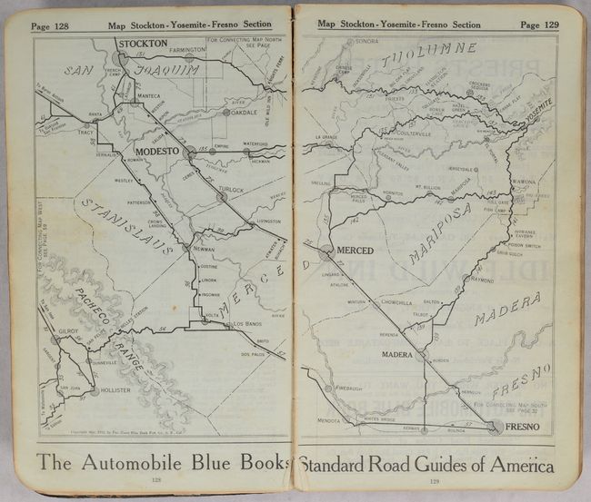
Auction 197, Lot 108
Subject: Western United States & Canada
The Pacific Coast Automobile Blue Book - 1915-1916 - California Washington Oregon British Columbia, 1915
Size: 5.4 x 9.3 inches (13.7 x 23.6 cm)
Estimate: $200 - $250
Sold for: $100
Closed on 4/24/2024
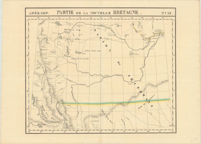
Auction 197, Lot 109
Subject: Northwestern United States & Canada
Vandermaelen, Philippe Marie Guillaume
Amer. Sep. Partie de la Nouvelle Bretagne. No. 32, 1825-27
Size: 22.2 x 18.4 inches (56.4 x 46.7 cm)
Estimate: $275 - $350
Sold for: $200
Closed on 4/24/2024
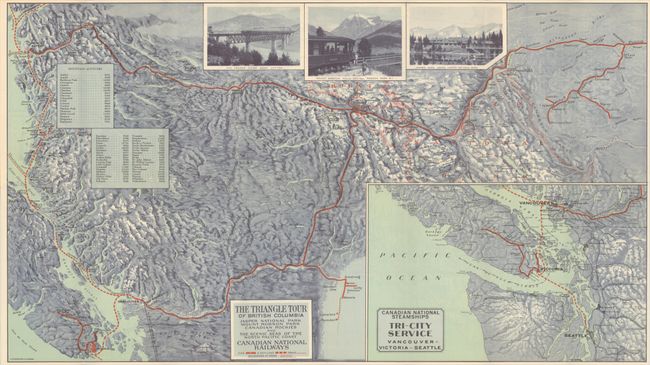
Auction 197, Lot 110
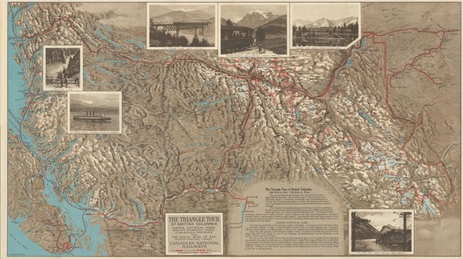
Subject: Northwestern United States & Canada
Railroad Companies, (Various)
The Triangle Tour of British Columbia - Jasper National Park Mount Robson Park Canadian Rockies and the Scenic Seas of the North Pacific Coast [on verso] Alaska and the Yukon, 1930
Size: 29.8 x 16.8 inches (75.7 x 42.7 cm)
Estimate: $150 - $180
Price reduced by $30
Unsold
Closed on 4/24/2024
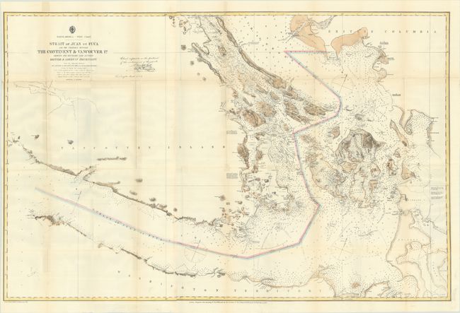
Auction 197, Lot 111
Subject: Washington & British Columbia
U.S. Hydrographic Office
Strait of Juan de Fuca and the Channels Between the Continent & Vancouver Id. Showing the Boundary Line Between British & American Possessions, 1872
Size: 44.4 x 28.9 inches (112.8 x 73.4 cm)
Estimate: $400 - $475
Sold for: $300
Closed on 4/24/2024
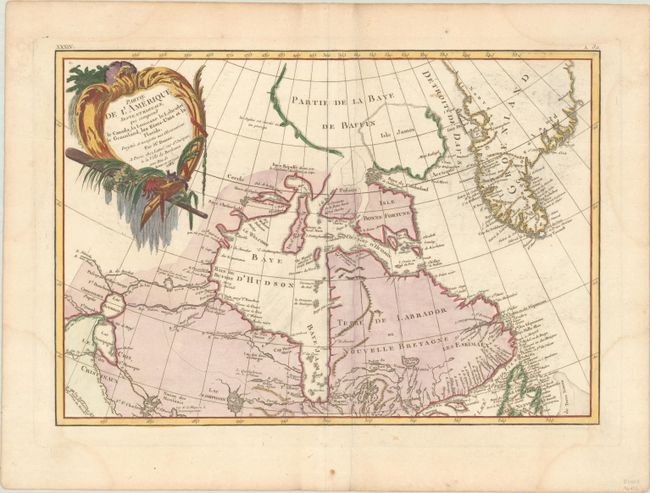
Auction 196, Lot 108
Subject: Eastern Canada & Greenland
Bonne/Lattre
Partie de l'Amerique Septentrionale, qui Comprend le Canada, la Louisiane le Labrador, le Groenland, les Etats-Unis et la Floride. Projettee et Assujettie aux Observations, 1783
Size: 17.2 x 11.8 inches (43.7 x 30 cm)
Estimate: $150 - $180
Sold for: $110
Closed on 2/7/2024
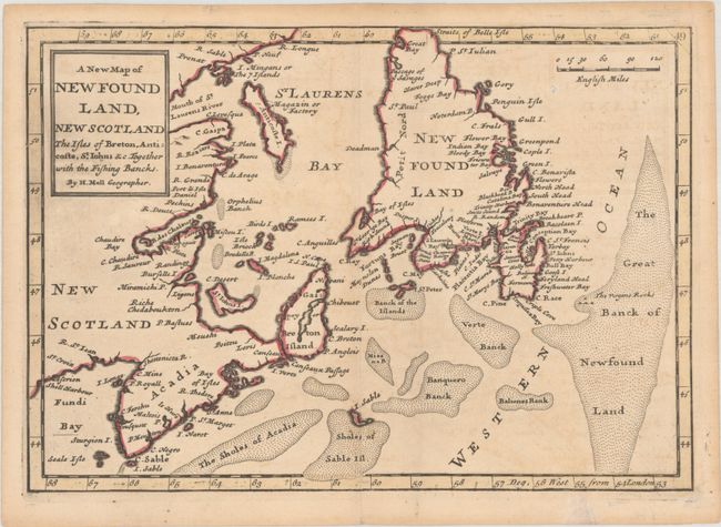
Auction 196, Lot 109
Subject: Eastern Canada
Moll, Herman
A New Map of New Found Land, New Scotland the Isles of Breton, Anticoste, St. Iohns &c. Together with the Fishing Bancks, 1781
Size: 10.2 x 7.1 inches (25.9 x 18 cm)
Estimate: $240 - $300
Sold for: $180
Closed on 2/7/2024
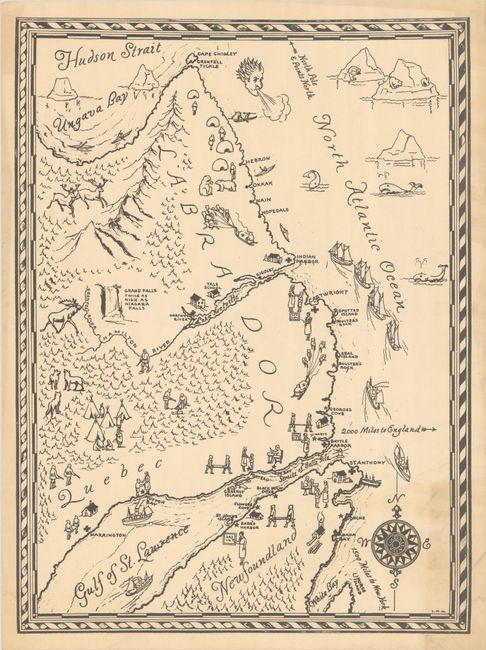
Auction 196, Lot 110
Subject: Newfoundland & Labrador, Canada
[Newfoundland & Labrador], 1930
Size: 12.8 x 17.2 inches (32.5 x 43.7 cm)
Estimate: $100 - $130
Sold for: $75
Closed on 2/7/2024
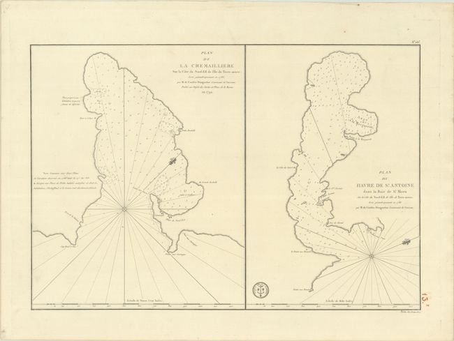
Auction 196, Lot 111
Subject: Newfoundland, Canada
Depot de la Marine
Plan de la Cremailliere sur la Cote du Nord-Est de l'Ile de Terre-Neuve... [on sheet with] Plan du Havre de St. Antoine dans la Baie de St. Meen..., 1792
Size: 22.5 x 15.4 inches (57.2 x 39.1 cm)
Estimate: $200 - $230
Unsold
Closed on 2/7/2024
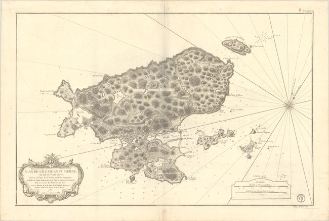
Auction 196, Lot 112
Subject: Saint Pierre Island
Depot de la Marine
Plan de l'Ile de Saint Pierre, au Sud de Terre-Neuve, Leve en 1763 par le Sr. Fortin Ingenieur Geographe..., 1763
Size: 34.6 x 22.5 inches (87.9 x 57.2 cm)
Estimate: $275 - $350
Sold for: $200
Closed on 2/7/2024
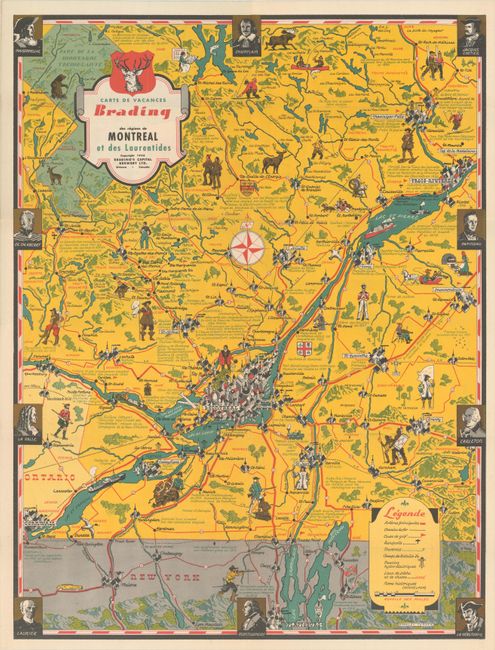
Auction 196, Lot 113
Subject: Quebec, Canada
Turner, Stanley
[Lot of 2] Carte de Vacances Brading des Regions de Montreal et des Laurentides [and] Carte de Vacances Brading du Bas St. Laurent et des Cantons de l'Est, 1948
Size: 16.8 x 22.1 inches (42.7 x 56.1 cm)
Estimate: $475 - $600
Sold for: $350
Closed on 2/7/2024
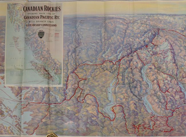
Auction 196, Lot 114
Subject: Western Canada
Railroad Companies, (Various)
[Map in Booklet] Canadian Rockies Showing Main Line of Canadian Pacific Ry. with Branch Lines & Steamship Connections [in] Resorts in the Canadian Rockies, 1930
Size: 46.3 x 16.8 inches (117.6 x 42.7 cm)
Estimate: $100 - $130
Sold for: $75
Closed on 2/7/2024
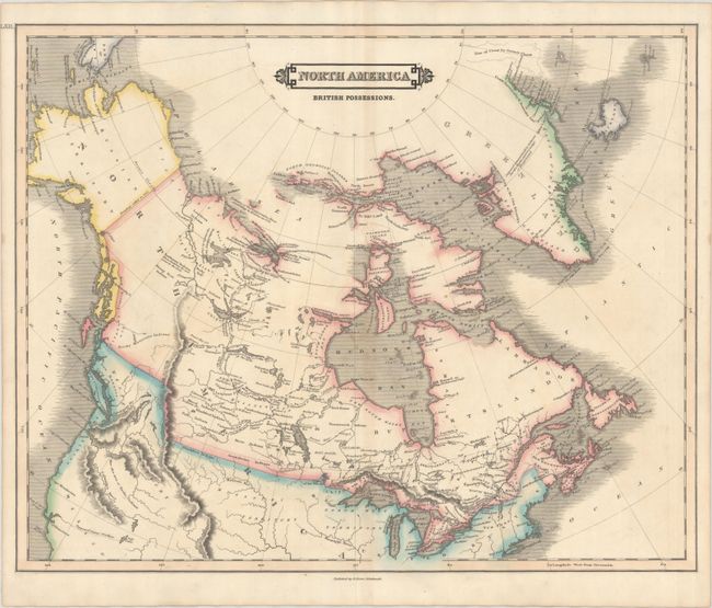
Auction 196, Lot 115
Subject: United States & Canada
Lizars, Daniel
North America British Possessions, 1830
Size: 20.6 x 16.6 inches (52.3 x 42.2 cm)
Estimate: $275 - $350
Sold for: $200
Closed on 2/7/2024
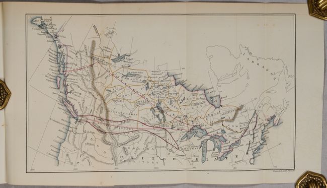
Auction 196, Lot 116
Subject: United States & Canada
U.S. Government
[Map in Report] [Untitled - Canada & Northern Part of the United States Showing Two Proposed Routes for a Pacific Railroad] [in] Relations Between the United States and Northwest British America. Letter from the Secretary of the Treasury…, 1862
Size: 5.8 x 8.9 inches (14.7 x 22.6 cm)
Estimate: $160 - $190
Sold for: $100
Closed on 2/7/2024
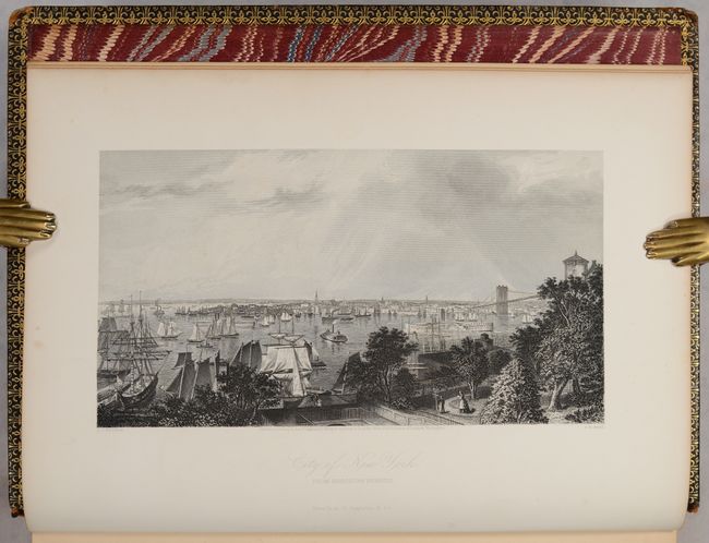
Auction 196, Lot 117
Subject: United States & Canada
Bryant, William C.
[2 Volumes] Picturesque America; or, the Land We Live In..., 1872-74
Size: 10.5 x 13 inches (26.7 x 33 cm)
Estimate: $550 - $700
Sold for: $425
Closed on 2/7/2024
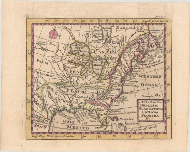
Auction 196, Lot 118
Subject: Colonial Eastern United States & Canada
Cowley, John
A Map of the British Plantations Canada Florida &c., 1742
Size: 5.2 x 4.3 inches (13.2 x 10.9 cm)
Estimate: $200 - $230
Sold for: $150
Closed on 2/7/2024
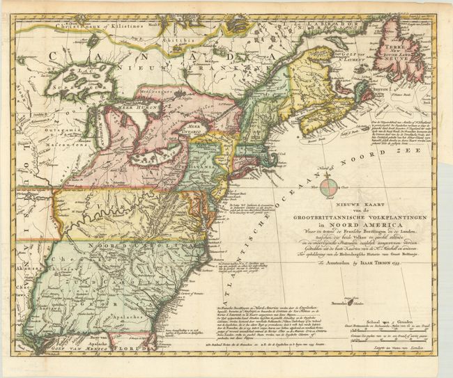
Auction 196, Lot 119
Subject: Colonial Eastern United States & Canada
Tirion, Isaac
Nieuwe Kaart van de Grootbrittannische Volkplantingen in Noord America waar in Tevens de Fransche Bezittingen en de Landen..., 1755
Size: 17.9 x 14.4 inches (45.5 x 36.6 cm)
Estimate: $600 - $750
Sold for: $500
Closed on 2/7/2024
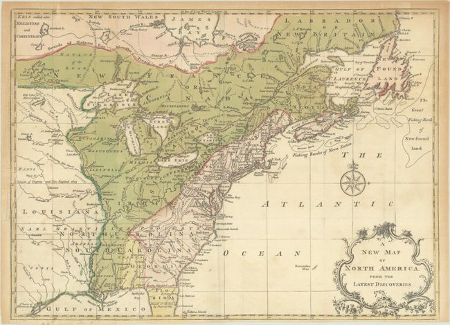
Auction 196, Lot 120
Subject: Colonial Eastern United States & Canada
Spilsbury, J.
A New Map of North America from the Latest Discoveries, 1763
Size: 15 x 10.9 inches (38.1 x 27.7 cm)
Estimate: $240 - $300
Sold for: $325
Closed on 2/7/2024
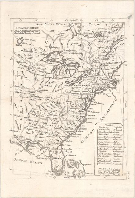
Auction 196, Lot 121
Subject: Eastern United States & Canada
Lopez, D. Tomas
Estados Unidos de la America Septenl. Parte de la Florida y el Canada, 1792
Size: 7 x 9.7 inches (17.8 x 24.6 cm)
Estimate: $300 - $375
Sold for: $220
Closed on 2/7/2024
Auction 196, Lot 122
Subject: Eastern United States & Canada, Texas
Monin, Charles V.
Etats Unis et Canada, 1830
Size: 18 x 12.6 inches (45.7 x 32 cm)
Estimate: $160 - $190
Sold for: $120
Closed on 2/7/2024
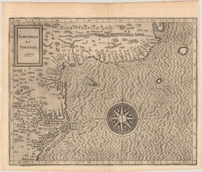
Auction 196, Lot 123
Subject: Colonial Northeastern United States & Canada
Wytfliet, Cornelis
Norumbega et Virginia, 1597
Size: 11.6 x 9.1 inches (29.5 x 23.1 cm)
Estimate: $2,750 - $3,500
Important, Early Map of the East Coast with Mythical City
Sold for: $3,750
Closed on 2/7/2024
Auction 196, Lot 124
Subject: Colonial Northeastern United States & Canada
Mallet, Alain Manesson
Canada ou Nouvelle France, 1683
Size: 3.9 x 5.6 inches (9.9 x 14.2 cm)
Estimate: $160 - $190
Sold for: $130
Closed on 2/7/2024
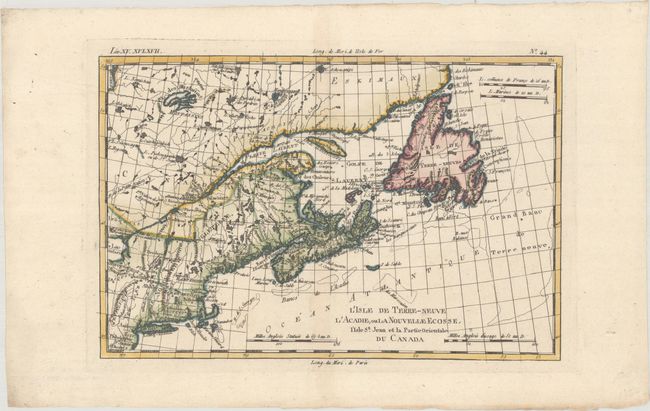
Auction 196, Lot 125
Subject: Colonial Northeastern United States & Canada
Bonne, Rigobert
L'Isle de Terre-Neuve l'Acadie, ou la Nouvelle Ecosse, l'Isle St. Jean et la Partie Orientale du Canada, 1783
Size: 12.4 x 8.3 inches (31.5 x 21.1 cm)
Estimate: $140 - $170
Sold for: $100
Closed on 2/7/2024
Auction 196, Lot 126
Subject: Central United States & Canada, Great Lakes
U.S. Government
[19 Maps in Report] Boundary Between the United States and Great Britain. Message from the President of the United States … In Relation to the Boundary Between the United States and Great Britain, 1838
Size: 5.6 x 8.9 inches (14.2 x 22.6 cm)
Estimate: $180 - $220
Sold for: $210
Closed on 2/7/2024
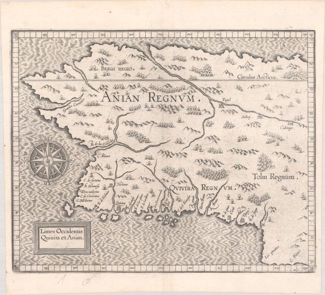
Auction 196, Lot 127
Subject: Alaska & Western Canada
Wytfliet, Cornelis
Limes Occidentis Quivira et Anian, 1607
Size: 11.6 x 9.3 inches (29.5 x 23.6 cm)
Estimate: $2,000 - $2,300
Early and Imaginary Map of Alaska and the Northwest Passage
Unsold
Closed on 2/7/2024
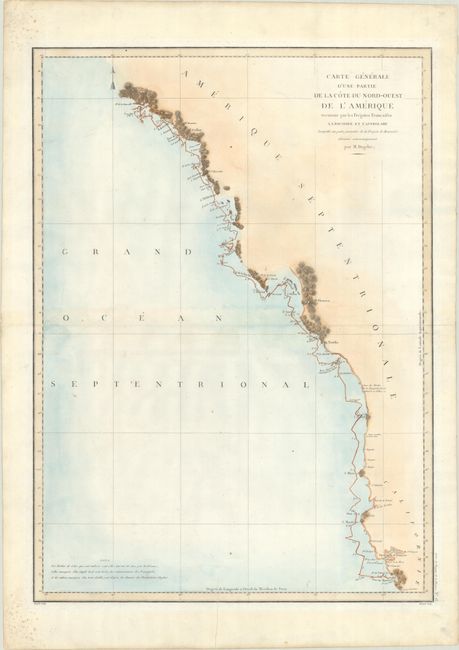
Auction 196, Lot 128
Subject: Western United States & Canada
La Perouse, Comte Jean F. Galoup, de
Carte Generale d'une Partie de la Cote du Nord-Ouest de l'Amerique Reconnue par les Fregates Francaises la Boussole et l'Astrolabe..., 1797
Size: 19.4 x 26.8 inches (49.3 x 68.1 cm)
Estimate: $275 - $350
Sold for: $170
Closed on 2/7/2024
Auction 196, Lot 129
Subject: Alaska & British Columbia
Railroad Companies, (Various)
The Triangle Tour of British Columbia - Jasper National Park Mount Robson Park Canadian Rockies and the Scenic Seas of the North Pacific Coast [on verso] Alaska and the Yukon, 1929
Size: 29.8 x 16.8 inches (75.7 x 42.7 cm)
Estimate: $160 - $190
Sold for: $120
Closed on 2/7/2024
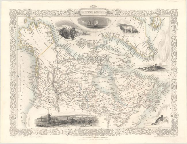
Auction 195, Lot 113
Subject: Canada
Tallis, John
British America, 1850
Size: 13 x 10.1 inches (33 x 25.7 cm)
Estimate: $240 - $300
Sold for: $150
Closed on 11/15/2023
2831 lots
Page 1 of 57