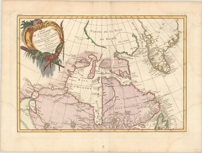
"Partie de l'Amerique Septentrionale, qui Comprend le Canada, la Louisiane le Labrador, le Groenland, les Etats-Unis et la Floride. Projettee et Assujettie aux Observations", Bonne/Lattre
Subject: Eastern Canada & Greenland
Period: 1783 (dated)
Publication: Atlas Moderne
Color: Hand Color
Size:
17.2 x 11.8 inches
43.7 x 30 cm
Third state of this lovely map that covers eastern Canada and Greenland from the bottom of Hudson Bay, northward beyond the Arctic Circle to about 70° N. latitude. It includes an interesting depiction of a passage between Lake Winnipeg and Hudson Bay alluding to a possible navigable passage to the Pacific. The sheet is decorated with a large title cartouche. This is the top sheet of a two-part map; thus it does not cover the whole region indicated in the title. The map has full borders and stands on its own without the other sheet.
References: Kershaw #475; McCorkle #771.2.
Condition: B+
Nice impression and thick paper with a large watermark of a Maltese cross encircled in rosary beads. There are faint damp stains in the corners of the sheet barely affecting map borders, and a crease parallel to centerfold, else very good.