Subject: Colonial Eastern United States & Canada
Period: 1741 (published)
Publication:
Color: Black & White
Size:
21.5 x 16.8 inches
54.6 x 42.7 cm
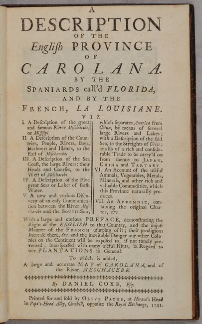
This is the complete fourth edition of Daniel Coxe's important work on the Southeast and the Mississippi Valley. The father of the author, Dr. Daniel Coxe (1640-1730), was a physician to the court of King Charles II of England and Queen Anne, and had acquired an enormous tract of land under the name Carolana, encompassing parts of the Carolinas, Florida, Georgia, Alabama, Mississippi and Louisiana. Carolana was named after King Charles I, who had initially granted a patent to the land to his attorney general, Sir Robert Heath, in 1629. Heath was expected to colonize and plant the region, as well as to defend it from foreign powers. Not able to complete the task alone, Heath assigned his patent to Henry, Lord Maltravers in 1632 to assist in colonization, and Maltravers' heirs sold the patent to Dr. Coxe in 1698. Numerous land speculators were involved in the attempted colonization of the region, to the extent that ownership of the land came under contention, particularly with the Lords Proprietors. Dr. Coxe was required to defend his claims on Caroloana before the Board of Trade in 1719, which he was only partially successful in doing. The younger Coxe published this work in 1722 to help further his family's claims in the Southeast. Coxe's account was based on information gathered from British hunters and explorers, as well as his own travels in the region, having lived there for 14 years. It serves as a record of the first British exploration of the Mississippi Valley and the first English account of Louisiana. In addition, Coxe stresses the importance of further colonization to the west in order to prevent occupation by the French.
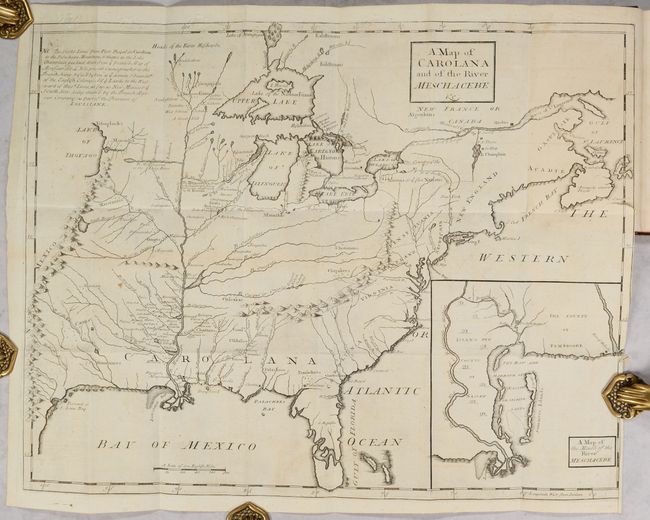
Included in the volume is an important map of the eastern United States extending west to the Rocky Mountains and Lake of Thoyago. The map is based in part on Guillaume Delisle's Carte de la Louisiane (1718) and features a dotted line depicting France's claims to the region, with the British colonies relegated to the eastern seaboard. Coxe, however, shows the region of Carolana stretching west of the Mississippi River, here called R. Meschacebe, thereby making a "bold assertion of the rights of England to the entire gulf region" (Howes). This is one of only two printed maps to use the term Carolana, the other being John Farrer's A Mapp of Virginia (1651). The map also identifies forts and numerous Native American settlements and includes an inset of the Mississippi Delta. Coxe's map is an improvement on previous maps in its depiction of the Appalachian and Ozark mountains, as well as elimination of several mountain ranges that had previously been shown along the Mississippi River.
Also of great interest is the preface, which is credited as "the first printed plan for a political confederation of the North American Colonies" (Cumming). In it, Coxe states: "That All the Colonies apertaining to the Crown of Great Britain on the Northern Continent of America be United under a Legal, Regular, and firm Establishment, over which it’s propos’d a Lieutenant or Supreme Governour may be constituted and appointed to Preside on the Spot, to whom the Governours of each Colony shall be Subordinate. . . So if the English Colonies in America were Consolidated as one Body and join’d in one Common Interest, as they are under one Gracious Sovereign, and with united Forces were ready and willing to act in Concert and assist each other, they would be better enabled to provide for and defend themselves against any troublesome Ambitious Neighbour or bold Invader."
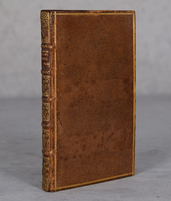
Coxe's work was published in 1722, 1726, 1727 and 1741 with the same text and map. A later edition was published in 1841 with a newly engraved map. The fourth edition is nearly identical to the first edition of 1722 with the exception of the title page, and was purportedly created using leftover sheets from the third edition of 1727. Small Octavo; (54pp.), 122 pp., and folding map. Hardbound in full mottled leather, covers with a gilt double filet border, spine with raised bands in six compartments and gilt tooling and titling, red-speckled edge.
Provenance: Previously from the North Library of the Earl of Macclesfield at Shirburn Castle, with armorial bookplate (motto: "Sapere aude") on inside front cover with shelfmark and the year 1860.
References: Cumming #190; Howes #C-826; Sabin #17281.
Condition: A
The map is a dark impression with minor toning and foxing, a 1" binding tear at right, and misfolding of the right edge of the map. The text is clean and bright with a bit of foxing and toning on the last few pages. There are small blind stamps of the coat of arms of the Earl of Macclesfield on the title page, first page of the preface, and along the top border of the map. The inside front cover includes the bookplate from the Earl. The hinge of the front cover is perished but the cover is still attached by the cords. There are small abrasions on the covers and spine, and the spine has a small chip within the title label.