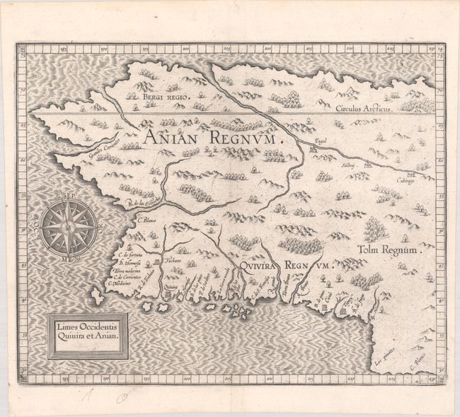
Subject: Alaska & Western Canada
Period: 1607 (circa)
Publication: Descriptionis Ptolemaicae Augmentum
Color: Black & White
Size:
11.6 x 9.3 inches
29.5 x 23.6 cm
This early copper plate engraving depicts the northwestern coast of North America and is generally considered the first map of Alaska, even though it is mostly an imaginary depiction. The general shape of the map is based on Gerard Mercator's world map of 1569. The mythical realms of Anian, Quivera and Tolm fill the interior and numerous place names are shown along the coastline. Several rivers are shown including a large one that flows into the sea to the north, which forms the fabled Northwest Passage. The map is adorned with a spectacular compass rose. This is the second state with the date removed from the title cartouche.
References: Burden #107; Mickwitz & Miekkavaara #307-14; Wagner (NW) #189.
Condition: A
A dark impression on a bright sheet with some minor printer's ink residue.