Subject: Eastern United States & Canada
Period: 1792 (circa)
Publication: Atlas Elemental
Color: Black & White
Size:
7 x 9.7 inches
17.8 x 24.6 cm
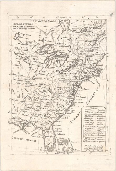
A very uncommon Spanish map depicting the eastern coast of North America from Nova Scotia to Florida. The map is based upon Rigobert Bonne's map of 1783 issued in Petit Atlas Moderne. Cartographically, Virginia, North Carolina, South Carolina and Georgia extend west to the Mississippi River, while Pennsylvania extends north to 43 degrees, just south of Lake Ontario. West Florida and East Florida are delineated. A table at lower right lists the capitals of the states.
References: cf. McCorkle #783.8; cf. Sellers & van Ee #183.
Condition: A
On a bright sheet with an ink spot just outside the border at top right. A short centerfold separation confined to the left blank margin has been closed on verso with archival tape.