Subject: Northwestern United States & Canada
Period: 1825-27 (published)
Publication: Atlas Universel de Geographie...
Color: Hand Color
Size:
22.2 x 18.4 inches
56.4 x 46.7 cm
Vandermaelen was the son of a wealthy industrialist who abandoned his father's business to follow a career in cartography. His goal was to produce the first atlas ever published in which every map was drawn on the same projection and to the same scale (1: 1,641,836), with each map covering an area of approximately 20 degrees of longitude (from Paris) and 6 degrees of latitude. Because of the consistent scale and projection, the maps could be joined together to form a huge globe that would measure over 25 feet in diameter. Vandermaelen had the only known globe constructed from his maps, requiring a special room for its display. It was also the first lithographic atlas ever published. There was one edition of the atlas, published in 1825-27, and the subscription list shows that only 810 copies were sold. Koeman called his Atlas Universel, "One of the most remarkable world atlases ever made. Far ahead of its time."
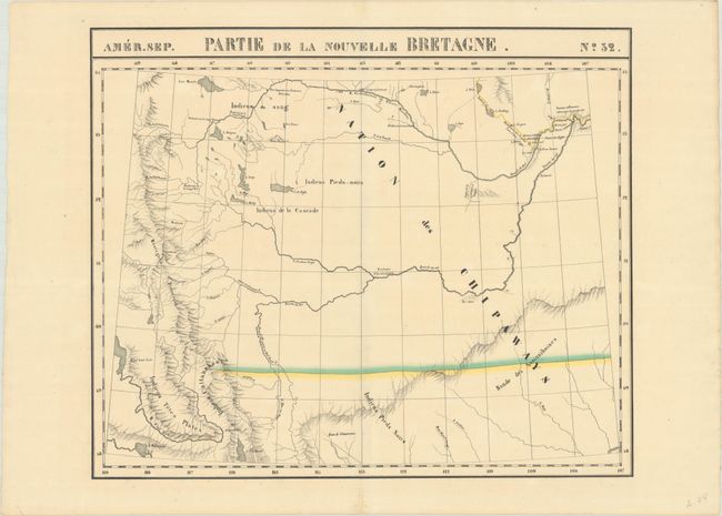
A detailed map extending from northwestern Montana north into Alberta showing good detail of watersheds and topography. Locates several lakes in the region including Flathead, Buffalo, and Sturgeon lakes and a number of Indian tribes, including the “Nation des Chipaways” in large bold text. The map also identifies a number of locations for the Hudson Bay Company and Northwest Company including the Chesterfield Factory, Fort George, Fort Augustin, and several others.
References:
Condition: A
A crisp impression on a clean sheet with a few faint spots.