Current Auction
Lot 91
Current Auction

Price reduced by $30

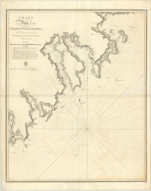
"Chart of Part of the Coast of Nova Scotia. From Documents in the Hydographical Office of the Admiralty. April 1824. Sheet III", British Admiralty

Subject: Nova Scotia, Canada

Period: 1831 (dated)

Publication:

Color: Black & White

Size:
24.8 x 30.4 inches
63 x 77.2 cm
Download High Resolution Image
(or just click on image to launch the Zoom viewer)

This uncommon chart covers the southeastern coast of Nova Scotia from Rugged Island Harbour (the vicinity of present-day East Side of Ragged Island) to Port Mouton. There is a lot of information for navigators, including depth soundings, anchorages, rocks, and more. Remarks below the title provide specific navigational directions for each of the harbors. There is fine topographical detail along the coasts, showing Port Joli, Port L'Hebert, and the mouth of the Sable River. The engraved seal of the Hydrographic Office appears below the title, distance scale, and remarks, with the price of "3s. 6d."

References:

Condition: B+

A fine impression on a sturdy sheet with the watermark of "T. Edmunds Wycombe." There is light offsetting, light dampstaining, and an extraneous vertical fold.

Estimate: $240 - $300

Sold for: $150

Closed on 4/24/2024

Closed