Catalog Archive
Auction 196, Lot 118

"A Map of the British Plantations Canada Florida &c.", Cowley, John

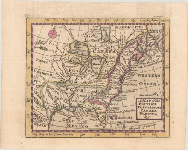
Subject: Colonial Eastern United States & Canada

Period: 1742 (published)

Publication: A New and Easy Introduction to the Study of Geography...

Color: Black & White

Size:
5.2 x 4.3 inches
13.2 x 10.9 cm
Download High Resolution Image
(or just click on image to launch the Zoom viewer)

This small but detailed map extends from the Eastern Seaboard to the "Head of Mississippi" and south to northern Mexico. British possessions are shown confined to east of the Appalachian Mountains with New France and an oversized Florida to its west. Beyond the Missouri River are Santa Fe and "Parts Unknown." Place names dominate the British possessions while the river systems draining into the Mississippi River dominate the trans-Appalachian west. Published in Johann Huebner's A New and Easy Introduction to the Study of Geography.

References: McCorkle (18th C. Geography Books) #197-31.

Condition: A

A crisp impression with faint offsetting and a few spots of foxing in the blank margins. Issued folding.

Estimate: $200 - $230

Sold for: $150

Closed on 2/7/2024

Archived