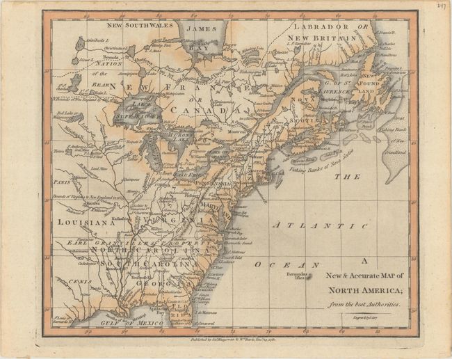
Subject: Colonial Eastern United States & Canada
Period: 1780 (dated)
Publication:
Color: Hand Color
Size:
8.8 x 7.6 inches
22.4 x 19.3 cm
This uncommon map covers the eastern part of North America from James Bay to the Gulf of Mexico. It shows boundaries, colonies, towns, cities, forts, and Indian tribal territory. Earl Granville's Property is shown to extend past the Mississippi to the western edge of the map. The southwest region is called Cenis, and there is a town with the same name. Fort St. Charles is the furthest west settlement. The map is based on John Entick's map of the region from The General History of the Late War published in 1766. Published by James Macgowan and William Davis.
References: cf. Sellers & Van Ee #105.
Condition: A
A nice impression with a hint of printer's ink residue and toning along the edges of the sheet.