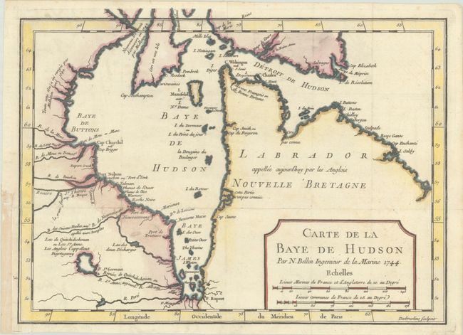
Subject: Eastern Canada, Hudson Bay
Period: 1744 (dated)
Publication: Histoire et Description Generale de la Nouvelle France
Color: Hand Color
Size:
11.5 x 8.5 inches
29.2 x 21.6 cm
This chart of Hudson Bay and Labrador depicts the coastal features and includes the forts of Rupert, Monsoni, St. Germain, and Bourbon. Inland, detail is limited to rivers and a few places names. Two notations identify the discoveries of Middleton in 1742. A simple title cartouche incorporates two distance scales. Engraver's imprint, Desbruslins Sculpsit, at lower right. An uncommon issue that pre-dates numerous Hudson Bay maps issued later by Bellin.
References: Kershaw #423.
Condition: A
A nice impression issued folding, now flat, on bright, watermarked paper. A few short splits along the horizontal fold have been archivally repaired on verso, and a binding trim in the bottom left margin has been replaced with old paper.