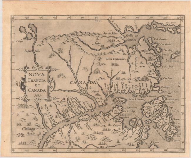
Subject: Eastern Canada
Period: 1597 (dated)
Publication: Descriptionis Ptolemaicae Augmentum
Color: Black & White
Size:
11.6 x 9.3 inches
29.5 x 23.6 cm
This map is cartographically significant for a number of reasons: it is the first state of the plate; it was issued in the first atlas of the New World; it is the first map to use Canada in its title; and it is the first map to concentrate on the St. Lawrence River and gulf. The general outline of the map is derived from Gerard Mercator and summarizes sixteenth-century knowledge of the region. The region north of the St. Lawrence and east of the Saguenai River is labeled Canada, and Nova Francia is centered on the town of Hochelaga (present-day Montreal).
References: Burden #102; Kershaw #35; Mickwitz & Miekkavaara #307-18; Shirley (BL Atlases) T.WYT-1a.
Condition: A
A dark impression on a faintly toned sheet with a small medallion watermark. There is printer's ink residue, minor weakness along the centerfold at top, and a short tear in the top margin. Small remnants of hinge tape on verso.