Subject: Saint Pierre Island
Period: 1763 (dated)
Publication:
Color: Black & White
Size:
34.6 x 22.5 inches
87.9 x 57.2 cm
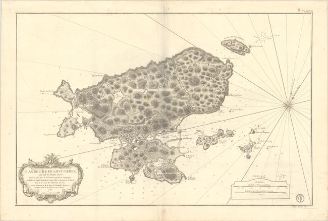
This large chart presents a detailed rendering of the region surrounding Saint Pierre Island off the southern coast of Newfoundland. There is good navigational detail including many soundings, shoals, bays and offshore islands. The chart also displays some detailed topographical features, including vegetation and forests, lakes, and elevation. North is oriented to the top right corner. The engraved seal of the Depot de la Marine appears at bottom right, along with the price of "Prix Trente Sols."
Following their defeat in the French & Indian War, France ceded all of their colonial possessions in North America with the exception of Saint Pierre and Miquelon, allowing French access to the rich fishing banks in the area. Today, Saint Pierre and Miquelon’s population is approximately 6,000 people.
References:
Condition: B+
A crisp impression on watermarked paper with light offsetting and a printer's crease adjacent to the lower centerfold. There are some minor dampstains in the margins and a short repaired edge tear in the bottom blank margin.