Subject: British Columbia, Canada, Mining
Period: 1897 (dated)
Publication:
Color: Printed Color
Size:
22.3 x 30.6 inches
56.6 x 77.7 cm
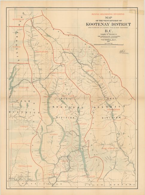
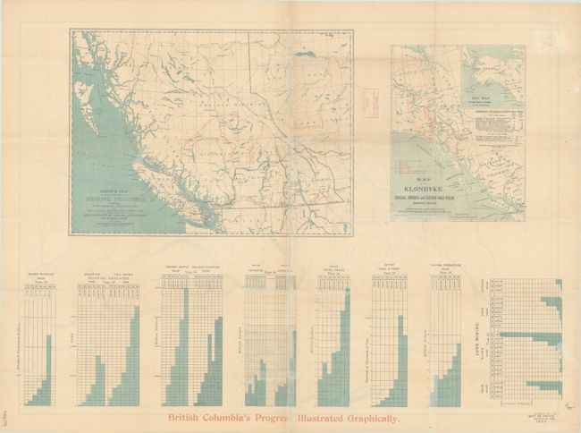
This informative map centers on the West Kootenay mining district near the eastern boundary of British Columbia. It was compiled under the direction of G.B. Martin, Chief Commissioner of the Department of Land and Works, based on surveys by Tom Kains. Red overprinting identifies various mining recording divisions. There is incredible detail of the region's watershed, including its various lakes and the Columbia and Kootenay rivers. Wagon roads, trails, railroads, towns, and settlements are located. Fort Steele, site of Galbraith's Ferry, is named. There was a gold mining boom in the Kootenay region in 1863 that quickly cooled off. However, by the 1890s, the introduction of large pump machinery revived mining in the region. This map was intended to promote the area during the excitement of the Klondike Gold Rush. On the verso are two additional maps, Sketch Map of the Southern Portion of British Columbia... (16.2 x 11.8") and Map of the Klondyke Cassiar, Omineca and Cariboo Gold Fields... (7.8 x 10.0"), and graphs illustrating "British Columbia's Progress" in its various industries from 1873 to 1896. Printed by The Colonist, Litho. in Victoria.
References:
Condition: B
Issued folding with light toning and backed in archival tissue to repair some fold separations and small chips with minor loss of image. A chip in the top right corner has been repaired with cello tape on recto.