Subject: United States & Canada
Period: 1830 (circa)
Publication:
Color: Hand Color
Size:
20.6 x 16.6 inches
52.3 x 42.2 cm
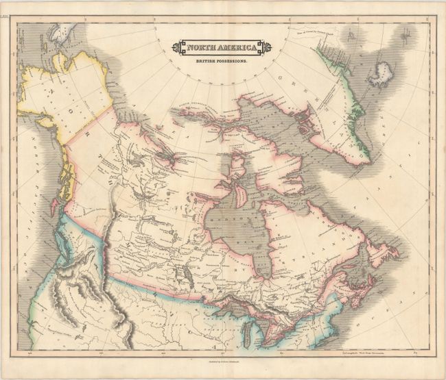
A handsome map of the northern half of North America, extending from the 40th parallel to the Arctic Circle. The map reflects increased exploration and a better understanding of northern and western Canada, including an extensive network of lakes and rivers west of Hudson Bay. The region that Alexander Mackenzie explored from the Great Slave Lake to the Arctic Ocean is well depicted, with many Indian tribes named and located, including the Dawhodinny Indians who were "reported to be cannibals." There is almost no detail west of the Mackenzie River and northern Rocky Mountains, however, and further to the south a spurious river connects the Great Salt Lake to the Pacific Ocean. Curiously, Lizars, a Scottish publisher, takes an American point of view with respect to the Oregon Boundary Dispute, showing U.S. claims extending well north into British Columbia.
References:
Condition: A
Contemporary outline color on watermarked paper with "1823" date. There is faint toning and a couple spots along the centerfold.