Subject: Northern England
Period: 1947 (published)
Publication:
Color: Printed Color
Size:
19 x 12.6 inches
48.3 x 32 cm
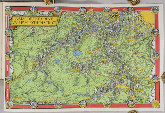
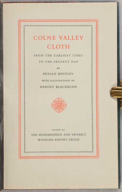
This exquisite pictorial map by the great MacDonald Gill shows the Colne Valley in West Yorkshire. It depicts thriving industry surrounded by verdant moors in the valley between the Colne and Holme rivers. Huddersfield, Marsden, Slaithwaite, Golcar, Meltham, and Holmfirth are among the towns and villages located. The map includes pictorial representations of the region's factories, a setting sun (a signature symbol for Gill), and 19 circular vignettes that are incorporated into the border. For centuries, the Colne Valley was home to hand loom weavers, but with the advent of water-powered textile mills during the Industrial Revolution, the region flourished into a major hub for textile manufacturing. World War II hit the region hard, and this map and the book it was published in were part of a concerted effort to revive textile exports in the aftermath of the war. The map was published in Phyllis Bentley's Colne Valley Cloth from the Earliest Times to the Present Day, a book issued by the Hudderfield and District Woollen Export Group. Four additional black & white maps by Gill are incorporated into the text along with several illustrations of the region's culture by Harold Blackburn. 70 pages. Hardbound in decorated cloth with gilt title on spine, protected by Mylar. Includes a type-written note from the Hudderfield and District Woollen Export Group.
Leslie MacDonald Gill (1884-1947), more commonly known as MacDonald Gill or Max Gill, was a British artist, architect, graphic designer and cartographer. He is known for his bold, colorful, Art-Deco style in pieces such as his Wonderground map of the London Underground. This map was one of Gill's final cartographic productions.
References: PJ Mode Collection #1339.01; Rumsey #6761.
Condition: A
The map is in fine condition, issued folding. Text is very good with just a hint of toning. Covers have minor shelf wear.