Subject: Exploration & Surveys
Period: 1754 (published)
Publication:
Color: Black & White
Size:
4 x 6.8 inches
10.2 x 17.3 cm
This is a nice example of volume forty-five of Prevost's history of voyages, with maps by Jacques Nicolas Bellin. This is the 1754 octavo edition, published by Firmin Didot in Paris. The focus of this volume is the Caribbean and northern South America, and includes the following five folding maps:
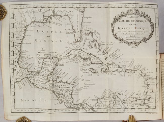
Carte du Golphe du Mexique et des Isles de l'Amerique… (14.9 x 10.8”). Attractive map of the islands of the Caribbean with the parts of the United States and Mexico that border the Gulf of Mexico, Central America, and the northern coastline of South America. Routes of several explorers are shown, including Cortez, Ponce de Leon, and Hernandez de Cordova, along with many coastal place names. A delicately engraved rococo-style title cartouche fills the upper right.
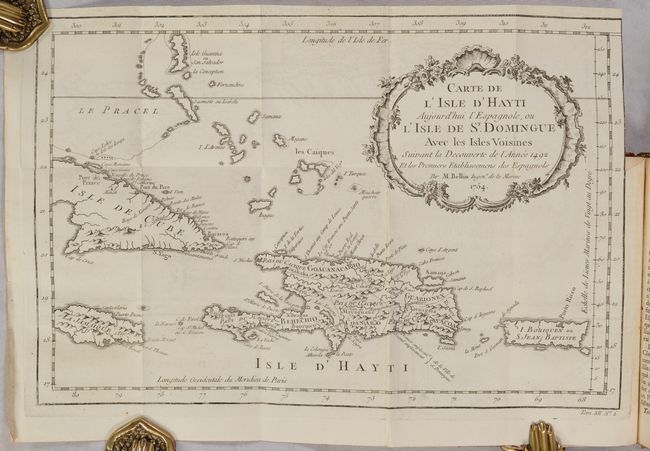
Carte de l'Isle d'Hayti Aujourd'hui l'Espagnole, ou l'Isle de St. Domingue… (13.3 x 8.8”). This decorative map of Hispaniola divided into five ancient cacicazgos, or Taino chiefdoms. The map extends to show Puerto Rico and the eastern portions of Cuba and Jamaica.
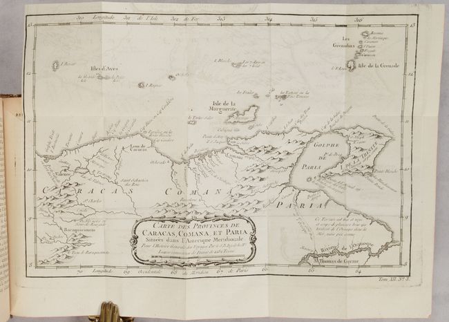
Carte des Provinces de Caracas, Comana, et Paria… (11.6 x 7.8”). Delicately engraved map of the northeastern part of Venezuela, including the islands of Margarita, Trinidad and the Grenadines. The locations of numerous settlements along the Venezuelan coast are noted, including Valencia, Caracas and Cumana.
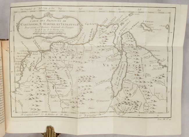
Carte des Provinces de Cartagene, S Marthe et Venezuela… (11.6 x 7.7”). This map is roughly centered on Lago de Maracaibo and includes portions of Colombia and Venezuela, as well as the islands of Aruba, Curacao and Bonaire. The locations of numerous settlements are noted along the coast, including Cartagena, Santa Marta, Maracaibo and Coro.
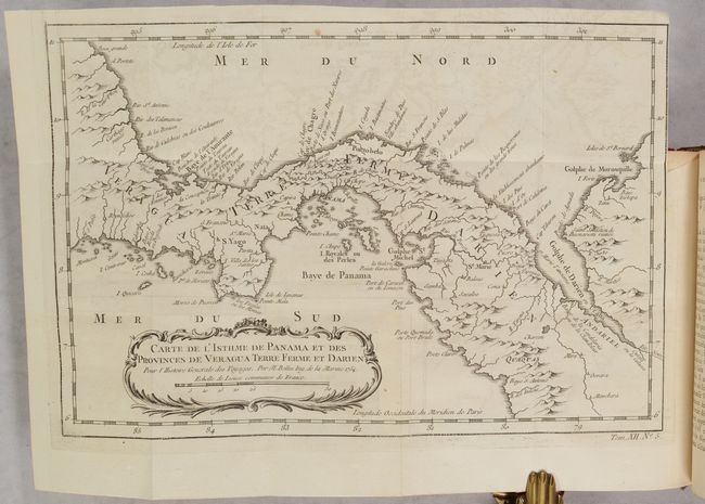
Carte de l'Isthme de Panama et des Provinces de Veragua Terre Ferme et Darien… (11.4 x 7.6”). An attractive, small map featuring good detail of Panama many years before the creation of the Canal and Lake Bayano. Numerous place names including S. Yago on the Azuevo Peninsula, Portobelo, Se. Marie, Panama, etc. Extends to include the Gulf of Darien.
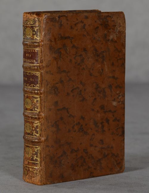
494 pages. 12mo, hardbound in full original leather with gilt tooling and title on red leather labels on spine. Marbled end-papers.
References:
Condition: A
The folding maps are clean and crisp with some faint offsetting. The Gulf of Mexico map has one misfold at left and a tiny binding tear at right. Text is mostly clean and tight with occasional faint toning or spot of foxing. Covers have light wear and minor abrasions.