Subject: Oklahoma
Period: 1902 (published)
Publication: H.R. Doc. 5, 57th Congress, 1st Session
Color: Printed Color
Size:
6 x 9.4 inches
15.2 x 23.9 cm
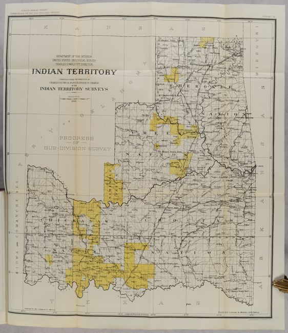
This is the eighth annual report of the Commission to the Five Civilized Tribes, with additional reports by the Indian Inspector to the Indian Territory, Board of Indian Commissioners, and an extensive listing of proposals received and contracts awarded for the Indian Service. The volume is well-illustrated with single-page plates, tables, and folding maps (missing only the first map of Indian Territory in black & white). Of particular interest is the colored map of Indian Territory (18.0 x 20.0") by Charles Fitch which matches the configuration of the rare State of Sequoyah, which the Indian Nations attempted to create in 1905 in an effort to thwart the expansive tendencies of the United States. It is also similar to the rare 1896 Senate edition which was issued in printed color. The regions of the Chickasaw, Choctaw, Creek, Seminole, Cherokee, and several other Indian tribes are named. The Territory of Oklahoma hovers ominously in the northwest. Fitch was the topographer in charge of the Indian Territory Surveys. The full listing of maps in the volume include:
A. Map Showing Progress of Allotment in Creek Nation (24.6 x 26.5").
B. Map of Seminole Nation Showing Progress of Allotment (10.3 x 19.0").
C. Indian Territory Progress of Sub-Division Survey (18.0 x 20.0").
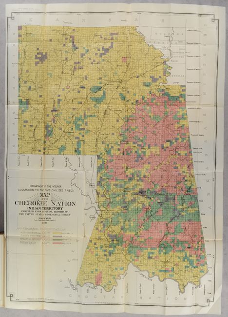
D. Map of the Cherokee Nation Indian Territory... (25.5 x 35.0").
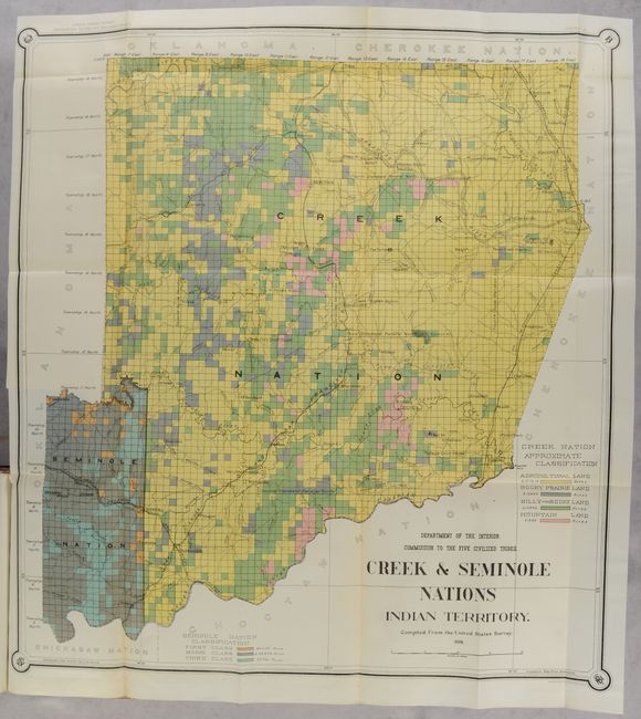
E. Creek & Seminole Nations Indian Territory (24.3 x 26.5").
F. Map of Chickasaw Nation Indian Territory... (30.6 x 33.2").
G. Map of Choctaw Nation Indian Territory... (32.7 x 36.8").
H. Exhibit 9 Section 33 T. 16 N. R. 18 E. (15.0 x 15.0").
I. Exhibit 10 Section 33 T. 16 N. R. 18 E. (15.0 x 15.0").
J. [Coal Claims] Map of Choctaw Nation Indian Territory... (18.1 x 20.0").
K. Map of the Indian Territory. Showing the Progress and Status of Townsite Surveys... (18.4 x 20.8").
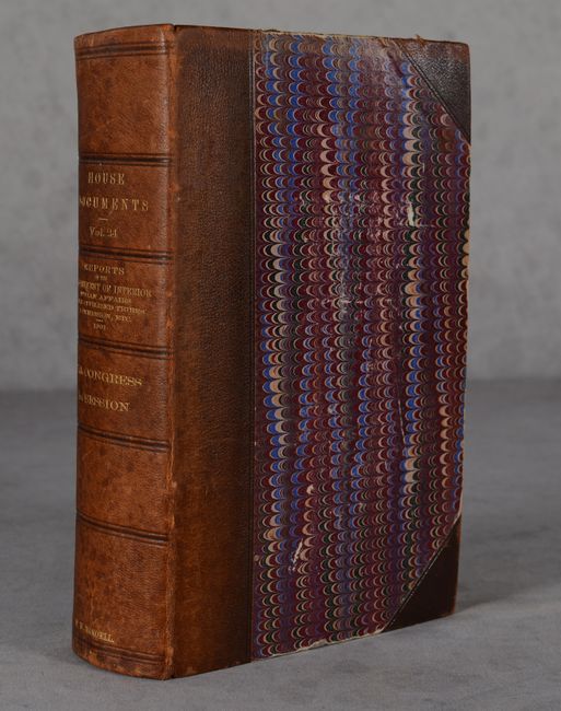
893 pages. Hardbound in contemporary three-quarter leather with gilt title on spine. This example was previously owned by Congressman F.W. Mondell of Wyoming, with his name gilt-stamped at the bottom of the spine.
References:
Condition: A
The folding maps are clean, bright and near fine with occasional short binding tears and minor toning along a few fold lines. Text has pleasant light toning. Binding has light shelf wear.