Subject: References, Lewis & Clark
Period: 2015 (published)
Publication:
Color: Printed Color
Size:
11.3 x 14.3 inches
28.7 x 36.3 cm
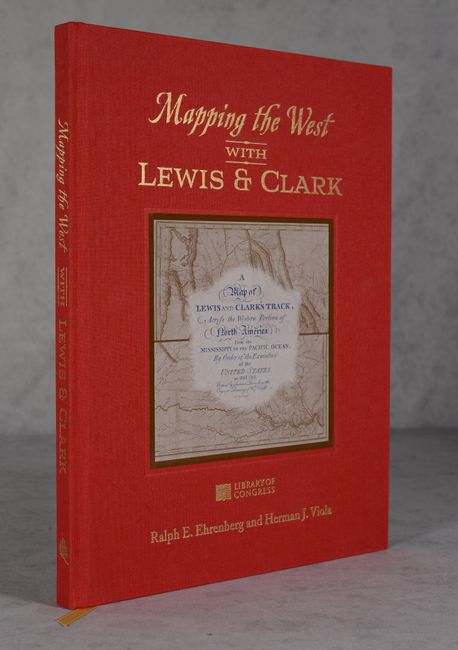
Published in collaboration with the Library of Congress, this study of the Lewis and Clark expedition and the mapping of the American West is by Ralph E. Ehrenberg, Chief of the Library of Congress' Geography and Map Division, and Herman J. Viola, Curator Emeritus at the Smithsonian Institute. According to J.C. McElveen's review, "This book is a fascinating and incredibly thorough examination of the Lewis and Clark expedition, from its inception to the publication of the fruits of the labors of all of the Corps of Discovery. It deserves a place of honor in the library of any student of the history of the westward expansion of the United States." The book is illustrated with numerous color reproductions of maps and historical documents and includes two folding map reproductions: A Composite Map of the American West (1803) and A Map of Part of the Continent of North America (1805). 111 pages. Hardbound in red cloth with gilt titles on cover and spine and an illustrated plate on cover.
References:
Condition: A+
Like new.