Subject: Atlases
Period: 1711 (published)
Publication:
Color: Black & White
Size:
3.3 x 8 inches
8.4 x 20.3 cm
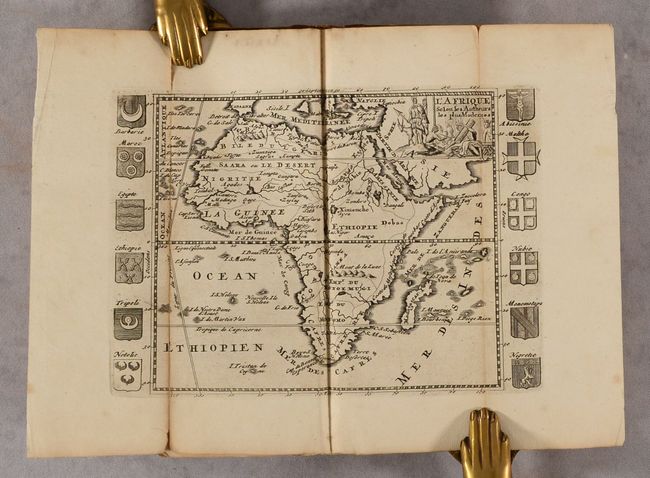
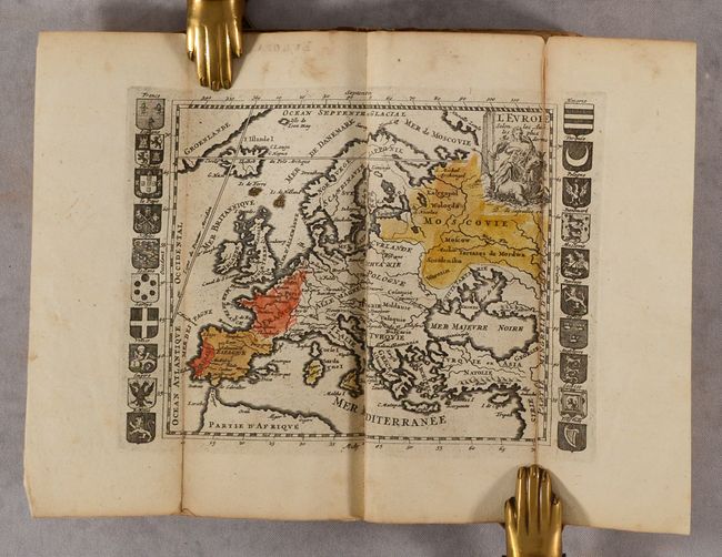
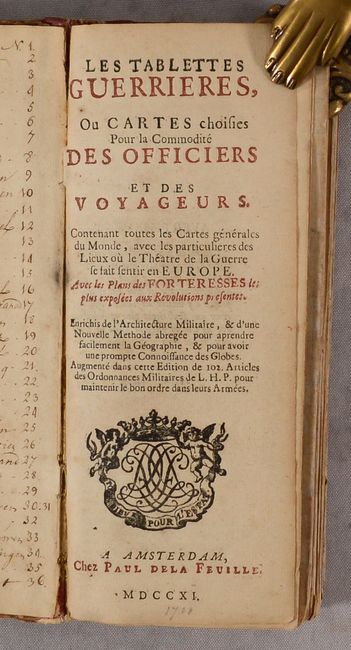
This charming miniature atlas contains 35 folding maps of the world, the 5 continents, regions around Europe, and a military-themed engraving. Daniel de la Feuille published the first edition of his Tablettes Guerrieres in Dutch and French text in 1706, with subsequent editions in 1707 and 1708 until his death in 1709, after which point his son, Paul, continued publishing the atlas through 1726. Nearly all of the maps, with the exception of the world map and several continent maps, are surrounded by armorial shields, city views, or city plans, adding a pleasant decorative element. The most important maps, of course, are those of the world and continents:
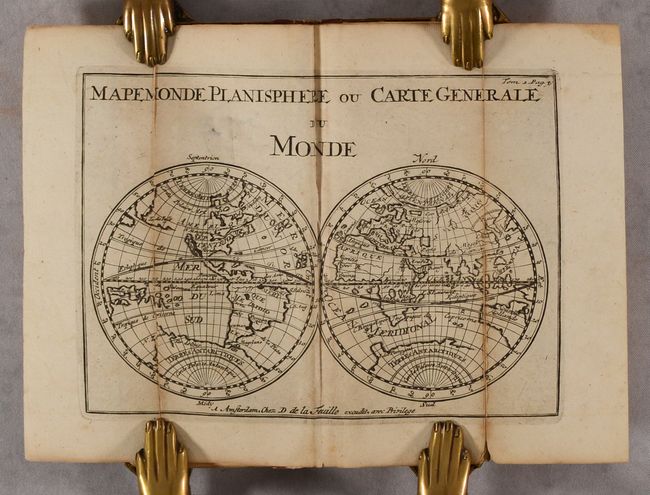
A. Mapemonde Planisphere ou Carte Generale du Monde presents the world as a simple double hemisphere showing the island of California, partially mapped Australia and New Zealand and still a good bit of the southern continent labeled Terres Antarctiques. In the North Pacific the T. de Jesso coastline stretches between Asia and North America.
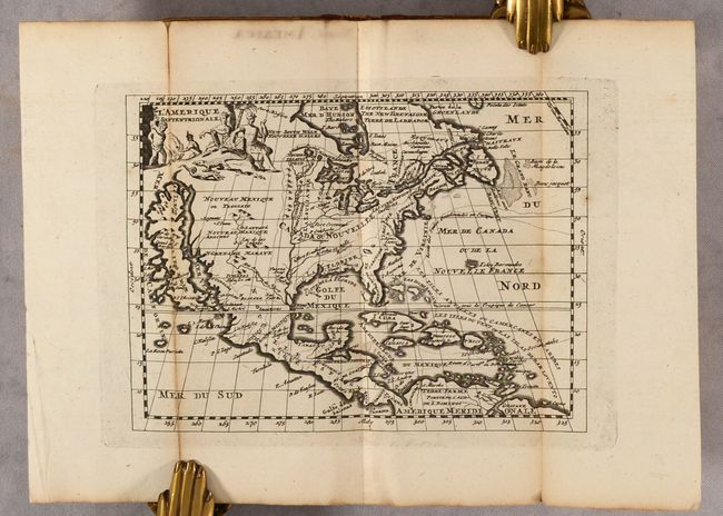
B. L'Amerique Septentrionale also features the island of California and a prominent Mississippi River with the Rio Bravo ou de Nort (Rio Grande) becoming its tributary just before emptying into the Gulf of Mexico, much too far west. The European route to and from the West Indies is also depicted. At upper left, a pictorial cartouche displays natives, a serpent and a lizard.
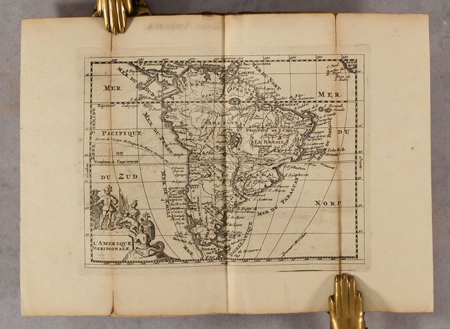
C. L'Amerique Meridionale shows South America with two large, spurious lakes. In the cartouche, natives offer gifts to a European trader while a rather alarming serpent looks on.
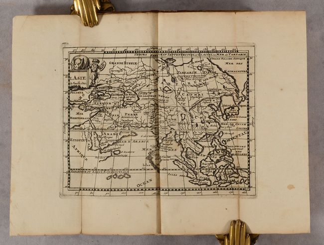
D. L'Asia presents a nearly circular Japan with some odd nearby islands and coastlines. The map is topped with a cartouche guarded by a warrior and an elephant.
E. Africa Selon les Autheurs les plus Modernes shows a quite up-to-date Africa flanked with armorial shields for major nations. The decorative cartouche depicts natives smoking and trading.
F. Europa Selon les Auth. les plus Modernes is also flanked by armorial shields for the kingdoms. The cartouche features the mythical Europa riding Zeus in the form of an aquatic bull.
There is a manuscript list of maps on the front pastedown, naming all 36 plates. Also included in the volume is a brief description of geography, an advertisement, and a table of latitudes and longitudes for cities throughout the world, with particular attention to cities in Europe. 12mo. Hardbound in quarter leather over paper boards.
References: Shirley (BL Atlases) G.FEU-1c; cf. McLaughlin #147.
Condition: B
Maps are good with some light toning along the folds and numerous fold separations that have been closed on verso with archival tape. There is some light dampstaining along the upper third of about 15 maps and is more pronounced in the maps of Provence, Poland and Sweden. There is an old school stamp on the verso of the world map and front free endpaper. Binding is heavily scuffed and worn.