Filtered by Category:Books, Atlases, Travel Guides, Geography & Reference Books(Show All Categories)
Showing results for:Auction 177
Catalog Archive
52 lots
Page 1 of 2
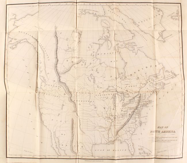
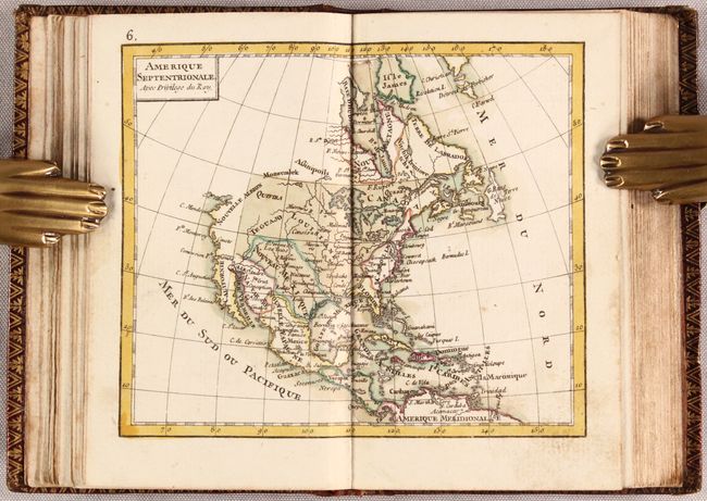
Auction 177, Lot 70
Subject: North America
Map of North America [bound in] [2 Volumes] Three Years in North America, 1833
Size: 5.2 x 7.8 inches (13.2 x 19.8 cm)
Estimate: $160 - $190
Sold for: $160
Closed on 4/29/2020
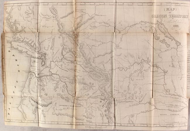
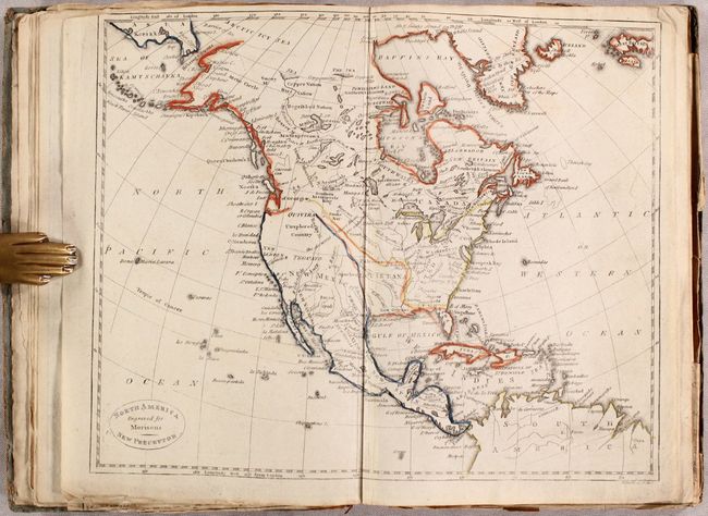
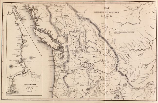
Auction 177, Lot 101
Subject: Western United States & Canada
Parker, Samuel (Rev.)
Journal of an Exploring Tour Beyond the Rocky Mountains... [with] Map of Oregon Territory , 1842
Size: 22 x 13.9 inches (55.9 x 35.3 cm)
Estimate: $475 - $600
Sold for: $425
Closed on 4/29/2020
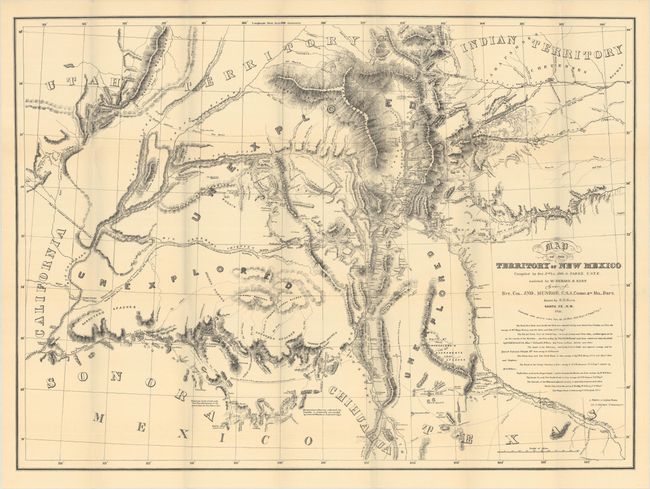
Auction 177, Lot 166
Subject: Southwestern United States
U.S. Bureau of Indian Affairs
[Lot of 4 - New Mexico Territory Maps] [with] The Official Correspondence of James S. Calhoun While Indian Agent at Santa Fe and Superintendent of Indian Affairs in New Mexico, 1915
Size: 6.2 x 9.2 inches (15.7 x 23.4 cm)
Estimate: $275 - $350
Sold for: $550
Closed on 4/29/2020
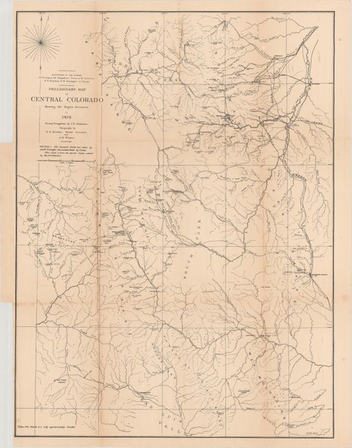
Auction 177, Lot 186
Subject: Colorado
Hayden, Ferdinand Vandeveer
Annual Report of the United States Geological and Geographical Survey of the Territories, Embracing Colorado..., 1874
Size: 6 x 9 inches (15.2 x 22.9 cm)
Estimate: $450 - $550
Sold for: $325
Closed on 4/29/2020
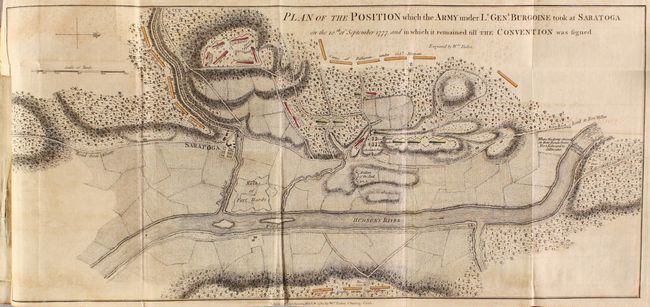
Auction 177, Lot 226
Subject: Colonial New York, Vermont, Revolutionary War
A State of the Expedition from Canada, as Laid Before the House of Commons, 1780
Size: 5.4 x 8.5 inches (13.7 x 21.6 cm)
Estimate: $2,750 - $3,500
General Burgoyne's Account with 6 Battle Maps
Sold for: $2,000
Closed on 4/29/2020
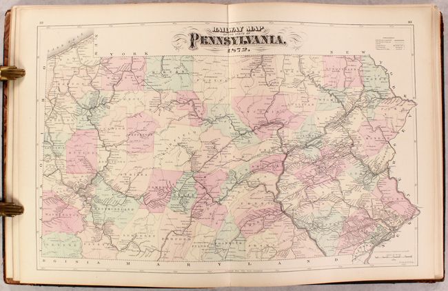
Auction 177, Lot 235
Subject: Pennsylvania, Atlases
Walling & Gray
New Topographical Atlas of the State of Pennsylvania with Descriptions Historical, Scientific, and Statistical..., 1872
Size: 14 x 17.8 inches (35.6 x 45.2 cm)
Estimate: $400 - $475
Sold for: $250
Closed on 4/29/2020
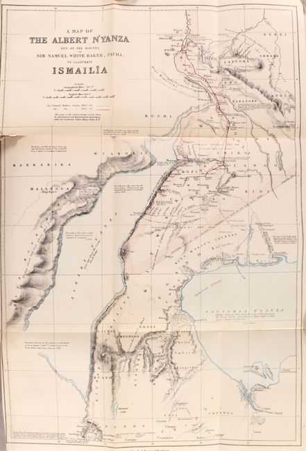
Auction 177, Lot 714
Subject: Central Africa
Harper Bros.
Ismailia: A Narrative of the Expedition to Central Africa for the Suppression of the Slave Trade, 1875
Size: 6.1 x 9.4 inches (15.5 x 23.9 cm)
Estimate: $220 - $250
Sold for: $170
Closed on 4/29/2020
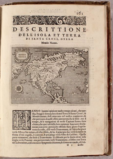
Auction 177, Lot 777
Subject: Atlases
Porcacchi, Tomaso
L'Isole Piu Famose del Mondo Descritte da Thomaso Porcacchi da Castiglione..., 1590
Size: 8.1 x 11.5 inches (20.6 x 29.2 cm)
Estimate: $4,750 - $6,000
Porcacchi's Island Atlas with 47 Maps
Sold for: $3,750
Closed on 4/29/2020
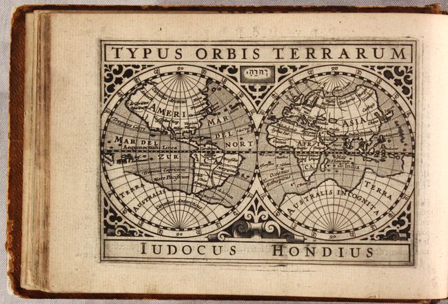
Auction 177, Lot 778
Subject: Atlases
Hondius/Bertius
P Bertij Tabularum Geographicarum Contractarum Libri Septem. In Quibus Tabulae Omnes Gradibus Distinctae, Descriptiones Accuratae..., 1618
Size: 7.5 x 5 inches (19.1 x 12.7 cm)
Estimate: $11,000 - $14,000
Miniature Atlas with Over 200 Maps by Hondius
Unsold
Closed on 4/29/2020
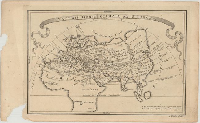
Auction 177, Lot 779
Subject: Atlases
Cellarius, Christophorus
[Disbound] Geographia Antiqua: Being a Complete Set of Maps of Antient Geography; Beautifully Engraved from Cellarius, on Thirty-Three Copper-Plates..., 1761
Size: 11.6 x 7.8 inches (29.5 x 19.8 cm)
Estimate: $300 - $375
Rare Dublin Edition of Cellarius' "Geographia Antiqua"
Sold for: $150
Closed on 4/29/2020
Auction 177, Lot 780
Subject: Atlases
Rizzi-Zannoni, Giovanni Antonio
Atlas Geographique Contenant la Mappemonde et les Quatre Parties, avec les Differents Etats d'Europe..., 1775
Size: 3.4 x 5.1 inches (8.6 x 13 cm)
Estimate: $1,400 - $1,700
Remarkable Miniature Atlas with 30 Maps
Sold for: $1,000
Closed on 4/29/2020
Auction 177, Lot 781
Subject: Atlases
Morison's Pocket Atlas; or, Portable Geographical Index..., 1810
Size: 6.1 x 8.8 inches (15.5 x 22.4 cm)
Estimate: $400 - $500
A Scarce Scottish Pocket Atlas with 24 Maps
Sold for: $300
Closed on 4/29/2020
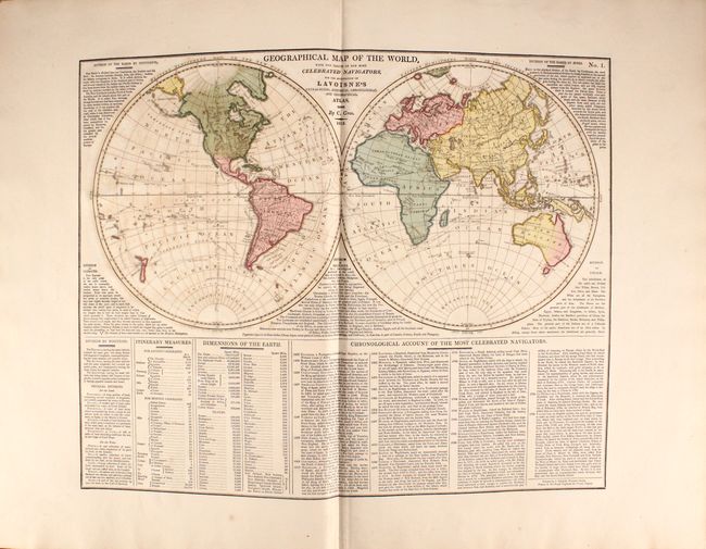
Auction 177, Lot 782
Subject: Atlases
Lavoisne/Aspin
Lavoisne's Complete Genealogical, Historical, Chronological, and Geographical Atlas; Being a General Guide to History, Both Ancient and Modern..., 1814
Size: 15.3 x 21.3 inches (38.9 x 54.1 cm)
Estimate: $750 - $900
With 30 Maps in Full Contemporary Color
Unsold
Closed on 4/29/2020
Auction 177, Lot 783
Subject: Atlases
Dirwaldt, Joseph
Allgemeiner Hand-Atlas zum Gebrauch fur die Jugend in Hoehern und Niedern Schulen..., 1818
Size: 20.5 x 15.7 inches (52.1 x 39.9 cm)
Estimate: $1,000 - $1,400
Rare Austrian School Atlas in Original Color
Sold for: $350
Closed on 4/29/2020
Auction 177, Lot 784
Subject: Atlases
Finley, Anthony
A New General Atlas, Comprising a Complete Set of Maps, Representing the Grand Divisions of the Globe..., 1824
Size: 10.9 x 14.1 inches (27.7 x 35.8 cm)
Estimate: $3,750 - $4,750
First Edition of Finley's General Atlas
Unsold
Closed on 4/29/2020
Auction 177, Lot 785
Subject: Atlases
Tardieu, Ambroise
Atlas Universel de Geographie Ancienne et Moderne, 1842
Size: 10 x 15.1 inches (25.4 x 38.4 cm)
Estimate: $550 - $700
Unsold
Closed on 4/29/2020
Auction 177, Lot 786
Subject: Atlases
Lothian, John
New Edinburg General Atlas. Exhibiting the Relative Extent & Divisions the Boundaries and Other Geographical Details of the Various Empires, States & Quarters of the World..., 1846
Size: 13.7 x 16.6 inches (34.8 x 42.2 cm)
Estimate: $800 - $950
Sold for: $550
Closed on 4/29/2020
Auction 177, Lot 787
Subject: Atlases
Mitchell, Samuel Augustus
A New Universal Atlas Containing Maps of the Various Empires, Kingdoms, States and Republics of the World..., 1849
Size: 14.3 x 17.8 inches (36.3 x 45.2 cm)
Estimate: $2,750 - $3,500
Mitchell's Desirable Atlas with 73 Plates
Sold for: $2,500
Closed on 4/29/2020
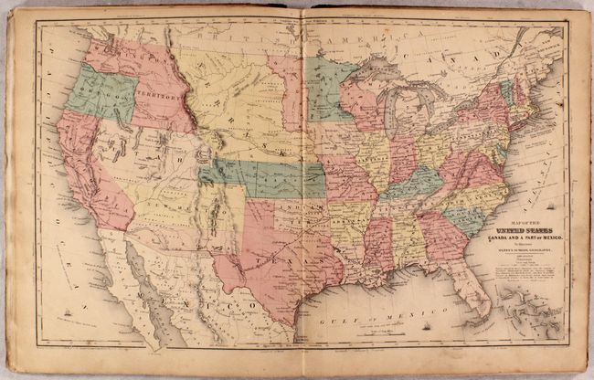
Auction 177, Lot 788
Subject: Atlases
Colton, Joseph Hutchins
[2 Volumes] Colton's Atlas of the World, Illustrating Physical and Political Geography..., 1856
Size: 16.6 x 19 inches (42.2 x 48.3 cm)
Estimate: $2,500 - $3,250
Colton's Superb Two-Volume Atlas of the World
Sold for: $1,800
Closed on 4/29/2020
Auction 177, Lot 789
Subject: Atlases
Olney, Jesse
Olney's Atlas: Comprising Modern and Ancient Geography, Designed to Accompany the Practical System of Geography for Schools and Families, 1860
Size: 9.6 x 12.1 inches (24.4 x 30.7 cm)
Estimate: $300 - $375
Sold for: $200
Closed on 4/29/2020
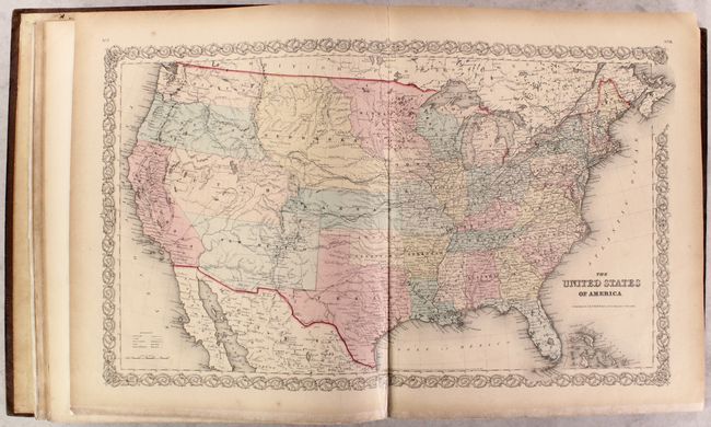
Auction 177, Lot 790
Subject: Atlases
Johnson and Ward
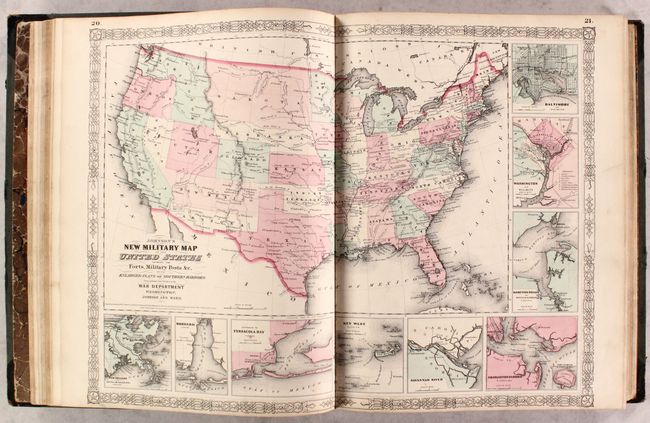
Johnson's New Illustrated (Steel Plate) Family Atlas, with Physical Geography, and with Descriptions Geographical, Statistical, and Historical..., 1863
Size: 14.9 x 18.5 inches (37.8 x 47 cm)
Estimate: $1,100 - $1,400
Complete with Several Civil War Edition Maps
Sold for: $800
Closed on 4/29/2020
Auction 177, Lot 791
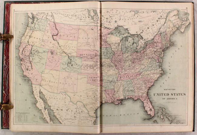
Subject: Atlases
Williams, J. David
The Peoples' Pictorial Atlas. Being a Complete and Popular Account of All the Countries of the World..., 1873
Size: 14.6 x 20 inches (37.1 x 50.8 cm)
Estimate: $1,400 - $1,700
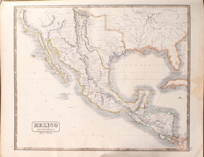
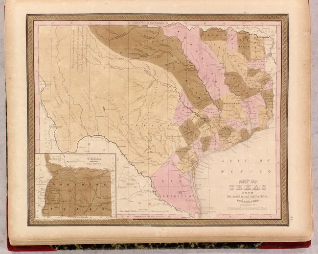
An Uncommon Atlas with Unusual Maps of the Western United States
Sold for: $900
Closed on 4/29/2020
Auction 177, Lot 792
Subject: Geography Books - Italy, Spain, France
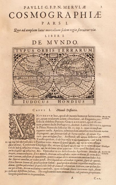
Merula, Paulus G.
Cosmographiae Generalis Libri Tres: Item Geographiae Particularis Libri Quatuor..., 1621
Size: 8.9 x 13.6 inches (22.6 x 34.5 cm)
Estimate: $2,400 - $3,000
Features 56 Miniature Maps of the World, Spain, France & Italy
Unsold
Closed on 4/29/2020
Auction 177, Lot 793
Subject: Geography Books
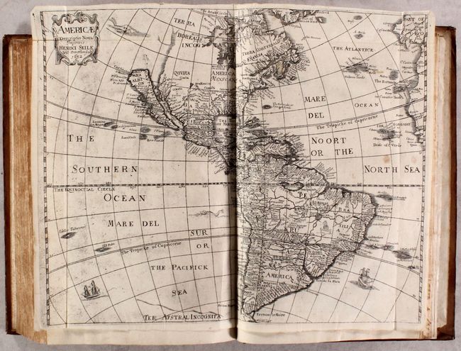
Heylin, Peter
Cosmographie in Foure Bookes Contayning the Chorographie & Historie of the Whole World, and All the Principall Kingdomes, Provinces, Seas, and Isles, Thereof, 1652
Size: 9.4 x 13.8 inches (23.9 x 35.1 cm)
Estimate: $1,700 - $2,000
Includes Four Maps of the Continents by Henry Seile
Sold for: $1,300
Closed on 4/29/2020
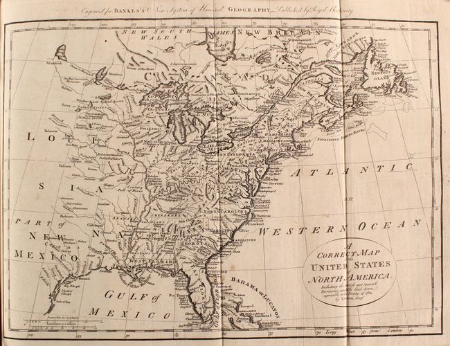
Auction 177, Lot 794
Subject: Geography Books
Bankes, Thomas
A Modern, Authentic and Complete System of Universal Geography. All the Late Important Discoveries Made by the English, and Other Celebrated Navigators of Various Nations..., 1797
Size: 10 x 15.6 inches (25.4 x 39.6 cm)
Estimate: $1,200 - $1,500
Sold for: $750
Closed on 4/29/2020
Auction 177, Lot 795
Subject: Geography Books
Morse, Sidney Edwards
A System of Geography, for the Use of Schools. Illustrated with More Than Fifty Cerographic Maps, and Numerous Wood-Cut Engravings, 1844
Size: 9.6 x 12.4 inches (24.4 x 31.5 cm)
Estimate: $250 - $325
First Edition of Morse's Geography to Use Cerography
Sold for: $150
Closed on 4/29/2020
Auction 177, Lot 796
Subject: Exploration & Surveys
Wilkes, Charles
[5 Volumes] Narrative of the United States Exploring Expedition. During the Years 1838, 1839, 1840, 1841, 1842, 1845
Size: 6.3 x 9.7 inches (16 x 24.6 cm)
Estimate: $900 - $1,100
Complete Octavo Edition of the First U.S. Naval Expedition
Sold for: $650
Closed on 4/29/2020
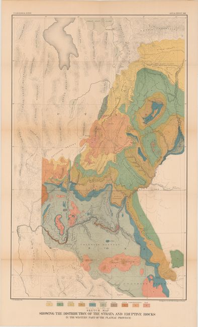
Auction 177, Lot 797
Subject: Exploration & Surveys, Grand Canyon
Powell, John Wesley
Second Annual Report of the United States Geological Survey to the Secretary of the Interior 1880-'81, 1882
Size: 7.4 x 11.6 inches (18.8 x 29.5 cm)
Estimate: $375 - $450
Sold for: $200
Closed on 4/29/2020
Auction 177, Lot 798
Subject: Miscellaneous Books
Beadle, D. W.
The American Lawyer, and Business-Man's Form-Book; Containing Forms and Instructions..., 1853
Size: 4.9 x 7.6 inches (12.4 x 19.3 cm)
Estimate: $100 - $130
Sold for: $75
Closed on 4/29/2020
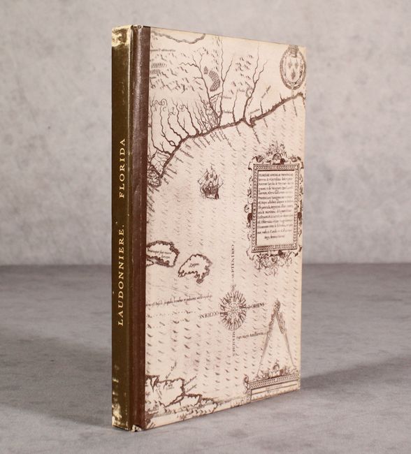
Auction 177, Lot 799
Subject: Facsimile
Hakluyt, Richard
[Facsimile] A Notable History Containing Four Voyages Made by Certain French Captains Unto Florida, 1964
Size: 5.9 x 9 inches (15 x 22.9 cm)
Estimate: $90 - $120
Hard to Find Reprint of Laudonniere's Account
Sold for: $120
Closed on 4/29/2020

Auction 177, Lot 800
Subject: References
[Lot of 3] A List of Maps of America in the Library of Congress Preceded by a List of Works Relating to Cartography [and] A List of Atlases and Maps Applicable to the World War [and] Descriptive Catalog of Maps Published by Congress 1817-1843, 1918-97
Size: See Description
Estimate: $120 - $150
Unsold
Closed on 4/29/2020
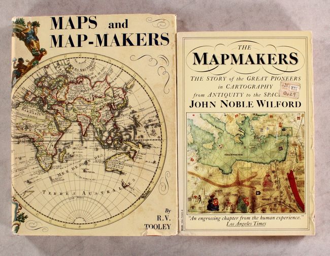
Auction 177, Lot 801
Subject: References
[Lot of 2] Maps and Map-Makers [and] The Mapmakers, 1961-81
Size: See Description
Estimate: $50 - $70
NO RESERVE
Sold for: $55
Closed on 4/29/2020
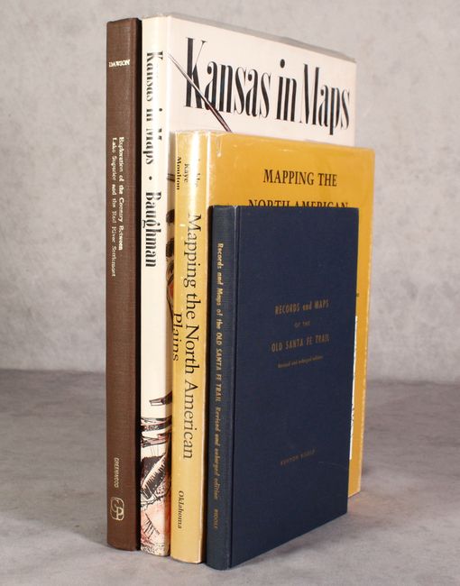
Auction 177, Lot 802
Subject: References; Central & Southwestern United States
[Lot of 4] Mapping the North American Plains... [and] Kansas in Maps [and] Records and Maps of the Old Santa Fe Trail [and] Report on the Exploration of the Country Between Lake Superior and the Red River Settlement…, 1961-87
Size: See Description
Estimate: $200 - $230
Sold for: $150
Closed on 4/29/2020
Auction 177, Lot 803
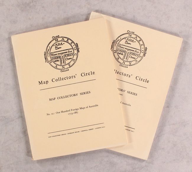
Subject: References, Australia
Tooley, R. V.
[Lot of 2] Map Collectors' Circle - No. 12: One Hundred Foreign Maps of Australia 1773-1887 [and] No. 79: Printed Maps of Australia - Part V, 1964-72
Size: 7.3 x 9.7 inches (18.5 x 24.6 cm)
Estimate: $25 - $45
NO RESERVE
Sold for: $23
Closed on 4/29/2020
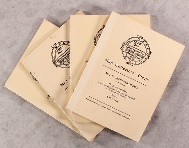
Auction 177, Lot 804
Subject: References, Africa
Tooley, R. V.
[Lot of 4] Map Collectors' Circle - Nos. 29 & 30: Printed Maps of the Continent of Africa Parts I & II. 1500-1600 [and] Nos. 47 & 48: Maps of Africa Parts I & II, 1966-68
Size: 7.3 x 9.7 inches (18.5 x 24.6 cm)
Estimate: $50 - $70
NO RESERVE
Sold for: $48
Closed on 4/29/2020
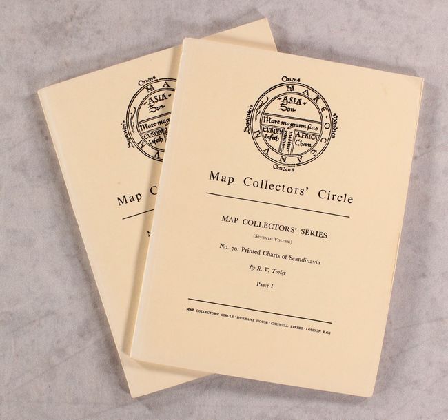
Auction 177, Lot 805
Subject: References, Scandinavia
Tooley, R. V.
[Lot of 2] Map Collectors' Circle - Nos. 70 & 71: Printed Charts of Scandinavia Parts I and II, 1971
Size: 7.3 x 9.7 inches (18.5 x 24.6 cm)
Estimate: $30 - $50
NO RESERVE
Sold for: $23
Closed on 4/29/2020
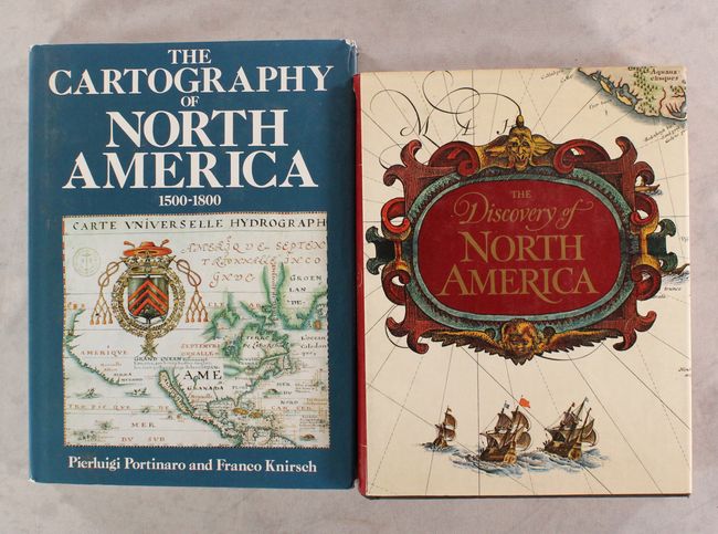
Auction 177, Lot 806
Subject: References, North America
Various
[Lot of 2] The Cartography of North America 1500-1800 [and] The Discovery of North America, 1972-87
Size: See Description
Estimate: $80 - $100
NO RESERVE
Sold for: $41
Closed on 4/29/2020
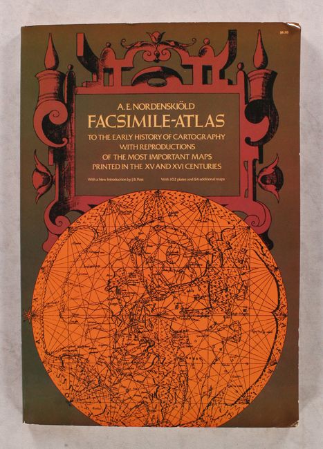
Auction 177, Lot 807
Subject: References
Nordenskiold, Nils Adolf E.
Facsimile-Atlas to the Early History of Cartography with Reproductions of the Most Important Maps Printed in the XV and XVI Centuries, 1973
Size: 11 x 15.9 inches (27.9 x 40.4 cm)
Estimate: $80 - $100
NO RESERVE
Sold for: $140
Closed on 4/29/2020

Auction 177, Lot 808
Subject: References, Southeast United States
Cumming, William P.
The Southeast in Early Maps with an Annotated Check List of Printed and Manuscript Regional and Local Maps of Southeastern North America During the Colonial Period, 1973
Size: 8.8 x 11.3 inches (22.4 x 28.7 cm)
Estimate: $120 - $150
NO RESERVE
Sold for: $37
Closed on 4/29/2020
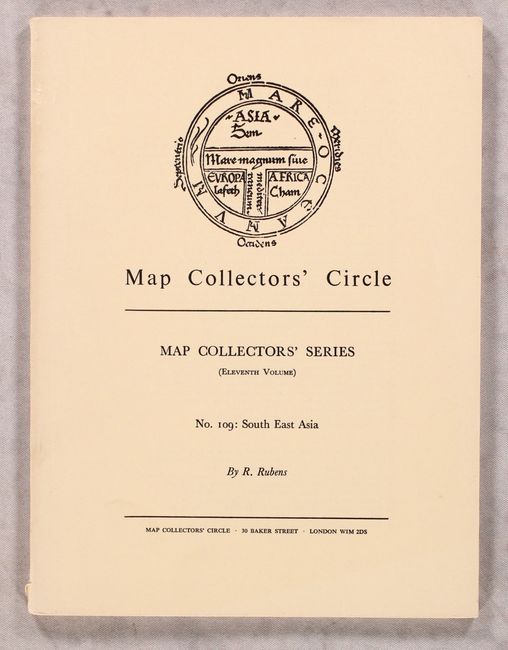
Auction 177, Lot 809
Subject: References, Southeast Asia
Tooley, R. V.
Map Collectors' Circle - No. 109: South East Asia, 1975
Size: 7.3 x 9.7 inches (18.5 x 24.6 cm)
Estimate: $20 - $40
NO RESERVE
Sold for: $24
Closed on 4/29/2020
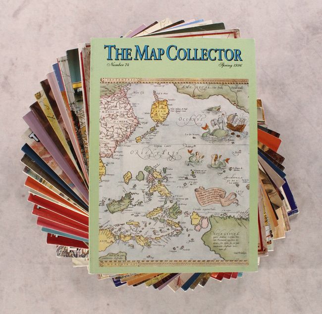
Auction 177, Lot 810
Subject: References, Magazines
[Lot of 26] The Map Collector, 1978-96
Size: 8.3 x 11.8 inches (21.1 x 30 cm)
Estimate: $140 - $170
Sold for: $70
Closed on 4/29/2020
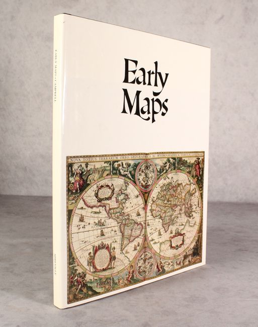
Auction 177, Lot 811
Subject: References
Campbell, Tony
Early Maps, 1981
Size: 12.3 x 15.3 inches (31.2 x 38.9 cm)
Estimate: $40 - $55
NO RESERVE
Sold for: $31
Closed on 4/29/2020
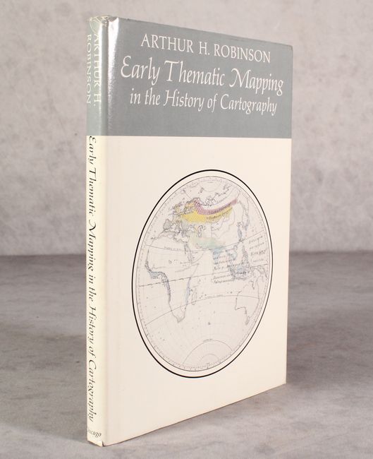
Auction 177, Lot 812
Subject: References
Early Thematic Mapping in the History of Cartography, 1982
Size: 6.9 x 9.8 inches (17.5 x 24.9 cm)
Estimate: $35 - $50
NO RESERVE
Sold for: $13
Closed on 4/29/2020
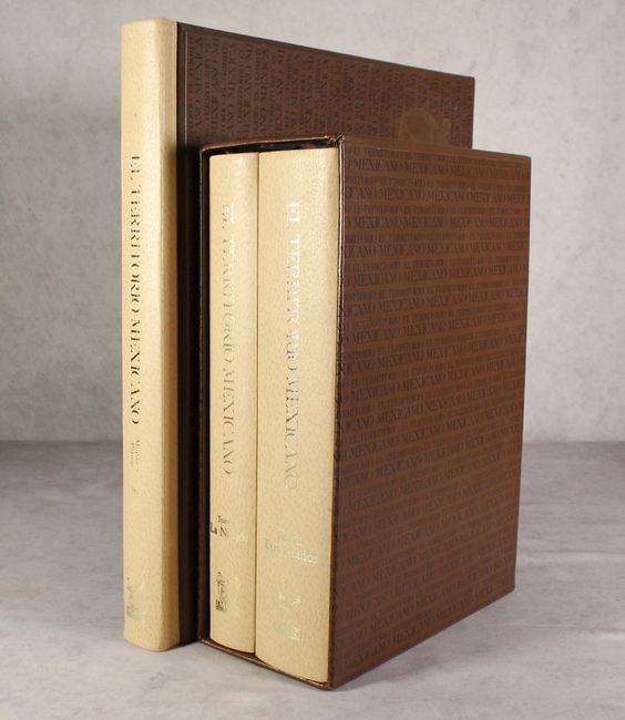
Auction 177, Lot 813
Subject: References, Mexico
[2 Volumes and a Portfolio] El Territorio Mexicano - Tomo I - La Nacion [and] Tomo II - Los Estados [and] Planos y Mapas, 1982
Size: See Description
Estimate: $550 - $700
Sold for: $400
Closed on 4/29/2020
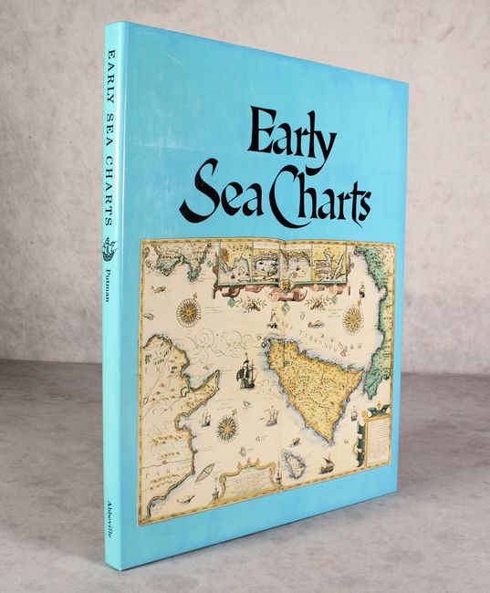
Auction 177, Lot 814
Subject: References, Sea Charts
Putman, Robert
Early Sea Charts, 1983
Size: 12 x 15.3 inches (30.5 x 38.9 cm)
Estimate: $40 - $55
NO RESERVE
Sold for: $41
Closed on 4/29/2020
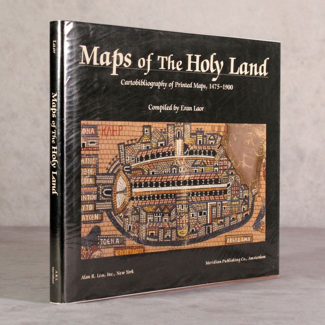
Auction 177, Lot 815
Subject: References, Holy Land
Maps of the Holy Land - Cartobibliography of Printed Maps, 1475-1900, 1986
Size: 12.4 x 10.3 inches (31.5 x 26.2 cm)
Estimate: $300 - $375
Sold for: $220
Closed on 4/29/2020
Auction 177, Lot 816
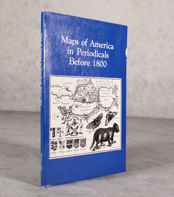
Subject: References, Western Hemisphere
Jolly, David C.
Maps of America in Periodicals Before 1800, 1989
Size: 6 x 9 inches (15.2 x 22.9 cm)
Estimate: $120 - $150
Sold for: $90
Closed on 4/29/2020
Auction 177, Lot 817
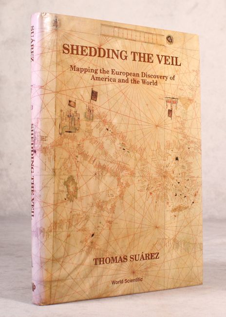
Subject: References
Suarez, Thomas
Shedding the Veil - Mapping the European Discovery of America and the World, 1992
Size: 8.7 x 11.8 inches (22.1 x 30 cm)
Estimate: $80 - $100
NO RESERVE
Sold for: $41
Closed on 4/29/2020

Auction 177, Lot 818
Subject: References, Romania
Romania Istorie in Documente, 1992
Size: 9.9 x 13.4 inches (25.1 x 34 cm)
Estimate: $60 - $80
NO RESERVE - Text in Romanian, French, and English
Sold for: $1
Closed on 4/29/2020
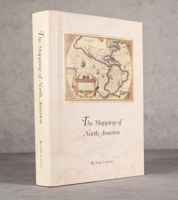
Auction 177, Lot 819
Subject: References, North America
Burden, Philip D.
The Mapping of North America - A List of Printed Maps 1511-1670, 1996
Size: 10.5 x 14.3 inches (26.7 x 36.3 cm)
Estimate: $200 - $230
Sold for: $275
Closed on 4/29/2020
52 lots
Page 1 of 2