Subject: Atlases
Period: 1590 (published)
Publication:
Color: Black & White
Size:
8.1 x 11.5 inches
20.6 x 29.2 cm
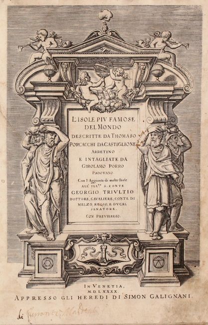
The Isole piu Famose was one of the last of the notable island atlases, with earlier publications compiled by the likes of Buondelmonti, Sonetti, and Bordonne. Porcacchi's atlas was popular and issued in seven different editions, beginning in 1572 with 30 maps. The atlas was subsequently enlarged to 47 maps in the 1576 and the 1590 editions (the present example). The maps were engraved by Girolamo Porro and include several maps of non-insular places including North America and Mexico City. The atlas is complete with all 47 maps and accompanying text. Of particular interest are the following maps:
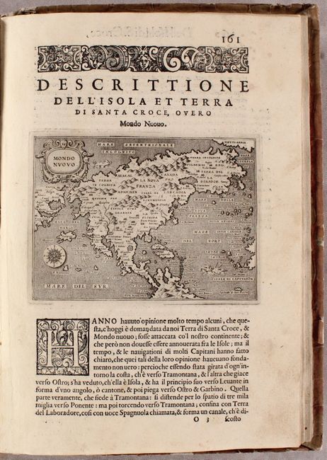
Mondo Nuovo. First state of this charming copper engraved map of the continent based on the Paolo Forlani map. The continent is depicted with a vastly elongated extension of the eastern seaboard and a rather odd bulge in the California peninsula with Giapan (Japan) just offshore. The map has a stippled engraved sea in the Italian style and is decorated with a strapwork title cartouche, compass rose and two wild-looking sea creatures. References: Burden #42; Manasek #35.
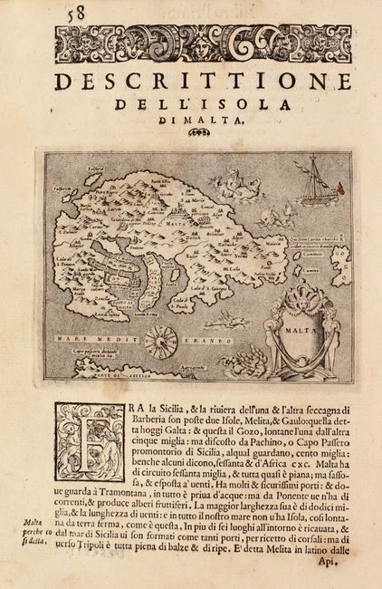
Malta. This is one of the earliest separate maps of Malta, with north oriented at the bottom. The map is adorned with a compass rose, sea monsters, sailing ship, merman, and a decorative cartouche featuring a wind head. The coast of Sicily is at bottom, and appears to be equidistant to Malta as the coast of Gozo, which is strangely depicted due west.
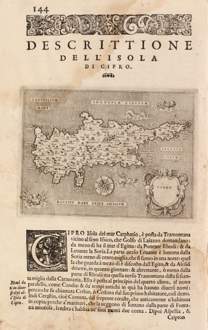
Cipro. This delicately engraved map of Cyprus was based on Giovanni Francesco Camocio's loose-sheet copperplate map from 1566, which in turn was based on Matheo Pagano's map of 1538. The map features the large fortified cities of Nicosia and Famagusta, four sea monsters, and a lovely title cartouche with a windhead at top. The unique compass rose uses the abbreviations for the traditional Italianate wind names.
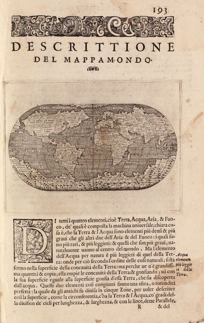
Descrittione del Mappamondo. First edition of this charming miniature map of the world on an oval projection, engraved by Girolamo Porro after a larger world map by Camoccio on the Gastaldi prototype. The huge mythical Terra Incognita dominates the Southern Hemisphere. Reference: Shirley #127.
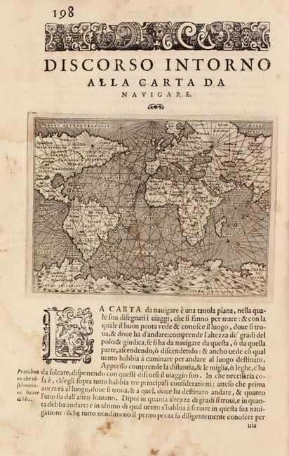
Discorso Intorno alla Carta da Navigare. This nautical map is the second world map in this atlas. It covers most of the world, excluding far eastern Asia and the western coast of North America; thus alluding to a connection between the two. The Terra Incognita landmass dominates the bottom of the map. The handsome map is filled with rhumb lines and the seas are fully stippled. Reference: Shirley #128.
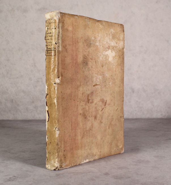
Title page, tables, 201 pages of text in three books. Limp vellum with manuscript title on spine.
References: Shirley (BL Atlases) T.POR-1c; Nordenskiold #189; King (2nd Ed.) pp. 57-59.
Condition: B
The maps range from good to near fine with overall crisp, dark impressions. There is light soiling and dampstains throughout, with 5 maps at the beginning of the volume having moderate dampstains (Iceland, Hebrides, Ireland, southern Scotland, and Venice). Text is fairly loose with several signatures close to separating from the block. Title page has manuscript notations in the bottom margin, and the map of Iceland has a chip along the right sheet edge that has been replaced with archival material. The hinges are starting, the covers are moderately worn, and the spine is chipped.