Subject: Atlases
Period: 1856 (published)
Publication:
Color: Hand Color
Size:
16.6 x 19 inches
42.2 x 48.3 cm
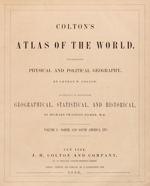
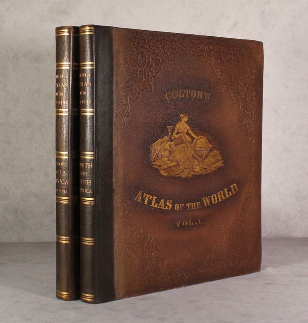
This complete, matching two volume folio atlas contains two engraved frontispieces and 105 maps/plans, each with Colton's decorative strapwork border. First edition, rebacked, with original brown cloth boards with embossed gilt illustration on covers. Both volumes with frontispiece, title page, list of maps, text and tables.
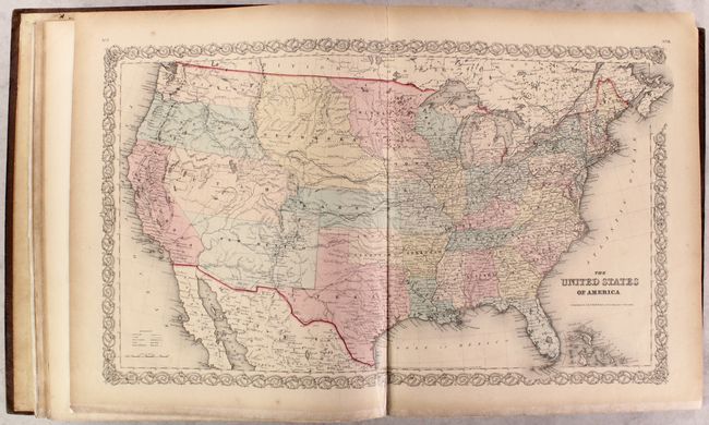
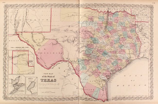
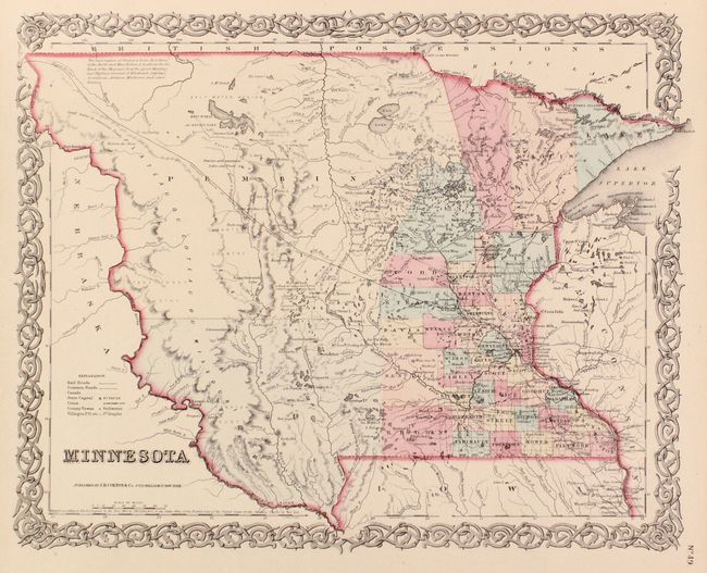
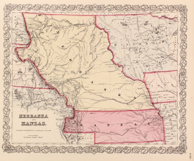
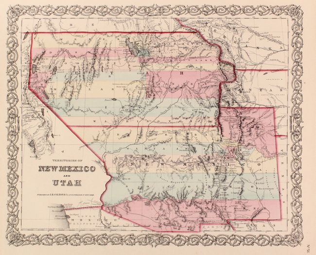
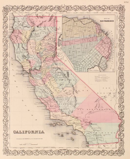
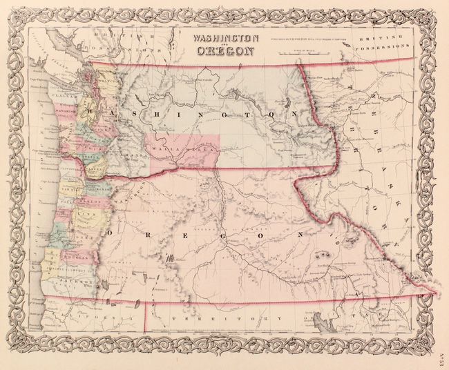
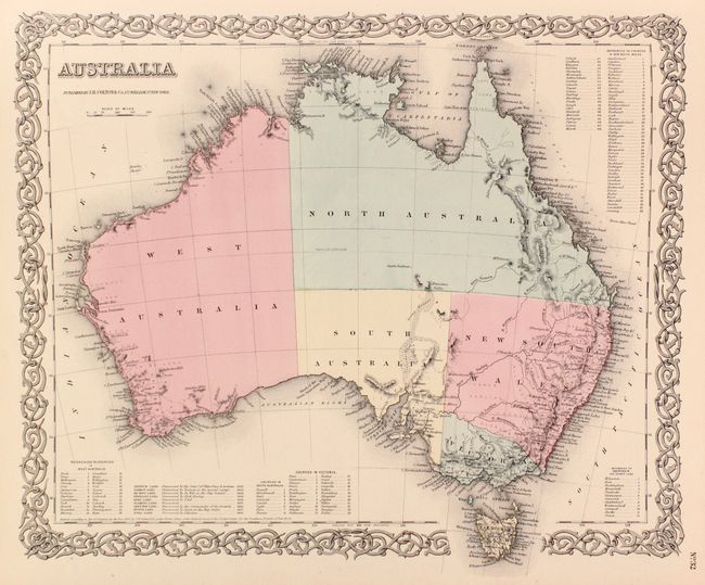
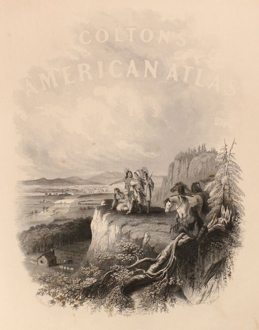
Volume I contains maps concentrating on the Western Hemisphere. 44 sheets relate to the United States, displaying 63 maps/plans, with numerous sought after single-page state maps - many with city insets. There are several great early western maps including: the U.S. map featuring Kanzas; the map of Texas with early county configurations; the early map of Minnesota showing its border on the Missouri River. Also present is the most desirable Nebraska and Kanzas map that depicts Nebraska stretching from Kansas to the Canadian border and bounded on the west by Washington and Oregon at the Continental Divide and Minnesota on the east. Includes the map of the territories of New Mexico and Utah, the California map with the large inset of San Francisco, and the territories of Washington and Oregon with their eastern boundaries on the Continental Divide and county development limited to the coastal areas. City plans included in Volume I are Montreal, Boston, New York (double-page), Philadelphia, Baltimore, Washington, Richmond, Norfolk/Portsmouth, Savannah/ Charleston, Louisville/New Orleans, Pittsburgh/Cincinnati, St. Louis/Chicago, Panama, Havana, Lima, Rio Janeiro, Pernambuco. This edition has the frontispiece showing Native American Indians overlooking a valley filled with frontier settlement and development.
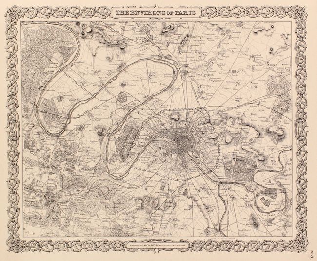
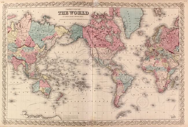
Volume II continues with 42 maps/plans of Europe, the Middle East, Africa, Asia and Oceania. City plans in Volume II include London and Paris (both full-page and uncolored), Amsterdam, Brussels, Hamburg, Bremen, Vienna, and Hong-Kong. Opposite the title page the frontispiece shows four women studying a large globe turned to the Eastern Hemisphere. Also with the double-page comparative chart illustrating the heights of mountains and lengths of rivers.
References:
Condition: B+
The maps are generally very good with pleasant light toning and occasional foxing (more prominent in volume 2). There are archivally repaired centerfold separations to the world map, comparative rivers & mountains plate (volume 2), and England map on recto. The bottom sheet edges of volume 1 have all been reinforced with tissue on both sides, and both the top and bottom sheet edges of volume 2 have been archivally reinforced. Professionally rebacked with original boards, which are lightly worn.