Filtered by Category:United States(Show All Categories)
Showing results for:Auction 177
Catalog Archive
183 lots
Page 1 of 4
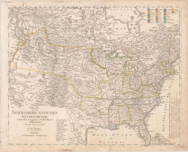
Auction 177, Lot 84
Subject: United States & Canada
Streit, Friedrich Wilhelm
Charte von dem Nordamericanischen Staatenbunde, nach den Neuesten Vorhandenen..., 1821
Size: 18.9 x 15.2 inches (48 x 38.6 cm)
Estimate: $325 - $400
Sold for: $240
Closed on 4/29/2020
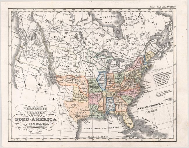
Auction 177, Lot 85
Subject: United States & Canada
Stieler, Adolph
Vereinigte Staaten von Nord-America und Canada, 1845
Size: 9.4 x 7.5 inches (23.9 x 19.1 cm)
Estimate: $150 - $180
Sold for: $110
Closed on 4/29/2020
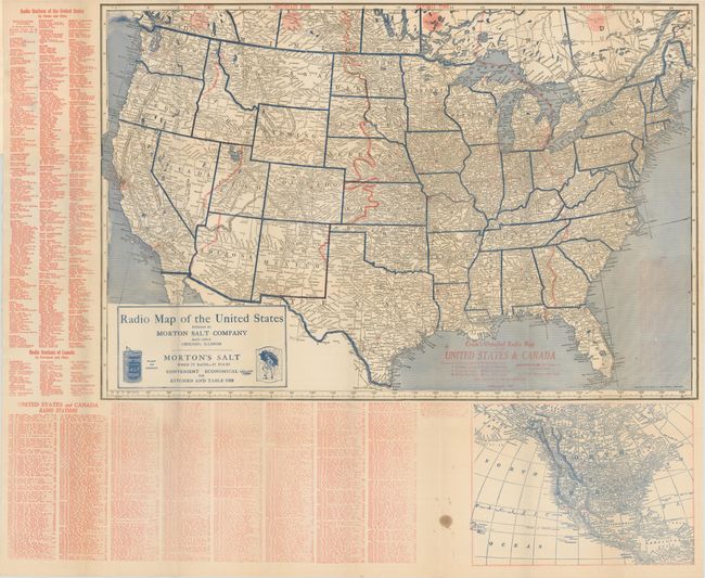
Auction 177, Lot 86
Subject: United States & Canada
Cram, George F. & Company
Cram's Detailed Radio Map of the United States & California, 1926
Size: 29 x 19.3 inches (73.7 x 49 cm)
Estimate: $160 - $190
Sold for: $120
Closed on 4/29/2020
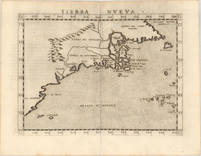
Auction 177, Lot 87
Subject: Eastern United States & Canada
Ruscelli, Girolamo
Tierra Nueva, 1561
Size: 9.6 x 7.1 inches (24.4 x 18 cm)
Estimate: $1,200 - $1,500
First State of Ruscelli's Map of the East Coast
Sold for: $850
Closed on 4/29/2020
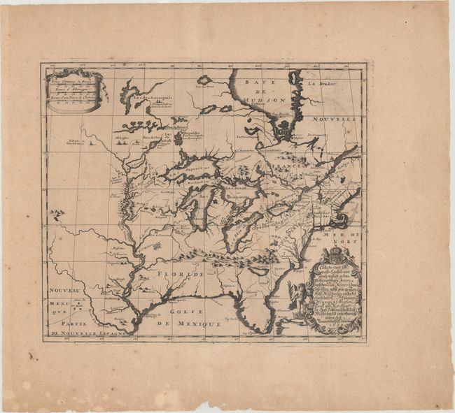
Auction 177, Lot 88
Subject: Colonial Eastern United States & Canada
Hennepin, Louis de (Fr.)
Charte Eines sehr Grossen Landes nur Gantz Neulich in dem Mitternachtigen America..., 1698
Size: 16.7 x 14.4 inches (42.4 x 36.6 cm)
Estimate: $2,200 - $2,500
Rare Separately-Issued German Edition of Hennepin's Map of Eastern North America
Sold for: $2,200
Closed on 4/29/2020
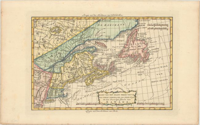
Auction 177, Lot 89
Subject: Eastern United States & Canada
Bachiene, Willem Albert
Kaart van het Eiland Terre-Neuve, van Nieuw Schotland, het Eiland St. Jan en het Oostelyk Gedeelte van Kanada, 1785
Size: 12.4 x 8.2 inches (31.5 x 20.8 cm)
Estimate: $275 - $350
Sold for: $150
Closed on 4/29/2020
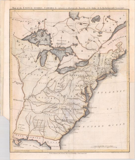
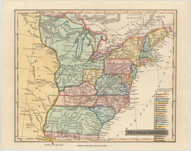
Auction 177, Lot 90
Subject: Eastern United States & Canada, Franklinia
Rochefoucald Liancourt, Francois Alexander
Map of the United States, Canada &c. Intended to Illustrate the Travels of the Duke de la Rochefoucault Liancourt, 1799
Size: 13.3 x 15.9 inches (33.8 x 40.4 cm)
Estimate: $900 - $1,100
Features the Short-Lived Franklinia and Morgania
Sold for: $1,200
Closed on 4/29/2020
Auction 177, Lot 91
Subject: Eastern United States & Canada, St. Lawrence River
Thomson, John
United States of America [on sheet with] The Course of the River St. Laurence, from Lake Ontario, to Manicouagan Point, 1815
Size: 24 x 15.9 inches (61 x 40.4 cm)
Estimate: $200 - $230
Sold for: $160
Closed on 4/29/2020
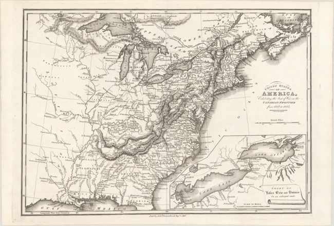
Auction 177, Lot 92
Subject: Eastern United States & Canada
Baines, Edward
United States of America, Exhibiting the Seat of War on the Canadian Frontier from 1812 to 1815, 1816
Size: 13.6 x 9.6 inches (34.5 x 24.4 cm)
Estimate: $240 - $300
Sold for: $180
Closed on 4/29/2020
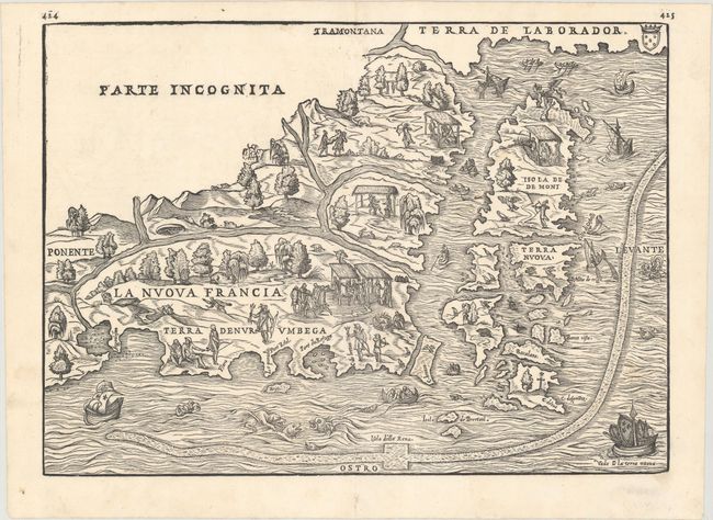
Auction 177, Lot 93
Subject: Northeastern United States & Canada
Gastaldi/Ramusio
La Nuova Francia, 1565
Size: 14.6 x 10.5 inches (37.1 x 26.7 cm)
Estimate: $3,000 - $3,750
The First Printed Map to Focus on New England and New France
Sold for: $3,250
Closed on 4/29/2020

Auction 177, Lot 94
Subject: Colonial Northeastern United States & Canada, Great Lakes
Champlain/Du Val
Le Canada Faict par le Sr de Champlain ou sont la Nouvelle France, la Nouvelle Angleterre, la Nouvelle Holande, la Nouvelle Suede, la Virginie &c..., 1670
Size: 21.4 x 13.8 inches (54.4 x 35.1 cm)
Estimate: $14,000 - $16,000
Very Rare Champlain/Duval Map of New France
Sold for: $10,500
Closed on 4/29/2020
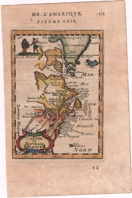
Auction 177, Lot 95
Subject: Colonial Northeastern United States & Canada
Mallet, Alain Manesson
Canada ou Nouvelle France, 1683
Size: 3.9 x 5.6 inches (9.9 x 14.2 cm)
Estimate: $200 - $230
Sold for: $150
Closed on 4/29/2020
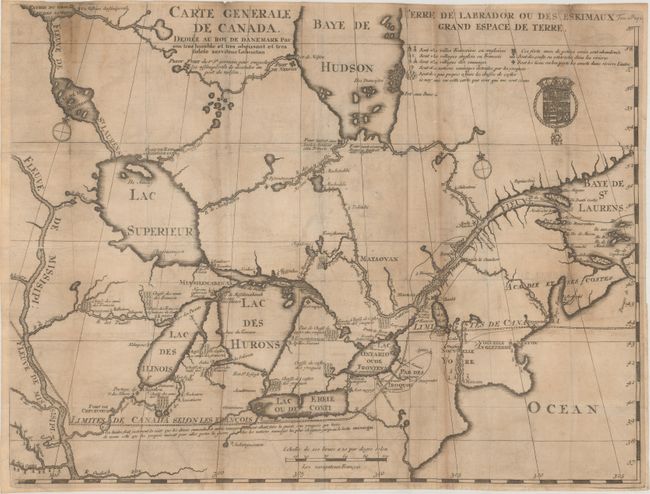
Auction 177, Lot 96
Subject: Colonial Northeastern United States & Canada, Great Lakes
Lahontan, Louis Armand, Baron de
Carte Generale de Canada. Dediee au Roy de Danemark par Son Tres Humble et Tres Obeissant et Tres Fidele Serviteur Lahontan, 1705
Size: 21.5 x 16.4 inches (54.6 x 41.7 cm)
Estimate: $2,200 - $2,500
Lahontan's Map of Canada and the Great Lakes
Sold for: $1,600
Closed on 4/29/2020
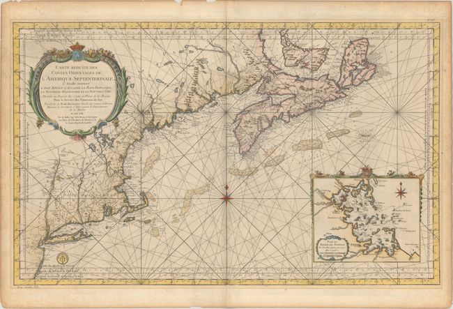
Auction 177, Lot 97
Subject: Colonial Northeastern United States & Canada
Bellin, Jacques Nicolas
Carte Reduite des Costes Orientales de l'Amerique Septentrionale 1re Feuille Contenant l'Isle Royale, l'Accadie, la Baye Francoise, la Nouvelle Angleterre et la Nouvelle Yorc..., 1757
Size: 34.9 x 21.5 inches (88.6 x 54.6 cm)
Estimate: $1,600 - $1,900
Scarce Large-Scale Chart of the Coast of New England
Sold for: $980
Closed on 4/29/2020
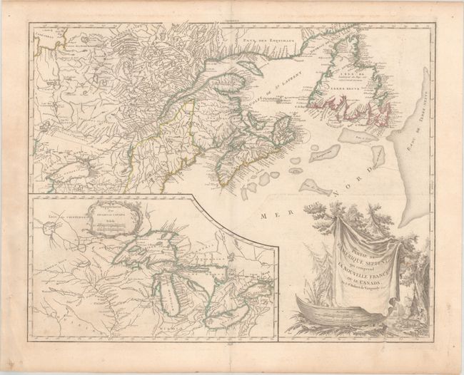
Auction 177, Lot 98
Subject: Colonial Northeastern United States & Canada, Great Lakes
Robert de Vaugondy, Didier
Partie de l'Amerique Septent? qui Comprend la Nouvelle France ou le Canada, 1799
Size: 23.8 x 18.9 inches (60.5 x 48 cm)
Estimate: $475 - $600
Sold for: $275
Closed on 4/29/2020
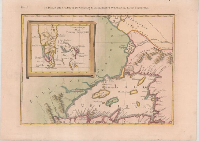
Auction 177, Lot 99
Subject: Great Lakes, Florida
Zatta, Antonio
Il Paese de Selvaggi Outauacesi, e Kilistinesi Intorno al Lago Superiore, 1785
Size: 16.7 x 12.1 inches (42.4 x 30.7 cm)
Estimate: $240 - $300
Sold for: $220
Closed on 4/29/2020
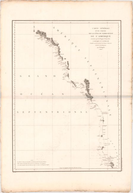
Auction 177, Lot 100
Subject: Western United States & Canada
La Perouse, Comte Jean F. Galoup, de
Carte Generale d'une Partie de la Cote du Nord-Ouest de l'Amerique Reconnue par les Fregates Francaises la Boussole et l'Astrolabe..., 1797
Size: 19.3 x 26.8 inches (49 x 68.1 cm)
Estimate: $275 - $350
Sold for: $190
Closed on 4/29/2020
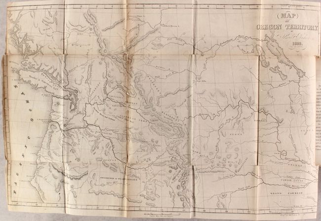
Auction 177, Lot 101
Subject: Western United States & Canada
Parker, Samuel (Rev.)
Journal of an Exploring Tour Beyond the Rocky Mountains... [with] Map of Oregon Territory , 1842
Size: 22 x 13.9 inches (55.9 x 35.3 cm)
Estimate: $475 - $600
Sold for: $425
Closed on 4/29/2020
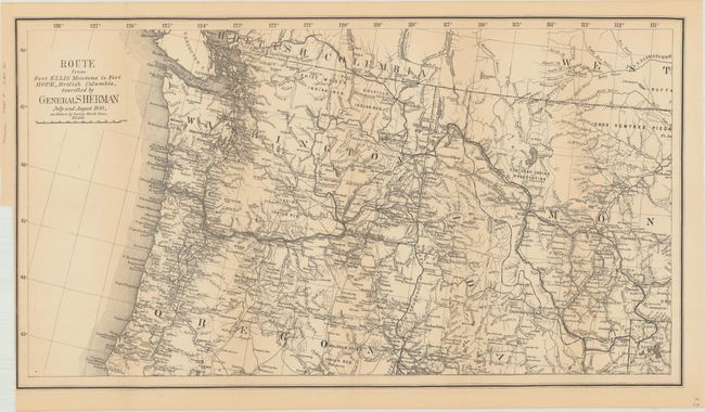
Auction 177, Lot 102
Subject: Northwestern United States, British Columbia
U.S. Government
Route from Fort Ellis Montana to Fort Hope, British Columbia, Travelled by General Sherman July and August 1883, as Shown by Heavy Black Line, 1883
Size: 27.4 x 15.2 inches (69.6 x 38.6 cm)
Estimate: $275 - $350
Sold for: $200
Closed on 4/29/2020
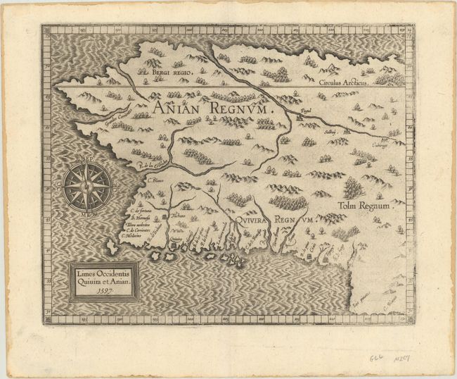
Auction 177, Lot 103
Subject: Alaska & Western Canada
Wytfliet, Cornelis
Limes Occidentis Quivira et Anian, 1597
Size: 11.4 x 9.1 inches (29 x 23.1 cm)
Estimate: $2,000 - $2,300
Early and Imaginary Map of Alaska and the Northwest Passage
Sold for: $1,400
Closed on 4/29/2020
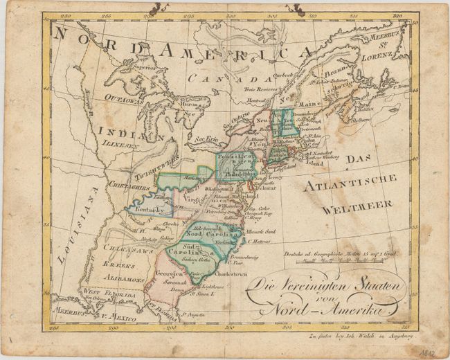
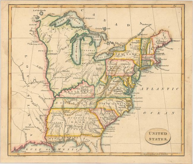
Auction 177, Lot 104
Subject: United States
[Lot of 2] Die Vereinigten Staaten von Nord-Amerika [and] Die Vereinigten Staaten von Nord America, 1795-1829
Size: See Description
Estimate: $275 - $350
Sold for: $200
Closed on 4/29/2020
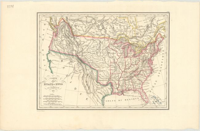
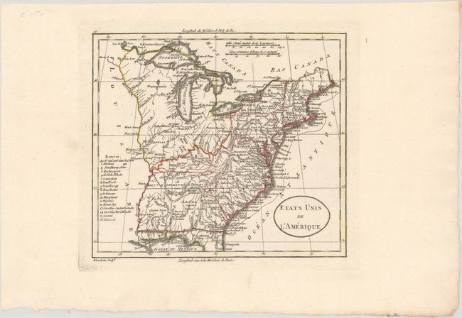
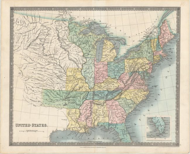
Auction 177, Lot 105
Subject: United States
Thierry
Carte des Etats-Unis d'Amerique, 1835
Size: 11.7 x 8.6 inches (29.7 x 21.8 cm)
Estimate: $110 - $140
Sold for: $110
Closed on 4/29/2020
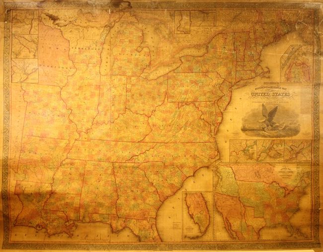
Auction 177, Lot 106
Subject: United States
Mitchell/Young
Mitchell's Reference & Distance Map of the United States, 1845
Size: 67 x 52.5 inches (170.2 x 133.4 cm)
Estimate: $1,500 - $1,800
Impressive Wall Map Featuring the Independent Republic of Texas
Sold for: $1,300
Closed on 4/29/2020
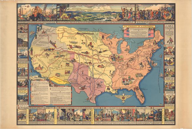
Auction 177, Lot 107
Subject: United States
The Conquest of a Continent, 1933
Size: 27.1 x 20.9 inches (68.8 x 53.1 cm)
Estimate: $240 - $300
A Map Illustrating "Manifest Destiny"
Sold for: $425
Closed on 4/29/2020
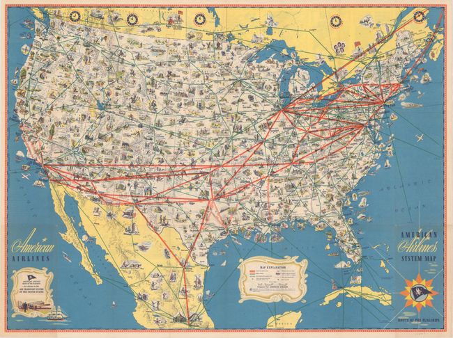
Auction 177, Lot 108
Subject: United States, Flight Map
American Airlines System Map - Route of the Flagships, 1945
Size: 31.1 x 23.2 inches (79 x 58.9 cm)
Estimate: $80 - $100
NO RESERVE
Sold for: $85
Closed on 4/29/2020
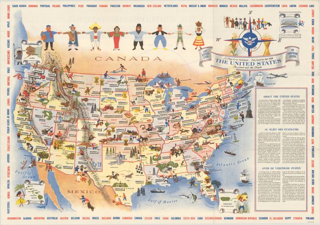
Auction 177, Lot 109
Subject: United States
The United States - The Land and the People, 1958
Size: 25.9 x 18.2 inches (65.8 x 46.2 cm)
Estimate: $180 - $220
Sold for: $120
Closed on 4/29/2020
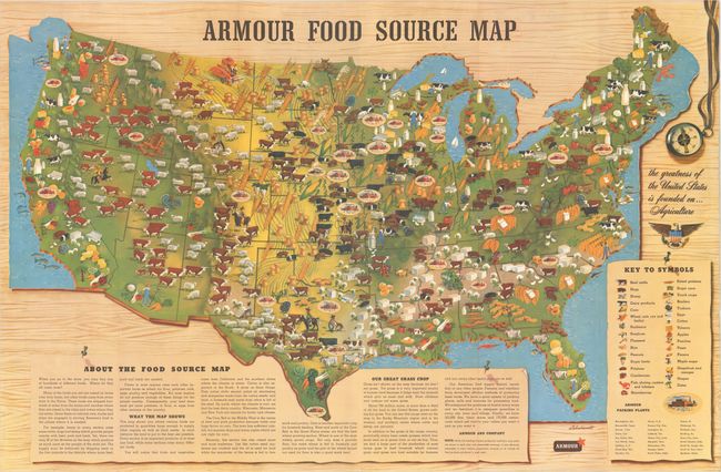
Auction 177, Lot 110
Subject: United States
Armour Food Source Map, 1960
Size: 36.9 x 24.2 inches (93.7 x 61.5 cm)
Estimate: $140 - $170
Sold for: $100
Closed on 4/29/2020
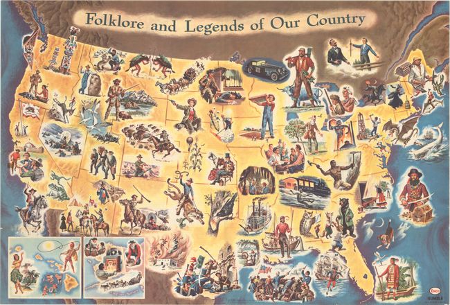
Auction 177, Lot 111
Subject: United States
Folklore and Legends of Our Country, 1962
Size: 33.5 x 22.7 inches (85.1 x 57.7 cm)
Estimate: $160 - $190
Sold for: $120
Closed on 4/29/2020
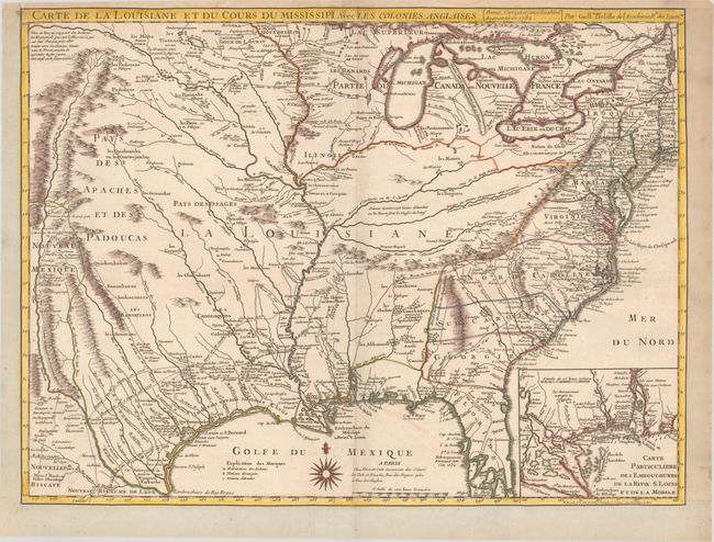
Auction 177, Lot 112
Subject: Colonial Eastern United States, Louisiana Territory
Delisle/Dezauche
Carte de la Louisiane et du Cours du Mississipi avec les Colonies Anglaises, 1782
Size: 25.6 x 19.2 inches (65 x 48.8 cm)
Estimate: $1,400 - $1,700
Delisle's Influential Map of the Louisiana Territory
Sold for: $1,000
Closed on 4/29/2020
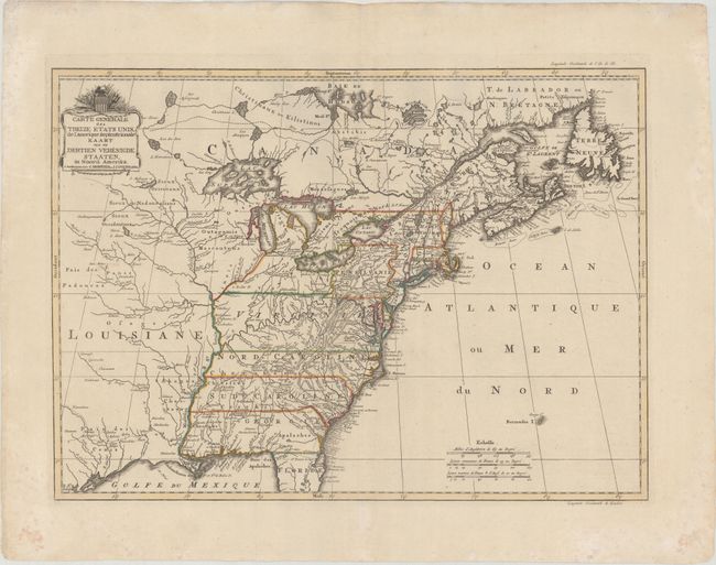
Auction 177, Lot 113
Subject: Eastern United States
Covens & Mortier
Carte Generale des Treize Etats Unis, de l'Amerique Septentrionale / Kaart van de Dertien Verenigde Staaten, in Noord Amerika, 1783
Size: 22.2 x 16.1 inches (56.4 x 40.9 cm)
Estimate: $2,200 - $2,500
Covens and Mortier's Map of the Young United States, with an Early Appearance of the Stars and Stripes
Sold for: $1,600
Closed on 4/29/2020
Auction 177, Lot 114
Subject: Eastern United States
[Lot of 2] Etats Unis de l'Amerique [and] Etats-Unis de l'Amerique Septentrionale, 1800-12
Size: See Description
Estimate: $230 - $275
Sold for: $170
Closed on 4/29/2020
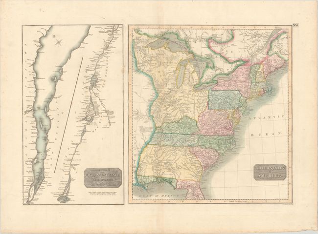
Auction 177, Lot 115
Subject: Eastern United States
Russell, John C., Jr.
United States, 1806
Size: 8.5 x 7.3 inches (21.6 x 18.5 cm)
Estimate: $250 - $325
Sold for: $180
Closed on 4/29/2020
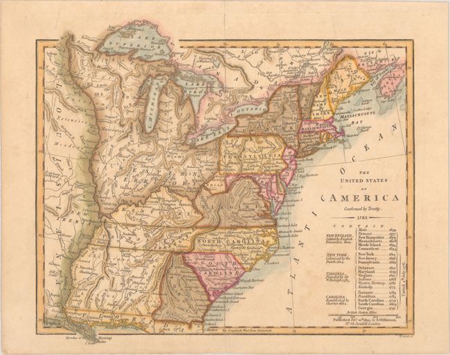
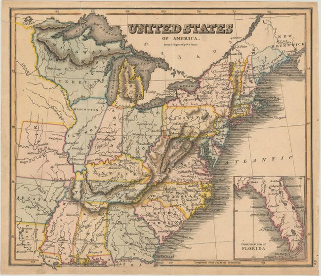
Auction 177, Lot 116
Subject: Eastern United States, Franklinia
Wilkinson, Robert
The United States of America Confirmed by Treaty. 1783, 1812
Size: 11.3 x 9.8 inches (28.7 x 24.9 cm)
Estimate: $800 - $950
Early Map of the United States Featuring Franklinia and the Indiana Land Company
Sold for: $550
Closed on 4/29/2020
Auction 177, Lot 117
Subject: Eastern United States
Smith, Charles
United States, 1820
Size: 14.5 x 11.1 inches (36.8 x 28.2 cm)
Estimate: $220 - $250
Sold for: $110
Closed on 4/29/2020
Auction 177, Lot 118
Subject: Eastern United States
Lizars, William Home
United States of America, 1820
Size: 8.9 x 7.6 inches (22.6 x 19.3 cm)
Estimate: $200 - $230
Sold for: $150
Closed on 4/29/2020
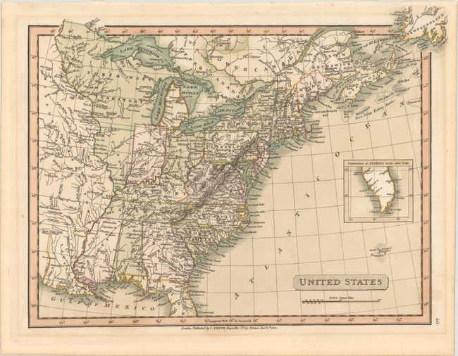
Auction 177, Lot 119
Subject: Eastern United States, Franklinia
Fisher, H.
States of America, 1823
Size: 8.7 x 7.4 inches (22.1 x 18.8 cm)
Estimate: $550 - $700
Sold for: $450
Closed on 4/29/2020
Auction 177, Lot 120
Subject: Eastern United States
Teesdale, Henry
United States, 1831
Size: 15.9 x 13 inches (40.4 x 33 cm)
Estimate: $160 - $190
Sold for: $120
Closed on 4/29/2020
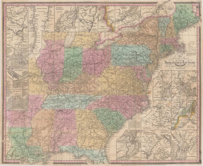
Auction 177, Lot 122
Subject: Eastern United States
Tanner, Henry Schenck
The Travellers Guide or Map of the Roads, Canals & Rail Roads of the United States... [with] The American Traveller; or Guide Through the United States..., 1836
Size: 22.3 x 18.5 inches (56.6 x 47 cm)
Estimate: $900 - $1,100
Sold for: $650
Closed on 4/29/2020
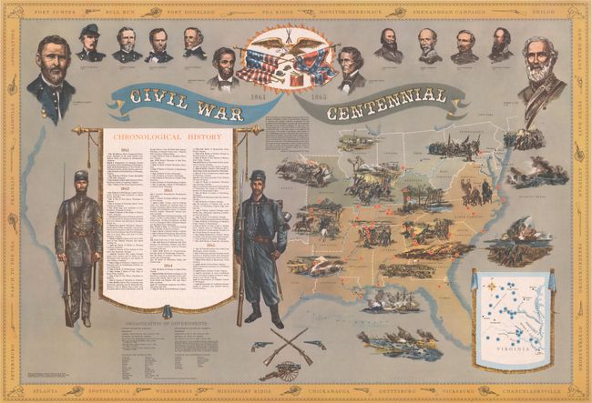
Auction 177, Lot 123
Subject: Eastern United States, Civil War
Civil War Centennial, 1960
Size: 28.1 x 41.2 inches (71.4 x 104.6 cm)
Estimate: $140 - $170
Sold for: $100
Closed on 4/29/2020
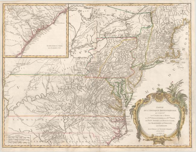
Auction 177, Lot 124
Subject: Colonial New England United States
Robert de Vaugondy
Partie de l'Amerique Septentrionale, qui Comprend le Cours de l'Ohio, la Nlle. Angleterre, la Nlle York, le New Jersey, la Pensylvanie, le Maryland la Virginie, la Caroline, 1755
Size: 24.8 x 18.9 inches (63 x 48 cm)
Estimate: $475 - $600
Sold for: $350
Closed on 4/29/2020
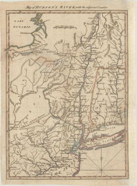
Auction 177, Lot 125
Subject: Colonial New England United States, Revolutionary War
Anon.
Map of Hudson's River, with the Adjacent Country, 1778
Size: 8.5 x 11.5 inches (21.6 x 29.2 cm)
Estimate: $190 - $220
Sold for: $140
Closed on 4/29/2020
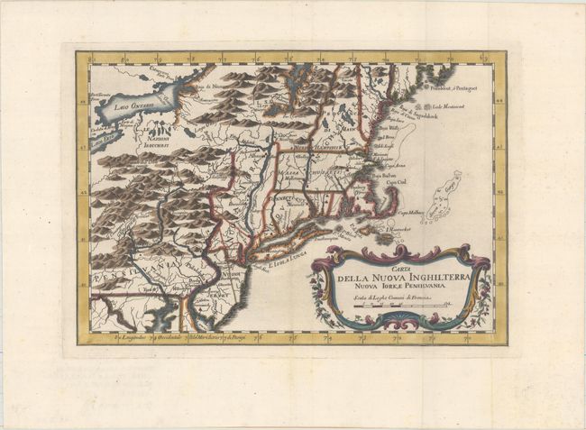
Auction 177, Lot 126
Subject: Colonial New England & Mid-Atlantic
Bellin, Jacques Nicolas
Carta della Nuova Inghilterra Nuova Iork, e Pensilvania, 1781
Size: 11.7 x 8.1 inches (29.7 x 20.6 cm)
Estimate: $200 - $230
Sold for: $150
Closed on 4/29/2020
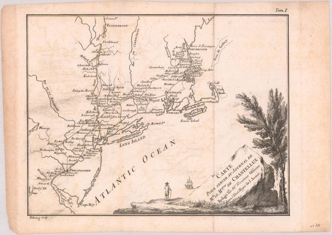
Auction 177, Lot 127
Subject: New England & Mid-Atlantic United States
[Lot of 2] Carte pour Servir au Journal de Mr. le Mquis. de Chastellux [and] Carte de la Partie Nord des Etats Unis de l'Amerique Septentrionale, 1783-86
Size: See Description
Estimate: $200 - $230
Sold for: $150
Closed on 4/29/2020
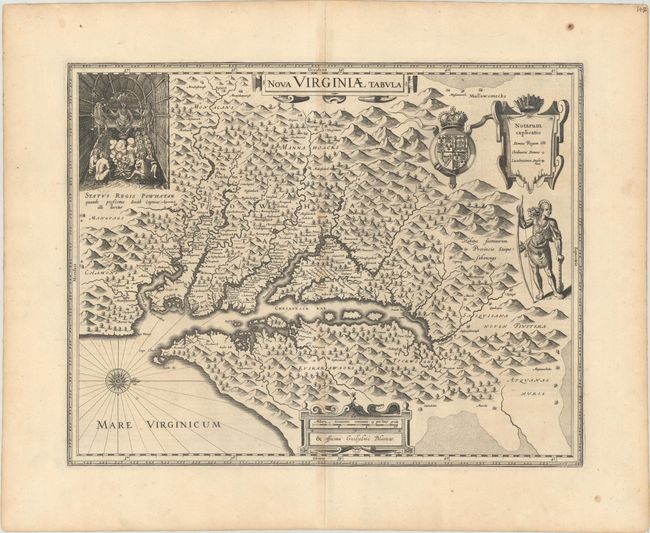
Auction 177, Lot 128
Subject: Colonial Mid-Atlantic United States
Hondius/Blaeu
Nova Virginiae Tabula, 1634
Size: 18.9 x 14.8 inches (48 x 37.6 cm)
Estimate: $1,900 - $2,200
One of the Most Important 17th Century Maps of the Chesapeake Bay
Sold for: $1,400
Closed on 4/29/2020
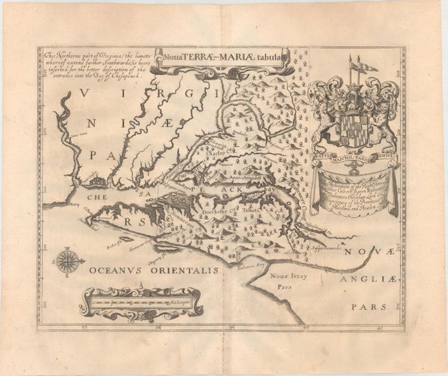
Auction 177, Lot 129
Subject: Colonial Mid-Atlantic United States, Maryland
Ogilby, John
Nova Terrae-Mariae Tabula, 1671
Size: 14.8 x 11.6 inches (37.6 x 29.5 cm)
Estimate: $5,500 - $7,000
Ogilby's Copy of the Extremely Rare "Lord Baltimore's Map," the Earliest Obtainable Printed Map of Maryland
Sold for: $4,000
Closed on 4/29/2020
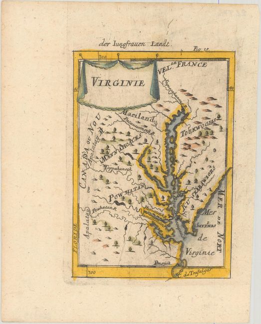
Auction 177, Lot 130
Subject: Colonial Mid-Atlantic United States
Mallet, Alain Manesson
Virginie, 1685
Size: 4 x 5.8 inches (10.2 x 14.7 cm)
Estimate: $240 - $300
Sold for: $180
Closed on 4/29/2020
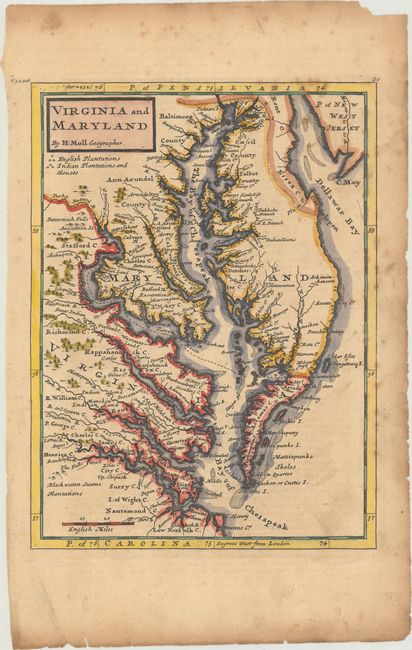
Auction 177, Lot 131
Subject: Colonial Mid-Atlantic United States
Moll, Herman
Virginia and Maryland, 1744
Size: 7.9 x 10.7 inches (20.1 x 27.2 cm)
Estimate: $500 - $650
Sold for: $350
Closed on 4/29/2020
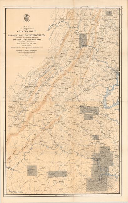
Auction 177, Lot 132
Subject: Pennsylvania & Virginia, Civil War
U.S. War Department
Map of the Region Between Gettysburg, PA. and Appomattox Court House, VA., 1869
Size: 27.4 x 43.8 inches (69.6 x 111.3 cm)
Estimate: $160 - $190
Sold for: $190
Closed on 4/29/2020
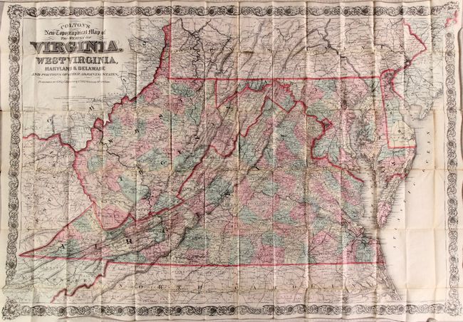
Auction 177, Lot 133
Subject: Virginia & West Virginia, Mid-Atlantic
Colton, G.W. & C.B.
Colton's New Topographical Map of the States of Virginia, West Virginia, Maryland & Delaware and Portions of Other Adjoining States, 1885
Size: 44.8 x 31 inches (113.8 x 78.7 cm)
Estimate: $700 - $850
Sold for: $500
Closed on 4/29/2020
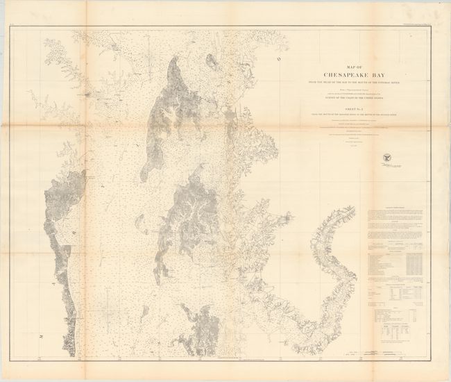
Auction 177, Lot 134
Subject: Chesapeake Bay, Maryland
U.S. Coast Survey
Map of Chesapeake Bay from the Head of the Bay to the Mouth of the Potomac River ... Sheet No. 2 from the Mouth of the Magothy River to the Mouth of the Hudson River, 1857
Size: 37.3 x 29.6 inches (94.7 x 75.2 cm)
Estimate: $140 - $170
Sold for: $120
Closed on 4/29/2020
183 lots
Page 1 of 4