Subject: Southwestern United States
Period: 1915 (published)
Publication:
Color: Black & White
Size:
6.2 x 9.2 inches
15.7 x 23.4 cm
This volume contains Calhoun's letter from 1848-54 along with an informative introduction by Annie Heloise Abel. Calhoun was the first territorial governor of New Mexico Territory and was in favor of the settlement of nomadic Indians onto reservations. The volume includes 4 large later edition maps at the rear of the volume including:
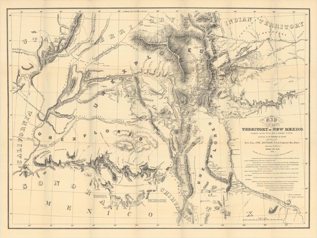
A. Map of the Territory of New Mexico Compiled by Bvt. 2nd Lt. Jno. G. Parke. U.S.T.E..., dated 1851 (but 1915) (33.0 x 24.3"). This is a later edition of this rare and important map of the Territory of New Mexico stretching from Pike's Peak to Cooke's Wagon Road in Sonora. Originally published in 1852, the map was distributed to officers in the region and those who requested it, but it never appeared in a report, making the original essentially unobtainable. Compiled by Lt. John G. Parke and drawn by Richard H. Kern, it shows the region in the years immediately following the Mexican-American War, when many boundary disputes were still ongoing and large swaths of land were unexplored. It replaced Abert's map as the primary cartographic source for the region. Richly detailed, it extends to show parts of Texas, Indian Territory, Utah Territory, California, and parts of Mexico.
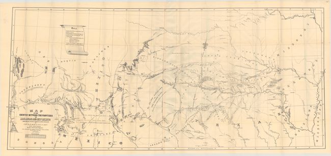
B. Map of the Country Between the Frontiers of Arkansas and New Mexico Embracing the Section Explored in 1849. 50. 51. & 52, by Captain R.B. Marcy, published 1915 (60.4 x 26.9"). Later edition.
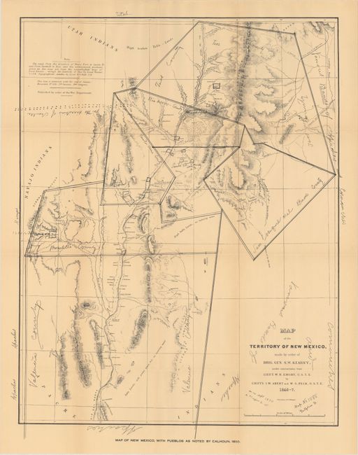
C. Map of the Territory of New Mexico..., dated 1846-47 (but 1915) (19.9 x 25.2"). Later edition.
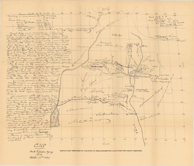
D. Sketch Map Prepared by Calhoun in 1849, Suggesting Localities for Indian Agencies, published 1915 (23.0 x 19.8").
554 pages. Octavo, hardbound in tan cloth with title on spine. Folding maps are housed in a rear pocket.
References: Howes #C-28.
Condition: A
Contents and maps are near fine with just a hint of pleasant light toning. Covers have light wear and soiling.