Subject: References; Central & Southwestern United States
Period: 1961-87 (published)
Publication:
Color:
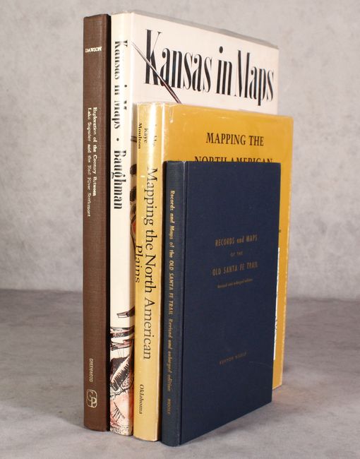
A. Mapping the North American Plains - Essays in the History of Cartography, edited by Frederick Luebke, Frances W. Kaye, and Gary E. Moulton, published 1987, black & white (8.7 x 11.3"). This book contains eleven important essays on the cartographic history of the American heartland. Illustrated with 101 uncolored maps from the early seventeenth to the twentieth century, 239 pp. 8vo, hardbound with illustrated dust jacket in protective sleeve. Condition: Contents clean and tight. Minor shelf wear to edges, and some rubbing to jacket.
B. Kansas in Maps, by Robert W. Baughman, published 1961, printed color (9.9 x 14.3"). This interesting work weaves historical maps into an invigorating tale of the Sunflower State's wild history. More than 90 maps are illustrated (16 in full color), 104 pp. Folio, hardbound in beige cloth with decorative title on front, with a striking illustrated dust jacket in plastic cover. Condition: Contents and covers are clean and tight. Dust jacket is lightly soiled.
C. Records and Maps of the Old Santa Fe Trail, by Kenyon Riddle, published 1963, black & white (6.3 x 9.4"). This work was compiled from original maps and surveys, accounts of early travelers, early military reconnaissance, and from present day traces of this important American trail. Illustrated with 10 black and white photographs, and several maps, 147 pp. 8vo, hardbound in original blue cloth with lettering in gilt. Condition: Minor shelf wear.
D. Report on the Exploration of the Country Between Lake Superior and the Red River Settlement…, by S.J. Dawson, published 1968, printed color (10.3 x 14.3"). This fine book is a reprint of a report originally published in 1859 by the Legislative Assembly in Toronto, and is nicely illustrated with 8 folding maps and numerous charts, unpaginated. Small folio, hardbound in brown cloth with gilt title on spine. Condition: Near fine.
References:
Condition: A
See description above.