Subject: Atlases
Period: 1873 (published)
Publication:
Color: Hand Color
Size:
14.6 x 20 inches
37.1 x 50.8 cm
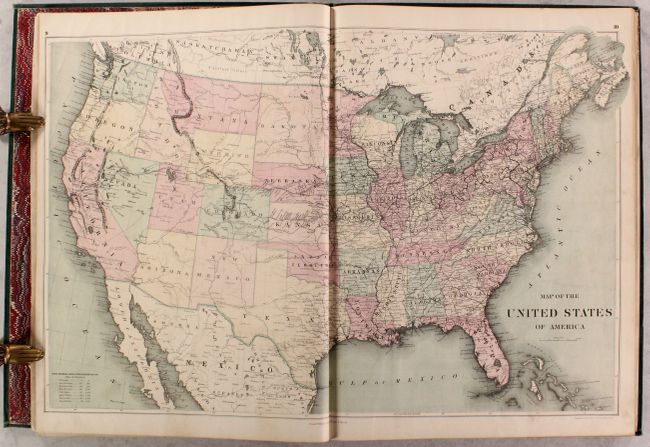
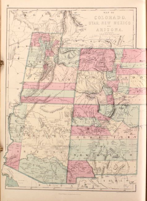
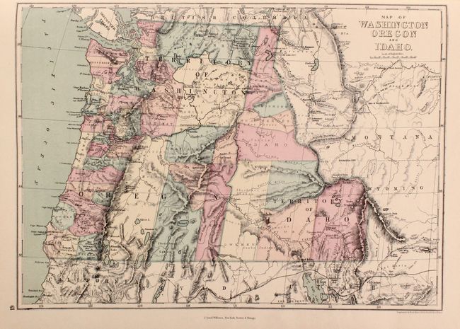
This complete folio atlas contains 11 double-page and 30 single-page maps including the world (1), Americas (21), Europe (13), Asia (4), Africa (1) and Oceania (1). The maps were compiled by important geographers of the time including Keith Johnston, H.D. Rogers, and Edward Weller. The maps utilize longitudinal projection lines, which increase in width the further south one goes, to more accurately reflect the curvature of the earth and distance between degrees of longitude. The atlas features a number of interesting and unusual maps of the western United States, each with hand coloring to show the oversized counties that the western states and territories had at this time period. Some of the more interesting maps include:
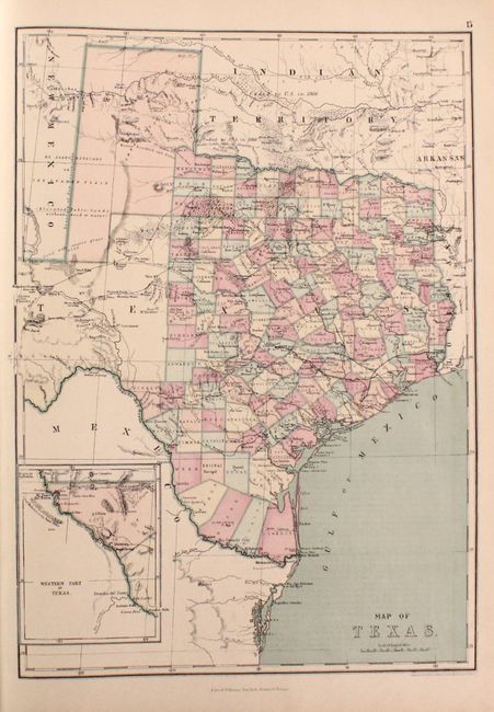
Texas. This comprehensive map includes superb detail of trails, ponds, springs, forts, and railroads along with additional information on the region's natural resources (gypsum, salt, arable land, timber, sand, course grass, and forests labeled Mesquite Openings). Also locates the Padre Silver Mine (now lost) east of El Paso in the inset map and emigrant crossings on the Pecos River. County development extends beyond the 100th meridian, with the large El Paso, Presidio, and Young territories still occupying the west. The "Western Part of Texas" is shown in an inset on the same scale as the main map.
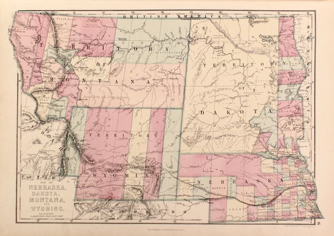
Map of Nebraska, Dakota. Montana, and Wyoming. A detailed regional map showing counties, towns, topography, rivers, railroads, and more. The Snake River is misnamed the Columbia in southern Idaho. Wyoming Territory shows little development with only five counties noted and no mention of Yellowstone. Dakota Territory is mostly unorganized except for a few counties in the extreme southeast tip. Filled with place names including forts and geographical features used by immigrants.
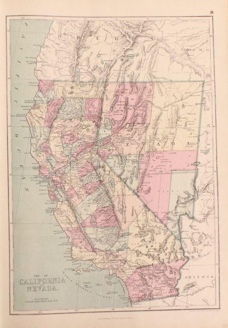
Map of California and Nevada. This map captures the rapid development taking place throughout California. Includes terrific detail of counties, towns, topography, rivers, railroads, and more. California has 37 counties with a huge San Bernardino County dominating the south. Railroads extend south to Monterey. Nevada shows early development in the Reno/Carson City corridor and only eleven counties are depicted.
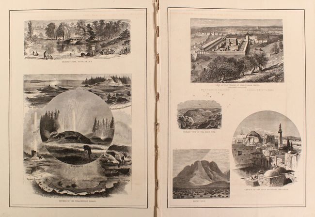
In addition to the maps, the atlas includes seven pages of illustrations at the front and end of the volume including depictions of Brooklyn Bridge, Vatican Library, Yosemite, Geysers in the Yellowstone Valley, and A Buddhist Temple in Siam to name a few. Hardbound in green cloth with gilt title on the front cover. All edges gilt.
References: Phillips (Atlases) #869; Rumsey #2307.
Condition: A
Condition code is for the maps, which were issued on thin paper. They are clean and bright with no tears and a hint of pleasant light toning. The first two pages of illustrations are somewhat loose. The front board is detached and the rear board is nearly detached. Covers are scuffed and stained and there is a chip along the spine.