Filtered by Category:Books, Atlases, Travel Guides, Geography & Reference Books(Show All Categories)
Current Auction
50 lots
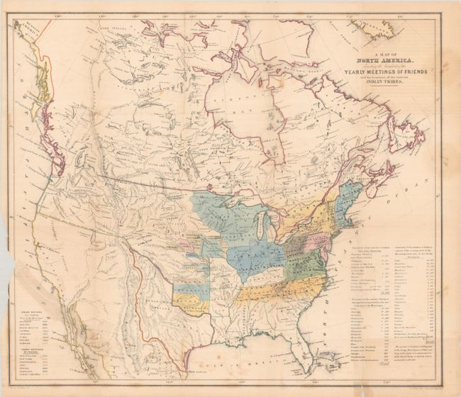
Lot 75
Subject: North America, Texas
Religious Society of Friends
[2 Maps in Report] A Map of North America, Denoting the Boundaries of the Yearly Meetings of Friends and the Locations of the Various Indian Tribes [and] Aboriginal America, East of the Mississippi, 1844
Size: 6 x 9 inches (15.2 x 22.9 cm)
Estimate: $240 - $300
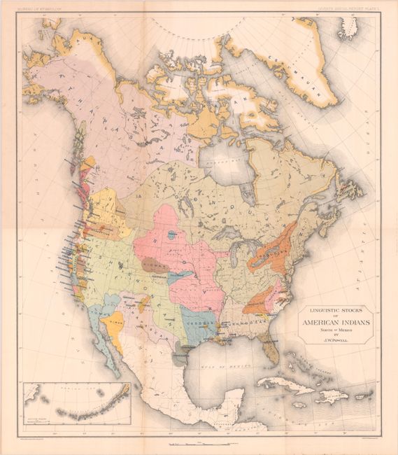
Lot 81
Subject: North America
Powell, John Wesley
[Map with Book] Linguistic Stocks of American Indians North of Mexico [with] Seventh Annual Report of the Bureau of Ethnology to the Secretary of the Smithsonian Institution 1885-'86, 1891
Size: 17.6 x 20.4 inches (44.7 x 51.8 cm)
Estimate: $300 - $375
Sold for: $220
Closed on 6/18/2025
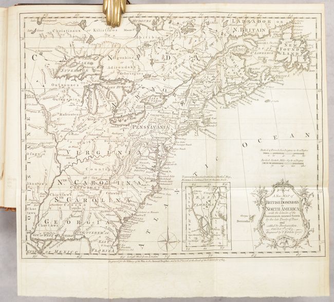
Lot 98
Subject: Colonial Eastern United States & Canada, History Book
Kitchin, Thomas
[Maps in Book] A New Map of the British Dominions in North America; with the Limits of the Governments Annexed Thereto by the Late Treaty of Peace... [bound in] The Annual Register, or a View of the History, Politicks, and Literature…, 1764
Size: 11.9 x 9.6 inches (30.2 x 24.4 cm)
Estimate: $600 - $750
Historical Map in First Edition Publication of Proclamation Ending French and Indian War
Sold for: $450
Closed on 6/18/2025
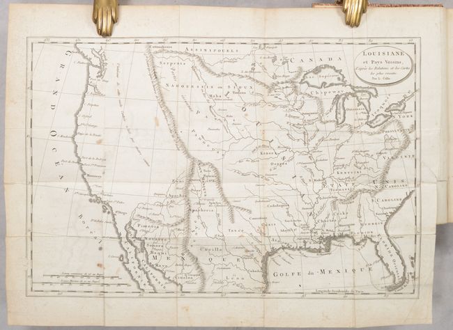
Lot 109
Subject: United States
Baudry des Lozieres, Louis Narciss
[Map in Book] Louisiane et Pays Voisins, d'Apres les Relations et les Cartes les Plus Recentes [in] Voyage a la Louisiane, et sur le Continent de l'Amerique Septentrionale..., 1802
Size: 5 x 8 inches (12.7 x 20.3 cm)
Estimate: $475 - $600
Sold for: $350
Closed on 6/18/2025
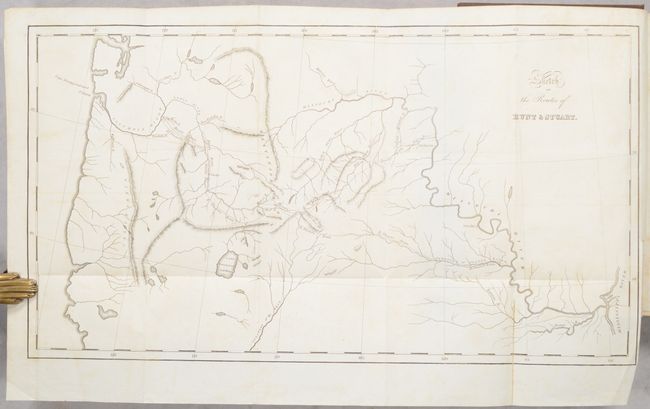
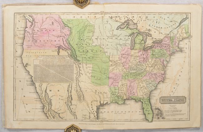
Lot 154
Subject: Western United States
Irving, Washington
[Map and 2 Volumes] Sketch of the Routes of Hunt & Stuart [in] Astoria, or Anecdotes of an Enterprise Beyond the Rocky Mountains Vol. I [and] Vol. II, 1836
Size: 17.8 x 9.8 inches (45.2 x 24.9 cm)
Estimate: $400 - $475
Sold for: $300
Closed on 6/18/2025
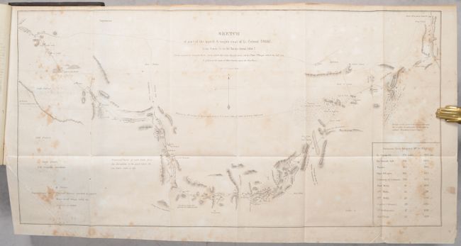
Lot 163
Subject: Southwestern United States
Emory, William Hemsley
[Map with Reports] Sketch of Part of the March & Wagon Road of Lt. Colonel Cooke... [bound in] Notes of a Military Reconnoissance, from Fort Leavenworth, in Missouri, to San Diego, in California…, 1848
Size: 22.9 x 11.6 inches (58.2 x 29.5 cm)
Estimate: $250 - $325
Sold for: $180
Closed on 6/18/2025
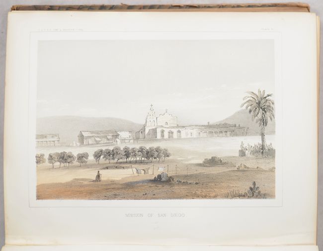
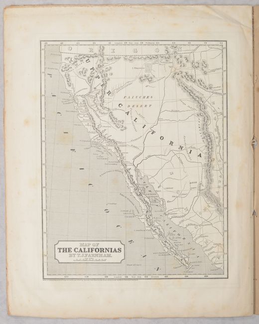
Lot 172
Subject: California
Koppel, Charles
[4 Early Views of California Bound in] Reports of Explorations and Surveys, to Ascertain the Most Practicable and Economical Route for a Railroad from the Mississippi River to the Pacific Ocean ... Volume V, 1856
Size: 9.4 x 11.8 inches (23.9 x 30 cm)
Estimate: $350 - $425
Sold for: $325
Closed on 6/18/2025
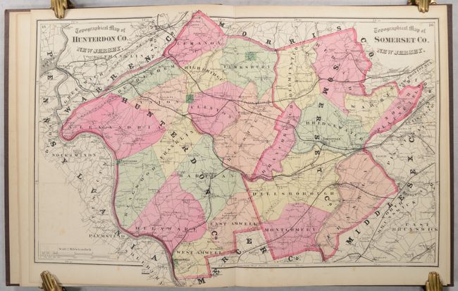
Lot 217
Subject: Northern New Jersey, Atlases
Beers, Comstock & Cline
Atlas of Somerset Co. New Jersey. From Recent and Actual Surveys and Records..., 1873
Size: 13.3 x 16 inches (33.8 x 40.6 cm)
Estimate: $300 - $375
First Atlas of Somerset County, New Jersey
Sold for: $200
Closed on 6/18/2025
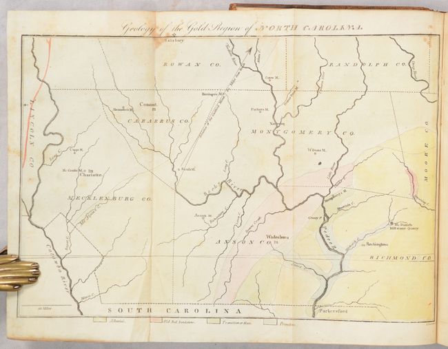
Lot 229
Subject: Western North Carolina
Doolittle, Amos
[Map in Book] Geology of the Gold Region of North Carolina [in] The American Journal of Science and Arts. Vol. XVI. - July, 1829, 1829
Size: 10.6 x 7.1 inches (26.9 x 18 cm)
Estimate: $200 - $230
First Geological Map of North Carolina
Sold for: $250
Closed on 6/18/2025
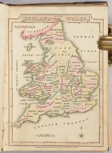
Lot 353
Subject: England & Wales, Atlas
Wallis, James
Wallis's New Pocket Edition of the English Counties or Travellers Companion..., 1812
Size: 4.3 x 5.9 inches (10.9 x 15 cm)
Estimate: $350 - $425
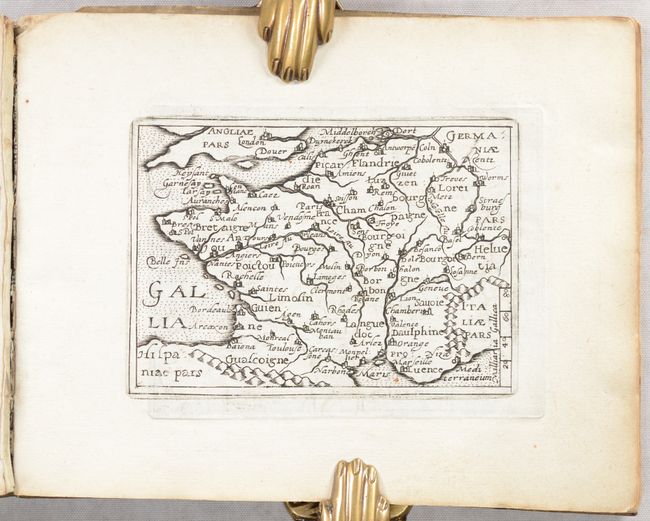
Lot 410
Subject: France, Atlas
Quad, Matthias von Kinckelbach
Deliciae Galliae sive Itinerarium per Universam Galliam..., 1603
Size: 7.8 x 6.1 inches (19.8 x 15.5 cm)
Estimate: $1,000 - $1,300
Rare Atlas with 32 Miniature Maps Based on Ortelius
Sold for: $750
Closed on 6/18/2025
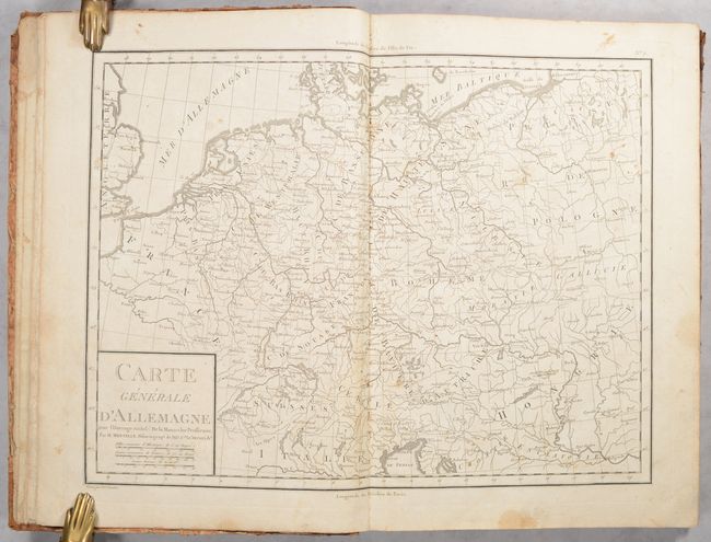
Lot 438
Subject: Central Europe, Atlas
Mentelle, Edme
Atlas de la Monarchie Prussienne, 1788
Size: 10.8 x 15.6 inches (27.4 x 39.6 cm)
Estimate: $300 - $375
Sold for: $220
Closed on 6/18/2025

Lot 583
Subject: Exploration & Surveys, Asia
Prevost, Anton Francois
Histoire Generale des Voyages, ou Nouvelle Collection de Toutes les Relations de Voyages ... Tome Septieme, 1749
Size: 8.4 x 10.3 inches (21.3 x 26.2 cm)
Estimate: $700 - $850
Lot 681
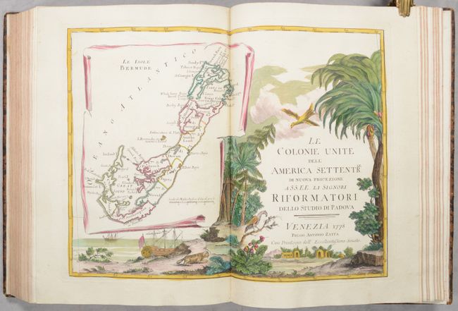
Subject: Atlases
Zatta, Antonio
[4 Volumes in 2 Books] Atlante Novissimo Tomo I-IV, 1779
Size: 11.2 x 15.5 inches (28.4 x 39.4 cm)
Estimate: $27,500 - $35,000
Zatta's Complete Atlas with 218 Maps in Full Contemporary Color
Sold for: $20,000
Closed on 6/18/2025
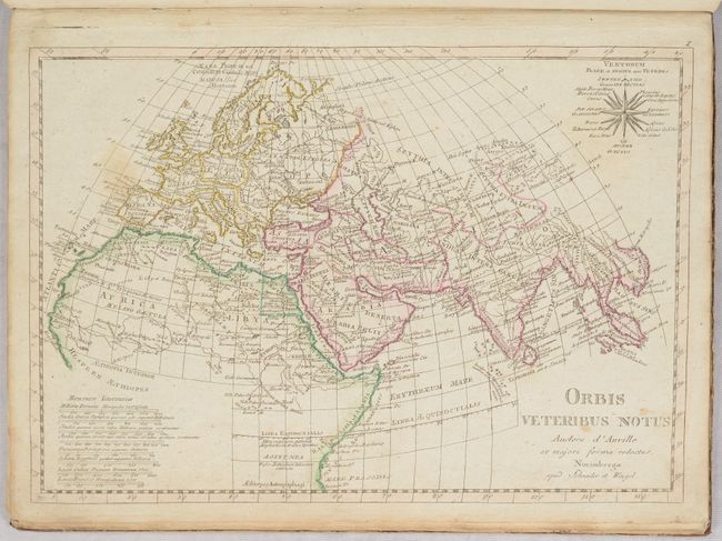
Lot 682
Subject: Atlases
Wilkinson, Robert
Atlas Classica Being a Collection of Maps of the Countries Mentioned by the Ancient Authors, Both Sacred and Profane..., 1796
Size: 11 x 13.5 inches (27.9 x 34.3 cm)
Estimate: $475 - $600
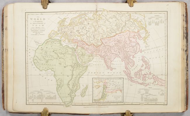
Lot 683
Subject: Atlases
Anville, Jean Baptiste Bourguignon d'
Atlas Antiquus Danvillianus Minor. Conspectus Tabularum Geographicum..., 1800
Size: 10.3 x 14 inches (26.2 x 35.6 cm)
Estimate: $400 - $475
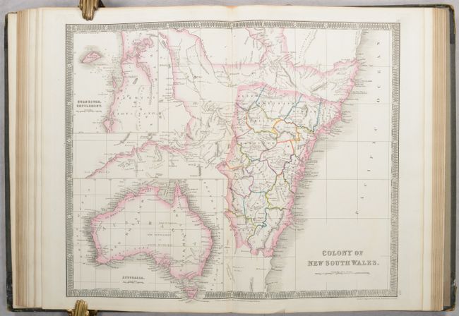
Lot 684
Subject: Atlases
Teesdale, Henry
A New General Atlas of the World, Compiled from the Latest Authorities Borth English & Foreign, Containing Separate Maps of Its Various Countries & States..., 1838
Size: 10.6 x 15 inches (26.9 x 38.1 cm)
Estimate: $1,400 - $1,700
Teesdale's Fine Atlas Featuring Detailed Maps of India, Australia and the Americas
Sold for: $1,800
Closed on 6/18/2025
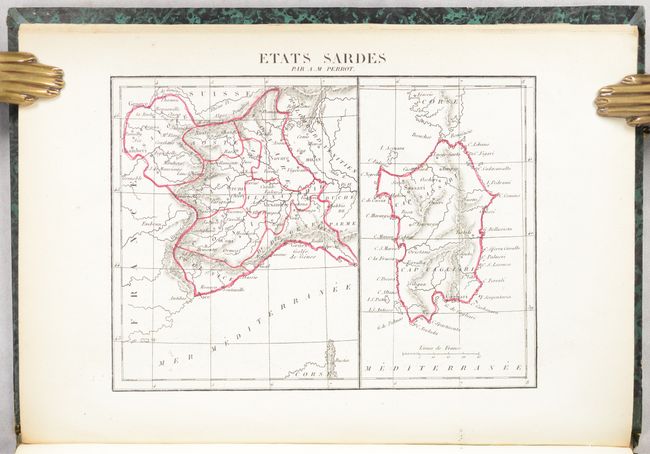
Lot 685
Subject: Atlases
Perrot, Aristide Michel
Atlas de 59 Cartes Coloriees ou Noires du Dictionnaire Universel de Geographie Moderne, 1843
Size: 7.7 x 11.1 inches (19.6 x 28.2 cm)
Estimate: $350 - $425
Lot 686
Subject: Atlases
Morse & Breese
The Cerographic Atlas of the United States. No. 3, 1845
Size: 14.6 x 18.4 inches (37.1 x 46.7 cm)
Estimate: $700 - $850
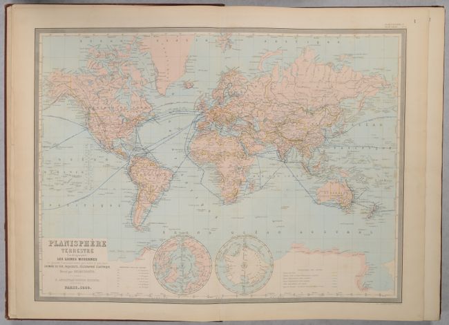
Lot 687
Subject: Atlases
Andriveau-Goujon, E.
Atlas Usuel de Geographie Moderne, 1868
Size: 14.8 x 21.4 inches (37.6 x 54.4 cm)
Estimate: $400 - $475
Lot 688
Subject: School Atlases
Olney, Jesse
A New and Improved School Atlas, to Accompany the Practical System of Modern Geography, 1837
Size: 9.4 x 11.7 inches (23.9 x 29.7 cm)
Estimate: $180 - $220
Sold for: $130
Closed on 6/18/2025
Lot 689
Subject: Geography Books
Smith, Roswell C.
Smith's Quarto, or Second Book in Geography. A Concise and Practical System of Geography, for Schools, Academies, and Families..., 1856
Size: 9.6 x 11.8 inches (24.4 x 30 cm)
Estimate: $200 - $230
Lot 690
Subject: Geography Books
Colby, Charles G.
The World in Miniature: with Descriptions of Every Nation and Country. Together with a Treatise on Physical Geography..., 1857
Size: 6.7 x 7.7 inches (17 x 19.6 cm)
Estimate: $325 - $400
Scarce New Orleans Edition
Lot 691
Subject: Exploration & Surveys
La Perouse, Comte Jean F. Galoup, de
Charts and Plates to La Perouse's Voyage, 1798
Size: 11.1 x 17.2 inches (28.2 x 43.7 cm)
Estimate: $2,750 - $3,500
English Edition of the Atlas Volume to Accompany La Perouse's Voyage Round the World
Lot 692
Subject: Bible
Keur, Pieter en Jacob
Biblia, dat is de Gantsche H. Schrifture, Vervattende alle de Canonijcke Boecken des Ouden en des Nieuwen Testaments..., 1710
Size: 9.3 x 13.3 inches (23.6 x 33.8 cm)
Estimate: $1,400 - $1,700
Lot 693
Subject: Miscellaneous Books - Spanish-American War
U.S. Army
Annual Report of the Major-General Commanding the Army to the Secretary of War, 1898
Size: 6 x 9.5 inches (15.2 x 24.1 cm)
Estimate: $200 - $250
Comprehensive Spanish-American War Report with Maps
Sold for: $100
Closed on 6/18/2025
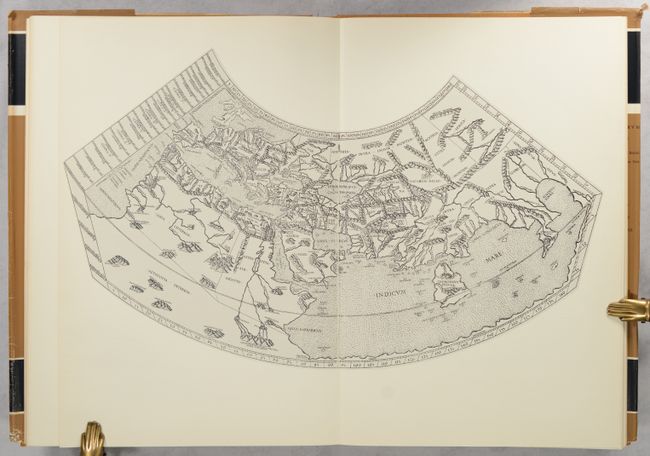
Lot 694
Subject: References, Facsimile Atlas
Ptolemy
[Facsimile] Cosmographia Roma 1478, 1966
Size: 12.2 x 17.6 inches (31 x 44.7 cm)
Estimate: $200 - $230
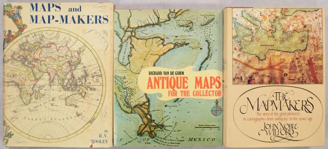
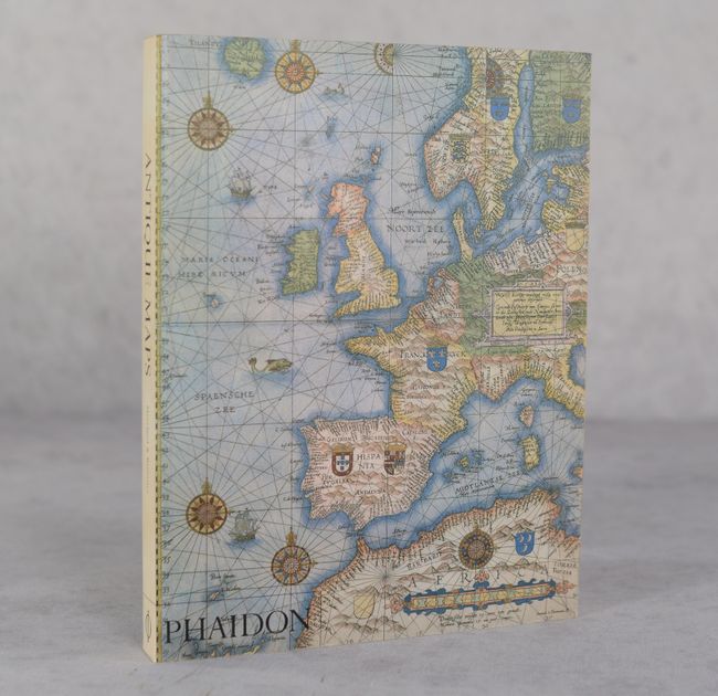
Lot 695
Subject: References
[Lot of 3] Maps and Map-Makers [and] Antique Maps for the Collector [and] The Mapmakers, 1961-81
Size: See Description
Estimate: $65 - $85
NO RESERVE
Sold for: $34
Closed on 6/18/2025
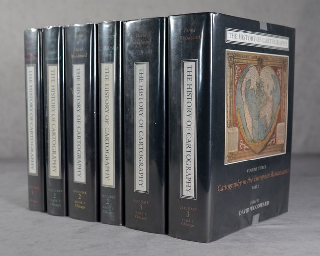
Lot 696
Subject: References
Woodward, David
[3 Volumes in 6 Books] The History of Cartography Volume One [and] Volume Two, Books 1-3 [and] Volume Three, Parts 1 & 2, 1987-2007
Size: 8.9 x 11.3 inches (22.6 x 28.7 cm)
Estimate: $800 - $950
First Three Available Volumes of this Comprehensive Reference Series
Sold for: $600
Closed on 6/18/2025
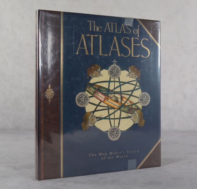
Lot 697
Subject: References
Allen, Phillip
The Atlas of Atlases - The Map Maker's Vision of the World - Atlases from the Cadbury Collection, Birmingham Central Library, 1992
Size: 10.8 x 12.4 inches (27.4 x 31.5 cm)
Estimate: $25 - $35
NO RESERVE
Sold for: $41
Closed on 6/18/2025
Lot 698
Subject: References
Moreland & Bannister
Antique Maps, 1994
Size: 7.5 x 9.8 inches (19.1 x 24.9 cm)
Estimate: $15 - $20
NO RESERVE
Sold for: $16
Closed on 6/18/2025
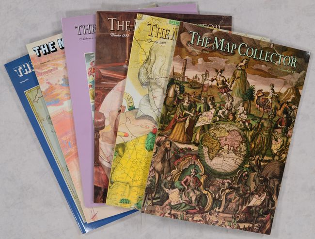
Lot 699
Subject: References, Magazines
[Lot of 74] The Map Collector, 1977-96
Size: 8.4 x 11.8 inches (21.3 x 30 cm)
Estimate: $450 - $550
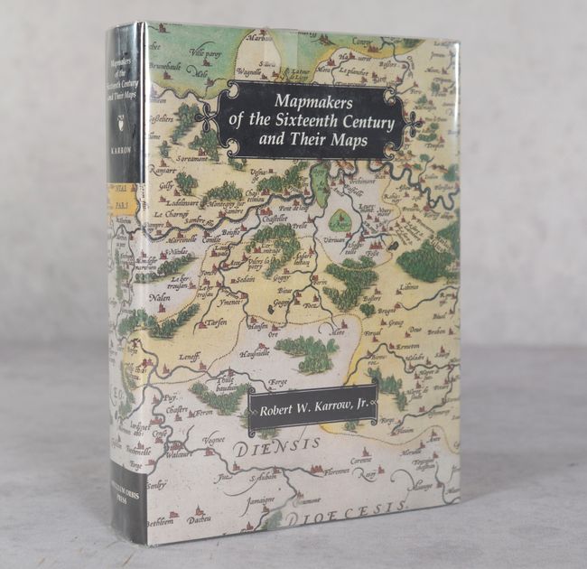
Lot 700
Subject: References, Mapmakers
Mapmakers of the Sixteenth Century and Their Maps - Bio-Bibliographies of the Cartographers of Abraham Ortelius, 1570, 1993
Size: 7.6 x 10.3 inches (19.3 x 26.2 cm)
Estimate: $180 - $220
Sold for: $130
Closed on 6/18/2025
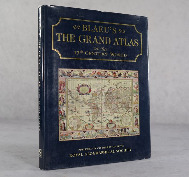
Lot 701
Subject: References, Blaeu
Goss, John
Blaeu's The Grand Atlas of the 17th Century World, 1997
Size: 11.4 x 14.6 inches (29 x 37.1 cm)
Estimate: $90 - $120
NO RESERVE
Sold for: $31
Closed on 6/18/2025
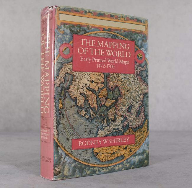
Lot 702
Subject: References, World
Shirley, Rodney W.
The Mapping of the World - Early Printed World Maps 1472-1700, 1984
Size: 9.7 x 13.7 inches (24.6 x 34.8 cm)
Estimate: $350 - $425

Lot 703
Subject: References, Globes
Krogt, Peter van der
Globi Neerlandici - The Production of Globes in the Low Countries, 1993
Size: 9.9 x 12.2 inches (25.1 x 31 cm)
Estimate: $100 - $130
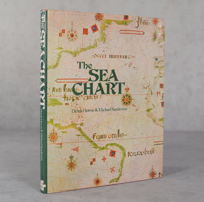
Lot 704
Subject: References, Sea Charts
Howse and Sanderson
The Sea Chart - An Historical Survey Based on the Collections in the National Maritime Museum, 1973
Size: 8.9 x 11.2 inches (22.6 x 28.4 cm)
Estimate: $30 - $40
NO RESERVE
Sold for: $12
Closed on 6/18/2025
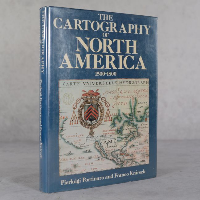
Lot 705
Subject: References, North America
Portinaro & Knirsch
The Cartography of North America 1500-1800, 1987
Size: 9.8 x 13.1 inches (24.9 x 33.3 cm)
Estimate: $45 - $65
NO RESERVE
Sold for: $17
Closed on 6/18/2025
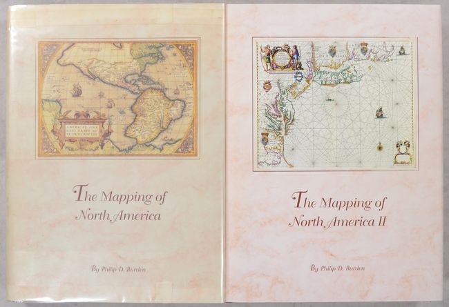
Lot 706
Subject: References, North America
Burden, Philip D.
[2 Volumes] The Mapping of North America - A List of Printed Maps 1511-1670 [and] ... 1671-1700, 1996-2007
Size: 10.8 x 14.3 inches (27.4 x 36.3 cm)
Estimate: $375 - $450
Lot 707
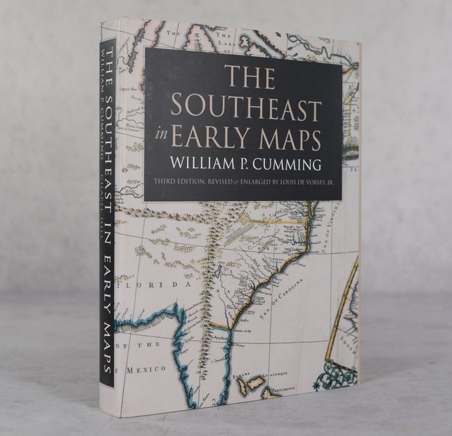
Subject: References, Southeastern United States
Cumming, William P.
The Southeast in Early Maps, 1998
Size: 9.3 x 12.3 inches (23.6 x 31.2 cm)
Estimate: $110 - $140
Sold for: $80
Closed on 6/18/2025
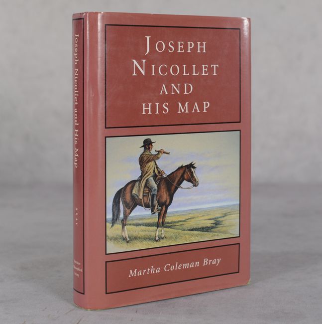
Lot 708
Subject: References, Upper Mississippi River
Joseph Nicollet and His Map, 1994
Size: 6.2 x 9.3 inches (15.7 x 23.6 cm)
Estimate: $40 - $50
NO RESERVE
Sold for: $3
Closed on 6/18/2025
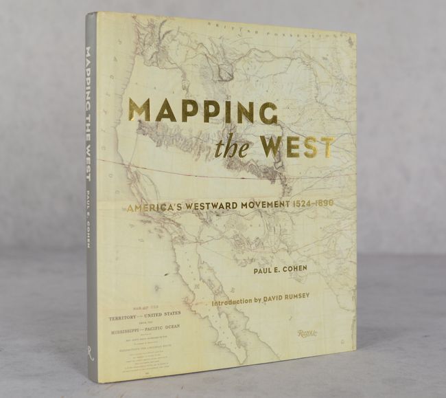
Lot 709
Subject: References, Western United States
Mapping the West - America's Westward Movement 1524-1890, 2002
Size: 9.4 x 10.9 inches (23.9 x 27.7 cm)
Estimate: $40 - $50
NO RESERVE
Sold for: $36
Closed on 6/18/2025

Lot 710
Subject: References, California
California 49 - Forty-Nine Maps of California from the Sixteenth Century to the Present, 1999
Size: 8.7 x 11.3 inches (22.1 x 28.7 cm)
Estimate: $80 - $100
NO RESERVE
Sold for: $42
Closed on 6/18/2025
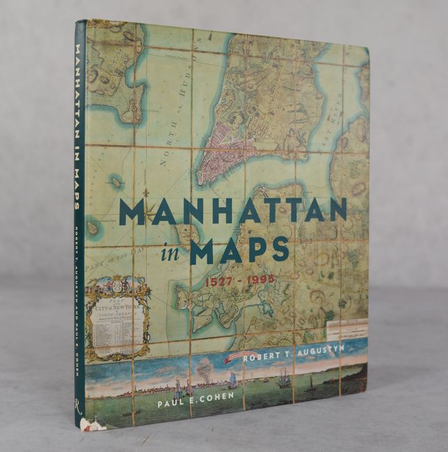
Lot 711
Subject: References, New York City
Manhattan in Maps 1527-1995, 1997
Size: 9.4 x 10.9 inches (23.9 x 27.7 cm)
Estimate: $30 - $40
NO RESERVE
Sold for: $11
Closed on 6/18/2025
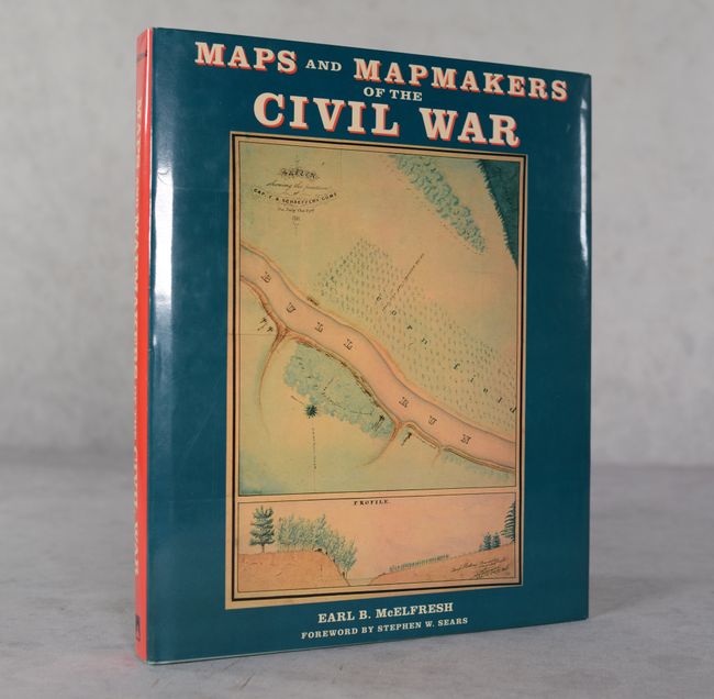
Lot 712
Subject: References, Civil War
McElfresh, Earl B.
Maps and Mapmakers of the Civil War, 1999
Size: 9.9 x 12 inches (25.1 x 30.5 cm)
Estimate: $30 - $40
NO RESERVE
Sold for: $12
Closed on 6/18/2025

Lot 713
Subject: References, Low Countries, Wall Maps
Schilder, Gunter
[Lot of 2 - Volume with Portfolio] Monumenta Cartographica Neerlandica I, 1997
Size: 22.3 x 16.2 inches (56.6 x 41.1 cm)
Estimate: $140 - $170
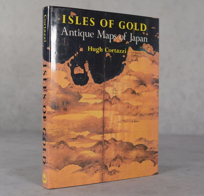
Lot 714
Subject: References, Japan
Cortazzi, Hugh
Isles of Gold - Antique Maps of Japan, 1992
Size: 9.3 x 12 inches (23.6 x 30.5 cm)
Estimate: $40 - $50
NO RESERVE
Sold for: $27
Closed on 6/18/2025
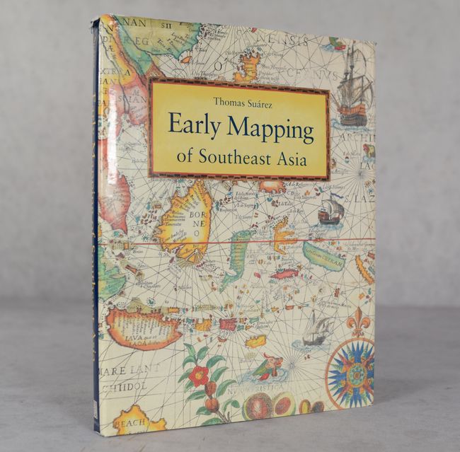
Lot 715
Subject: References, Southeast Asia
Suarez, Thomas
Early Mapping of Southeast Asia, 1999
Size: 9.4 x 12.4 inches (23.9 x 31.5 cm)
Estimate: $70 - $90
NO RESERVE
Sold for: $12
Closed on 6/18/2025
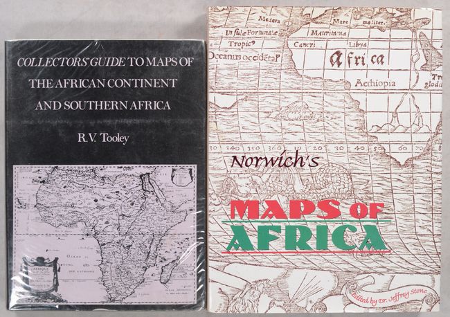
Lot 716
Subject: References, Africa
[Lot of 2] Collectors' Guide to Maps of the African Continent and Southern Africa [and] Norwich's Maps of Africa - An Illustrated and Annotated Carto-Bibliography, 1969-97
Size: See Description
Estimate: $110 - $140
Sold for: $80
Closed on 6/18/2025
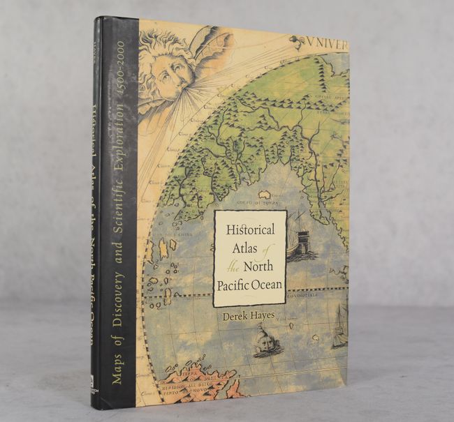
Lot 717
Subject: References, North Pacific Ocean
Historical Atlas of the North Pacific Ocean - Maps of Discovery and Scientific Exploration 1500-2000, 2001
Size: 9.8 x 13.1 inches (24.9 x 33.3 cm)
Estimate: $30 - $40
NO RESERVE
Sold for: $11
Closed on 6/18/2025
50 lots