Subject: Atlases
Period: 1779 (published)
Publication:
Color: Hand Color
Size:
11.2 x 15.5 inches
28.4 x 39.4 cm
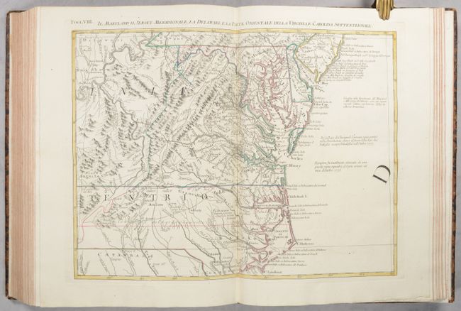
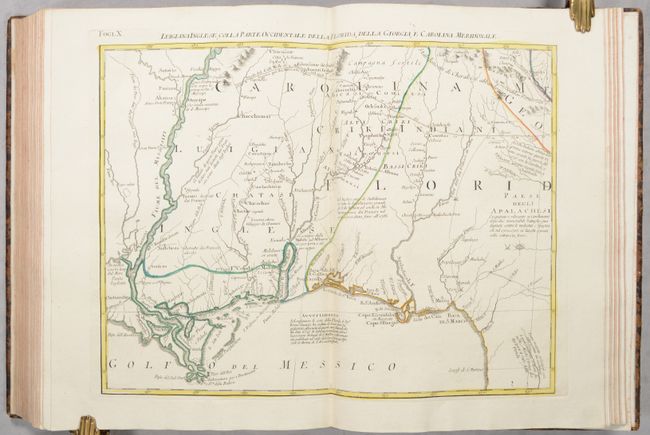
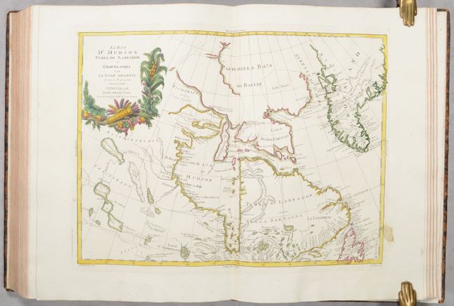
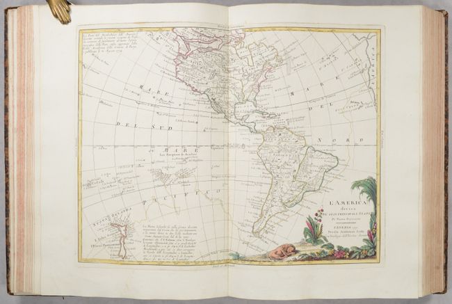
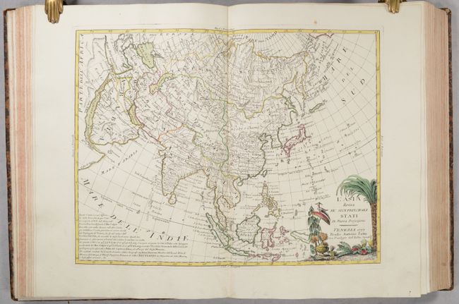
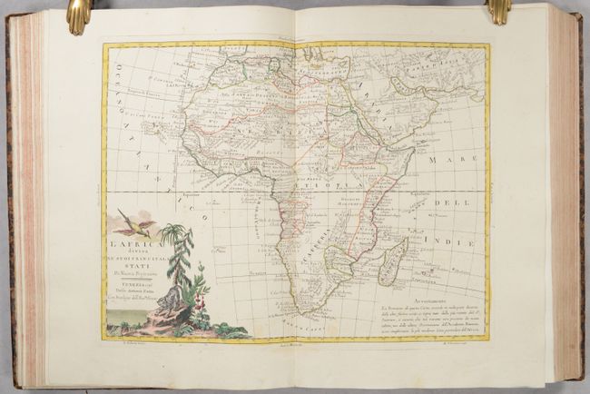
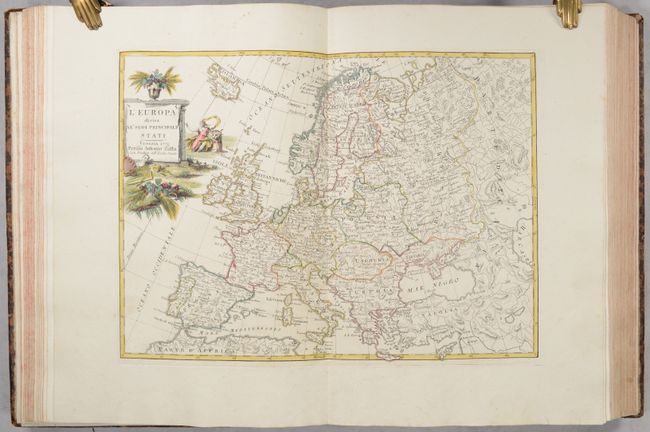
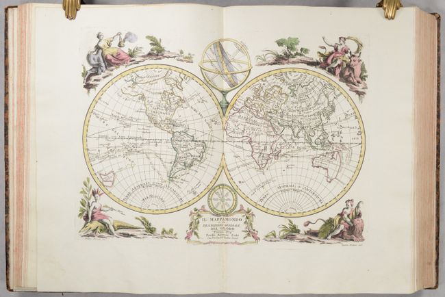
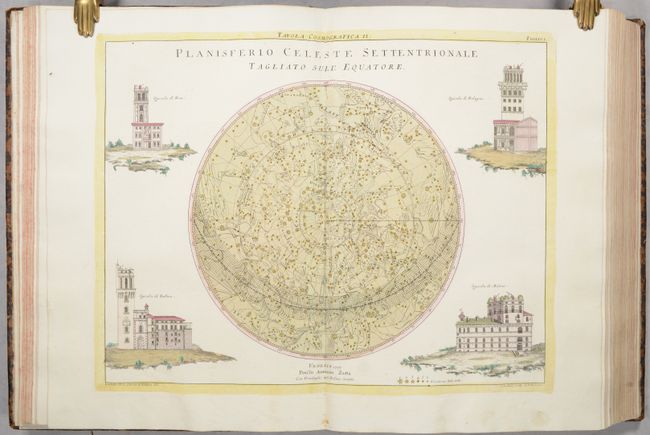
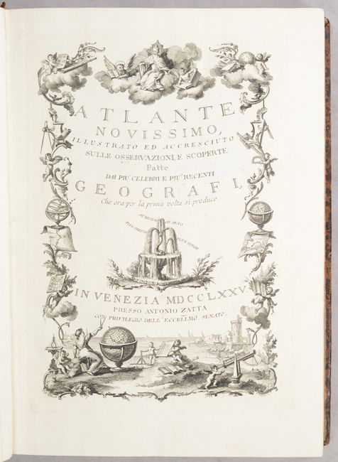
This is an attractive example of Zatta's Atlante Novissimo, complete with 218 double-page maps in full contemporary color. Zatta's ornate atlas was published to accompany the 1773 Italian edition of Anton Friedrich Busching's Neue Erdbeschreibung (1754), translated by Father Gaudioso Jagemann under the title Nuova Geografia. The atlas is divided into four volumes with the first volume dated 1775, the second and third dated 1784, and the fourth dated 1785. The first three focus on the world and Europe while the fourth volume examines the rest of the world (the list of maps for volume 1 note 18 mostly American maps that are actually in volume 4). Map count is broken out into the following geographies: world (9), Europe (143), Asia (18), Africa (8), Americas (28), and ancient maps (12). The atlas features a number of desirable American maps including Zatta's version of Mitchell's 12-sheet map of North America, two maps highlighting Cook's discoveries in the Pacific including a dedicated map of New Zealand, maps of the continents, several world and polar maps, and numerous regional maps. Each is drawn in the Venetian style and many are accompanied by related vignette illustrations of important buildings, animals and vegetation.
The twelve-sheet map is Antonio Zatta's version of John Mitchell's landmark map with some additional notes relating to both the Treaty of 1763 and events in the Revolutionary War. Most importantly, Mitchell's map was the first printed map devoted to the thirteen states, and to use a name distinguishing them from their previous status as British Colonies. The name 'United Colonies' was used in the Declaration of Independence and was not officially replaced until the Articles of Confederation adopted the name ‘The United States of America.’ The map covers North America west to the Mississippi and Spanish-owned Louisiana, and north to the Great Lakes. The title appears within a large cartouche, which includes a large inset map of Bermuda and fills one sheet.
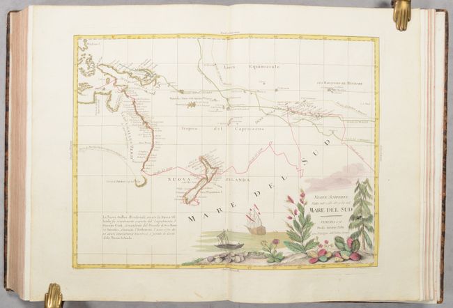
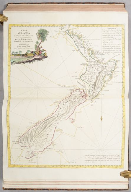
Zatta's first edition map of New Zealand is complete with the two islands' coastlines. Zatta closely copied Cook's original chart, first published in the account of his voyages in 1773, which Zatta attributes in a note at bottom right. The chart shows the track of the Endeavour from Cook's first voyage, with dates and soundings. The interior of the islands reflects the mountainous topography. Zatta has added a lovely vignette to the title cartouche, typical of his style.
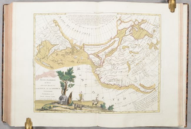
Zatta's map of the North Pacific entitled Nuove Scoperte de' Russi al Nord del Mare del Sud si nell' Asia, che nell' America is a fascinating chart showing the western coast of North America from the Baja Peninsula, along the coast of California to Alaska and thence to the Bering Strait and the Kamchatka Peninsula. The map presents an interesting array of hypothetical cartography. The northwest coast of North America is filled with the fictitious system of rivers and lakes of the Northwest Passage that were supposedly discovered by Admiral de Fonte. In addition to those wide passages that connect Hudson Bay with the Pacific, two rivers provide possibilities for the legendary River of the West theories. Alaska is represented by a group of islands clustered off the coast of Russia, collectively identified as Isole Alessiane. There is a notation of the legendary Chinese colony of Fou-Sang in the general vicinity of Vancouver Island. The pictorial title cartouche includes several incongruent animals - a crocodile, an elephant, a rhinoceros, and an ostrich.
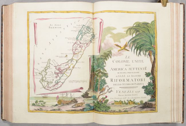
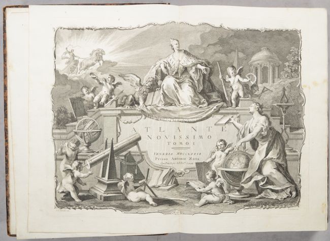
The atlas is embellished with a decorative double-page title page (dated 1779) at the front of the first volume filled with allegorical figures utilizing various cartographic equipment including a globe with dividers, telescope, compass, protractor, and more. The four volumes are bound into two volumes, each with full contemporary mottled calf with gilt decorations on covers and spine, and gilt title labels. Text has decorative speckled red edges.
References: Phillips (Atlases) #650, Shirley (BL Atlases) #T.ZAT-1a.
Condition: A
Condition code is for the maps, which are remarkably clean and bright on watermarked paper with full contemporary color throughout. The maps are nearly all near fine to fine with very occasional printer's ink residue or an errant spot. Contemporary bindings are moderately worn with some scuffs and gouging to the boards. Spines have some light cracking. An overall attractive example of this desirable atlas.