Subject: School Atlases
Period: 1837 (published)
Publication:
Color: Hand Color
Size:
9.4 x 11.7 inches
23.9 x 29.7 cm
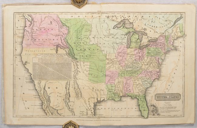
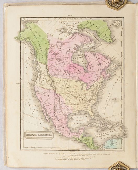
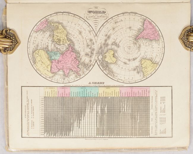
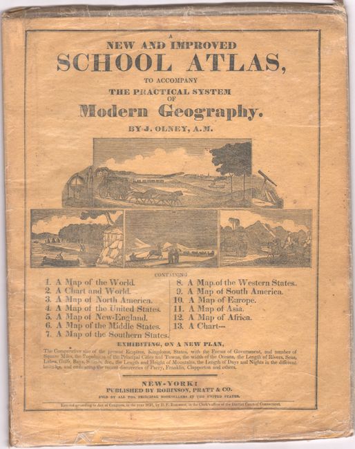
This school atlas is complete with 12 maps, each either dated 1828-29 or not dated. The cartography in the United States map shows Wisconsin Territory between Lake Michigan and the Missouri River. The large Missouri Territory extends from the Missouri River to Oregon Territory and south to include Indian Territory. Texas still appears to be part of Mexico. On the North American and United States maps, the boundary in the Northwest extends well into British America with notation "Boundary determined 1824." Northern California is "Unexplored Region." Maps included are: World in Hemispheres (double-page); World with thematic chart of religions; North America; United States (double-page); Eastern States; Middle States (double-page); Southern States (double-page); Western States (Missouri through Ohio - double-paged); South America; Europe; Asia; and Africa. The thirteenth engraving is a thematic chart exhibiting comparative size, population, and forms of government across the globe with four engraved vignettes showing Morocco, Constantinople, and New York. Printed paper covers double as the title page and list of maps. Published by Robinson, Pratt & Company.
References:
Condition: B+
Maps are mostly clean and bright with some light offsetting that is more prominent on the U.S. map. The maps of the southern and western states have light staining along the centerfold. Covers are lightly worn, and are wrapped in wax paper which is attached to the front pastedown with old tape.