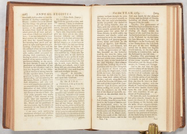
Historical Map in First Edition Publication of Proclamation Ending French and Indian War
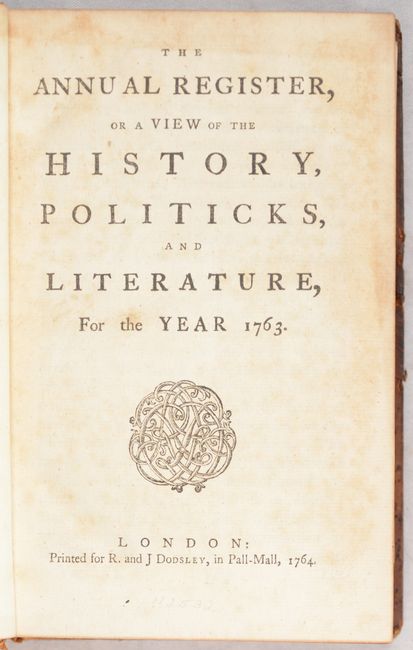
"[Maps in Book] A New Map of the British Dominions in North America; with the Limits of the Governments Annexed Thereto by the Late Treaty of Peace... [bound in] The Annual Register, or a View of the History, Politicks, and Literature…", Kitchin, Thomas
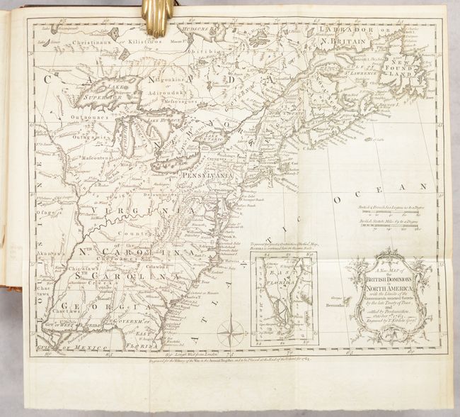
Subject: Colonial Eastern United States & Canada, History Book
This very historical map illustrates the British colonies after the Treaty of Paris and at the conclusion of the French and Indian War in America. The treaty ended French colonial ambitions in North America with minor exceptions. As a result, Spain ceded East and West Florida to Great Britain, France relinquished the title to the Louisiana Territory to Spain, and the Mississippi River was established as the British-Spanish Boundary. The map reflects the claims of the southern colonies that their charters extended to the Mississippi River. Also of interest are the names and locations of many Indian tribes and nations located away from the more populated areas of English settlements. An inset of East Florida on the same scale lies between the coastline and the decorative rococo-style title cartouche. A simple compass rose rests in the Atlantic.
The map is still bound into the first editionThe Annual Register, or a View of the History, Politics, and Literature, For the Year 1763, published in 1764. In addition to the map, this volume is significant in printing the Proclamation of King George (p. 208) ending the war and assuming British control over Canada and Florida. The proclamation has been called “a critical document in the history of North America” and “one of the most important state papers of the 19th century” (click here for more details). The 307-page volume also includes sections on the history of Europe, a chronicle of events, "characters" for the year, and four maps bound in at the end of the text. In addition to the map described above are: A New Map of the Seat of War on the Coast of Malabar & Coromandel... (8.9 x 9.5"); An Accurate Map of the Seat of War in the Kingdom of Prussia... (9.1 x 7.9"); and A New and Correct Chart of the Seat of War, on the Coasts of France, Spain, Portugal and Italy... (11.6 x 9.8"). Printed for R. and J. Dodsley in London. Jolly notes that this is the only volume of the Annual Register to contain maps, and it went through a number of editions (at least 8). Hardbound in full contemporary leather.
References: Jolly #ANNREG-1-4; McCorkle #763.5; Sellers & Van Ee #103.
Condition: B+
The folding map of North America is near fine with a hint of offsetting. Other folding maps are very good to near fine with light offsetting. Text is tight with a hint of toning throughout. Bookplate of Guilford College Libraries on the front pastedown. Binding is sturdy but worn with some minor staining along the edges of the covers and a small chip to the title label on spine.